![](/images/other/stat-length.png)
![Excursión Motor Ieper - Eerste Wereldoorlog rond Ieper - Photo](https://media.geolcdn.com/t/1900/400/ext.pjpeg?maxdim=2&url=https%3A%2F%2Fservices.sitytrail.com%2FGeolivesWS%2FDownloadMedia.ashx%3FTrailID%3D243034%26Media%3D9c182fe9-1bd5-41e5-8222-cea0f51d33d0.jpg)
Eerste Wereldoorlog rond Ieper
1418
Usuario
![Longitud](/images/other/stat-length.png)
![Altitud máxima](https://static1.geolcdn.com/siteimages/upload/files/1508320355ic_sort_altitude_max_24dp.png)
![Desnivel positivo](https://static1.geolcdn.com/siteimages/upload/files/1508320355ic_sort_den_pos_24dp.png)
![Km-Effort](/images/other/stat-length.png)
![Altitud mínima](https://static1.geolcdn.com/siteimages/upload/files/1508320355ic_sort_altitude_min_24dp.png)
![Desnivel negativo](https://static1.geolcdn.com/siteimages/upload/files/1508320355ic_sort_den_neg_24dp.png)
![Boucle](https://static1.geolcdn.com/siteimages/upload/files/16400158638029165_repeat_loop_refresh_sync_direction_icon.png)
![Motor](https://static1.geolcdn.com/sitytour/trail-icons/400.png)
2h00
Dificultad : Fácil
![Escanee este código QR para abrir la excursión en la aplicación SityTrail](https://capi.geolives.com/qq0zvz2zws4bq2lad0pu/sitytour/trails/243034/qr.png?size=200)
Aplicación GPS de excursión GRATIS
A propósito
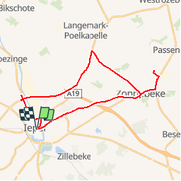
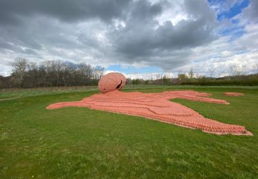
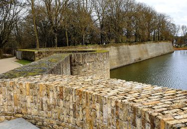
Ruta Motor de 29 km a descubrir en Flandes, Flandes Occidental, Ieper. Esta ruta ha sido propuesta por 1418.
Descripción
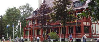
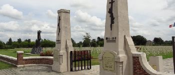
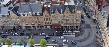
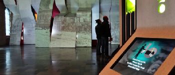
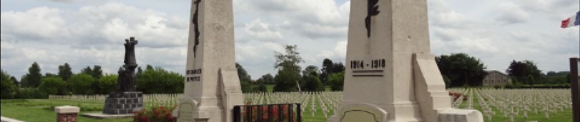
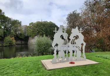
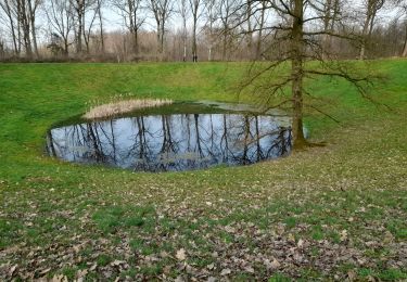
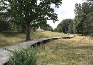
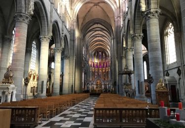
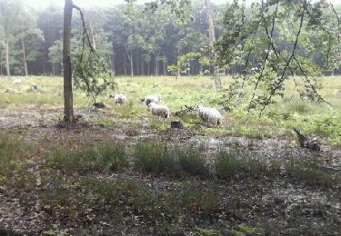
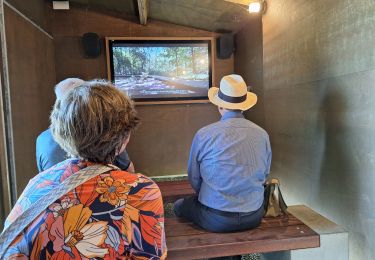
De Westhoek is bezaaid met begraafplaatsen, monumenten en musea in verband met de Eerste Wereldoorlog. Met de 100-jarige herdenking van 2014-2018 kregen veel herdenkingsplaatsen een opfrisbeurt, uitbreiding of restyling. Met deze korte autoroute in en rond Ieper brengen we je langs een grote verscheidenheid aan herinneringsplaatsen. Starten doe je in Ieper met het vernieuwde In Flanders Fields Museum. Dan volgt een kleine bijzondere begraafplaats en een herdenkingsmonument. In Passendale brengen we je tot het Tyne Cot Cemetery inclusief Bezoekerscentrum. Het Memorial Museum Passchendaele 1917 heeft twee unieke belevingsmomenten voor je in petto. Terugrijden doe je via een grote Franse begraafplaats. Met zo'n 30 kilometer op de teller heb je ruimschoots de tijd om alles rustig te bezichtigen en te beleven.
Localización
Comentarios
Excursiones cerca
![Excursión Senderismo Ieper - ypres- moitié des remparts - Photo](https://media.geolcdn.com/t/375/260/23ddc9d7-073a-4187-ba47-caf2213ec756.jpg&format=jpg&maxdim=2)
![Senderismo Senderismo](https://static1.geolcdn.com/sitytour/trail-icons/101.png)
Senderismo
![](/images/other/stat-length.png)
![](https://static1.geolcdn.com/siteimages/upload/files/16400158638029165_repeat_loop_refresh_sync_direction_icon.png)
![Excursión Senderismo Ieper - Palingbeek courte 8,4 - Photo](https://media.geolcdn.com/t/375/260/06feb11b-e53d-43cb-82a4-ec428dfd2584.jpg&format=jpg&maxdim=2)
![Senderismo Senderismo](https://static1.geolcdn.com/sitytour/trail-icons/101.png)
Senderismo
![](/images/other/stat-length.png)
![](https://static1.geolcdn.com/siteimages/upload/files/16400158638029165_repeat_loop_refresh_sync_direction_icon.png)
![Excursión Senderismo Ieper - Ypres Zillebeke vijver 17 km - Photo](https://media.geolcdn.com/t/375/260/04485afd-960b-4696-ac08-8378b35826a9.jpg&format=jpg&maxdim=2)
![Senderismo Senderismo](https://static1.geolcdn.com/sitytour/trail-icons/101.png)
Senderismo
![](/images/other/stat-length.png)
![](https://static1.geolcdn.com/siteimages/upload/files/16400158638029165_repeat_loop_refresh_sync_direction_icon.png)
![Excursión Senderismo Ieper - Ypres Yper 19 km - Photo](https://media.geolcdn.com/t/375/260/ext.jpg?maxdim=2&url=https%3A%2F%2Fservices.sitytrail.com%2FGeolivesWS%2FDownloadMedia.ashx%3FTrailID%3D1082648%26Media%3D20181209152922.jpg)
![Senderismo Senderismo](https://static1.geolcdn.com/sitytour/trail-icons/101.png)
Senderismo
![](/images/other/stat-length.png)
![](https://static1.geolcdn.com/siteimages/upload/files/16400158638029165_repeat_loop_refresh_sync_direction_icon.png)
![Excursión Carrera Ieper - gasthuisbossen - Photo](https://media.geolcdn.com/t/375/260/ext.jpg?maxdim=2&url=https%3A%2F%2Fservices.sitytrail.com%2FGeolivesWS%2FDownloadMedia.ashx%3FTrailID%3D199917%26Media%3D20130623101720.jpeg)
![Carrera Carrera](https://static1.geolcdn.com/sitytour/trail-icons/103.png)
Carrera
![](/images/other/stat-length.png)
![](https://static1.geolcdn.com/siteimages/upload/files/16400158638029165_repeat_loop_refresh_sync_direction_icon.png)
![Excursión Senderismo Ieper - palingbeek 8.5km - Photo](https://media.geolcdn.com/t/375/260/8d9f189a-dff3-4658-8e25-4f99f6f79b94.jpg&format=jpg&maxdim=2)
![Senderismo Senderismo](https://static1.geolcdn.com/sitytour/trail-icons/101.png)
Senderismo
![](/images/other/stat-length.png)
![](https://static1.geolcdn.com/siteimages/upload/files/16400158638029165_repeat_loop_refresh_sync_direction_icon.png)
![Excursión Senderismo Ieper - piste synder - Photo](https://media.geolcdn.com/t/375/260/ext.jpg?maxdim=2&url=https%3A%2F%2Fstatic1.geolcdn.com%2Fsiteimages%2Fupload%2Ffiles%2F1553511878bg_sport_marche.png)
![Senderismo Senderismo](https://static1.geolcdn.com/sitytour/trail-icons/101.png)
Senderismo
![](/images/other/stat-length.png)
![](https://static1.geolcdn.com/siteimages/upload/files/16400158638029165_repeat_loop_refresh_sync_direction_icon.png)
![Excursión Senderismo Ieper - Oudevaartroute - Photo](https://media.geolcdn.com/t/375/260/67cadf35-30ae-42d7-9fcb-5ea58e83f547.jpg&format=jpg&maxdim=2)
![Senderismo Senderismo](https://static1.geolcdn.com/sitytour/trail-icons/101.png)
Senderismo
![](/images/other/stat-length.png)
![](https://static1.geolcdn.com/siteimages/upload/files/16400158638029165_repeat_loop_refresh_sync_direction_icon.png)
![Excursión Senderismo Ieper - Ypres - Photo](https://media.geolcdn.com/t/375/260/5fa078a5-2dc1-429b-9d10-d81744b8156f.jpg&format=jpg&maxdim=2)
![Senderismo Senderismo](https://static1.geolcdn.com/sitytour/trail-icons/101.png)
Senderismo
![](/images/other/stat-length.png)
![](https://static1.geolcdn.com/siteimages/upload/files/16400158638029165_repeat_loop_refresh_sync_direction_icon.png)