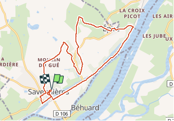
![](/images/other/stat-length.png)
![Excursión Senderismo Savennières - Savennières - Photo](https://media.geolcdn.com/t/1900/400/ext.pjpeg?maxdim=2&url=https%3A%2F%2Fstatic1.geolcdn.com%2Fsiteimages%2Fupload%2Ffiles%2F1553511878bg_sport_marche.png)
Savennières
Polenade
Usuario
![Longitud](/images/other/stat-length.png)
![Altitud máxima](https://static1.geolcdn.com/siteimages/upload/files/1508320355ic_sort_altitude_max_24dp.png)
![Desnivel positivo](https://static1.geolcdn.com/siteimages/upload/files/1508320355ic_sort_den_pos_24dp.png)
![Km-Effort](/images/other/stat-length.png)
![Altitud mínima](https://static1.geolcdn.com/siteimages/upload/files/1508320355ic_sort_altitude_min_24dp.png)
![Desnivel negativo](https://static1.geolcdn.com/siteimages/upload/files/1508320355ic_sort_den_neg_24dp.png)
![Boucle](https://static1.geolcdn.com/siteimages/upload/files/16400158638029165_repeat_loop_refresh_sync_direction_icon.png)
![Senderismo](https://static1.geolcdn.com/sitytour/trail-icons/101.png)
2h15
Dificultad : Fácil
![Escanee este código QR para abrir la excursión en la aplicación SityTrail](https://capi.geolives.com/qq0zvz2zws4bq2lad0pu/sitytour/trails/2399850/qr.png?size=200)
Aplicación GPS de excursión GRATIS
A propósito
Ruta Senderismo de 10,6 km a descubrir en Países del Loira, Maine-y-Loira, Savennières. Esta ruta ha sido propuesta por Polenade.
Descripción
La Loire, le vignoble, les villages ... Tout est à délecter, dont le vin local.
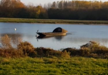
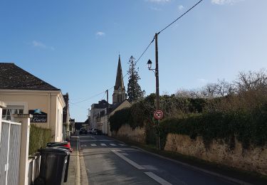
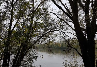
Départ sur le parking derrière cette belle église à visiter. Après avoir passer sous la voie ferrée prendre le second escalier à gauche. On longe la Loire en face de l'île de Béhuard. On monte à gauche après la Pierre Bécherelle, lieu d'escalade.
A voir la fontaine St Guénette, le petit bourg d'Epiré avec son chai dans une ancienne église. On atteint les vignes par le chemin du Pitrouillet. Ici on cultive le chenin qui donne le fameux Savennières : vues imprenables sur la vallée de la Loire que l'on domine. on retrouve les vignes après une très agréable montée en sous-bois. Puis on replonge sur le superbe village de Savennières : belles demeures, chateaux... En fin de parcours ne pas oublier cet arbre remarquable : un platane de qui couvre 1300 m au sol!
Localización
Comentarios
Excursiones cerca
![Excursión Senderismo Rochefort-sur-Loire - track - Photo](https://media.geolcdn.com/t/375/260/ext.jpg?maxdim=2&url=https%3A%2F%2Fstatic1.geolcdn.com%2Fsiteimages%2Fupload%2Ffiles%2F1553511878bg_sport_marche.png)
![Senderismo Senderismo](https://static1.geolcdn.com/sitytour/trail-icons/101.png)
Senderismo
![](/images/other/stat-length.png)
![](https://static1.geolcdn.com/siteimages/upload/files/16400158638029165_repeat_loop_refresh_sync_direction_icon.png)
![Excursión Senderismo La Possonnière - Translayon 2023 14ème édition - Photo](https://media.geolcdn.com/t/375/260/5ef3cacd-2fd7-425a-b597-91c88ce44ce7.jpg&format=jpg&maxdim=2)
![Senderismo Senderismo](https://static1.geolcdn.com/sitytour/trail-icons/101.png)
Senderismo
![](/images/other/stat-length.png)
![](https://static1.geolcdn.com/siteimages/upload/files/16400158638029165_repeat_loop_refresh_sync_direction_icon.png)
![Excursión Senderismo Chaudefonds-sur-Layon - Chaudefonds sur Layon - Photo](https://media.geolcdn.com/t/375/260/b9c1cdb4-a84d-417b-9741-37e30567b309.jpg&format=jpg&maxdim=2)
![Senderismo Senderismo](https://static1.geolcdn.com/sitytour/trail-icons/101.png)
Senderismo
![](/images/other/stat-length.png)
![](https://static1.geolcdn.com/siteimages/upload/files/16400158638029165_repeat_loop_refresh_sync_direction_icon.png)
![Excursión Senderismo Bouchemaine - la pointe bouchemaine - Photo](https://media.geolcdn.com/t/375/260/1c019e92-72e1-4aea-896a-815dbdaf932e.jpg&format=jpg&maxdim=2)
![Senderismo Senderismo](https://static1.geolcdn.com/sitytour/trail-icons/101.png)
Senderismo
![](/images/other/stat-length.png)
![](https://static1.geolcdn.com/siteimages/upload/files/16400158638029165_repeat_loop_refresh_sync_direction_icon.png)
![Excursión A pie Béhuard - Béhuard : flânerie autour de l'île - Photo](https://media.geolcdn.com/t/375/260/807d8b25-3443-44eb-a6bc-013ab0a11d16.jpeg&format=jpg&maxdim=2)
![A pie A pie](https://static1.geolcdn.com/sitytour/trail-icons/100.png)
A pie
![](/images/other/stat-length.png)
![](https://static1.geolcdn.com/siteimages/upload/files/16400158638029165_repeat_loop_refresh_sync_direction_icon.png)
![Excursión Senderismo Bouchemaine - Bouchemaine, abbaye de La Baumette - Photo](https://media.geolcdn.com/t/375/260/cfc5d746-9ef4-467c-82cc-192252dd2c23.jpg&format=jpg&maxdim=2)
![Senderismo Senderismo](https://static1.geolcdn.com/sitytour/trail-icons/101.png)
Senderismo
![](/images/other/stat-length.png)
![](https://static1.geolcdn.com/siteimages/upload/files/16400158638029165_repeat_loop_refresh_sync_direction_icon.png)
![Excursión Senderismo Val-du-Layon - gpx-trace - Photo](https://media.geolcdn.com/t/375/260/ext.jpg?maxdim=2&url=https%3A%2F%2Fstatic1.geolcdn.com%2Fsiteimages%2Fupload%2Ffiles%2F1553511878bg_sport_marche.png)
![Senderismo Senderismo](https://static1.geolcdn.com/sitytour/trail-icons/101.png)
Senderismo
![](/images/other/stat-length.png)
![](https://static1.geolcdn.com/siteimages/upload/files/16400158638029165_repeat_loop_refresh_sync_direction_icon.png)
![Excursión Senderismo Savennières - Savennières - Photo](https://media.geolcdn.com/t/375/260/ce74d5bc-e7d7-44a8-a836-a5b5e41618f0.jpg&format=jpg&maxdim=2)
![Senderismo Senderismo](https://static1.geolcdn.com/sitytour/trail-icons/101.png)
Senderismo
![](/images/other/stat-length.png)
![](https://static1.geolcdn.com/siteimages/upload/files/16400158638029165_repeat_loop_refresh_sync_direction_icon.png)
![Excursión Senderismo Saint-Jean-de-la-Croix - St Jean de la Croix - Photo](https://media.geolcdn.com/t/375/260/688eb6fe-ce75-4f32-bc41-11b45e639a66.jpg&format=jpg&maxdim=2)
![Senderismo Senderismo](https://static1.geolcdn.com/sitytour/trail-icons/101.png)
Senderismo
![](/images/other/stat-length.png)
![](https://static1.geolcdn.com/siteimages/upload/files/16400158638029165_repeat_loop_refresh_sync_direction_icon.png)