![](/images/other/stat-length.png)
![Excursión Otra actividad Zernez - Furcola Val Botsch / Sur il Foss / Costainas - Photo](https://media.geolcdn.com/t/1900/400/ext.pjpeg?maxdim=2&url=https%3A%2F%2Fstatic1.geolcdn.com%2Fsiteimages%2Fupload%2Ffiles%2F1545311037marcheuse_200dpi.jpg)
Furcola Val Botsch / Sur il Foss / Costainas
bffcuc
Usuario
![Longitud](/images/other/stat-length.png)
![Altitud máxima](https://static1.geolcdn.com/siteimages/upload/files/1508320355ic_sort_altitude_max_24dp.png)
![Desnivel positivo](https://static1.geolcdn.com/siteimages/upload/files/1508320355ic_sort_den_pos_24dp.png)
![Km-Effort](/images/other/stat-length.png)
![Altitud mínima](https://static1.geolcdn.com/siteimages/upload/files/1508320355ic_sort_altitude_min_24dp.png)
![Desnivel negativo](https://static1.geolcdn.com/siteimages/upload/files/1508320355ic_sort_den_neg_24dp.png)
![Boucle](https://static1.geolcdn.com/siteimages/upload/files/16400158638029165_repeat_loop_refresh_sync_direction_icon.png)
![Otra actividad](https://static1.geolcdn.com/sitytour/trail-icons/900.png)
--
Dificultad : Desconocido
![Escanee este código QR para abrir la excursión en la aplicación SityTrail](https://capi.geolives.com/qq0zvz2zws4bq2lad0pu/sitytour/trails/23888/qr.png?size=200)
Aplicación GPS de excursión GRATIS
A propósito
Ruta Otra actividad de 30 km a descubrir en Grisones, Region Engiadina Bassa/Val Müstair, Zernez. Esta ruta ha sido propuesta por bffcuc.
Descripción
Anstrengende aber grossartige Tour duch den Nationalpark.
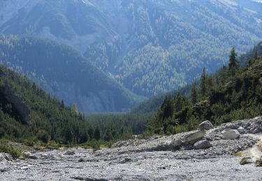
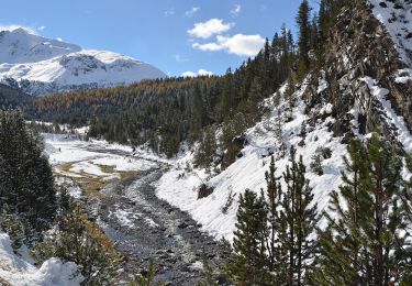
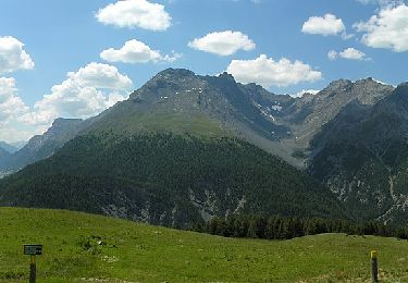
Von Buffalora aus steigt man an den alten Eisenerzminen vorbei zum Nationalpark auf. Danach verläft die Route auf gut 2''300 Metern Höhe richtung Munt la Schera. Gämsen und Murmeltiere können beobachtet werden. Danach steigt man zum Plateau des Munt la Schera hoch, von wo man eine grossartige Aussicht hat. Danach gehts runter auf die Alp la Schera und weiter Richtung Spölschlucht. Kurz vor der Staumauer zweigt man rechts ab und überquert die Spöl. Dann folgt man hoch über dem FLuss dem Verlauf der Schlucht bis man auf den Fussweg der vom Munter herunterommt trifft. Hier überquert man die Spöl erneut, traversiert dann die Ofenpasstrasse und wandert durch einen schönen Bergwald hoch zur Alp Grumells. Von her hat man einen wunderbaren Ausblick ins Fuorn-Tal. Danach geht es runter nach Il Fuorn. Hier gibt es ein Hotel, es ist die einzige Verpflegungsmöglichkeit während der ganzen Wanderung. Dnach folgt man dem Fuorntal hoch in zurück nach Buffalora. Dieser Teil der Wanderung ist nicht mehr sonderlich attraktiv. Wer will kann auch das Postauto nehmen.
Localización
Comentarios
Excursiones cerca
![Excursión A pie Zernez - Nationalpark Wanderroute 16 (Fuorntal) - Photo](https://media.geolcdn.com/t/375/260/dev_b47906a4-0a0c-47a9-8e95-628ca5757862.jpeg&format=jpg&maxdim=2)
![A pie A pie](https://static1.geolcdn.com/sitytour/trail-icons/100.png)
A pie
![](/images/other/stat-length.png)
![](https://static1.geolcdn.com/siteimages/upload/files/16400158638029165_repeat_loop_refresh_sync_direction_icon.png)
![Excursión A pie Zernez - P7 - Margunet - Stabelchod - P8 - P7 - Photo](https://media.geolcdn.com/t/375/260/83a8d9bc-4994-4e4a-92b2-11a43b17ba43.jpeg&format=jpg&maxdim=2)
![A pie A pie](https://static1.geolcdn.com/sitytour/trail-icons/100.png)
A pie
![](/images/other/stat-length.png)
![](https://static1.geolcdn.com/siteimages/upload/files/16400158638029165_repeat_loop_refresh_sync_direction_icon.png)
![Excursión A pie Zernez - Punt dal Gal - Punt la Drossa - Photo](https://media.geolcdn.com/t/375/260/b5a85f00-7869-4b1d-bb20-90c2864a66f0.jpeg&format=jpg&maxdim=2)
![A pie A pie](https://static1.geolcdn.com/sitytour/trail-icons/100.png)
A pie
![](/images/other/stat-length.png)
![](https://static1.geolcdn.com/siteimages/upload/files/16400158638029165_repeat_loop_refresh_sync_direction_icon.png)
![Excursión A pie Zernez - Nationalpark Wanderroute 13 (Champlönch) - Photo](https://media.geolcdn.com/t/375/260/7214e2c0-1b5b-4610-beb4-b5246d065ea1.jpeg&format=jpg&maxdim=2)
![A pie A pie](https://static1.geolcdn.com/sitytour/trail-icons/100.png)
A pie
![](/images/other/stat-length.png)
![](https://static1.geolcdn.com/siteimages/upload/files/16400158638029165_repeat_loop_refresh_sync_direction_icon.png)
![Excursión A pie Val Müstair - Nationalpark Wanderroute 15 (Munt la Schera) - Photo](https://media.geolcdn.com/t/375/260/dev_a970fcb7-0ab6-49e0-9e68-48c02f68ec84.jpeg&format=jpg&maxdim=2)
![A pie A pie](https://static1.geolcdn.com/sitytour/trail-icons/100.png)
A pie
![](/images/other/stat-length.png)
![](https://static1.geolcdn.com/siteimages/upload/files/16400158638029165_repeat_loop_refresh_sync_direction_icon.png)
![Excursión Otra actividad Zernez - w10_10_natpark - Photo](https://media.geolcdn.com/t/375/260/ext.jpg?maxdim=2&url=https%3A%2F%2Fstatic1.geolcdn.com%2Fsiteimages%2Fupload%2Ffiles%2F1545311037marcheuse_200dpi.jpg)
![Otra actividad Otra actividad](https://static1.geolcdn.com/sitytour/trail-icons/900.png)
Otra actividad
![](/images/other/stat-length.png)
![](https://static1.geolcdn.com/siteimages/upload/files/16400158638029165_repeat_loop_refresh_sync_direction_icon.png)
![Excursión Otra actividad Val Müstair - La Schera Runde - Photo](https://media.geolcdn.com/t/375/260/ext.jpg?maxdim=2&url=https%3A%2F%2Fstatic1.geolcdn.com%2Fsiteimages%2Fupload%2Ffiles%2F1545311037marcheuse_200dpi.jpg)
![Otra actividad Otra actividad](https://static1.geolcdn.com/sitytour/trail-icons/900.png)
Otra actividad
![](/images/other/stat-length.png)
![](https://static1.geolcdn.com/siteimages/upload/files/16400158638029165_repeat_loop_refresh_sync_direction_icon.png)
![Excursión Otra actividad Zernez - Valaun Chafuol, Murter, Val Cluozza, Zernez - Photo](https://media.geolcdn.com/t/375/260/ext.jpg?maxdim=2&url=https%3A%2F%2Fstatic1.geolcdn.com%2Fsiteimages%2Fupload%2Ffiles%2F1545311037marcheuse_200dpi.jpg)
![Otra actividad Otra actividad](https://static1.geolcdn.com/sitytour/trail-icons/900.png)
Otra actividad
![](/images/other/stat-length.png)
![](https://static1.geolcdn.com/siteimages/upload/files/16400158638029165_repeat_loop_refresh_sync_direction_icon.png)
![Excursión Otra actividad Zernez - Nationalpark: Margunet - Photo](https://media.geolcdn.com/t/375/260/ext.jpg?maxdim=2&url=https%3A%2F%2Fstatic1.geolcdn.com%2Fsiteimages%2Fupload%2Ffiles%2F1545311037marcheuse_200dpi.jpg)
![Otra actividad Otra actividad](https://static1.geolcdn.com/sitytour/trail-icons/900.png)
Otra actividad
![](/images/other/stat-length.png)
![](https://static1.geolcdn.com/siteimages/upload/files/16400158638029165_repeat_loop_refresh_sync_direction_icon.png)