![](/images/other/stat-length.png)
![Excursión París - SityTrail - 817601 - gr-2024-complet - Photo](https://media.geolcdn.com/t/1900/400/ext.pjpeg?maxdim=2&url=https%3A%2F%2Fsecurestorage.geolives.com%2Fsitytour%2Ftrail-bg%2Fdefault.jpg)
SityTrail - 817601 - gr-2024-complet
BobC
Usuario
![Longitud](/images/other/stat-length.png)
![Altitud máxima](https://static1.geolcdn.com/siteimages/upload/files/1508320355ic_sort_altitude_max_24dp.png)
![Desnivel positivo](https://static1.geolcdn.com/siteimages/upload/files/1508320355ic_sort_den_pos_24dp.png)
![Km-Effort](/images/other/stat-length.png)
![Altitud mínima](https://static1.geolcdn.com/siteimages/upload/files/1508320355ic_sort_altitude_min_24dp.png)
![Desnivel negativo](https://static1.geolcdn.com/siteimages/upload/files/1508320355ic_sort_den_neg_24dp.png)
![Boucle](https://static1.geolcdn.com/siteimages/upload/files/16400158638029165_repeat_loop_refresh_sync_direction_icon.png)
![Escanee este código QR para abrir la excursión en la aplicación SityTrail](https://capi.geolives.com/qq0zvz2zws4bq2lad0pu/sitytour/trails/2364168/qr.png?size=200)
Aplicación GPS de excursión GRATIS
A propósito
Ruta de 51 km a descubrir en Isla de Francia, París, París. Esta ruta ha sido propuesta por BobC.
Descripción
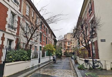
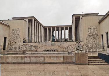
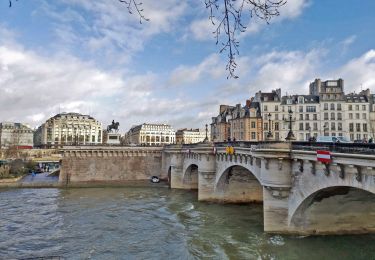
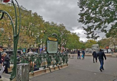
Le parcours du GR est exclusivement parisien. Son point de départ et d'arrivée est fixé à la Géode, au parc de la Villette. Il est connecté aux sept sentiers (GR1, GR2, GR22, GR14, GR 14A, GR655) qui aboutissent à Paris. Longeant en partie l'ancienne ligne de Petite Ceinture, il traverse 70 espaces verts dont le parc de la Villette, le parc Kellermann, le parc de Bercy, le bois de Vincennes, le parc André-Citroën, le parc Martin-Luther-King, le bois de Boulogne, et passe près de nombreux centres sportifs (parc des Princes, stade Charléty, etc), dont certains sites olympiques des JO de 1900 et de 1924, comme la piscine Georges-Vallerey.
Partenaires
Le GR2024 est inauguré le 15 juin 2017 par la Ville de Paris, de la Fédération française de la randonnée pédestre et de l’athlète Ladji Doucouré. Le parcours est créé en soutien à la candidature de Paris pour l'organisation des Jeux olympiques d'été de 2024.
Localización
Comentarios
Excursiones cerca
![Excursión Senderismo París - PAH-02 - Photo](https://media.geolcdn.com/t/375/260/ee3b1f27-bb87-433f-86a1-54f44c35876e.jpg&format=jpg&maxdim=2)
![Senderismo Senderismo](https://static1.geolcdn.com/sitytour/trail-icons/101.png)
![Excursión Senderismo París - DP75-16 De Chevaleret à Tolbiac - Photo](https://media.geolcdn.com/t/375/260/8a47c3b6-24b3-49fa-a2b6-5293a39f948c.jpg&format=jpg&maxdim=2)
![Senderismo Senderismo](https://static1.geolcdn.com/sitytour/trail-icons/101.png)
Senderismo
![](/images/other/stat-length.png)
![](https://static1.geolcdn.com/siteimages/upload/files/16400158638029165_repeat_loop_refresh_sync_direction_icon.png)
![Excursión Senderismo París - DP75-15 Du square Saint-Médard à Chevaleret - Photo](https://media.geolcdn.com/t/375/260/78e272bf-5c47-4ff2-b6dd-62e8326c2885.jpg&format=jpg&maxdim=2)
![Senderismo Senderismo](https://static1.geolcdn.com/sitytour/trail-icons/101.png)
Senderismo
![](/images/other/stat-length.png)
![](https://static1.geolcdn.com/siteimages/upload/files/16400158638029165_repeat_loop_refresh_sync_direction_icon.png)
![Excursión Senderismo París - DP75-14 De Sèvres-Babylone au square Saint-Médard - Photo](https://media.geolcdn.com/t/375/260/a199d31d-b175-4057-acc7-f0c89d3fc917.jpg&format=jpg&maxdim=2)
![Senderismo Senderismo](https://static1.geolcdn.com/sitytour/trail-icons/101.png)
Senderismo
![](/images/other/stat-length.png)
![](https://static1.geolcdn.com/siteimages/upload/files/16400158638029165_repeat_loop_refresh_sync_direction_icon.png)
![Excursión Senderismo París - DP75-13 De Vaugirard à Sèvres-Babylone - Photo](https://media.geolcdn.com/t/375/260/ef3b90ff-736f-49ef-8953-54f5a63f322a.jpg&format=jpg&maxdim=2)
![Senderismo Senderismo](https://static1.geolcdn.com/sitytour/trail-icons/101.png)
Senderismo
![](/images/other/stat-length.png)
![](https://static1.geolcdn.com/siteimages/upload/files/16400158638029165_repeat_loop_refresh_sync_direction_icon.png)
![Excursión Senderismo París - DP75-11 De Boulainvilliers à pont du Garigliano - Photo](https://media.geolcdn.com/t/375/260/65f6b9b8-257b-4cb3-ae12-0b82159348dc.jpg&format=jpg&maxdim=2)
![Senderismo Senderismo](https://static1.geolcdn.com/sitytour/trail-icons/101.png)
Senderismo
![](/images/other/stat-length.png)
![](https://static1.geolcdn.com/siteimages/upload/files/16400158638029165_repeat_loop_refresh_sync_direction_icon.png)
![Excursión Senderismo París - DP75-10 De Invalides à Boulainvilliers - Photo](https://media.geolcdn.com/t/375/260/06e8c009-77c2-4d8d-a0b6-c63aa8c7d3f7.jpg&format=jpg&maxdim=2)
![Senderismo Senderismo](https://static1.geolcdn.com/sitytour/trail-icons/101.png)
Senderismo
![](/images/other/stat-length.png)
![](https://static1.geolcdn.com/siteimages/upload/files/16400158638029165_repeat_loop_refresh_sync_direction_icon.png)
![Excursión Senderismo París - DP75-09 De l'Hôtel de Ville à Invalides - Photo](https://media.geolcdn.com/t/375/260/865635ba-b03a-40ab-adac-58ed4742b4c6.jpg&format=jpg&maxdim=2)
![Senderismo Senderismo](https://static1.geolcdn.com/sitytour/trail-icons/101.png)
Senderismo
![](/images/other/stat-length.png)
![](https://static1.geolcdn.com/siteimages/upload/files/16400158638029165_repeat_loop_refresh_sync_direction_icon.png)
![Excursión Senderismo París - DP75-05 De Goncourt à Porte de Bagnolet - Photo](https://media.geolcdn.com/t/375/260/552f8292-8390-4b20-8ba7-076e18f66d66.jpg&format=jpg&maxdim=2)
![Senderismo Senderismo](https://static1.geolcdn.com/sitytour/trail-icons/101.png)
Senderismo
![](/images/other/stat-length.png)
![](https://static1.geolcdn.com/siteimages/upload/files/16400158638029165_repeat_loop_refresh_sync_direction_icon.png)