![](/images/other/stat-length.png)
![Excursión Senderismo Escales - ESCALES - La tour Romane - Photo](https://media.geolcdn.com/t/1900/400/dfcd4544-fef2-456a-b32a-8ca1903f77b4.jpg&format=pjpeg&maxdim=2)
ESCALES - La tour Romane
Licianus2
Usuario
![Longitud](/images/other/stat-length.png)
![Altitud máxima](https://static1.geolcdn.com/siteimages/upload/files/1508320355ic_sort_altitude_max_24dp.png)
![Desnivel positivo](https://static1.geolcdn.com/siteimages/upload/files/1508320355ic_sort_den_pos_24dp.png)
![Km-Effort](/images/other/stat-length.png)
![Altitud mínima](https://static1.geolcdn.com/siteimages/upload/files/1508320355ic_sort_altitude_min_24dp.png)
![Desnivel negativo](https://static1.geolcdn.com/siteimages/upload/files/1508320355ic_sort_den_neg_24dp.png)
![Boucle](https://static1.geolcdn.com/siteimages/upload/files/16400158638029165_repeat_loop_refresh_sync_direction_icon.png)
![Senderismo](https://static1.geolcdn.com/sitytour/trail-icons/101.png)
1h05
Dificultad : Muy fácil
![Escanee este código QR para abrir la excursión en la aplicación SityTrail](https://capi.geolives.com/qq0zvz2zws4bq2lad0pu/sitytour/trails/2346053/qr.png?size=200)
Aplicación GPS de excursión GRATIS
A propósito
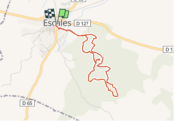
Ruta Senderismo de 4,2 km a descubrir en Occitania, Aude, Escales. Esta ruta ha sido propuesta por Licianus2.
Descripción
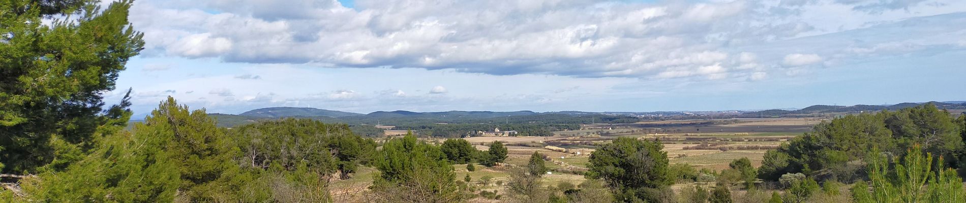
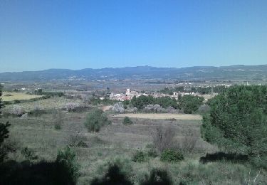
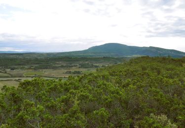
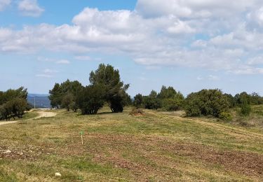
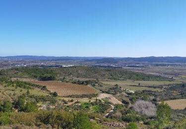
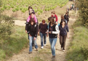
Petite boucle très bien balisée en jaune. Peut se faire en famille. Ombragée avec un dénivelé limité. Sur le parcours la « Tour d’Escales » à voir.
La tour d'escales était une tour de guet romane. Une tour de guet car, lorsque l'on rentre dans la tour, en hauteur sur le mur de droite, on peut voir une meurtrière dans une niche, orientée vers la pente, où pouvait attaquer l'ennemi. Et romane car, on peut clairement distinguer, tout en haut, deux arcs de cercle typiques de l'art roman. Deuxièmement, les ruines à droite de la tour, on peut distinguer, de par sa forme, la nef, les transepts et le cœur, ce qui indique donc un petit lieu de culte chrétien pour que les gardes de surveillance puissent prier.
Au pied de la colline qui supporte la tour, dans les environs immédiats d'une « borio », réside un cimetière dit wisigothique. Les tombes, certaines ouvertes, sont orientées vers le soleil levant. Une « borio » désigne en patois occitan un petit corps de ferme. La « borio » en question est aujourd'hui occupée.
Localización
Comentarios
Excursiones cerca
![Excursión Senderismo Tourouzelle - 11-Tourouzelle la Pinède de la Bade - 23/02/2014 - Photo](https://media.geolcdn.com/t/375/260/ext.jpg?maxdim=2&url=https%3A%2F%2Fservices.sitytrail.com%2FGeolivesWS%2FDownloadMedia.ashx%3FTrailID%3D252416%26Media%3Dfix__20140223114729.jpg)
![Senderismo Senderismo](https://static1.geolcdn.com/sitytour/trail-icons/101.png)
Senderismo
![](/images/other/stat-length.png)
![](https://static1.geolcdn.com/siteimages/upload/files/16400158638029165_repeat_loop_refresh_sync_direction_icon.png)
![Excursión Senderismo Montbrun-des-Corbières - Montbrun - Photo](https://media.geolcdn.com/t/375/260/ext.jpg?maxdim=2&url=https%3A%2F%2Fstatic1.geolcdn.com%2Fsiteimages%2Fupload%2Ffiles%2F1553511878bg_sport_marche.png)
![Senderismo Senderismo](https://static1.geolcdn.com/sitytour/trail-icons/101.png)
Senderismo
![](/images/other/stat-length.png)
![](https://static1.geolcdn.com/siteimages/upload/files/16400158638029165_repeat_loop_refresh_sync_direction_icon.png)
![Senderismo Senderismo](https://static1.geolcdn.com/sitytour/trail-icons/101.png)
Senderismo
![](/images/other/stat-length.png)
![](https://static1.geolcdn.com/siteimages/upload/files/16400158638029165_repeat_loop_refresh_sync_direction_icon.png)
![Excursión Senderismo Lézignan-Corbières - LEZIGNAN La pinède par les éoliennes - Photo](https://media.geolcdn.com/t/375/260/0c2d43da-86db-4ced-b9c3-8217ccc6dfd7.jpg&format=jpg&maxdim=2)
![Senderismo Senderismo](https://static1.geolcdn.com/sitytour/trail-icons/101.png)
Senderismo
![](/images/other/stat-length.png)
![](https://static1.geolcdn.com/siteimages/upload/files/16400158638029165_repeat_loop_refresh_sync_direction_icon.png)
![Excursión Senderismo Conilhac-Corbières - CONILHAC Les Eoliennes - Photo](https://media.geolcdn.com/t/375/260/61a6f362-e725-47d8-be5f-e8d8f9b00380.jpg&format=jpg&maxdim=2)
![Senderismo Senderismo](https://static1.geolcdn.com/sitytour/trail-icons/101.png)
Senderismo
![](/images/other/stat-length.png)
![](https://static1.geolcdn.com/siteimages/upload/files/16400158638029165_repeat_loop_refresh_sync_direction_icon.png)
![Excursión Senderismo Conilhac-Corbières - CONILHAC - lausines - Photo](https://media.geolcdn.com/t/375/260/eabb2449-16e0-4bf7-bb9c-bc1f8dc0926e.jpg&format=jpg&maxdim=2)
![Senderismo Senderismo](https://static1.geolcdn.com/sitytour/trail-icons/101.png)
Senderismo
![](/images/other/stat-length.png)
![](https://static1.geolcdn.com/siteimages/upload/files/16400158638029165_repeat_loop_refresh_sync_direction_icon.png)
![Excursión Senderismo Castelnau-d'Aude - En Corbières - Le Bosquet - Castelnau d'Aude - Photo](https://media.geolcdn.com/t/375/260/ext.jpg?maxdim=2&url=https%3A%2F%2Fservices.sitytrail.com%2FGeolivesWS%2FDownloadMedia.ashx%3FTrailID%3D172655%26Media%3D14026_3.jpg)
![Senderismo Senderismo](https://static1.geolcdn.com/sitytour/trail-icons/101.png)
Senderismo
![](/images/other/stat-length.png)
![](https://static1.geolcdn.com/siteimages/upload/files/16400158638029165_repeat_loop_refresh_sync_direction_icon.png)
![Excursión Senderismo Lézignan-Corbières - Lezignan - Photo](https://media.geolcdn.com/t/375/260/13b0da84-8142-49b5-8131-e76e6ff6171b.jpg&format=jpg&maxdim=2)
![Senderismo Senderismo](https://static1.geolcdn.com/sitytour/trail-icons/101.png)
Senderismo
![](/images/other/stat-length.png)
![](https://static1.geolcdn.com/siteimages/upload/files/16400158638029165_repeat_loop_refresh_sync_direction_icon.png)
![Excursión Senderismo La Redorte - la redorte - Photo](https://media.geolcdn.com/t/375/260/ext.jpg?maxdim=2&url=https%3A%2F%2Fstatic1.geolcdn.com%2Fsiteimages%2Fupload%2Ffiles%2F1553511878bg_sport_marche.png)
![Senderismo Senderismo](https://static1.geolcdn.com/sitytour/trail-icons/101.png)
entraînement