![](/images/other/stat-length.png)
![Excursión Senderismo Cuers - Le Castellas Cuers - Photo](https://media.geolcdn.com/t/1900/400/352a6607-7115-4274-b0d0-dbfd463c1c51.jpg&format=pjpeg&maxdim=2)
Le Castellas Cuers
Christiancordin
Usuario
![Longitud](/images/other/stat-length.png)
Longitud
13,8 km
![Altitud máxima](https://static1.geolcdn.com/siteimages/upload/files/1508320355ic_sort_altitude_max_24dp.png)
Altitud máxima
435 m
![Desnivel positivo](https://static1.geolcdn.com/siteimages/upload/files/1508320355ic_sort_den_pos_24dp.png)
Desnivel positivo
477 m
![Km-Effort](/images/other/stat-length.png)
Km-Effort
20 km
![Altitud mínima](https://static1.geolcdn.com/siteimages/upload/files/1508320355ic_sort_altitude_min_24dp.png)
Altitud mínima
150 m
![Desnivel negativo](https://static1.geolcdn.com/siteimages/upload/files/1508320355ic_sort_den_neg_24dp.png)
Desnivel negativo
476 m
![Boucle](https://static1.geolcdn.com/siteimages/upload/files/16400158638029165_repeat_loop_refresh_sync_direction_icon.png)
Boucle
Sí
Fecha de creación :
2020-02-21 08:31:11.262
Última modificación :
2020-02-21 14:25:44.102
![Senderismo](https://static1.geolcdn.com/sitytour/trail-icons/101.png)
3h49
Dificultad : Medio
![Escanee este código QR para abrir la excursión en la aplicación SityTrail](https://capi.geolives.com/qq0zvz2zws4bq2lad0pu/sitytour/trails/2341777/qr.png?size=200)
Aplicación GPS de excursión GRATIS
A propósito
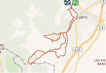
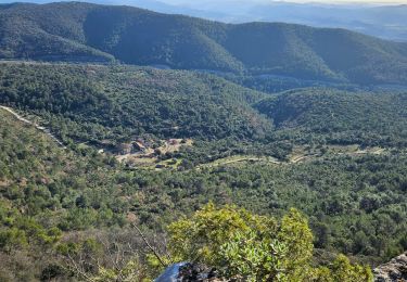
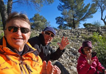
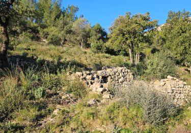
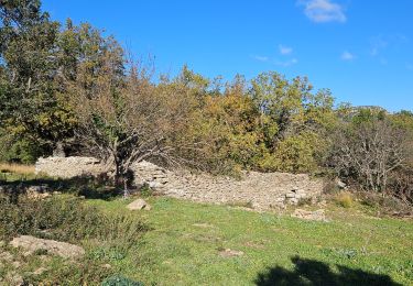
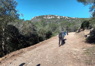
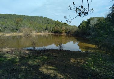
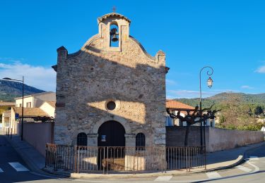
Ruta Senderismo de 13,8 km a descubrir en Provenza-Alpes-Costa Azul, Var, Cuers. Esta ruta ha sido propuesta por Christiancordin.
Descripción
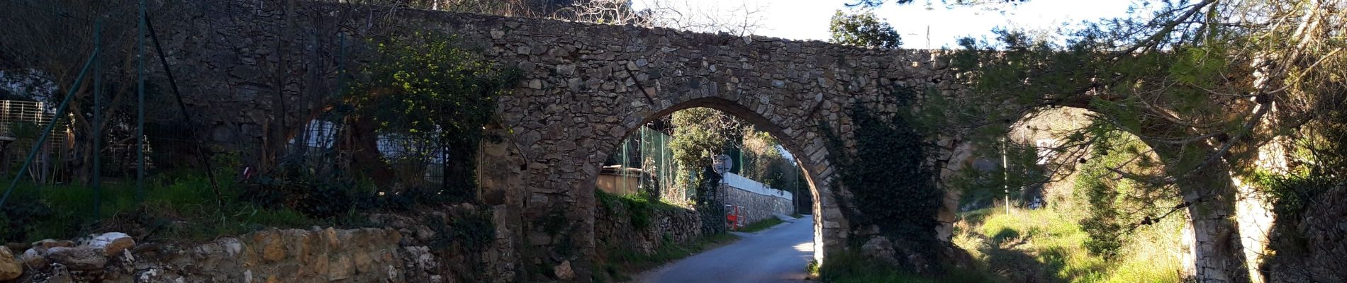
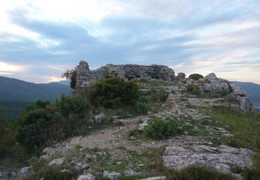
Cuers Aqueduc des 5 ponts Notre Dame de pitié le Castellas oppidum Chapelle Ste Christine.
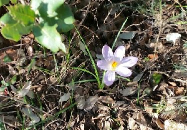
Localización
País:
France
Región :
Provenza-Alpes-Costa Azul
Departamento/provincia :
Var
Municipio :
Cuers
Localidad:
Unknown
Salida:(Dec)
Salida:(UTM)
261856 ; 4791713 (32T) N.
Comentarios
Excursiones cerca
![Excursión Bici de montaña Rocbaron - La Chapelle Sainte-Philomène - Rocbaron - Photo](https://media.geolcdn.com/t/375/260/ext.jpg?maxdim=2&url=https%3A%2F%2Fservices.sitytrail.com%2FGeolivesWS%2FDownloadMedia.ashx%3FTrailID%3D173149%26Media%3D14715_4.jpg)
![Bici de montaña Bici de montaña](https://static1.geolcdn.com/sitytour/trail-icons/202.png)
La Chapelle Sainte-Philomène - Rocbaron
Bici de montaña
Difícil
(1)
Rocbaron,
Provenza-Alpes-Costa Azul,
Var,
France
![](/images/other/stat-length.png)
25 km | 34 km-effort
4h 0min
![](https://static1.geolcdn.com/siteimages/upload/files/16400158638029165_repeat_loop_refresh_sync_direction_icon.png)
Sí
![Excursión Senderismo Cuers - la foux cuers opidum - Photo](https://media.geolcdn.com/t/375/260/ext.jpg?maxdim=2&url=https%3A%2F%2Fservices.sitytrail.com%2FGeolivesWS%2FDownloadMedia.ashx%3FTrailID%3D518258%26Media%3Dfix__20160127150117.jpg)
![Senderismo Senderismo](https://static1.geolcdn.com/sitytour/trail-icons/101.png)
la foux cuers opidum
Senderismo
Difícil
(2)
Cuers,
Provenza-Alpes-Costa Azul,
Var,
France
![](/images/other/stat-length.png)
15,1 km | 25 km-effort
6h 8min
![](https://static1.geolcdn.com/siteimages/upload/files/16400158638029165_repeat_loop_refresh_sync_direction_icon.png)
Sí
![Excursión Senderismo Cuers - Pilon Saint Clément - Photo](https://media.geolcdn.com/t/375/260/127c8d12-3441-42a6-b036-f1c61808aeac.jpg&format=jpg&maxdim=2)
![Senderismo Senderismo](https://static1.geolcdn.com/sitytour/trail-icons/101.png)
Pilon Saint Clément
Senderismo
Difícil
Cuers,
Provenza-Alpes-Costa Azul,
Var,
France
![](/images/other/stat-length.png)
9,4 km | 15,2 km-effort
4h 55min
![](https://static1.geolcdn.com/siteimages/upload/files/16400158638029165_repeat_loop_refresh_sync_direction_icon.png)
Sí
![Excursión Senderismo Cuers - Du col de la bigue vers le bas des barres de Cuers - Photo](https://media.geolcdn.com/t/375/260/4deb610c-bf41-4af0-baa2-7e7e353ac8a9.jpg&format=jpg&maxdim=2)
![Senderismo Senderismo](https://static1.geolcdn.com/sitytour/trail-icons/101.png)
Du col de la bigue vers le bas des barres de Cuers
Senderismo
Difícil
Cuers,
Provenza-Alpes-Costa Azul,
Var,
France
![](/images/other/stat-length.png)
11,9 km | 16,5 km-effort
5h 56min
![](https://static1.geolcdn.com/siteimages/upload/files/16400158638029165_repeat_loop_refresh_sync_direction_icon.png)
Sí
![Excursión Senderismo Cuers - Sous les barres de Cuers en partant de La Foux - Photo](https://media.geolcdn.com/t/375/260/ddaffc22-d3b7-42da-aa7d-3b1cd8482841.jpg&format=jpg&maxdim=2)
![Senderismo Senderismo](https://static1.geolcdn.com/sitytour/trail-icons/101.png)
Sous les barres de Cuers en partant de La Foux
Senderismo
Difícil
Cuers,
Provenza-Alpes-Costa Azul,
Var,
France
![](/images/other/stat-length.png)
13,4 km | 18,4 km-effort
4h 10min
![](https://static1.geolcdn.com/siteimages/upload/files/16400158638029165_repeat_loop_refresh_sync_direction_icon.png)
Sí
![Excursión Senderismo Cuers - Promenade sous les barres de Cuers, en partant du village de Cuers - Photo](https://media.geolcdn.com/t/375/260/763db821-3faf-41c8-99d4-ebbc220e66cf.jpg&format=jpg&maxdim=2)
![Senderismo Senderismo](https://static1.geolcdn.com/sitytour/trail-icons/101.png)
Promenade sous les barres de Cuers, en partant du village de Cuers
Senderismo
Muy difícil
Cuers,
Provenza-Alpes-Costa Azul,
Var,
France
![](/images/other/stat-length.png)
16,7 km | 22 km-effort
5h 50min
![](https://static1.geolcdn.com/siteimages/upload/files/16400158638029165_repeat_loop_refresh_sync_direction_icon.png)
Sí
![Excursión Senderismo Cuers - pilon St Clément-06-03-2024 - Photo](https://media.geolcdn.com/t/375/260/09d4d944-939e-4591-ae88-1b9547cd46a5.jpg&format=jpg&maxdim=2)
![Senderismo Senderismo](https://static1.geolcdn.com/sitytour/trail-icons/101.png)
pilon St Clément-06-03-2024
Senderismo
Medio
Cuers,
Provenza-Alpes-Costa Azul,
Var,
France
![](/images/other/stat-length.png)
18,5 km | 30 km-effort
7h 4min
![](https://static1.geolcdn.com/siteimages/upload/files/16400158638029165_repeat_loop_refresh_sync_direction_icon.png)
Sí
![Excursión Senderismo Solliès-Pont - Lac de Montbel - Photo](https://media.geolcdn.com/t/375/260/6fc5c56f-f92a-41ee-8ff6-d281a9a6dd5e.jpg&format=jpg&maxdim=2)
![Senderismo Senderismo](https://static1.geolcdn.com/sitytour/trail-icons/101.png)
Lac de Montbel
Senderismo
Muy difícil
Solliès-Pont,
Provenza-Alpes-Costa Azul,
Var,
France
![](/images/other/stat-length.png)
14,1 km | 20 km-effort
4h 34min
![](https://static1.geolcdn.com/siteimages/upload/files/16400158638029165_repeat_loop_refresh_sync_direction_icon.png)
Sí
![Excursión Senderismo Cuers - valcros ste christine - Photo](https://media.geolcdn.com/t/375/260/67c16a7c-08b4-45b7-8bdf-43004381fa9e.jpg&format=jpg&maxdim=2)
![Senderismo Senderismo](https://static1.geolcdn.com/sitytour/trail-icons/101.png)
valcros ste christine
Senderismo
Muy difícil
Cuers,
Provenza-Alpes-Costa Azul,
Var,
France
![](/images/other/stat-length.png)
15,2 km | 24 km-effort
5h 21min
![](https://static1.geolcdn.com/siteimages/upload/files/16400158638029165_repeat_loop_refresh_sync_direction_icon.png)
Sí