![](/images/other/stat-length.png)
![Excursión Senderismo Lentegí - les arbres petrifies - Photo](https://media.geolcdn.com/t/1900/400/ext.pjpeg?maxdim=2&url=https%3A%2F%2Fmedia.geolcdn.com%2Ff%2F0b9d6321-13d8-4551-a0f4-c4e1d276d87a.jpg)
les arbres petrifies
jpipacific
Usuario
![Longitud](/images/other/stat-length.png)
Longitud
9,5 km
![Altitud máxima](https://static1.geolcdn.com/siteimages/upload/files/1508320355ic_sort_altitude_max_24dp.png)
Altitud máxima
1079 m
![Desnivel positivo](https://static1.geolcdn.com/siteimages/upload/files/1508320355ic_sort_den_pos_24dp.png)
Desnivel positivo
409 m
![Km-Effort](/images/other/stat-length.png)
Km-Effort
15 km
![Altitud mínima](https://static1.geolcdn.com/siteimages/upload/files/1508320355ic_sort_altitude_min_24dp.png)
Altitud mínima
772 m
![Desnivel negativo](https://static1.geolcdn.com/siteimages/upload/files/1508320355ic_sort_den_neg_24dp.png)
Desnivel negativo
411 m
![Boucle](https://static1.geolcdn.com/siteimages/upload/files/16400158638029165_repeat_loop_refresh_sync_direction_icon.png)
Boucle
Sí
Fecha de creación :
2020-01-27 10:26:31.572
Última modificación :
2020-01-27 16:43:26.099
![Senderismo](https://static1.geolcdn.com/sitytour/trail-icons/101.png)
3h46
Dificultad : Difícil
![Escanee este código QR para abrir la excursión en la aplicación SityTrail](https://capi.geolives.com/qq0zvz2zws4bq2lad0pu/sitytour/trails/2317024/qr.png?size=200)
Aplicación GPS de excursión GRATIS
A propósito
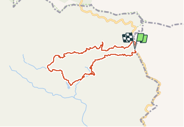
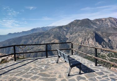
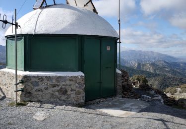
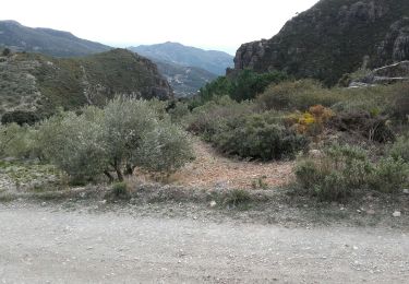
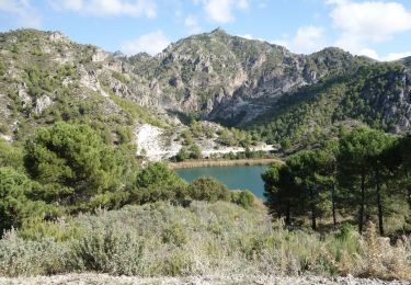
Ruta Senderismo de 9,5 km a descubrir en Andalucía, Granada, Lentegí. Esta ruta ha sido propuesta por jpipacific.
Descripción
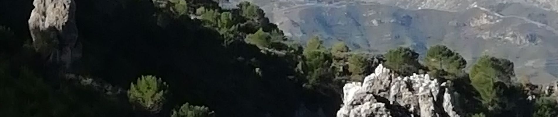
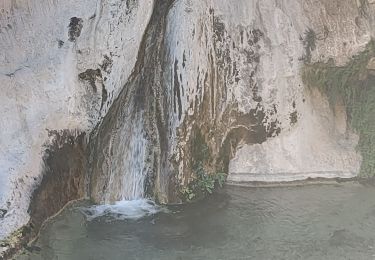
Magnifique randonnée jusqu'à la cascade des arbres pétrifiés.
Après c'est un peu long, les paysages sont moins époustouflants et la pente n'est pas douce.
Localización
País:
Spain
Región :
Andalucía
Departamento/provincia :
Granada
Municipio :
Lentegí
Localidad:
Unknown
Salida:(Dec)
Salida:(UTM)
435496 ; 4079750 (30S) N.
Comentarios
Excursiones cerca
![Excursión Senderismo Lentegí - Poza de las animas - Photo](https://media.geolcdn.com/t/375/260/ext.jpg?maxdim=2&url=https%3A%2F%2Fmedia.geolcdn.com%2Ff%2F138d79bf-c8e6-4959-ad11-fb1767b7d5eb.jpg)
![Senderismo Senderismo](https://static1.geolcdn.com/sitytour/trail-icons/101.png)
Poza de las animas
Senderismo
Medio
(1)
Lentegí,
Andalucía,
Granada,
Spain
![](/images/other/stat-length.png)
5,4 km | 9,5 km-effort
2h 42min
![](https://static1.geolcdn.com/siteimages/upload/files/16400158638029165_repeat_loop_refresh_sync_direction_icon.png)
Sí
![Excursión Senderismo Albuñuelas - Casas forestales de la huida - Photo](https://media.geolcdn.com/t/375/260/ext.jpg?maxdim=2&url=https%3A%2F%2Fmedia.geolcdn.com%2Ff%2Fb799c49f-c161-43d0-a137-70666738a819.jpg)
![Senderismo Senderismo](https://static1.geolcdn.com/sitytour/trail-icons/101.png)
Casas forestales de la huida
Senderismo
Medio
Albuñuelas,
Andalucía,
Granada,
Spain
![](/images/other/stat-length.png)
7,7 km | 10,3 km-effort
2h 20min
![](https://static1.geolcdn.com/siteimages/upload/files/16400158638029165_repeat_loop_refresh_sync_direction_icon.png)
Sí
![Excursión Senderismo Lentegí - Lentegi Las Bizarras - Photo](https://media.geolcdn.com/t/375/260/ext.jpg?maxdim=2&url=https%3A%2F%2Fmedia.geolcdn.com%2Ff%2F6e3b7bc9-1a0d-4a1d-bbbf-2f25e6bc75de.jpg)
![Senderismo Senderismo](https://static1.geolcdn.com/sitytour/trail-icons/101.png)
Lentegi Las Bizarras
Senderismo
Medio
Lentegí,
Andalucía,
Granada,
Spain
![](/images/other/stat-length.png)
8,5 km | 13,9 km-effort
3h 51min
![](https://static1.geolcdn.com/siteimages/upload/files/16400158638029165_repeat_loop_refresh_sync_direction_icon.png)
Sí
![Excursión Senderismo Albuñuelas - pico Lopera - Photo](https://media.geolcdn.com/t/375/260/ext.jpg?maxdim=2&url=https%3A%2F%2Fmedia.geolcdn.com%2Ff%2F35cc272b-f47d-4f9b-80d4-f6141b4e6d16.jpg)
![Senderismo Senderismo](https://static1.geolcdn.com/sitytour/trail-icons/101.png)
![Excursión Motocross Lentegí - Lentegi Vélez de Benaudalla - Photo](https://media.geolcdn.com/t/375/260/ext.jpg?maxdim=2&url=https%3A%2F%2Fmedia.geolcdn.com%2Ff%2F82f69f2a-fa53-4f07-aef5-63c3aeaa5dc3.jpg)
![Motocross Motocross](https://static1.geolcdn.com/sitytour/trail-icons/406.png)
Lentegi Vélez de Benaudalla
Motocross
Muy fácil
Lentegí,
Andalucía,
Granada,
Spain
![](/images/other/stat-length.png)
74 km | 104 km-effort
2h 31min
![](https://static1.geolcdn.com/siteimages/upload/files/16400158638029165_repeat_loop_refresh_sync_direction_icon.png)
No
![Excursión Senderismo Lentegí - Lentegi 2019 - Photo](https://media.geolcdn.com/t/375/260/ext.jpg?maxdim=2&url=https%3A%2F%2Fmedia.geolcdn.com%2Ff%2Fa924e236-f249-4f5e-ad92-4ffdbc7fba71.jpg)
![Senderismo Senderismo](https://static1.geolcdn.com/sitytour/trail-icons/101.png)
Lentegi 2019
Senderismo
Muy fácil
Lentegí,
Andalucía,
Granada,
Spain
![](/images/other/stat-length.png)
5 km | 7,4 km-effort
1h 33min
![](https://static1.geolcdn.com/siteimages/upload/files/16400158638029165_repeat_loop_refresh_sync_direction_icon.png)
Sí
![Excursión Senderismo Otívar - 1er novembre 2017 Roi Verde - Photo](https://media.geolcdn.com/t/375/260/ext.jpg?maxdim=2&url=https%3A%2F%2Fmedia.geolcdn.com%2Ff%2Ff047a4e1-d181-47a5-aade-4e2f9b3d73aa.JPG)
![Senderismo Senderismo](https://static1.geolcdn.com/sitytour/trail-icons/101.png)
1er novembre 2017 Roi Verde
Senderismo
Muy fácil
Otívar,
Andalucía,
Granada,
Spain
![](/images/other/stat-length.png)
55 km | 77 km-effort
1h 58min
![](https://static1.geolcdn.com/siteimages/upload/files/16400158638029165_repeat_loop_refresh_sync_direction_icon.png)
No
![Excursión Senderismo Otívar - rio verde depuis parking GPX - Photo](https://media.geolcdn.com/t/375/260/ext.jpg?maxdim=2&url=https%3A%2F%2Fstatic1.geolcdn.com%2Fsiteimages%2Fupload%2Ffiles%2F1553511878bg_sport_marche.png)
![Senderismo Senderismo](https://static1.geolcdn.com/sitytour/trail-icons/101.png)
rio verde depuis parking GPX
Senderismo
Muy fácil
Otívar,
Andalucía,
Granada,
Spain
![](/images/other/stat-length.png)
8,7 km | 15,1 km-effort
3h 17min
![](https://static1.geolcdn.com/siteimages/upload/files/16400158638029165_repeat_loop_refresh_sync_direction_icon.png)
Sí
![Excursión Senderismo Lentegí - Rio Verde alta GPX - Photo](https://media.geolcdn.com/t/375/260/ext.jpg?maxdim=2&url=https%3A%2F%2Fstatic1.geolcdn.com%2Fsiteimages%2Fupload%2Ffiles%2F1553511878bg_sport_marche.png)
![Senderismo Senderismo](https://static1.geolcdn.com/sitytour/trail-icons/101.png)
Rio Verde alta GPX
Senderismo
Muy fácil
Lentegí,
Andalucía,
Granada,
Spain
![](/images/other/stat-length.png)
7,2 km | 10,5 km-effort
2h 19min
![](https://static1.geolcdn.com/siteimages/upload/files/16400158638029165_repeat_loop_refresh_sync_direction_icon.png)
No