![](/images/other/stat-length.png)
LUC SUR ORBIEU - la Roche trouée
Licianus2
Usuario
![Longitud](/images/other/stat-length.png)
![Altitud máxima](https://static1.geolcdn.com/siteimages/upload/files/1508320355ic_sort_altitude_max_24dp.png)
![Desnivel positivo](https://static1.geolcdn.com/siteimages/upload/files/1508320355ic_sort_den_pos_24dp.png)
![Km-Effort](/images/other/stat-length.png)
![Altitud mínima](https://static1.geolcdn.com/siteimages/upload/files/1508320355ic_sort_altitude_min_24dp.png)
![Desnivel negativo](https://static1.geolcdn.com/siteimages/upload/files/1508320355ic_sort_den_neg_24dp.png)
![Boucle](https://static1.geolcdn.com/siteimages/upload/files/16400158638029165_repeat_loop_refresh_sync_direction_icon.png)
![Senderismo](https://static1.geolcdn.com/sitytour/trail-icons/101.png)
1h33
Dificultad : Muy fácil
![Escanee este código QR para abrir la excursión en la aplicación SityTrail](https://capi.geolives.com/qq0zvz2zws4bq2lad0pu/sitytour/trails/2299376/qr.png?size=200)
Aplicación GPS de excursión GRATIS
A propósito
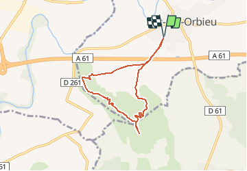
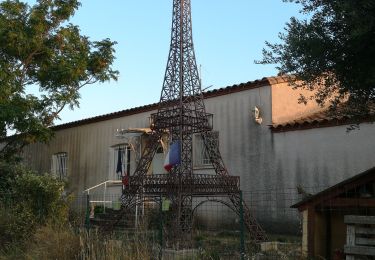
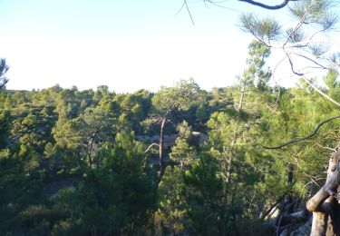
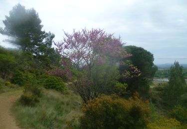
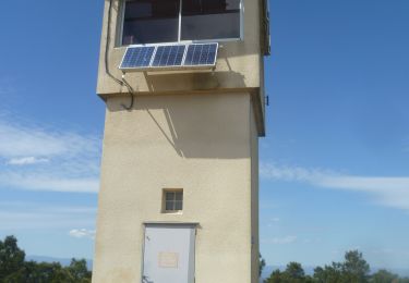
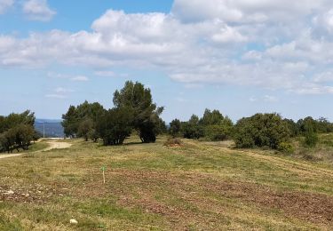
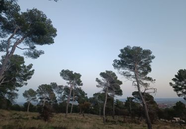
Ruta Senderismo de 6,8 km a descubrir en Occitania, Aude, Luc-sur-Orbieu. Esta ruta ha sido propuesta por Licianus2.
Descripción
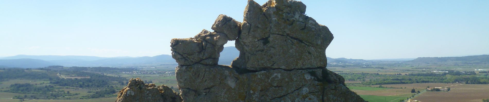
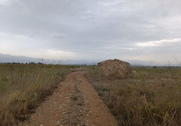
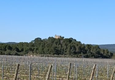
Petite boucle constituée principalement de pistes et d'une bonne partie de chemins ruraux goudronnée. Le petit passage par "la roche trouée" reste cependant agréable et pensez à dépasser la croix du balisage pour monter jusqu’à une borne géodésique à 180 m, offrant une belle panoramique.
Localización
Comentarios
Excursiones cerca
![Excursión Senderismo Lézignan-Corbières - La Roche Trouée (2) - Photo](https://media.geolcdn.com/t/375/260/26c1d966-bce5-454f-8bb9-55217d5081e5.jpg&format=jpg&maxdim=2)
![Senderismo Senderismo](https://static1.geolcdn.com/sitytour/trail-icons/101.png)
Senderismo
![](/images/other/stat-length.png)
![](https://static1.geolcdn.com/siteimages/upload/files/16400158638029165_repeat_loop_refresh_sync_direction_icon.png)
![Excursión Senderismo Lézignan-Corbières - Lézignan Corbières-Argens Minervois-Olonzac - Photo](https://media.geolcdn.com/t/375/260/6f6845e7-9549-4c29-a070-e1ffdd655148.jpg&format=jpg&maxdim=2)
![Senderismo Senderismo](https://static1.geolcdn.com/sitytour/trail-icons/101.png)
Senderismo
![](/images/other/stat-length.png)
![](https://static1.geolcdn.com/siteimages/upload/files/16400158638029165_repeat_loop_refresh_sync_direction_icon.png)
![Excursión Senderismo Lézignan-Corbières - Lézignan Corbières - Fontarèche- Relais des Corbières - Photo](https://media.geolcdn.com/t/375/260/5886abe1-3fe5-40bd-b548-3f7c4ae5c568.jpg&format=jpg&maxdim=2)
![Senderismo Senderismo](https://static1.geolcdn.com/sitytour/trail-icons/101.png)
Senderismo
![](/images/other/stat-length.png)
![](https://static1.geolcdn.com/siteimages/upload/files/16400158638029165_repeat_loop_refresh_sync_direction_icon.png)
![Excursión Senderismo Boutenac - BOUTENAC - Circuit des combes par la chapelle St Siméon - Photo](https://media.geolcdn.com/t/375/260/6d952a44-6ab0-4a19-85d3-879d77425b43.jpg&format=jpg&maxdim=2)
![Senderismo Senderismo](https://static1.geolcdn.com/sitytour/trail-icons/101.png)
Senderismo
![](/images/other/stat-length.png)
![](https://static1.geolcdn.com/siteimages/upload/files/16400158638029165_repeat_loop_refresh_sync_direction_icon.png)
![Senderismo Senderismo](https://static1.geolcdn.com/sitytour/trail-icons/101.png)
Senderismo
![](/images/other/stat-length.png)
![](https://static1.geolcdn.com/siteimages/upload/files/16400158638029165_repeat_loop_refresh_sync_direction_icon.png)
![Senderismo Senderismo](https://static1.geolcdn.com/sitytour/trail-icons/101.png)
Senderismo
![](/images/other/stat-length.png)
![](https://static1.geolcdn.com/siteimages/upload/files/16400158638029165_repeat_loop_refresh_sync_direction_icon.png)
![Excursión Senderismo Lézignan-Corbières - LEZIGNAN La pinède par les éoliennes - Photo](https://media.geolcdn.com/t/375/260/0c2d43da-86db-4ced-b9c3-8217ccc6dfd7.jpg&format=jpg&maxdim=2)
![Senderismo Senderismo](https://static1.geolcdn.com/sitytour/trail-icons/101.png)
Senderismo
![](/images/other/stat-length.png)
![](https://static1.geolcdn.com/siteimages/upload/files/16400158638029165_repeat_loop_refresh_sync_direction_icon.png)
![Excursión Senderismo Lézignan-Corbières - La Pinède Lézignan Corbières - Photo](https://media.geolcdn.com/t/375/260/b6ff1560-ed9b-46b9-a1db-33279c5f55ff.jpg&format=jpg&maxdim=2)
![Senderismo Senderismo](https://static1.geolcdn.com/sitytour/trail-icons/101.png)
Senderismo
![](/images/other/stat-length.png)
![](https://static1.geolcdn.com/siteimages/upload/files/16400158638029165_repeat_loop_refresh_sync_direction_icon.png)
![Excursión Senderismo Lézignan-Corbières - Lezignan - Photo](https://media.geolcdn.com/t/375/260/13b0da84-8142-49b5-8131-e76e6ff6171b.jpg&format=jpg&maxdim=2)
![Senderismo Senderismo](https://static1.geolcdn.com/sitytour/trail-icons/101.png)
Senderismo
![](/images/other/stat-length.png)
![](https://static1.geolcdn.com/siteimages/upload/files/16400158638029165_repeat_loop_refresh_sync_direction_icon.png)