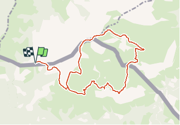
![](/images/other/stat-length.png)
![Excursión Senderismo Itxassou - Peñas de Itsusi - Photo](https://media.geolcdn.com/t/1900/400/32f81863-fda3-4b8b-8eaf-8aeeb3a20d72.jpg&format=pjpeg&maxdim=2)
Peñas de Itsusi
DECHAMPD
Usuario
![Longitud](/images/other/stat-length.png)
![Altitud máxima](https://static1.geolcdn.com/siteimages/upload/files/1508320355ic_sort_altitude_max_24dp.png)
![Desnivel positivo](https://static1.geolcdn.com/siteimages/upload/files/1508320355ic_sort_den_pos_24dp.png)
![Km-Effort](/images/other/stat-length.png)
![Altitud mínima](https://static1.geolcdn.com/siteimages/upload/files/1508320355ic_sort_altitude_min_24dp.png)
![Desnivel negativo](https://static1.geolcdn.com/siteimages/upload/files/1508320355ic_sort_den_neg_24dp.png)
![Boucle](https://static1.geolcdn.com/siteimages/upload/files/16400158638029165_repeat_loop_refresh_sync_direction_icon.png)
![Senderismo](https://static1.geolcdn.com/sitytour/trail-icons/101.png)
3h44
Dificultad : Difícil
![Escanee este código QR para abrir la excursión en la aplicación SityTrail](https://capi.geolives.com/qq0zvz2zws4bq2lad0pu/sitytour/trails/2292774/qr.png?size=200)
Aplicación GPS de excursión GRATIS
A propósito
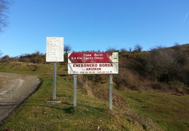
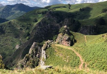
Ruta Senderismo de 11,1 km a descubrir en Nueva Aquitania, Pirineos-Atlánticos, Itxassou. Esta ruta ha sido propuesta por DECHAMPD.
Descripción
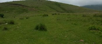
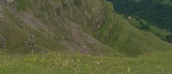
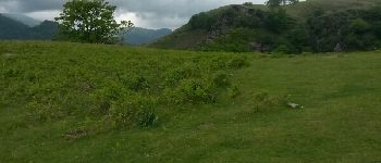
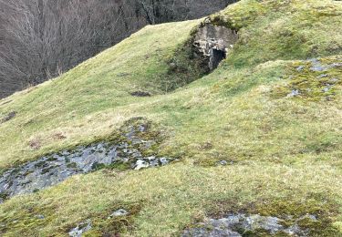
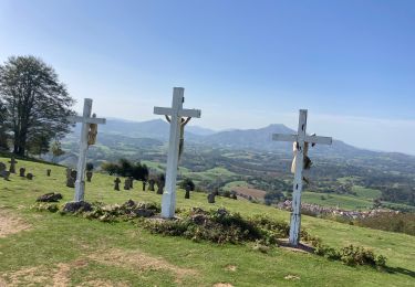
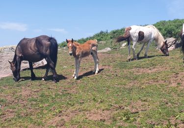
Magnifique randonnées avec une montée aux Peñas des plus pittoresque, puis un sentier qui avant de redescendre longe toutes les falaises où niche le vautour fauve.
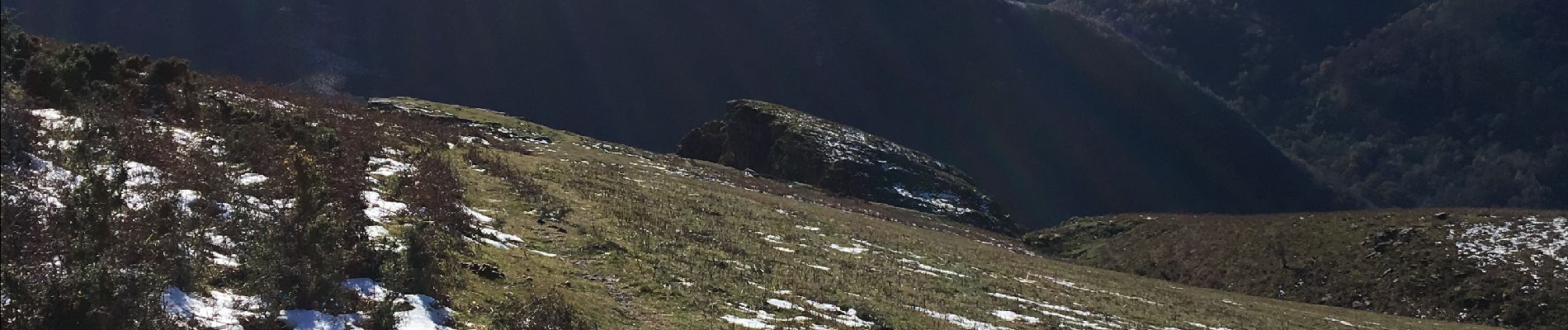
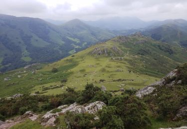
depuis le col des Veaux, col de Méhatché, Mendiburu Kabidea, Harrisketa, Zelhaiburu, col d'Espalza, pic d'Itsusi, Pagamendi, Irazelaika et arrivée.
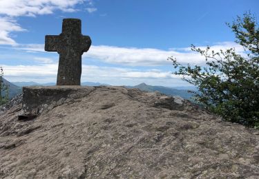
Puntos de interés
Localización
Comentarios
Excursiones cerca
![Excursión Senderismo Bidarray - Peñas d'Itxusi - Photo](https://media.geolcdn.com/t/375/260/ext.jpg?maxdim=2&url=https%3A%2F%2Fservices.sitytrail.com%2FGeolivesWS%2FDownloadMedia.ashx%3FTrailID%3D609763%26Media%3D20160806162954.jpg)
![Senderismo Senderismo](https://static1.geolcdn.com/sitytour/trail-icons/101.png)
Senderismo
![](/images/other/stat-length.png)
![](https://static1.geolcdn.com/siteimages/upload/files/16400158638029165_repeat_loop_refresh_sync_direction_icon.png)
![Excursión Senderismo Itxassou - L'ARTZAMENDI - Photo](https://media.geolcdn.com/t/375/260/ext.jpg?maxdim=2&url=https%3A%2F%2Fstatic1.geolcdn.com%2Fsiteimages%2Fupload%2Ffiles%2F1553511878bg_sport_marche.png)
![Senderismo Senderismo](https://static1.geolcdn.com/sitytour/trail-icons/101.png)
Senderismo
![](/images/other/stat-length.png)
![](https://static1.geolcdn.com/siteimages/upload/files/16400158638029165_repeat_loop_refresh_sync_direction_icon.png)
![Excursión Senderismo Baztán - MAILARRETA OTSONDO Frontières en béton dans le massif du Gorramendi 300m. - Photo](https://media.geolcdn.com/t/375/260/8b1035fc-8a50-4048-9924-4944066be27d.jpg&format=jpg&maxdim=2)
![Senderismo Senderismo](https://static1.geolcdn.com/sitytour/trail-icons/101.png)
Senderismo
![](/images/other/stat-length.png)
![](https://static1.geolcdn.com/siteimages/upload/files/16400158638029165_repeat_loop_refresh_sync_direction_icon.png)
![Excursión Senderismo Baztán - MAILARRETA OTSONDO Frontières en béton dans le massif du Gorramendi - Photo](https://media.geolcdn.com/t/375/260/ext.jpg?maxdim=2&url=https%3A%2F%2Fservices.sitytrail.com%2FGeolivesWS%2FDownloadMedia.ashx%3FTrailID%3D526426%26Media%3Dfix__20160208095835.jpg)
![Senderismo Senderismo](https://static1.geolcdn.com/sitytour/trail-icons/101.png)
Senderismo
![](/images/other/stat-length.png)
![](https://static1.geolcdn.com/siteimages/upload/files/16400158638029165_repeat_loop_refresh_sync_direction_icon.png)
![Excursión Senderismo Ainhoa - Dantcheria gorospil col des croix erre il - Photo](https://media.geolcdn.com/t/375/260/5dc57095-42d8-40d9-8d91-50ef1ee955dd.jpg&format=jpg&maxdim=2)
![Senderismo Senderismo](https://static1.geolcdn.com/sitytour/trail-icons/101.png)
Senderismo
![](/images/other/stat-length.png)
![](https://static1.geolcdn.com/siteimages/upload/files/16400158638029165_repeat_loop_refresh_sync_direction_icon.png)
![Excursión Senderismo Itxassou - artzamendi - Photo](https://media.geolcdn.com/t/375/260/7db140df-79e5-4629-a736-b7906dba94c0.jpg&format=jpg&maxdim=2)
![Senderismo Senderismo](https://static1.geolcdn.com/sitytour/trail-icons/101.png)
Senderismo
![](/images/other/stat-length.png)
![](https://static1.geolcdn.com/siteimages/upload/files/16400158638029165_repeat_loop_refresh_sync_direction_icon.png)
![Excursión Senderismo Itxassou - itxassou col des veaux - Photo](https://media.geolcdn.com/t/375/260/4638f7a2-c52b-49c6-b2f1-de823a44343d.jpg&format=jpg&maxdim=2)
![Senderismo Senderismo](https://static1.geolcdn.com/sitytour/trail-icons/101.png)
Senderismo
![](/images/other/stat-length.png)
![](https://static1.geolcdn.com/siteimages/upload/files/16400158638029165_repeat_loop_refresh_sync_direction_icon.png)
![Excursión Senderismo Espelette - 20210518 Pres d’Espelette - Photo](https://media.geolcdn.com/t/375/260/37a15aaf-024e-43cd-923a-b0411b970c4f.jpg&format=jpg&maxdim=2)
![Senderismo Senderismo](https://static1.geolcdn.com/sitytour/trail-icons/101.png)
Senderismo
![](/images/other/stat-length.png)
![](https://static1.geolcdn.com/siteimages/upload/files/16400158638029165_repeat_loop_refresh_sync_direction_icon.png)
![Excursión Senderismo Itxassou - Les Peñas d' Itsusi depuis Mehatze - Photo](https://media.geolcdn.com/t/375/260/16ffea23-dd36-4d51-90a9-9f29c30a6517.jpg&format=jpg&maxdim=2)
![Senderismo Senderismo](https://static1.geolcdn.com/sitytour/trail-icons/101.png)
Senderismo
![](/images/other/stat-length.png)
![](https://static1.geolcdn.com/siteimages/upload/files/16400158638029165_repeat_loop_refresh_sync_direction_icon.png)