![](/images/other/stat-length.png)
![Excursión Senderismo Saint-Privat - SityTrail - Tour de Carlan - Photo](https://media.geolcdn.com/t/1900/400/44e4f369-3e49-43f7-a62d-c17bb6af5e68.jpg&format=pjpeg&maxdim=2)
SityTrail - Tour de Carlan
mdauzat
Usuario
![Longitud](/images/other/stat-length.png)
![Altitud máxima](https://static1.geolcdn.com/siteimages/upload/files/1508320355ic_sort_altitude_max_24dp.png)
![Desnivel positivo](https://static1.geolcdn.com/siteimages/upload/files/1508320355ic_sort_den_pos_24dp.png)
![Km-Effort](/images/other/stat-length.png)
![Altitud mínima](https://static1.geolcdn.com/siteimages/upload/files/1508320355ic_sort_altitude_min_24dp.png)
![Desnivel negativo](https://static1.geolcdn.com/siteimages/upload/files/1508320355ic_sort_den_neg_24dp.png)
![Boucle](https://static1.geolcdn.com/siteimages/upload/files/16400158638029165_repeat_loop_refresh_sync_direction_icon.png)
![Senderismo](https://static1.geolcdn.com/sitytour/trail-icons/101.png)
1h55
Dificultad : Medio
![Marcha nórdica](https://static1.geolcdn.com/sitytour/trail-icons/102.png)
--
Dificultad : Fácil
![Escanee este código QR para abrir la excursión en la aplicación SityTrail](https://capi.geolives.com/qq0zvz2zws4bq2lad0pu/sitytour/trails/2273367/qr.png?size=200)
Aplicación GPS de excursión GRATIS
A propósito
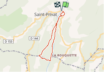
Ruta Senderismo de 6,6 km a descubrir en Occitania, Hérault, Saint-Privat. Esta ruta ha sido propuesta por mdauzat.
Descripción
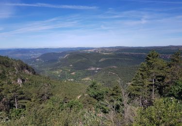
A partir de l'aire de stationnement située à droite juste après l'entrée du village, on descend par un petit sentier vers le ruisseau, que l'on suit ensuite sur une large et belle piste, d'abord sur la rive gauche, puis sur la rive droite. On arrive ensuite devant de belles vignes et l'on prend alors, sur la droite, un petit sentier qui grimpe résolument, en sous-bois, pour rejoindre enfin une nouvelle large et belle piste qui ramène vers le village. Une très jolie "bouclette", donc, qui permet de profiter des très belles vues sur la nature parée des plus merveilleuses couleurs automnales. Pas de difficulté significative hormis le petit raidillon sur le sentier en sous-bois.
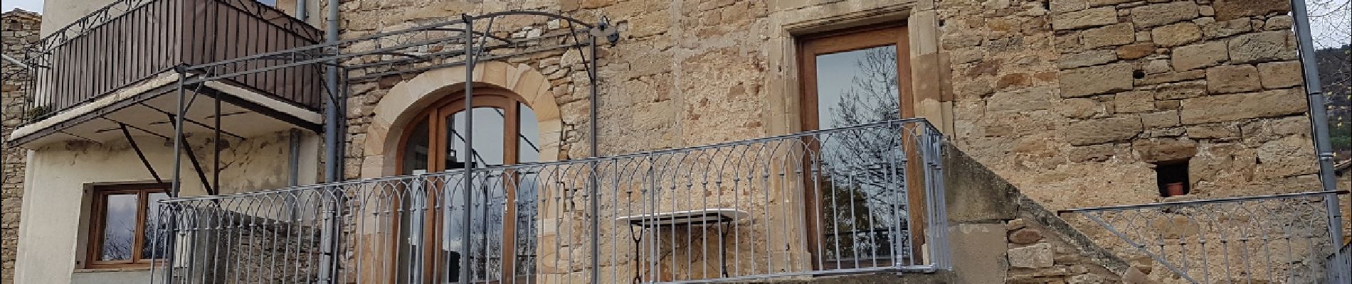
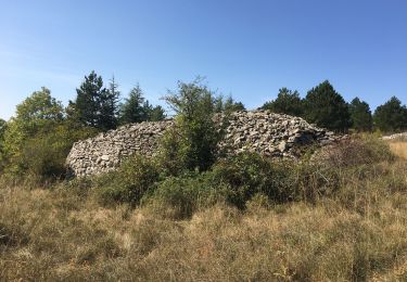
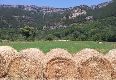
Localización
Comentarios
Excursiones cerca
![Excursión Senderismo Saint-Étienne-de-Gourgas - St Etienne de Gourgas - col de Melanque - Puech haut - Photo](https://media.geolcdn.com/t/375/260/ext.jpg?maxdim=2&url=https%3A%2F%2Fservices.sitytrail.com%2FGeolivesWS%2FDownloadMedia.ashx%3FTrailID%3D334032%26Media%3Decee9542-ae6c-4b78-860f-f4fbe993ce14.jpg)
![Senderismo Senderismo](https://static1.geolcdn.com/sitytour/trail-icons/101.png)
Senderismo
![](/images/other/stat-length.png)
![](https://static1.geolcdn.com/siteimages/upload/files/16400158638029165_repeat_loop_refresh_sync_direction_icon.png)
![Excursión Senderismo Saint-Pierre-de-la-Fage - Parlatges - La Vacquerie-et-St-Martin-de-Castries - Photo](https://media.geolcdn.com/t/375/260/076ea1bb-8acb-4fc6-bfb0-1a2a8946e2fc.jpg&format=jpg&maxdim=2)
![Senderismo Senderismo](https://static1.geolcdn.com/sitytour/trail-icons/101.png)
Senderismo
![](/images/other/stat-length.png)
![](https://static1.geolcdn.com/siteimages/upload/files/16400158638029165_repeat_loop_refresh_sync_direction_icon.png)
![Excursión Senderismo Le Bosc - Le Bosc - prieuré de Grandmont - Le Brédou - Soumont - Photo](https://media.geolcdn.com/t/375/260/ext.jpg?maxdim=2&url=https%3A%2F%2Fservices.sitytrail.com%2FGeolivesWS%2FDownloadMedia.ashx%3FTrailID%3D384816%26Media%3D8c6417b4-a39d-4b75-b1b0-b5a0d180c222.jpg)
![Senderismo Senderismo](https://static1.geolcdn.com/sitytour/trail-icons/101.png)
Senderismo
![](/images/other/stat-length.png)
![](https://static1.geolcdn.com/siteimages/upload/files/16400158638029165_repeat_loop_refresh_sync_direction_icon.png)
![Excursión Senderismo Saint-Étienne-de-Gourgas - Le cirque du Bout-du-Monde - Photo](https://media.geolcdn.com/t/375/260/ext.jpg?maxdim=2&url=https%3A%2F%2Fservices.sitytrail.com%2FGeolivesWS%2FDownloadMedia.ashx%3FTrailID%3D206744%26Media%3Dfix__20130721140204.jpg)
![Senderismo Senderismo](https://static1.geolcdn.com/sitytour/trail-icons/101.png)
Senderismo
![](/images/other/stat-length.png)
![](https://static1.geolcdn.com/siteimages/upload/files/16400158638029165_repeat_loop_refresh_sync_direction_icon.png)
![Excursión Senderismo Montpeyroux - Saint baudille - Photo](https://media.geolcdn.com/t/375/260/ext.jpg?maxdim=2&url=https%3A%2F%2Fservices.sitytrail.com%2FGeolivesWS%2FDownloadMedia.ashx%3FTrailID%3D246463%26Media%3Dfix__20140202141416.jpg)
![Senderismo Senderismo](https://static1.geolcdn.com/sitytour/trail-icons/101.png)
Senderismo
![](/images/other/stat-length.png)
![](https://static1.geolcdn.com/siteimages/upload/files/16400158638029165_repeat_loop_refresh_sync_direction_icon.png)
![Excursión Senderismo Saint-Jean-de-la-Blaquière - Les Bois de Homs et de Latude - Photo](https://media.geolcdn.com/t/375/260/ext.jpg?maxdim=2&url=https%3A%2F%2Fstatic1.geolcdn.com%2Fsiteimages%2Fupload%2Ffiles%2F1553511878bg_sport_marche.png)
![Senderismo Senderismo](https://static1.geolcdn.com/sitytour/trail-icons/101.png)
Senderismo
![](/images/other/stat-length.png)
![](https://static1.geolcdn.com/siteimages/upload/files/16400158638029165_repeat_loop_refresh_sync_direction_icon.png)
![Excursión Senderismo Montpeyroux - Saint-Baudille - Photo](https://media.geolcdn.com/t/375/260/58bec8c6-cffd-4c3b-ad5e-045ac6c12b87.jpg&format=jpg&maxdim=2)
![Senderismo Senderismo](https://static1.geolcdn.com/sitytour/trail-icons/101.png)
Senderismo
![](/images/other/stat-length.png)
![](https://static1.geolcdn.com/siteimages/upload/files/16400158638029165_repeat_loop_refresh_sync_direction_icon.png)
![Excursión Senderismo Montpeyroux - Font du Griffe le Baudille - Photo](https://media.geolcdn.com/t/375/260/443db8a3-4e7a-451b-87ed-5204bd667dbf.jpg&format=jpg&maxdim=2)
![Senderismo Senderismo](https://static1.geolcdn.com/sitytour/trail-icons/101.png)
Senderismo
![](/images/other/stat-length.png)
![](https://static1.geolcdn.com/siteimages/upload/files/16400158638029165_repeat_loop_refresh_sync_direction_icon.png)
![Excursión Marcha nórdica Saint-Pierre-de-la-Fage - SityTrail - St-Pierre de la Fage - Pas de Cabane - Roqueboude - Photo](https://media.geolcdn.com/t/375/260/f3de2af3-46a7-4008-bd2a-646a63c35c72.jpg&format=jpg&maxdim=2)
![Marcha nórdica Marcha nórdica](https://static1.geolcdn.com/sitytour/trail-icons/102.png)
Marcha nórdica
![](/images/other/stat-length.png)
![](https://static1.geolcdn.com/siteimages/upload/files/16400158638029165_repeat_loop_refresh_sync_direction_icon.png)
très belle rando, avec une belle ascension du flanc de la colline à mi parcours. très beaux paysages. Merci.