![](/images/other/stat-length.png)
![Excursión Senderismo Beersel - Dworp Herisemmolen vers Elsemheide - Photo](https://media.geolcdn.com/t/1900/400/ext.pjpeg?maxdim=2&url=https%3A%2F%2Fservices.sitytrail.com%2FGeolivesWS%2FDownloadMedia.ashx%3FTrailID%3D225257%26Media%3Dfix__20131004160100.jpg)
Dworp Herisemmolen vers Elsemheide
sanpaty
Usuario
![Longitud](/images/other/stat-length.png)
Longitud
5,3 km
![Altitud máxima](https://static1.geolcdn.com/siteimages/upload/files/1508320355ic_sort_altitude_max_24dp.png)
Altitud máxima
111 m
![Desnivel positivo](https://static1.geolcdn.com/siteimages/upload/files/1508320355ic_sort_den_pos_24dp.png)
Desnivel positivo
82 m
![Km-Effort](/images/other/stat-length.png)
Km-Effort
6,4 km
![Altitud mínima](https://static1.geolcdn.com/siteimages/upload/files/1508320355ic_sort_altitude_min_24dp.png)
Altitud mínima
54 m
![Desnivel negativo](https://static1.geolcdn.com/siteimages/upload/files/1508320355ic_sort_den_neg_24dp.png)
Desnivel negativo
81 m
![Boucle](https://static1.geolcdn.com/siteimages/upload/files/16400158638029165_repeat_loop_refresh_sync_direction_icon.png)
Boucle
Sí
Fecha de creación :
2014-12-10 00:00:00.0
Última modificación :
2014-12-10 00:00:00.0
![Senderismo](https://static1.geolcdn.com/sitytour/trail-icons/101.png)
1h26
Dificultad : Fácil
![Escanee este código QR para abrir la excursión en la aplicación SityTrail](https://capi.geolives.com/qq0zvz2zws4bq2lad0pu/sitytour/trails/225257/qr.png?size=200)
Aplicación GPS de excursión GRATIS
A propósito
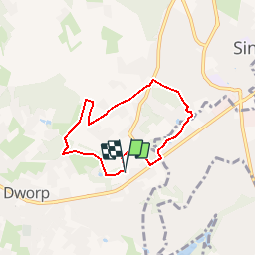
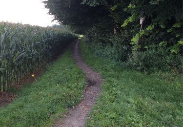
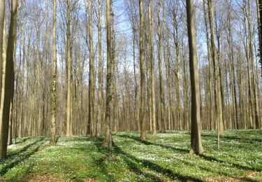
Ruta Senderismo de 5,3 km a descubrir en Flandes, Brabante Flamenco, Beersel. Esta ruta ha sido propuesta por sanpaty.
Descripción
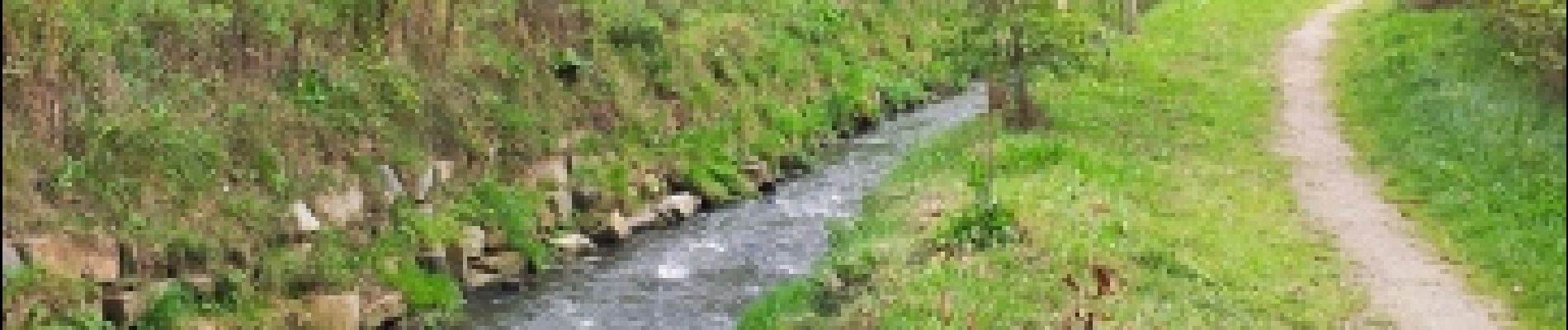
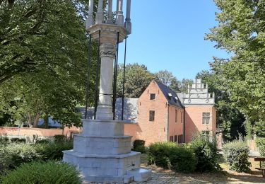
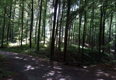
promenade de 5.5 km dans Dworp, au départ du moulin Herisem. Au retour, possibilité de prendre un verre ou un plat à la brasserie de Smidse
Localización
País:
Belgium
Región :
Flandes
Departamento/provincia :
Brabante Flamenco
Municipio :
Beersel
Localidad:
Alsemberg
Salida:(Dec)
Salida:(UTM)
593029 ; 5620923 (31U) N.
Comentarios
Excursiones cerca
![Excursión Senderismo Linkebeek - Linkebeek Perkhoeve en Peter Pan - 8 km RT - Photo](https://media.geolcdn.com/t/375/260/ext.jpg?maxdim=2&url=https%3A%2F%2Fstatic1.geolcdn.com%2Fsiteimages%2Fupload%2Ffiles%2F1553511878bg_sport_marche.png)
![Senderismo Senderismo](https://static1.geolcdn.com/sitytour/trail-icons/101.png)
Linkebeek Perkhoeve en Peter Pan - 8 km RT
Senderismo
Muy fácil
(5)
Linkebeek,
Flandes,
Brabante Flamenco,
Belgium
![](/images/other/stat-length.png)
7,6 km | 9,3 km-effort
Desconocido
![](https://static1.geolcdn.com/siteimages/upload/files/16400158638029165_repeat_loop_refresh_sync_direction_icon.png)
Sí
![Excursión Senderismo Beersel - GG2-Bw-24_Beersel-Hennuyères_2021-11-04 - Photo](https://media.geolcdn.com/t/375/260/102ff410-776a-4c59-ae38-58c43777bc8a.jpg&format=jpg&maxdim=2)
![Senderismo Senderismo](https://static1.geolcdn.com/sitytour/trail-icons/101.png)
GG2-Bw-24_Beersel-Hennuyères_2021-11-04
Senderismo
Medio
(2)
Beersel,
Flandes,
Brabante Flamenco,
Belgium
![](/images/other/stat-length.png)
37 km | 47 km-effort
10h 44min
![](https://static1.geolcdn.com/siteimages/upload/files/16400158638029165_repeat_loop_refresh_sync_direction_icon.png)
No
![Excursión Senderismo Halle - Balade dans le Bois de Halle - Photo](https://media.geolcdn.com/t/375/260/ext.jpg?maxdim=2&url=https%3A%2F%2Fservices.sitytrail.com%2FGeolivesWS%2FDownloadMedia.ashx%3FTrailID%3D411974%26Media%3D4cfcce27-edaf-4211-9dbe-1277fff36f47.JPG)
![Senderismo Senderismo](https://static1.geolcdn.com/sitytour/trail-icons/101.png)
Balade dans le Bois de Halle
Senderismo
Fácil
(2)
Halle,
Flandes,
Brabante Flamenco,
Belgium
![](/images/other/stat-length.png)
8,6 km | 10,5 km-effort
2h 14min
![](https://static1.geolcdn.com/siteimages/upload/files/16400158638029165_repeat_loop_refresh_sync_direction_icon.png)
Sí
![Excursión Senderismo Beersel - Beersel 10km - Photo](https://media.geolcdn.com/t/375/260/4be021b0-0611-495b-8c11-6bedba66a35d.jpg&format=jpg&maxdim=2)
![Senderismo Senderismo](https://static1.geolcdn.com/sitytour/trail-icons/101.png)
Beersel 10km
Senderismo
Medio
(2)
Beersel,
Flandes,
Brabante Flamenco,
Belgium
![](/images/other/stat-length.png)
10,5 km | 13,1 km-effort
2h 34min
![](https://static1.geolcdn.com/siteimages/upload/files/16400158638029165_repeat_loop_refresh_sync_direction_icon.png)
Sí
![Excursión Senderismo Beersel - 2019-01-10 Boucle Huizingen 22 km - Photo](https://media.geolcdn.com/t/375/260/8543774e-ca92-454e-9fd7-9ac7878ef135.jpg&format=jpg&maxdim=2)
![Senderismo Senderismo](https://static1.geolcdn.com/sitytour/trail-icons/101.png)
2019-01-10 Boucle Huizingen 22 km
Senderismo
Muy fácil
(1)
Beersel,
Flandes,
Brabante Flamenco,
Belgium
![](/images/other/stat-length.png)
22 km | 27 km-effort
4h 38min
![](https://static1.geolcdn.com/siteimages/upload/files/16400158638029165_repeat_loop_refresh_sync_direction_icon.png)
Sí
![Excursión Senderismo Braine-l'Alleud - Entre l'Ermite et Odeghien - Photo](https://media.geolcdn.com/t/375/260/ext.jpg?maxdim=2&url=https%3A%2F%2Fservices.sitytrail.com%2FGeolivesWS%2FDownloadMedia.ashx%3FTrailID%3D338686%26Media%3D20140824140258.jpg)
![Senderismo Senderismo](https://static1.geolcdn.com/sitytour/trail-icons/101.png)
Entre l'Ermite et Odeghien
Senderismo
Fácil
(4)
Braine-l'Alleud,
Valonia,
Brabante Valón,
Belgium
![](/images/other/stat-length.png)
7,2 km | 8,7 km-effort
1h 52min
![](https://static1.geolcdn.com/siteimages/upload/files/16400158638029165_repeat_loop_refresh_sync_direction_icon.png)
No
![Excursión Senderismo Beersel - Entre Beersel et Dworp - Photo](https://media.geolcdn.com/t/375/260/ext.jpg?maxdim=2&url=https%3A%2F%2Fservices.sitytrail.com%2FGeolivesWS%2FDownloadMedia.ashx%3FTrailID%3D310076%26Media%3D3efa6535-4846-4e23-9c11-65c16b69488b.jpg)
![Senderismo Senderismo](https://static1.geolcdn.com/sitytour/trail-icons/101.png)
Entre Beersel et Dworp
Senderismo
Medio
(1)
Beersel,
Flandes,
Brabante Flamenco,
Belgium
![](/images/other/stat-length.png)
10,1 km | 13 km-effort
2h 45min
![](https://static1.geolcdn.com/siteimages/upload/files/16400158638029165_repeat_loop_refresh_sync_direction_icon.png)
Sí
![Excursión Senderismo Halle - bois de halle hallerbos - Photo](https://media.geolcdn.com/t/375/260/171c7fd8-9c79-49a4-b4c2-e78fc47fb1c7.jpg&format=jpg&maxdim=2)
![Senderismo Senderismo](https://static1.geolcdn.com/sitytour/trail-icons/101.png)
bois de halle hallerbos
Senderismo
Muy fácil
(1)
Halle,
Flandes,
Brabante Flamenco,
Belgium
![](/images/other/stat-length.png)
7,1 km | 8,6 km-effort
1h 35min
![](https://static1.geolcdn.com/siteimages/upload/files/16400158638029165_repeat_loop_refresh_sync_direction_icon.png)
Sí
![Excursión Senderismo Braine-l'Alleud - culot 7 fontaines final aà corriger - Photo](https://media.geolcdn.com/t/375/260/ext.jpg?maxdim=2&url=https%3A%2F%2Fservices.sitytrail.com%2FGeolivesWS%2FDownloadMedia.ashx%3FTrailID%3D720346%26Media%3D20170325133930.jpg)
![Senderismo Senderismo](https://static1.geolcdn.com/sitytour/trail-icons/101.png)
culot 7 fontaines final aà corriger
Senderismo
Fácil
(1)
Braine-l'Alleud,
Valonia,
Brabante Valón,
Belgium
![](/images/other/stat-length.png)
14,2 km | 17,8 km-effort
4h 32min
![](https://static1.geolcdn.com/siteimages/upload/files/16400158638029165_repeat_loop_refresh_sync_direction_icon.png)
Sí
j'ai adoré cette rando