![](/images/other/stat-length.png)
![Excursión Paseo ecuestre Muttersholtz - Circuit LB muttersholtz-thannenkirch-ribeauville-par-chateaux - Photo](https://media.geolcdn.com/t/1900/400/ext.pjpeg?maxdim=2&url=https%3A%2F%2Fmedia.geolcdn.com%2Ff%2F924eebd7-d451-45cc-805d-5150931bc4bf.jpg)
Circuit LB muttersholtz-thannenkirch-ribeauville-par-chateaux
Tourisme Equestre Alsace
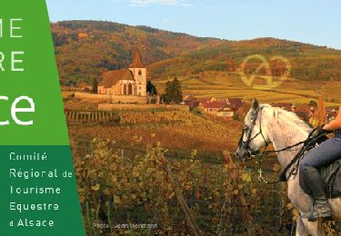
Promouvoir le Tourisme Equestre en Alsace GUIDE+
![Longitud](/images/other/stat-length.png)
Longitud
35 km
![Altitud máxima](https://static1.geolcdn.com/siteimages/upload/files/1508320355ic_sort_altitude_max_24dp.png)
Altitud máxima
654 m
![Desnivel positivo](https://static1.geolcdn.com/siteimages/upload/files/1508320355ic_sort_den_pos_24dp.png)
Desnivel positivo
817 m
![Km-Effort](/images/other/stat-length.png)
Km-Effort
46 km
![Altitud mínima](https://static1.geolcdn.com/siteimages/upload/files/1508320355ic_sort_altitude_min_24dp.png)
Altitud mínima
160 m
![Desnivel negativo](https://static1.geolcdn.com/siteimages/upload/files/1508320355ic_sort_den_neg_24dp.png)
Desnivel negativo
772 m
![Boucle](https://static1.geolcdn.com/siteimages/upload/files/16400158638029165_repeat_loop_refresh_sync_direction_icon.png)
Boucle
No
Fecha de creación :
2016-03-09 00:00:00.0
Última modificación :
2019-01-10 22:55:50.552
![Paseo ecuestre](https://static1.geolcdn.com/sitytour/trail-icons/301.png)
5h39
Dificultad : Muy difícil
![Escanee este código QR para abrir la excursión en la aplicación SityTrail](https://capi.geolives.com/qq0zvz2zws4bq2lad0pu/sitytour/trails/223724/qr.png?size=200)
Aplicación GPS de excursión GRATIS
A propósito
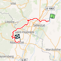
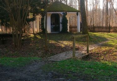
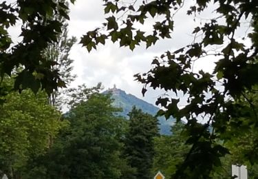
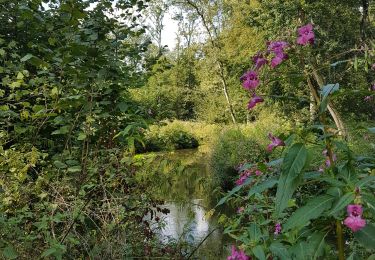
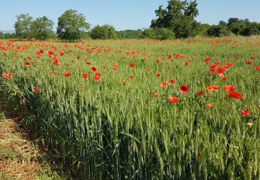
Ruta Paseo ecuestre de 35 km a descubrir en Gran Este, Bajo-Rin, Muttersholtz. Esta ruta ha sido propuesta por Tourisme Equestre Alsace.
Descripción
Circuit LB muttersholtz-ribeauville-par-chateaux
Puntos de interés
Localización
País:
France
Región :
Gran Este
Departamento/provincia :
Bajo-Rin
Municipio :
Muttersholtz
Localidad:
Unknown
Salida:(Dec)
Salida:(UTM)
389639 ; 5347697 (32U) N.
Comentarios
Excursiones cerca
![Excursión Senderismo Sélestat - Sentier de l'Illwald - Photo](https://media.geolcdn.com/t/375/260/ext.jpg?maxdim=2&url=https%3A%2F%2Fservices.sitytrail.com%2FGeolivesWS%2FDownloadMedia.ashx%3FTrailID%3D108918%26Media%3D2607_1.jpg)
![Senderismo Senderismo](https://static1.geolcdn.com/sitytour/trail-icons/101.png)
Sentier de l'Illwald
Senderismo
Medio
(1)
Sélestat,
Gran Este,
Bajo-Rin,
France
![](/images/other/stat-length.png)
13,2 km | 14,6 km-effort
3h 45min
![](https://static1.geolcdn.com/siteimages/upload/files/16400158638029165_repeat_loop_refresh_sync_direction_icon.png)
Sí
![Excursión A pie Muttersholtz - Circuit de la Chouette - Photo](https://media.geolcdn.com/t/375/260/ext.jpg?maxdim=2&url=https%3A%2F%2Fmedia.geolcdn.com%2Ff%2F8dfef33b-5472-4898-aedc-01912c133d95.jpeg)
![A pie A pie](https://static1.geolcdn.com/sitytour/trail-icons/100.png)
Circuit de la Chouette
A pie
Fácil
Muttersholtz,
Gran Este,
Bajo-Rin,
France
![](/images/other/stat-length.png)
6,2 km | 6,6 km-effort
1h 29min
![](https://static1.geolcdn.com/siteimages/upload/files/16400158638029165_repeat_loop_refresh_sync_direction_icon.png)
Sí
![Excursión A pie Muttersholtz - Sentier de la Cigogne - Photo](https://media.geolcdn.com/t/375/260/ext.jpg?maxdim=2&url=https%3A%2F%2Fmedia.geolcdn.com%2Ff%2F8dfef33b-5472-4898-aedc-01912c133d95.jpeg)
![A pie A pie](https://static1.geolcdn.com/sitytour/trail-icons/100.png)
Sentier de la Cigogne
A pie
Fácil
Muttersholtz,
Gran Este,
Bajo-Rin,
France
![](/images/other/stat-length.png)
8,7 km | 9,4 km-effort
2h 7min
![](https://static1.geolcdn.com/siteimages/upload/files/16400158638029165_repeat_loop_refresh_sync_direction_icon.png)
Sí
![Excursión Senderismo Sélestat - Sélestat : balade dans le Ried - Photo](https://media.geolcdn.com/t/375/260/ext.jpg?maxdim=2&url=https%3A%2F%2Fmedia.geolcdn.com%2Ff%2F0862c1a6-56e5-41b9-bfa1-16468b949245.jpg)
![Senderismo Senderismo](https://static1.geolcdn.com/sitytour/trail-icons/101.png)
Sélestat : balade dans le Ried
Senderismo
Difícil
Sélestat,
Gran Este,
Bajo-Rin,
France
![](/images/other/stat-length.png)
11,4 km | 12,6 km-effort
2h 51min
![](https://static1.geolcdn.com/siteimages/upload/files/16400158638029165_repeat_loop_refresh_sync_direction_icon.png)
Sí
![Excursión Senderismo Sélestat - Selestat- Boucle Au fil des vous d'eau du Ried - Photo](https://media.geolcdn.com/t/375/260/ext.jpg?maxdim=2&url=https%3A%2F%2Fmedia.geolcdn.com%2Ff%2Ff2cb5a6e-31f2-4580-bee9-5d78076bbf70.jpg)
![Senderismo Senderismo](https://static1.geolcdn.com/sitytour/trail-icons/101.png)
Selestat- Boucle Au fil des vous d'eau du Ried
Senderismo
Fácil
(1)
Sélestat,
Gran Este,
Bajo-Rin,
France
![](/images/other/stat-length.png)
11,3 km | 12,5 km-effort
2h 10min
![](https://static1.geolcdn.com/siteimages/upload/files/16400158638029165_repeat_loop_refresh_sync_direction_icon.png)
Sí
![Excursión Senderismo Sélestat - Sélestat le Grand Ried - balade dans la forêt de l'II - passerelles - Photo](https://media.geolcdn.com/t/375/260/ext.jpg?maxdim=2&url=https%3A%2F%2Fmedia.geolcdn.com%2Ff%2F166f2794-d0ba-40f5-9de5-d81636e78051.jpg)
![Senderismo Senderismo](https://static1.geolcdn.com/sitytour/trail-icons/101.png)
Sélestat le Grand Ried - balade dans la forêt de l'II - passerelles
Senderismo
Fácil
(1)
Sélestat,
Gran Este,
Bajo-Rin,
France
![](/images/other/stat-length.png)
11,5 km | 12,8 km-effort
2h 12min
![](https://static1.geolcdn.com/siteimages/upload/files/16400158638029165_repeat_loop_refresh_sync_direction_icon.png)
Sí
![Excursión Paseo ecuestre Hilsenheim - SityTrail - Boucle attelage Hilsenheim - Huttenheim - Photo](https://media.geolcdn.com/t/375/260/ext.jpg?maxdim=2&url=https%3A%2F%2Fmedia.geolcdn.com%2Ff%2F5f5785bd-3b27-425f-b1d3-694fb0df146e.jpg)
![Paseo ecuestre Paseo ecuestre](https://static1.geolcdn.com/sitytour/trail-icons/301.png)
SityTrail - Boucle attelage Hilsenheim - Huttenheim
Paseo ecuestre
Medio
Hilsenheim,
Gran Este,
Bajo-Rin,
France
![](/images/other/stat-length.png)
24 km | 25 km-effort
3h 17min
![](https://static1.geolcdn.com/siteimages/upload/files/16400158638029165_repeat_loop_refresh_sync_direction_icon.png)
Sí
![Excursión Senderismo Sélestat - (09/9/2019) Le ried à Selestat - Photo](https://media.geolcdn.com/t/375/260/ext.jpg?maxdim=2&url=https%3A%2F%2Fmedia.geolcdn.com%2Ff%2F61c13918-1a44-482b-a858-b621aed8b81b.jpg)
![Senderismo Senderismo](https://static1.geolcdn.com/sitytour/trail-icons/101.png)
(09/9/2019) Le ried à Selestat
Senderismo
Muy fácil
Sélestat,
Gran Este,
Bajo-Rin,
France
![](/images/other/stat-length.png)
15,3 km | 17 km-effort
3h 38min
![](https://static1.geolcdn.com/siteimages/upload/files/16400158638029165_repeat_loop_refresh_sync_direction_icon.png)
Sí
![Excursión Senderismo Muttersholtz - LE RIED DE MUTTERSHOLTZ - Photo](https://media.geolcdn.com/t/375/260/ext.jpg?maxdim=2&url=https%3A%2F%2Fmedia.geolcdn.com%2Ff%2Fdbd73ab6-0b8a-48e8-aa00-24527cdf655d.jpg)
![Senderismo Senderismo](https://static1.geolcdn.com/sitytour/trail-icons/101.png)
LE RIED DE MUTTERSHOLTZ
Senderismo
Muy fácil
Muttersholtz,
Gran Este,
Bajo-Rin,
France
![](/images/other/stat-length.png)
11,6 km | 12,7 km-effort
3h 44min
![](https://static1.geolcdn.com/siteimages/upload/files/16400158638029165_repeat_loop_refresh_sync_direction_icon.png)
Sí