![](/images/other/stat-length.png)
![Excursión A pie Montoulieu - La cabane des gardes - Photo](https://media.geolcdn.com/t/1900/400/b1e64f52-ac0f-467f-8d74-d3b4ab718910.jpg&format=pjpeg&maxdim=2)
La cabane des gardes
c.chehere
Usuario
![Longitud](/images/other/stat-length.png)
![Altitud máxima](https://static1.geolcdn.com/siteimages/upload/files/1508320355ic_sort_altitude_max_24dp.png)
![Desnivel positivo](https://static1.geolcdn.com/siteimages/upload/files/1508320355ic_sort_den_pos_24dp.png)
![Km-Effort](/images/other/stat-length.png)
![Altitud mínima](https://static1.geolcdn.com/siteimages/upload/files/1508320355ic_sort_altitude_min_24dp.png)
![Desnivel negativo](https://static1.geolcdn.com/siteimages/upload/files/1508320355ic_sort_den_neg_24dp.png)
![Boucle](https://static1.geolcdn.com/siteimages/upload/files/16400158638029165_repeat_loop_refresh_sync_direction_icon.png)
![A pie](https://static1.geolcdn.com/sitytour/trail-icons/100.png)
--
Dificultad : Medio
![Escanee este código QR para abrir la excursión en la aplicación SityTrail](https://capi.geolives.com/qq0zvz2zws4bq2lad0pu/sitytour/trails/2224249/qr.png?size=200)
Aplicación GPS de excursión GRATIS
A propósito
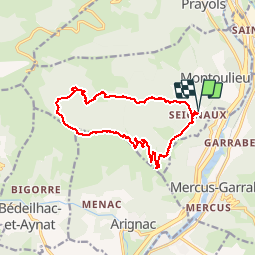
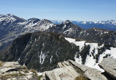
Ruta A pie de 15,5 km a descubrir en Occitania, Ariège, Montoulieu. Esta ruta ha sido propuesta por c.chehere.
Descripción
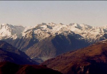
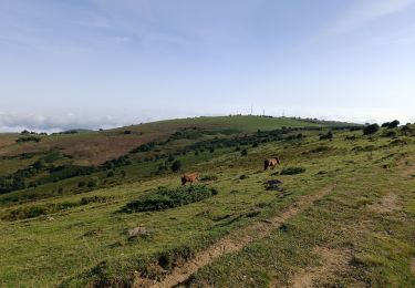
Belle balade Pause déjeuner au pied de l'antenne du roc de Traucadou, mais après pas trouvé le sentier de descente. la végétation a reprie le dessus. Galère dans les fougères (1h30 entre l'antenne et le col ). Vues fantastisques sur Tarascon et la vallée de l'Ariège.
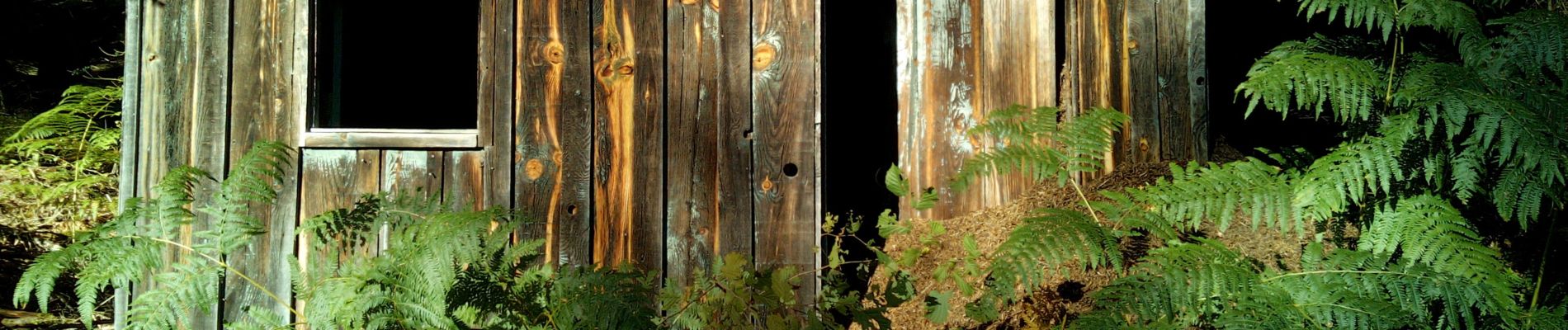
Cabane des gardes absolument nickel
Localización
Comentarios
Excursiones cerca
![Excursión Senderismo Saint-Paul-de-Jarrat - Le Mont Fourcat - Croquié - Photo](https://media.geolcdn.com/t/375/260/ext.jpg?maxdim=2&url=https%3A%2F%2Fservices.sitytrail.com%2FGeolivesWS%2FDownloadMedia.ashx%3FTrailID%3D111871%26Media%3D8704_3.jpg)
![Senderismo Senderismo](https://static1.geolcdn.com/sitytour/trail-icons/101.png)
Senderismo
![](/images/other/stat-length.png)
![](https://static1.geolcdn.com/siteimages/upload/files/16400158638029165_repeat_loop_refresh_sync_direction_icon.png)
![Excursión Senderismo Ganac - Prat d'Albis Alain Goudou - Photo](https://media.geolcdn.com/t/375/260/e01d843f-f77d-410c-9ffc-0deb7487accd.jpg&format=jpg&maxdim=2)
![Senderismo Senderismo](https://static1.geolcdn.com/sitytour/trail-icons/101.png)
Senderismo
![](/images/other/stat-length.png)
![](https://static1.geolcdn.com/siteimages/upload/files/16400158638029165_repeat_loop_refresh_sync_direction_icon.png)
![Excursión Senderismo Mercus-Garrabet - Mont Fourcat depuis Croquié - Photo](https://media.geolcdn.com/t/375/260/ext.jpg?maxdim=2&url=https%3A%2F%2Fstatic1.geolcdn.com%2Fsiteimages%2Fupload%2Ffiles%2F1553511878bg_sport_marche.png)
![Senderismo Senderismo](https://static1.geolcdn.com/sitytour/trail-icons/101.png)
Senderismo
![](/images/other/stat-length.png)
![](https://static1.geolcdn.com/siteimages/upload/files/16400158638029165_repeat_loop_refresh_sync_direction_icon.png)
![Excursión Carrera Mercus-Garrabet - mercus1 - Photo](https://media.geolcdn.com/t/375/260/ext.jpg?maxdim=2&url=https%3A%2F%2Fstatic1.geolcdn.com%2Fsiteimages%2Fupload%2Ffiles%2F1524743154running.jpg)
![Carrera Carrera](https://static1.geolcdn.com/sitytour/trail-icons/103.png)
Carrera
![](/images/other/stat-length.png)
![](https://static1.geolcdn.com/siteimages/upload/files/16400158638029165_repeat_loop_refresh_sync_direction_icon.png)
![Excursión Senderismo Mercus-Garrabet - Mont Fourcat en A/R - Photo](https://media.geolcdn.com/t/375/260/fc33e43c-0fba-41f5-9ec5-a4495279cfda.jpg&format=jpg&maxdim=2)
![Senderismo Senderismo](https://static1.geolcdn.com/sitytour/trail-icons/101.png)
Senderismo
![](/images/other/stat-length.png)
![](https://static1.geolcdn.com/siteimages/upload/files/16400158638029165_repeat_loop_refresh_sync_direction_icon.png)
![Excursión Senderismo Prayols - Cuminge - Photo](https://media.geolcdn.com/t/375/260/ext.jpg?maxdim=2&url=https%3A%2F%2Fstatic1.geolcdn.com%2Fsiteimages%2Fupload%2Ffiles%2F1553511878bg_sport_marche.png)
![Senderismo Senderismo](https://static1.geolcdn.com/sitytour/trail-icons/101.png)
![Excursión Senderismo Ganac - Prat d'Albis - Photo](https://media.geolcdn.com/t/375/260/94538044-696f-49c3-99b2-381f51b7e113.jpg&format=jpg&maxdim=2)
![Senderismo Senderismo](https://static1.geolcdn.com/sitytour/trail-icons/101.png)
Senderismo
![](/images/other/stat-length.png)
![](https://static1.geolcdn.com/siteimages/upload/files/16400158638029165_repeat_loop_refresh_sync_direction_icon.png)
![Excursión Senderismo Surba - Tour du roc de Sédour - Photo](https://media.geolcdn.com/t/375/260/0a6f46ec-50b3-4cd7-935e-a334e1ae38c6.jpg&format=jpg&maxdim=2)
![Senderismo Senderismo](https://static1.geolcdn.com/sitytour/trail-icons/101.png)
Senderismo
![](/images/other/stat-length.png)
![](https://static1.geolcdn.com/siteimages/upload/files/16400158638029165_repeat_loop_refresh_sync_direction_icon.png)
![Excursión Senderismo Montoulieu - MONTOULIEU - GINABAT - Photo](https://media.geolcdn.com/t/375/260/87787d72-9b54-41ea-9fde-bbe7dfb8000e.jpg&format=jpg&maxdim=2)
![Senderismo Senderismo](https://static1.geolcdn.com/sitytour/trail-icons/101.png)
Senderismo
![](/images/other/stat-length.png)
![](https://static1.geolcdn.com/siteimages/upload/files/16400158638029165_repeat_loop_refresh_sync_direction_icon.png)