![](/images/other/stat-length.png)
![Excursión Senderismo Unknown - Andorre TSM groupe 2 vendredi 13 septembre - Photo](https://media.geolcdn.com/t/1900/400/695cc9e4-9bde-4be3-97a9-506aad1c36da.jpg&format=pjpeg&maxdim=2)
Andorre TSM groupe 2 vendredi 13 septembre
zanogueb
Usuario
![Longitud](/images/other/stat-length.png)
![Altitud máxima](https://static1.geolcdn.com/siteimages/upload/files/1508320355ic_sort_altitude_max_24dp.png)
![Desnivel positivo](https://static1.geolcdn.com/siteimages/upload/files/1508320355ic_sort_den_pos_24dp.png)
![Km-Effort](/images/other/stat-length.png)
![Altitud mínima](https://static1.geolcdn.com/siteimages/upload/files/1508320355ic_sort_altitude_min_24dp.png)
![Desnivel negativo](https://static1.geolcdn.com/siteimages/upload/files/1508320355ic_sort_den_neg_24dp.png)
![Boucle](https://static1.geolcdn.com/siteimages/upload/files/16400158638029165_repeat_loop_refresh_sync_direction_icon.png)
![Senderismo](https://static1.geolcdn.com/sitytour/trail-icons/101.png)
3h39
Dificultad : Medio
![Escanee este código QR para abrir la excursión en la aplicación SityTrail](https://capi.geolives.com/qq0zvz2zws4bq2lad0pu/sitytour/trails/2200884/qr.png?size=200)
Aplicación GPS de excursión GRATIS
A propósito
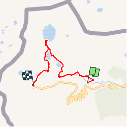
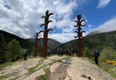
Ruta Senderismo de 5,4 km a descubrir en Andorra. Esta ruta ha sido propuesta por zanogueb.
Descripción
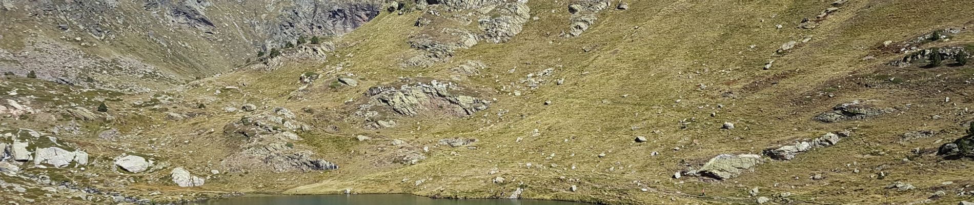
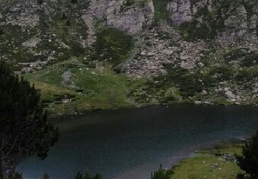
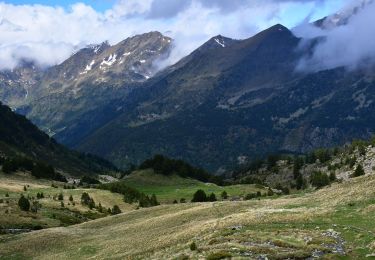
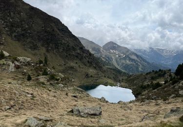
Randonnée des LACS DE TRISTAINA
Départ pour les lacs de Tristaina. A 2200 m à la fin de la route de « Vall Nord », un chemin très fréquenté mais également d’une grande beauté permettra d’atteindre en quelques minutes le 2ème lac des 3 lacs de Tristaina. Cet endroit est spécialement apprécié par les pêcheurs de truites saumonées. Beau paysage sans trop d’effort, avec la
possibilité de rallonger ou d’écourter l’itinéraire.
Localización
Comentarios
Excursiones cerca
![Excursión Senderismo - llorts_lac_angonella - Photo](https://media.geolcdn.com/t/375/260/ext.jpg?maxdim=2&url=https%3A%2F%2Fservices.sitytrail.com%2FGeolivesWS%2FDownloadMedia.ashx%3FTrailID%3D793517%26Media%3Dfix__20170721150953.jpg)
![Senderismo Senderismo](https://static1.geolcdn.com/sitytour/trail-icons/101.png)
![Excursión Senderismo Auzat - Les étangs de la Gardelle - Auzat - Photo](https://media.geolcdn.com/t/375/260/ext.jpg?maxdim=2&url=https%3A%2F%2Fstatic1.geolcdn.com%2Fsiteimages%2Fupload%2Ffiles%2F1553511878bg_sport_marche.png)
![Senderismo Senderismo](https://static1.geolcdn.com/sitytour/trail-icons/101.png)
Senderismo
![](/images/other/stat-length.png)
![](https://static1.geolcdn.com/siteimages/upload/files/16400158638029165_repeat_loop_refresh_sync_direction_icon.png)
![Senderismo Senderismo](https://static1.geolcdn.com/sitytour/trail-icons/101.png)
![Excursión sport - Ortiz - Photo](https://media.geolcdn.com/t/375/260/119fa109-5a2a-456e-9c8b-e18e4b6e9501.jpg&format=jpg&maxdim=2)
![Excursión sport - Arcalis - Photo](https://media.geolcdn.com/t/375/260/04058f44-9f8f-463f-a1cc-559cb86b42ee.jpg&format=jpg&maxdim=2)
![Excursión Senderismo Auzat - Domaine de Montcalm -port Rat Pic Rouge - Photo](https://media.geolcdn.com/t/375/260/4ee9492f-31eb-4d1a-b77c-878ac1f5c4df.jpg&format=jpg&maxdim=2)
![Senderismo Senderismo](https://static1.geolcdn.com/sitytour/trail-icons/101.png)
Senderismo
![](/images/other/stat-length.png)
![](https://static1.geolcdn.com/siteimages/upload/files/16400158638029165_repeat_loop_refresh_sync_direction_icon.png)
![Excursión Senderismo Auzat - Tour des lacs - Sarroucanes - Photo](https://media.geolcdn.com/t/375/260/45e48d9e-2f03-4378-bfe0-01a4ae1719c1.jpg&format=jpg&maxdim=2)
![Senderismo Senderismo](https://static1.geolcdn.com/sitytour/trail-icons/101.png)
Senderismo
![](/images/other/stat-length.png)
![](https://static1.geolcdn.com/siteimages/upload/files/16400158638029165_repeat_loop_refresh_sync_direction_icon.png)
![Excursión Senderismo Auzat - Caraussans - Photo](https://media.geolcdn.com/t/375/260/13f3c7b9-396a-4438-ab57-e6debb7e127e.jpg&format=jpg&maxdim=2)
![Senderismo Senderismo](https://static1.geolcdn.com/sitytour/trail-icons/101.png)
Senderismo
![](/images/other/stat-length.png)
![](https://static1.geolcdn.com/siteimages/upload/files/16400158638029165_repeat_loop_refresh_sync_direction_icon.png)