


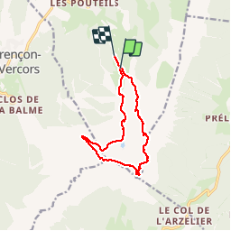

7,7 km | 13,8 km-effort

Usuario GUIDE


Aplicación GPS de excursión GRATIS
 SityTrail
IGN / Institutos geográficos
SityTrail World
El mundo es suyo
Ruta Senderismo de 11,8 km a descubrir en Auvergne-Rhône-Alpes, Isère, Villard-de-Lans. Esta ruta ha sido propuesta por nadd73.
Villard de lans télécabine jusque 1750.
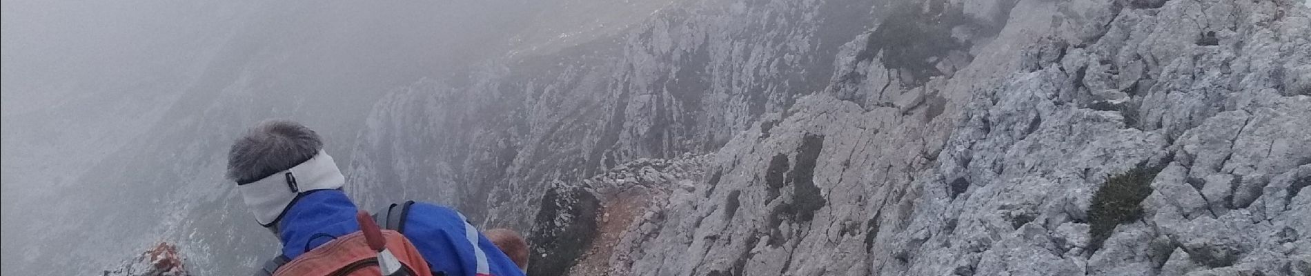
suivre la piste monter l'arete. piolet et bonne chaussures. aérien


Senderismo

Senderismo

Senderismo

Bici de montaña

Senderismo

Senderismo

Senderismo

Senderismo

Senderismo