![](/images/other/stat-length.png)
![Excursión Senderismo Cléden-Cap-Sizun - Pointe du Van - Pointe du Raz par le GR34 - 13.5km 310m 4h10 (40mn) - 2019 09 04 - Photo](https://media.geolcdn.com/t/1900/400/06129bcd-1428-4839-9879-17e65208fdf9.jpg&format=pjpeg&maxdim=2)
Pointe du Van - Pointe du Raz par le GR34 - 13.5km 310m 4h10 (40mn) - 2019 09 04
Orcal37
Usuario GUIDE
![Longitud](/images/other/stat-length.png)
Longitud
13,5 km
![Altitud máxima](https://static1.geolcdn.com/siteimages/upload/files/1508320355ic_sort_altitude_max_24dp.png)
Altitud máxima
76 m
![Desnivel positivo](https://static1.geolcdn.com/siteimages/upload/files/1508320355ic_sort_den_pos_24dp.png)
Desnivel positivo
310 m
![Km-Effort](/images/other/stat-length.png)
Km-Effort
17,6 km
![Altitud mínima](https://static1.geolcdn.com/siteimages/upload/files/1508320355ic_sort_altitude_min_24dp.png)
Altitud mínima
5 m
![Desnivel negativo](https://static1.geolcdn.com/siteimages/upload/files/1508320355ic_sort_den_neg_24dp.png)
Desnivel negativo
309 m
![Boucle](https://static1.geolcdn.com/siteimages/upload/files/16400158638029165_repeat_loop_refresh_sync_direction_icon.png)
Boucle
Sí
Fecha de creación :
2019-09-04 09:39:33.507
Última modificación :
2021-09-19 17:37:23.288
![Senderismo](https://static1.geolcdn.com/sitytour/trail-icons/101.png)
4h10
Dificultad : Medio
![Escanee este código QR para abrir la excursión en la aplicación SityTrail](https://capi.geolives.com/qq0zvz2zws4bq2lad0pu/sitytour/trails/2191818/qr.png?size=200)
Aplicación GPS de excursión GRATIS
A propósito
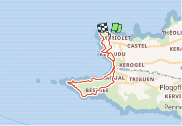
Ruta Senderismo de 13,5 km a descubrir en Bretaña, Finisterre, Cléden-Cap-Sizun. Esta ruta ha sido propuesta por Orcal37.
Descripción
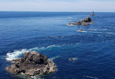
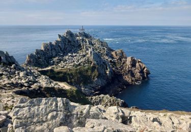
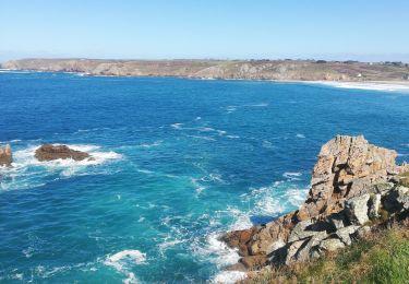
Pointe du Van - Pointe du Raz par le GR34 - boucle retour via routes - 13.5km 310m 4h10 (40mn) - 2019 09 04
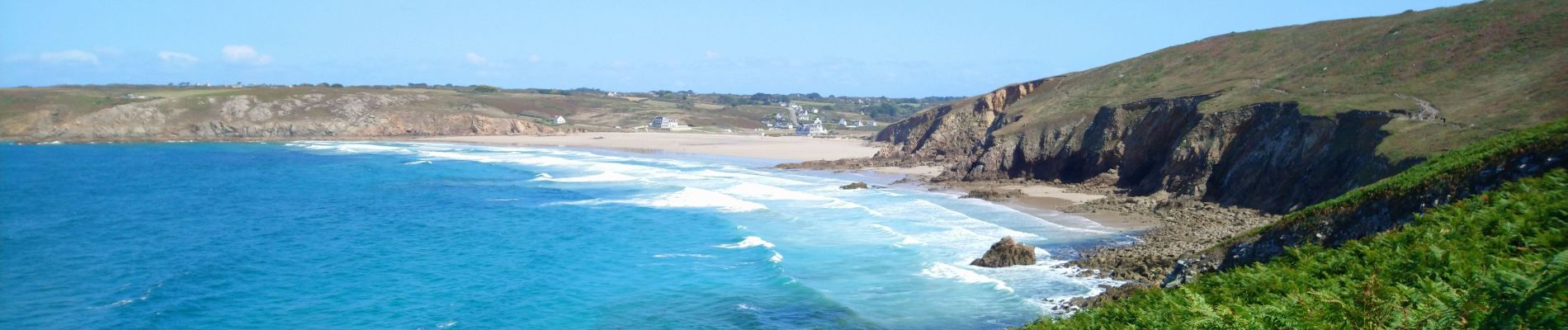
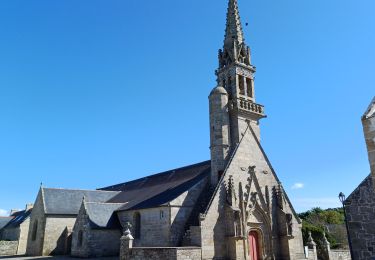
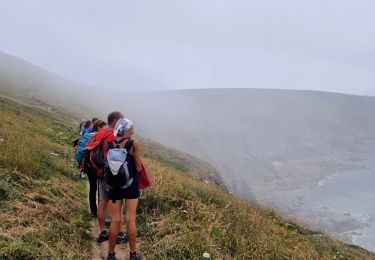
Localización
País:
France
Región :
Bretaña
Departamento/provincia :
Finisterre
Municipio :
Cléden-Cap-Sizun
Localidad:
Unknown
Salida:(Dec)
Salida:(UTM)
372771 ; 5324348 (30U) N.
Comentarios
Excursiones cerca
![Excursión Senderismo Cléden-Cap-Sizun - GR34 Pointe de Brézelec -- Cléden-Cap-Sizun (Pointe du Raz) - Photo](https://media.geolcdn.com/t/375/260/c8e4b333-f389-409b-a569-fa6f65a7aa66.jpg&format=jpg&maxdim=2)
![Senderismo Senderismo](https://static1.geolcdn.com/sitytour/trail-icons/101.png)
GR34 Pointe de Brézelec -- Cléden-Cap-Sizun (Pointe du Raz)
Senderismo
Muy difícil
Cléden-Cap-Sizun,
Bretaña,
Finisterre,
France
![](/images/other/stat-length.png)
23 km | 30 km-effort
6h 54min
![](https://static1.geolcdn.com/siteimages/upload/files/16400158638029165_repeat_loop_refresh_sync_direction_icon.png)
No
![Excursión Senderismo Plogoff - TREK RCY GR34 J4 2022 Pointe du Raz/ baie des trépassés - Photo](https://media.geolcdn.com/t/375/260/5d2c6731-b703-4e85-be24-5e5d9a1ced82.jpg&format=jpg&maxdim=2)
![Senderismo Senderismo](https://static1.geolcdn.com/sitytour/trail-icons/101.png)
TREK RCY GR34 J4 2022 Pointe du Raz/ baie des trépassés
Senderismo
Fácil
Plogoff,
Bretaña,
Finisterre,
France
![](/images/other/stat-length.png)
13,9 km | 18,3 km-effort
3h 42min
![](https://static1.geolcdn.com/siteimages/upload/files/16400158638029165_repeat_loop_refresh_sync_direction_icon.png)
No
![Excursión Senderismo Plogoff - la pointe du Raz - Photo](https://media.geolcdn.com/t/375/260/106b0dee-166f-4747-926b-7aeac04a59f3.jpg&format=jpg&maxdim=2)
![Senderismo Senderismo](https://static1.geolcdn.com/sitytour/trail-icons/101.png)
la pointe du Raz
Senderismo
Difícil
Plogoff,
Bretaña,
Finisterre,
France
![](/images/other/stat-length.png)
5,3 km | 7 km-effort
2h 56min
![](https://static1.geolcdn.com/siteimages/upload/files/16400158638029165_repeat_loop_refresh_sync_direction_icon.png)
Sí
![Excursión Senderismo Plogoff - plogoff loual - Photo](https://media.geolcdn.com/t/375/260/ext.jpg?maxdim=2&url=https%3A%2F%2Fstatic1.geolcdn.com%2Fsiteimages%2Fupload%2Ffiles%2F1553511878bg_sport_marche.png)
![Senderismo Senderismo](https://static1.geolcdn.com/sitytour/trail-icons/101.png)
plogoff loual
Senderismo
Fácil
(1)
Plogoff,
Bretaña,
Finisterre,
France
![](/images/other/stat-length.png)
4,1 km | 5 km-effort
1h 8min
![](https://static1.geolcdn.com/siteimages/upload/files/16400158638029165_repeat_loop_refresh_sync_direction_icon.png)
Sí
![Excursión Senderismo Plogoff - la pointe du raz Bretagne - Photo](https://media.geolcdn.com/t/375/260/ext.jpg?maxdim=2&url=https%3A%2F%2Fstatic1.geolcdn.com%2Fsiteimages%2Fupload%2Ffiles%2F1553511878bg_sport_marche.png)
![Senderismo Senderismo](https://static1.geolcdn.com/sitytour/trail-icons/101.png)
la pointe du raz Bretagne
Senderismo
Muy fácil
(1)
Plogoff,
Bretaña,
Finisterre,
France
![](/images/other/stat-length.png)
6,8 km | 9 km-effort
2h 19min
![](https://static1.geolcdn.com/siteimages/upload/files/16400158638029165_repeat_loop_refresh_sync_direction_icon.png)
Sí
![Excursión Senderismo Cléden-Cap-Sizun - point du van - Photo](https://media.geolcdn.com/t/375/260/ext.jpg?maxdim=2&url=https%3A%2F%2Fstatic1.geolcdn.com%2Fsiteimages%2Fupload%2Ffiles%2F1553511878bg_sport_marche.png)
![Senderismo Senderismo](https://static1.geolcdn.com/sitytour/trail-icons/101.png)
point du van
Senderismo
Medio
(1)
Cléden-Cap-Sizun,
Bretaña,
Finisterre,
France
![](/images/other/stat-length.png)
10,6 km | 13,9 km-effort
Desconocido
![](https://static1.geolcdn.com/siteimages/upload/files/16400158638029165_repeat_loop_refresh_sync_direction_icon.png)
Sí
![Excursión Senderismo Cléden-Cap-Sizun - Gr34 Cléden-Cap-Sizun -- Audierne - Photo](https://media.geolcdn.com/t/375/260/5b525b84-6ac9-4943-b831-b8f433338692.jpg&format=jpg&maxdim=2)
![Senderismo Senderismo](https://static1.geolcdn.com/sitytour/trail-icons/101.png)
Gr34 Cléden-Cap-Sizun -- Audierne
Senderismo
Muy difícil
Cléden-Cap-Sizun,
Bretaña,
Finisterre,
France
![](/images/other/stat-length.png)
21 km | 25 km-effort
5h 36min
![](https://static1.geolcdn.com/siteimages/upload/files/16400158638029165_repeat_loop_refresh_sync_direction_icon.png)
No
![Excursión Senderismo Cléden-Cap-Sizun - POINTE DU RAZ - Photo](https://media.geolcdn.com/t/375/260/50bf8e99-98ae-4340-8c1b-eb502686b93f.jpg&format=jpg&maxdim=2)
![Senderismo Senderismo](https://static1.geolcdn.com/sitytour/trail-icons/101.png)
POINTE DU RAZ
Senderismo
Fácil
Cléden-Cap-Sizun,
Bretaña,
Finisterre,
France
![](/images/other/stat-length.png)
15,7 km | 20 km-effort
4h 38min
![](https://static1.geolcdn.com/siteimages/upload/files/16400158638029165_repeat_loop_refresh_sync_direction_icon.png)
Sí
![Excursión Senderismo Plogoff - pointe du Raz - Photo](https://media.geolcdn.com/t/375/260/f0356271-982d-47aa-a59e-15ed79828940.jpg&format=jpg&maxdim=2)
![Senderismo Senderismo](https://static1.geolcdn.com/sitytour/trail-icons/101.png)
pointe du Raz
Senderismo
Medio
Plogoff,
Bretaña,
Finisterre,
France
![](/images/other/stat-length.png)
6,4 km | 8,6 km-effort
2h 18min
![](https://static1.geolcdn.com/siteimages/upload/files/16400158638029165_repeat_loop_refresh_sync_direction_icon.png)
Sí