


3,2 km | 5,3 km-effort


Usuario


Aplicación GPS de excursión GRATIS
 SityTrail
IGN / Institutos geográficos
SityTrail World
El mundo es suyo
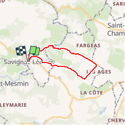
Ruta Senderismo de 10,1 km a descubrir en Nueva Aquitania, Dordogne, Savignac-Lédrier. Esta ruta ha sido propuesta por YV24.
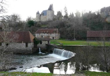
Départ parking village.
Septembre 2019 : Attention, balisage approximatif, vert au départ, peu de jaune et souvent insuffisant, voire inexistant !
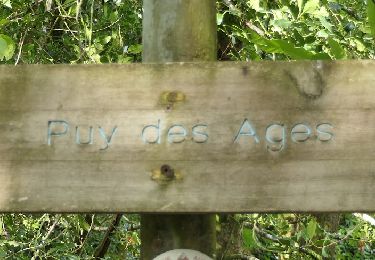
Tracé relevé sur le terrain, agréable, beau point de vue depuis la chapelle du Puy des Ages. Beau chemin de bruyères fleuries en fin d'été. Pas très ombragé.
Surtout, ne pas manquer les visites de la papeterie ancienne de Vaux (à Payzac) et des forges de Savignac Lédrier.
Senderismo
A pie
Senderismo
Bici de montaña

Senderismo
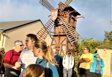
Senderismo

Senderismo
Senderismo

A pie