![](/images/other/stat-length.png)
![Excursión Bicicleta híbrida Issy-les-Moulineaux - Veloscenie au départ d'Issy par la coulée verte, retour forêt de meudon - Photo](https://media.geolcdn.com/t/1900/400/ext.pjpeg?maxdim=2&url=https%3A%2F%2Fstatic1.geolcdn.com%2Fsiteimages%2Fupload%2Ffiles%2F1524743154velo.jpg)
Veloscenie au départ d'Issy par la coulée verte, retour forêt de meudon
Sarah92130
Usuario
![Longitud](/images/other/stat-length.png)
![Altitud máxima](https://static1.geolcdn.com/siteimages/upload/files/1508320355ic_sort_altitude_max_24dp.png)
![Desnivel positivo](https://static1.geolcdn.com/siteimages/upload/files/1508320355ic_sort_den_pos_24dp.png)
![Km-Effort](/images/other/stat-length.png)
![Altitud mínima](https://static1.geolcdn.com/siteimages/upload/files/1508320355ic_sort_altitude_min_24dp.png)
![Desnivel negativo](https://static1.geolcdn.com/siteimages/upload/files/1508320355ic_sort_den_neg_24dp.png)
![Boucle](https://static1.geolcdn.com/siteimages/upload/files/16400158638029165_repeat_loop_refresh_sync_direction_icon.png)
![Bicicleta híbrida](https://static1.geolcdn.com/sitytour/trail-icons/203.png)
3h03
Dificultad : Medio
![Escanee este código QR para abrir la excursión en la aplicación SityTrail](https://capi.geolives.com/qq0zvz2zws4bq2lad0pu/sitytour/trails/2186696/qr.png?size=200)
Aplicación GPS de excursión GRATIS
A propósito
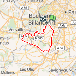
Ruta Bicicleta híbrida de 41 km a descubrir en Isla de Francia, Altos del Sena, Issy-les-Moulineaux. Esta ruta ha sido propuesta por Sarah92130.
Descripción
Boucle au départ d'Issy faite en VTT mais largement accessible en vtc. On va quasiment jusqu'à Versailles via piste cyclable ou forêt. l'itinéraire privilegie le moins de dénivelé possible et est donc très accessible. possibilité de passer par la route au retour pour traverser la forêt de Meudon.
Localización
Comentarios
Excursiones cerca
![Excursión Senderismo París - DP75-14 De Sèvres-Babylone au square Saint-Médard - Photo](https://media.geolcdn.com/t/375/260/a199d31d-b175-4057-acc7-f0c89d3fc917.jpg&format=jpg&maxdim=2)
![Senderismo Senderismo](https://static1.geolcdn.com/sitytour/trail-icons/101.png)
Senderismo
![](/images/other/stat-length.png)
![](https://static1.geolcdn.com/siteimages/upload/files/16400158638029165_repeat_loop_refresh_sync_direction_icon.png)
![Excursión Senderismo París - DP75-13 De Vaugirard à Sèvres-Babylone - Photo](https://media.geolcdn.com/t/375/260/ef3b90ff-736f-49ef-8953-54f5a63f322a.jpg&format=jpg&maxdim=2)
![Senderismo Senderismo](https://static1.geolcdn.com/sitytour/trail-icons/101.png)
Senderismo
![](/images/other/stat-length.png)
![](https://static1.geolcdn.com/siteimages/upload/files/16400158638029165_repeat_loop_refresh_sync_direction_icon.png)
![Excursión Senderismo París - DP75-11 De Boulainvilliers à pont du Garigliano - Photo](https://media.geolcdn.com/t/375/260/65f6b9b8-257b-4cb3-ae12-0b82159348dc.jpg&format=jpg&maxdim=2)
![Senderismo Senderismo](https://static1.geolcdn.com/sitytour/trail-icons/101.png)
Senderismo
![](/images/other/stat-length.png)
![](https://static1.geolcdn.com/siteimages/upload/files/16400158638029165_repeat_loop_refresh_sync_direction_icon.png)
![Excursión Senderismo París - DP75-10 De Invalides à Boulainvilliers - Photo](https://media.geolcdn.com/t/375/260/06e8c009-77c2-4d8d-a0b6-c63aa8c7d3f7.jpg&format=jpg&maxdim=2)
![Senderismo Senderismo](https://static1.geolcdn.com/sitytour/trail-icons/101.png)
Senderismo
![](/images/other/stat-length.png)
![](https://static1.geolcdn.com/siteimages/upload/files/16400158638029165_repeat_loop_refresh_sync_direction_icon.png)
![Excursión Senderismo París - DP75-32 De Charles-Michel à Plaisance - Photo](https://media.geolcdn.com/t/375/260/392c6463-e03b-44f3-85b1-02c32ee10469.jpg&format=jpg&maxdim=2)
![Senderismo Senderismo](https://static1.geolcdn.com/sitytour/trail-icons/101.png)
Senderismo
![](/images/other/stat-length.png)
![](https://static1.geolcdn.com/siteimages/upload/files/16400158638029165_repeat_loop_refresh_sync_direction_icon.png)
![Excursión Senderismo París - DP75-31 De Passy à Charles-Michel - Photo](https://media.geolcdn.com/t/375/260/96431e96-6d3c-47dc-91ae-d446da1f3a1d.jpg&format=jpg&maxdim=2)
![Senderismo Senderismo](https://static1.geolcdn.com/sitytour/trail-icons/101.png)
Senderismo
![](/images/other/stat-length.png)
![](https://static1.geolcdn.com/siteimages/upload/files/16400158638029165_repeat_loop_refresh_sync_direction_icon.png)
![Excursión Bicicleta París - Paris au bord de Seine - Photo](https://media.geolcdn.com/t/375/260/ext.jpg?maxdim=2&url=https%3A%2F%2Fservices.sitytrail.com%2FGeolivesWS%2FDownloadMedia.ashx%3FTrailID%3D137119%26Media%3D20120703185331.jpg)
![Bicicleta Bicicleta](https://static1.geolcdn.com/sitytour/trail-icons/200.png)
Bicicleta
![](/images/other/stat-length.png)
![](https://static1.geolcdn.com/siteimages/upload/files/16400158638029165_repeat_loop_refresh_sync_direction_icon.png)
![Excursión Senderismo París - 75-05-Paris les Boulevards 13km-625-799- - Photo](https://media.geolcdn.com/t/375/260/65e75e6a-35fa-4760-a028-d929907d2fd8.jpg&format=jpg&maxdim=2)
![Senderismo Senderismo](https://static1.geolcdn.com/sitytour/trail-icons/101.png)
Senderismo
![](/images/other/stat-length.png)
![](https://static1.geolcdn.com/siteimages/upload/files/16400158638029165_repeat_loop_refresh_sync_direction_icon.png)
![Excursión Senderismo París - 75-04-Paris les Ponts 13km-493-55- - Photo](https://media.geolcdn.com/t/375/260/ffa79fa9-c1ae-4345-951e-9e30af6e17a7.jpg&format=jpg&maxdim=2)
![Senderismo Senderismo](https://static1.geolcdn.com/sitytour/trail-icons/101.png)
Senderismo
![](/images/other/stat-length.png)
![](https://static1.geolcdn.com/siteimages/upload/files/16400158638029165_repeat_loop_refresh_sync_direction_icon.png)