![](/images/other/stat-length.png)
![Excursión Arques - SityTrail - Les Berques - Arques - Photo](https://media.geolcdn.com/t/1900/400/ext.pjpeg?maxdim=2&url=https%3A%2F%2Fsecurestorage.geolives.com%2Fsitytour%2Ftrail-bg%2Fdefault.jpg)
SityTrail - Les Berques - Arques
mouma_77
Usuario
![Longitud](/images/other/stat-length.png)
![Altitud máxima](https://static1.geolcdn.com/siteimages/upload/files/1508320355ic_sort_altitude_max_24dp.png)
![Desnivel positivo](https://static1.geolcdn.com/siteimages/upload/files/1508320355ic_sort_den_pos_24dp.png)
![Km-Effort](/images/other/stat-length.png)
![Altitud mínima](https://static1.geolcdn.com/siteimages/upload/files/1508320355ic_sort_altitude_min_24dp.png)
![Desnivel negativo](https://static1.geolcdn.com/siteimages/upload/files/1508320355ic_sort_den_neg_24dp.png)
![Boucle](https://static1.geolcdn.com/siteimages/upload/files/16400158638029165_repeat_loop_refresh_sync_direction_icon.png)
![Escanee este código QR para abrir la excursión en la aplicación SityTrail](https://capi.geolives.com/qq0zvz2zws4bq2lad0pu/sitytour/trails/2184292/qr.png?size=200)
Aplicación GPS de excursión GRATIS
A propósito
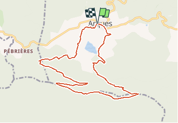
Ruta de 11,4 km a descubrir en Occitania, Aude, Arques. Esta ruta ha sido propuesta por mouma_77.
Descripción
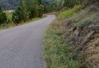
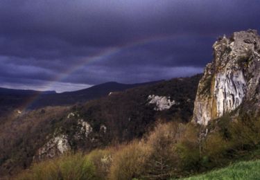
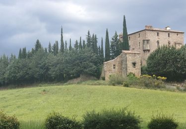
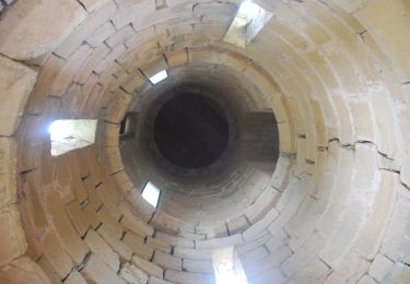
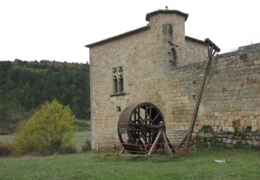
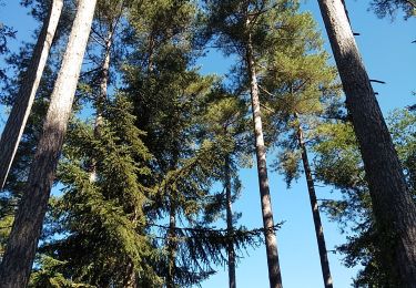
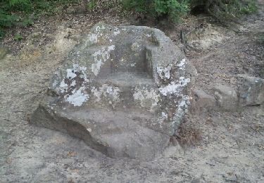
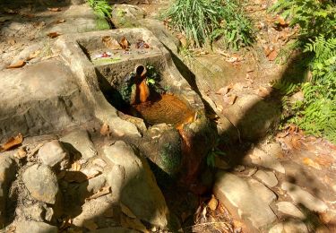
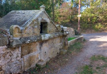
Circuit proposé par le Pays de Couiza. Départ de l'église d'Arques. Cet itinéraire offre un panorama somptueux depuis les deux sommets principaux de la forêt du Rialsesse d’où l’on aperçoit le lac d’Arques. Cette forêt des Corbières Occidentales est domaniale et s’étend sur 8 communes. Les différents étages de la végétation s’échelonnent du chêne pubescent aux résineux : pins noirs, pins laricio, pins sylvestres et à l’étage supérieur, les sapins, cèdres et hêtres. Vues exceptionnelles sur Arques, la vallée et les collines qui l’entourent avec au sud, le Pech de Bugarach et à l’ouest, la chaîne des Pyrénées orientales et ariégeoises. Retrouvez cette randonnée sur le site du Pays de Couiza.
Localización
Comentarios
Excursiones cerca
![Excursión Bicicleta Arques - CCS FFC Aude en Pyrénées - Circuit n°11 - Arques - Photo](https://media.geolcdn.com/t/375/260/ext.jpg?maxdim=2&url=https%3A%2F%2Fservices.sitytrail.com%2FGeolivesWS%2FDownloadMedia.ashx%3FTrailID%3D111470%26Media%3D7353_1.jpg)
![Bicicleta Bicicleta](https://static1.geolcdn.com/sitytour/trail-icons/200.png)
Bicicleta
![](/images/other/stat-length.png)
![](https://static1.geolcdn.com/siteimages/upload/files/16400158638029165_repeat_loop_refresh_sync_direction_icon.png)
![Excursión Senderismo Serres - Serres Cardou - Photo](https://media.geolcdn.com/t/375/260/3dcdcfad-e675-4328-969d-93b02c6e2d21.jpg&format=jpg&maxdim=2)
![Senderismo Senderismo](https://static1.geolcdn.com/sitytour/trail-icons/101.png)
![Excursión A pie Arques - La Frau - Photo](https://media.geolcdn.com/t/375/260/dd7678c6-a794-444d-a52c-e2d60c9d9291.jpeg&format=jpg&maxdim=2)
![A pie A pie](https://static1.geolcdn.com/sitytour/trail-icons/100.png)
![Excursión A pie Arques - Les Berques - Photo](https://media.geolcdn.com/t/375/260/84344748-6b6d-47a0-bbe7-d97839fec542.jpeg&format=jpg&maxdim=2)
![A pie A pie](https://static1.geolcdn.com/sitytour/trail-icons/100.png)
![Excursión Senderismo Arques - Arques 29 09 3019 - Photo](https://media.geolcdn.com/t/375/260/d8261a14-6ebe-438a-a45c-071567d1fc57.jpg&format=jpg&maxdim=2)
![Senderismo Senderismo](https://static1.geolcdn.com/sitytour/trail-icons/101.png)
Senderismo
![](/images/other/stat-length.png)
![](https://static1.geolcdn.com/siteimages/upload/files/16400158638029165_repeat_loop_refresh_sync_direction_icon.png)
![Excursión Senderismo Rennes-les-Bains - Sources Rennes les bains - Photo](https://media.geolcdn.com/t/375/260/ext.jpg?maxdim=2&url=https%3A%2F%2Fservices.sitytrail.com%2FGeolivesWS%2FDownloadMedia.ashx%3FTrailID%3D139042%26Media%3D20120625205934.jpeg)
![Senderismo Senderismo](https://static1.geolcdn.com/sitytour/trail-icons/101.png)
Senderismo
![](/images/other/stat-length.png)
![](https://static1.geolcdn.com/siteimages/upload/files/16400158638029165_repeat_loop_refresh_sync_direction_icon.png)
![Excursión Senderismo Rennes-les-Bains - Rennes-les-Bains-le fauteuil du diable - Photo](https://media.geolcdn.com/t/375/260/00addcaa-31da-40b2-8ced-3828d5d82226.jpg&format=jpg&maxdim=2)
![Senderismo Senderismo](https://static1.geolcdn.com/sitytour/trail-icons/101.png)
Senderismo
![](/images/other/stat-length.png)
![](https://static1.geolcdn.com/siteimages/upload/files/16400158638029165_repeat_loop_refresh_sync_direction_icon.png)
![Excursión Senderismo Rennes-les-Bains - Rennes-les-Bains le pech Cardou - Photo](https://media.geolcdn.com/t/375/260/15aaa3e2-afa0-4a81-ba73-18c11f064f8c.jpg&format=jpg&maxdim=2)
![Senderismo Senderismo](https://static1.geolcdn.com/sitytour/trail-icons/101.png)
Senderismo
![](/images/other/stat-length.png)
![](https://static1.geolcdn.com/siteimages/upload/files/16400158638029165_repeat_loop_refresh_sync_direction_icon.png)
![Excursión Senderismo Serres - gogo1965 - Photo](https://media.geolcdn.com/t/375/260/2c2ad03e-8680-4903-b90a-a34f9c6cb5bc.jpg&format=jpg&maxdim=2)
![Senderismo Senderismo](https://static1.geolcdn.com/sitytour/trail-icons/101.png)