![](/images/other/stat-length.png)
![Excursión Cicloturismo Sète - Sète -Narbonne - Photo](https://media.geolcdn.com/t/1900/400/68bcbb9a-3276-48d7-8f16-700aafadf642.jpg&format=pjpeg&maxdim=2)
Sète -Narbonne
karawatsj
Usuario
![Longitud](/images/other/stat-length.png)
![Altitud máxima](https://static1.geolcdn.com/siteimages/upload/files/1508320355ic_sort_altitude_max_24dp.png)
![Desnivel positivo](https://static1.geolcdn.com/siteimages/upload/files/1508320355ic_sort_den_pos_24dp.png)
![Km-Effort](/images/other/stat-length.png)
![Altitud mínima](https://static1.geolcdn.com/siteimages/upload/files/1508320355ic_sort_altitude_min_24dp.png)
![Desnivel negativo](https://static1.geolcdn.com/siteimages/upload/files/1508320355ic_sort_den_neg_24dp.png)
![Boucle](https://static1.geolcdn.com/siteimages/upload/files/16400158638029165_repeat_loop_refresh_sync_direction_icon.png)
![Cicloturismo](https://static1.geolcdn.com/sitytour/trail-icons/204.png)
5h03
Dificultad : Difícil
![Escanee este código QR para abrir la excursión en la aplicación SityTrail](https://capi.geolives.com/qq0zvz2zws4bq2lad0pu/sitytour/trails/2121257/qr.png?size=200)
Aplicación GPS de excursión GRATIS
A propósito
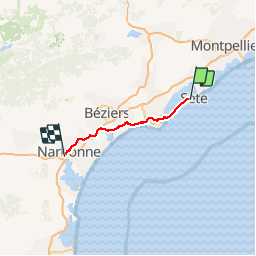
Ruta Cicloturismo de 76 km a descubrir en Occitania, Hérault, Sète. Esta ruta ha sido propuesta por karawatsj.
Descripción
Door de vlakte van de Hérault, de Orb en de Aude.
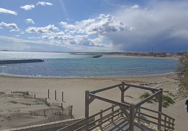
We verlaten de badstad Séte over een mooi fietspad door de smalle duinengordel tussen de Middellandse Zee en het Etang de Thau.
In Marseillan Plage sluiten we aan op het Canal du Midi. Dat kanaal verlaten we slechts even te Agden om een fietsenmaker te zoeken.
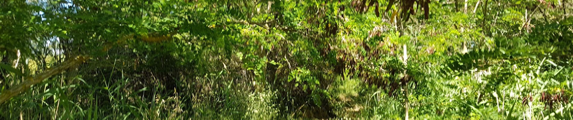
De weg langs de Canal du Midi is onverhard en in slechte staat, eigenlijk uitsluitend voor VTT geschikt.
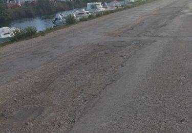
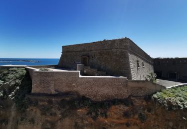
De historische "Ouvrages du Libron" en de aangename stopplaats (bar en resto) aan de jachthaven van Le Boat zijn om niet te missen.
We verlate he Canal du Midi en steken even latet de Orb over en komen al snel op het gezellige marktplein te Sérignan terecht.
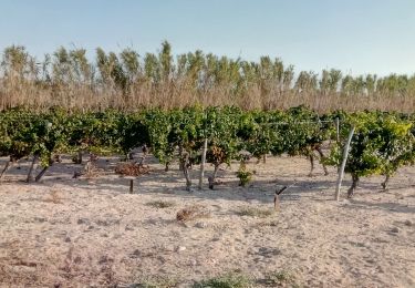
We klimmen uit de vallei van de Orb naar de wijngaarden op het plateau en dalen weer af in de vallei van de Aude die we even volgen maar dan oversteken.
Door de vlakte, vol met wijngaarden, en ver weg in het zuiden de Pyreneeën en in het Westen de bergen van Haut Languedoc fietsen we (over slechte wegen) tot de oude stad Narbonne met dwars door de stad het Canal de la Robine.
Zeer afwisselend, mooi, maar zwaar.
Localización
Comentarios
Excursiones cerca
![Excursión Senderismo Sète - Jolie balade à Sète - Photo](https://media.geolcdn.com/t/375/260/2901ad28-9840-4293-b72b-03831aa6126d.jpg&format=jpg&maxdim=2)
![Senderismo Senderismo](https://static1.geolcdn.com/sitytour/trail-icons/101.png)
Senderismo
![](/images/other/stat-length.png)
![](https://static1.geolcdn.com/siteimages/upload/files/16400158638029165_repeat_loop_refresh_sync_direction_icon.png)
![Excursión Bici de carretera Sète - vélo sete balaruc pinet - Photo](https://media.geolcdn.com/t/375/260/7879f4d8-d04c-4b53-9739-207a531fd449.jpg&format=jpg&maxdim=2)
![Bici de carretera Bici de carretera](https://static1.geolcdn.com/sitytour/trail-icons/201.png)
Bici de carretera
![](/images/other/stat-length.png)
![](https://static1.geolcdn.com/siteimages/upload/files/16400158638029165_repeat_loop_refresh_sync_direction_icon.png)
![Excursión Bici de montaña Sète - listel - Photo](https://media.geolcdn.com/t/375/260/412805d1-94d4-411b-b3a6-2827e8c0f61d.jpg&format=jpg&maxdim=2)
![Bici de montaña Bici de montaña](https://static1.geolcdn.com/sitytour/trail-icons/202.png)
![Excursión Senderismo Sète - 34 Sète Mont-Saint-Clair Corniche Centre ville - Photo](https://media.geolcdn.com/t/375/260/94d570a8-2280-4b7c-a591-7c78a3ec15d4.jpg&format=jpg&maxdim=2)
![Senderismo Senderismo](https://static1.geolcdn.com/sitytour/trail-icons/101.png)
Senderismo
![](/images/other/stat-length.png)
![](https://static1.geolcdn.com/siteimages/upload/files/16400158638029165_repeat_loop_refresh_sync_direction_icon.png)
![Excursión Senderismo Sète - CAP D'AGDE ( Sète et le Mont St- Clair) - Photo](https://media.geolcdn.com/t/375/260/ext.jpg?maxdim=2&url=https%3A%2F%2Fservices.sitytrail.com%2FGeolivesWS%2FDownloadMedia.ashx%3FTrailID%3D1038284%26Media%3Dfix__20180911150730.jpg)
![Senderismo Senderismo](https://static1.geolcdn.com/sitytour/trail-icons/101.png)
Senderismo
![](/images/other/stat-length.png)
![](https://static1.geolcdn.com/siteimages/upload/files/16400158638029165_repeat_loop_refresh_sync_direction_icon.png)
![Excursión Senderismo Balaruc-les-Bains - Balance 20 09 24 - Photo](https://media.geolcdn.com/t/375/260/9aa071df-497a-4188-82fc-e028eb7f877c.jpg&format=jpg&maxdim=2)
![Senderismo Senderismo](https://static1.geolcdn.com/sitytour/trail-icons/101.png)
Senderismo
![](/images/other/stat-length.png)
![](https://static1.geolcdn.com/siteimages/upload/files/16400158638029165_repeat_loop_refresh_sync_direction_icon.png)
![Excursión Senderismo Sète - Mont St. Clair, Sète. - Photo](https://media.geolcdn.com/t/375/260/7c669180-6916-45f0-9bd5-baede6c8447e.jpg&format=jpg&maxdim=2)
![Senderismo Senderismo](https://static1.geolcdn.com/sitytour/trail-icons/101.png)
Senderismo
![](/images/other/stat-length.png)
![](https://static1.geolcdn.com/siteimages/upload/files/16400158638029165_repeat_loop_refresh_sync_direction_icon.png)
![Excursión Senderismo Sète - Sète - Photo](https://media.geolcdn.com/t/375/260/1e0289c6-5fbc-4dbe-bac8-4ddeaa315c86.jpg&format=jpg&maxdim=2)
![Senderismo Senderismo](https://static1.geolcdn.com/sitytour/trail-icons/101.png)
![Excursión Bicicleta híbrida Balaruc-les-Bains - Balaruc ➡️ Meze - Photo](https://media.geolcdn.com/t/375/260/a301d48d-9a05-4275-8b36-b489fc32adf4.jpg&format=jpg&maxdim=2)
![Bicicleta híbrida Bicicleta híbrida](https://static1.geolcdn.com/sitytour/trail-icons/203.png)
Bicicleta híbrida
![](/images/other/stat-length.png)
![](https://static1.geolcdn.com/siteimages/upload/files/16400158638029165_repeat_loop_refresh_sync_direction_icon.png)