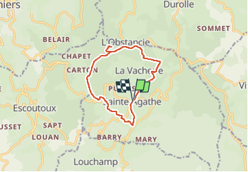
![](/images/other/stat-length.png)
![Excursión Senderismo Sainte-Agathe - Ste_Agathe_Peage - Photo](https://media.geolcdn.com/t/1900/400/ae73d591-dc6d-481d-b0b0-e0d1ded3bb7c.jpg&format=pjpeg&maxdim=2)
Ste_Agathe_Peage
jagarnier
Usuario GUIDE
![Longitud](/images/other/stat-length.png)
![Altitud máxima](https://static1.geolcdn.com/siteimages/upload/files/1508320355ic_sort_altitude_max_24dp.png)
![Desnivel positivo](https://static1.geolcdn.com/siteimages/upload/files/1508320355ic_sort_den_pos_24dp.png)
![Km-Effort](/images/other/stat-length.png)
![Altitud mínima](https://static1.geolcdn.com/siteimages/upload/files/1508320355ic_sort_altitude_min_24dp.png)
![Desnivel negativo](https://static1.geolcdn.com/siteimages/upload/files/1508320355ic_sort_den_neg_24dp.png)
![Boucle](https://static1.geolcdn.com/siteimages/upload/files/16400158638029165_repeat_loop_refresh_sync_direction_icon.png)
![Senderismo](https://static1.geolcdn.com/sitytour/trail-icons/101.png)
3h15
Dificultad : Medio
![Escanee este código QR para abrir la excursión en la aplicación SityTrail](https://capi.geolives.com/qq0zvz2zws4bq2lad0pu/sitytour/trails/2100017/qr.png?size=200)
Aplicación GPS de excursión GRATIS
A propósito
Ruta Senderismo de 11,1 km a descubrir en Auvergne-Rhône-Alpes, Puy-de-Dôme, Sainte-Agathe. Esta ruta ha sido propuesta por jagarnier.
Descripción
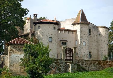
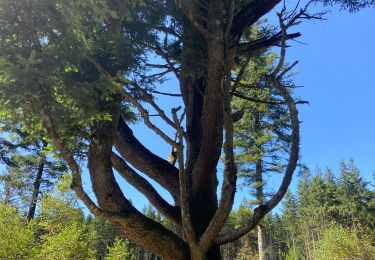
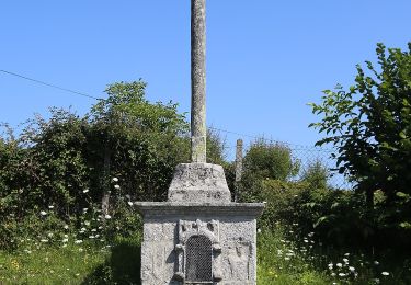
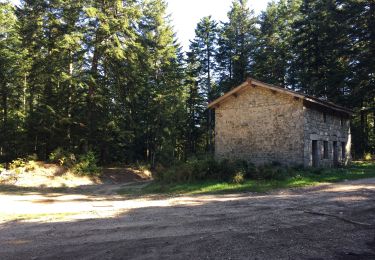
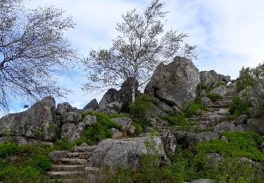
Depuis Saint-Agathe et son église, vous partirez vers les ruines du château de Montguerlhe. C'est un château très mystérieux érigé à la fin du XIème siècle sur un plateau dénudé. Une situation qui lui permet de voir très loin pour surveiller la route économique de Lyon à Thiers. D'ailleurs, « Mont-guerlhe » signifie le mont d'où l'on peut guetter.
Localización
Comentarios
Excursiones cerca
![Excursión Senderismo Thiers - Thiers_Horts - Photo](https://media.geolcdn.com/t/375/260/a517b9ce-72b2-4eb8-b533-599543dd0dbf.jpg&format=jpg&maxdim=2)
![Senderismo Senderismo](https://static1.geolcdn.com/sitytour/trail-icons/101.png)
Senderismo
![](/images/other/stat-length.png)
![](https://static1.geolcdn.com/siteimages/upload/files/16400158638029165_repeat_loop_refresh_sync_direction_icon.png)
![Excursión A pie Celles-sur-Durolle - Le Puy d'Oscot - Photo](https://media.geolcdn.com/t/375/260/72c9d667-7b0d-4bd4-bdcc-04dd7bd66561.jpeg&format=jpg&maxdim=2)
![A pie A pie](https://static1.geolcdn.com/sitytour/trail-icons/100.png)
A pie
![](/images/other/stat-length.png)
![](https://static1.geolcdn.com/siteimages/upload/files/16400158638029165_repeat_loop_refresh_sync_direction_icon.png)
![Excursión A pie Thiers - De l'Enfer aux Rouets - Photo](https://media.geolcdn.com/t/375/260/929c0432-0df8-4b9b-9f47-7f14e14b443e.jpeg&format=jpg&maxdim=2)
![A pie A pie](https://static1.geolcdn.com/sitytour/trail-icons/100.png)
A pie
![](/images/other/stat-length.png)
![](https://static1.geolcdn.com/siteimages/upload/files/16400158638029165_repeat_loop_refresh_sync_direction_icon.png)
![Excursión Senderismo Vollore-Montagne - Pierre pamole - Photo](https://media.geolcdn.com/t/375/260/6ff9709e-f627-424b-aa61-bab39a073f9f.jpg&format=jpg&maxdim=2)
![Senderismo Senderismo](https://static1.geolcdn.com/sitytour/trail-icons/101.png)
Senderismo
![](/images/other/stat-length.png)
![](https://static1.geolcdn.com/siteimages/upload/files/16400158638029165_repeat_loop_refresh_sync_direction_icon.png)
![Excursión A pie Vollore-Ville - Le Grun de Chignore - Photo](https://media.geolcdn.com/t/375/260/d670d619-94c1-4ebf-b98b-e05e4075dc52.jpeg&format=jpg&maxdim=2)
![A pie A pie](https://static1.geolcdn.com/sitytour/trail-icons/100.png)
A pie
![](/images/other/stat-length.png)
![](https://static1.geolcdn.com/siteimages/upload/files/16400158638029165_repeat_loop_refresh_sync_direction_icon.png)
![Excursión Senderismo Thiers - La Coutelière - Photo](https://media.geolcdn.com/t/375/260/992eeb0b-423c-425f-bb61-680ebb682524.jpg&format=jpg&maxdim=2)
![Senderismo Senderismo](https://static1.geolcdn.com/sitytour/trail-icons/101.png)
Senderismo
![](/images/other/stat-length.png)
![](https://static1.geolcdn.com/siteimages/upload/files/16400158638029165_repeat_loop_refresh_sync_direction_icon.png)
![Excursión Senderismo Viscomtat - La Virée des Rocs Nº2/Rocher de Pierre Beille - Photo](https://media.geolcdn.com/t/375/260/bf0a1021-65c7-48d0-bcc1-daa8d158a6cc.jpg&format=jpg&maxdim=2)
![Senderismo Senderismo](https://static1.geolcdn.com/sitytour/trail-icons/101.png)
Senderismo
![](/images/other/stat-length.png)
![](https://static1.geolcdn.com/siteimages/upload/files/16400158638029165_repeat_loop_refresh_sync_direction_icon.png)
![Excursión Senderismo Vollore-Montagne - Vollore_Pierre_Pamole - Photo](https://media.geolcdn.com/t/375/260/6b691788-f28f-4215-bbc2-e488c61bc7e3.jpg&format=jpg&maxdim=2)
![Senderismo Senderismo](https://static1.geolcdn.com/sitytour/trail-icons/101.png)
Senderismo
![](/images/other/stat-length.png)
![](https://static1.geolcdn.com/siteimages/upload/files/16400158638029165_repeat_loop_refresh_sync_direction_icon.png)
![Excursión Senderismo Sainte-Agathe - Saint agate 3ieme jour - Photo](https://media.geolcdn.com/t/375/260/339ddc93-a3ab-4bd3-b422-9ab8f5ca89f2.jpg&format=jpg&maxdim=2)
![Senderismo Senderismo](https://static1.geolcdn.com/sitytour/trail-icons/101.png)
Senderismo
![](/images/other/stat-length.png)
![](https://static1.geolcdn.com/siteimages/upload/files/16400158638029165_repeat_loop_refresh_sync_direction_icon.png)