


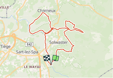


10,1 km | 13,3 km-effort

Randonnez sur et autour des GR ® wallons (Sentiers de Grande Randonnée). PRO


Aplicación GPS de excursión GRATIS
 SityTrail
IGN / Institutos geográficos
SityTrail World
El mundo es suyo
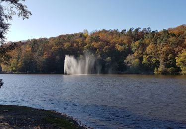
Ruta Senderismo de 20 km a descubrir en Valonia, Lieja, Jalhay. Esta ruta ha sido propuesta por GR Rando.
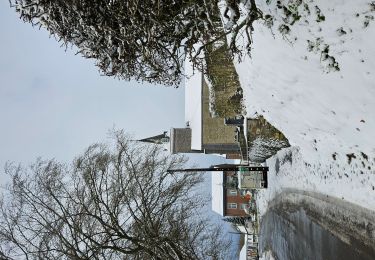
Au pied du plateau des Hautes Fagnes La balade des ruisseaux
Avertissement :
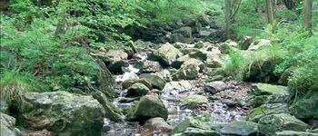
le long de la Hoëgne, du ruisseau de Bilisse et de la Sawe, les racines, les gros blocs de pierre et les rochers qui affleurent sur le parcours, de même que les planches des ponts et des caillebotis, peuvent être très glissants par temps de pluie. Munissez-vous pour cette balade de chaussures dont les semelles adhèrent bien. Un bâton peut être utile.
(Hoëgne, ru de Bilisse, Statte, Sawe, ru de Dison, ru de Charneux)
Cartographie et documentation :
Cartes IGN au 1 : 20 000, 50/1-2 « Sart – Xhoffraix » et 43/5-6 « Limbourg – Eupen ».
Topo-guide du GR 573 « Vesdre – Hoëgne – Helle et Hautes Fagnes ».
Où se désaltérer et se restaurer :
Au pont de Belheid : un chalet café–restaurant et un restaurant.
À Solwaster : un café et des restaurants.
À Hockay : cafés et auberges.
Infos touristiques :
Syndicat d’Initiative de Sart-lez-Spa : www.sart.be
Syndicat d’Initiative de Jalhay, 4, rue de la Fagne, 4845 Jalhay, tél. 087/ 64 70 02


Senderismo

Senderismo

Senderismo

Senderismo

Senderismo

Senderismo
Senderismo

Carrera
super promenade
superbe randonn?e ...Une des plus belles de toutes.