


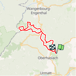

14,9 km | 21 km-effort


Usuario GUIDE


Aplicación GPS de excursión GRATIS
 SityTrail
IGN / Institutos geográficos
SityTrail World
El mundo es suyo
Ruta Paseo ecuestre de 26 km a descubrir en Gran Este, Bajo-Rin, Still. Esta ruta ha sido propuesta por holtzv.
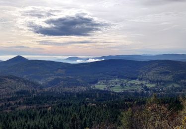
Repas de midi tiré du sac au Schneeberg en passant par la réserve du Baerenberg.
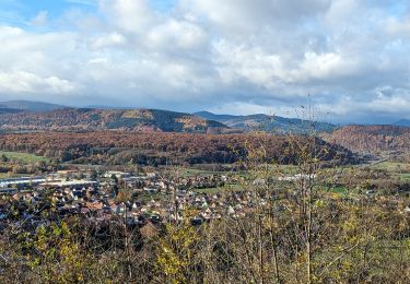
Passage par le carrefour des Pandours et par le point de vue du Rocher du Pfaffenlapp

Senderismo

Paseo ecuestre

Bici de montaña

Bici de montaña

Senderismo
Paseo ecuestre
Paseo ecuestre
Paseo ecuestre

Paseo ecuestre