![](/images/other/stat-length.png)
![Excursión Senderismo Geyssans - Geyssans - Photo](https://media.geolcdn.com/t/1900/400/ext.pjpeg?maxdim=2&url=https%3A%2F%2Fstatic1.geolcdn.com%2Fsiteimages%2Fupload%2Ffiles%2F1553511878bg_sport_marche.png)
Geyssans
meillon
Usuario
![Longitud](/images/other/stat-length.png)
Longitud
10,3 km
![Boucle](https://static1.geolcdn.com/siteimages/upload/files/16400158638029165_repeat_loop_refresh_sync_direction_icon.png)
Boucle
Sí
Fecha de creación :
2019-05-10 08:52:22.237
Última modificación :
2019-05-10 12:28:41.003
![Senderismo](https://static1.geolcdn.com/sitytour/trail-icons/101.png)
3h35
Dificultad : Fácil
![Escanee este código QR para abrir la excursión en la aplicación SityTrail](https://capi.geolives.com/qq0zvz2zws4bq2lad0pu/sitytour/trails/2077890/qr.png?size=200)
Aplicación GPS de excursión GRATIS
A propósito
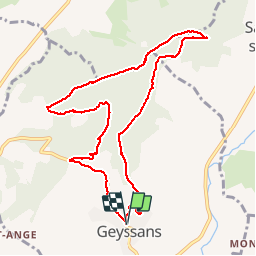
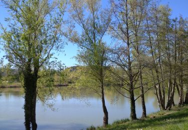
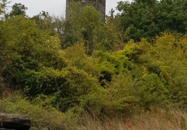
Ruta Senderismo de 10,3 km a descubrir en Auvergne-Rhône-Alpes, Drôme, Geyssans. Esta ruta ha sido propuesta por meillon.
Descripción
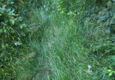
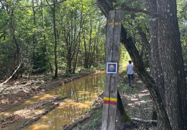
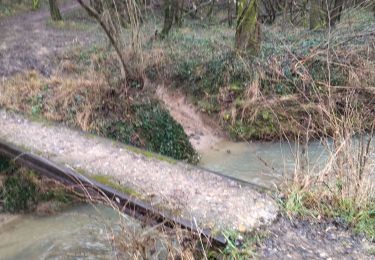
randonnée en grande partie Sylvestre à éviter en temps de pluie passage boueux mais parcours agréable avec vue sur le grand Veymont parfois.
Localización
País:
France
Región :
Auvergne-Rhône-Alpes
Departamento/provincia :
Drôme
Municipio :
Geyssans
Localidad:
Unknown
Salida:(Dec)
Salida:(UTM)
664662 ; 4998578 (31T) N.
Comentarios
Excursiones cerca
![Excursión Senderismo Geyssans - Geyssans - Photo](https://media.geolcdn.com/t/375/260/ext.jpg?maxdim=2&url=https%3A%2F%2Fstatic1.geolcdn.com%2Fsiteimages%2Fupload%2Ffiles%2F1553511878bg_sport_marche.png)
![Senderismo Senderismo](https://static1.geolcdn.com/sitytour/trail-icons/101.png)
Geyssans
Senderismo
Muy fácil
(3)
Geyssans,
Auvergne-Rhône-Alpes,
Drôme,
France
![](/images/other/stat-length.png)
8 km | 10 km-effort
2h 8min
![](https://static1.geolcdn.com/siteimages/upload/files/16400158638029165_repeat_loop_refresh_sync_direction_icon.png)
Sí
![Excursión Senderismo Crépol - 26 crepol aarthemonay pas a pas - Photo](https://media.geolcdn.com/t/375/260/6c99bf12-4c07-4347-b0d4-4b8aaac347b8.jpg&format=jpg&maxdim=2)
![Senderismo Senderismo](https://static1.geolcdn.com/sitytour/trail-icons/101.png)
26 crepol aarthemonay pas a pas
Senderismo
Fácil
Crépol,
Auvergne-Rhône-Alpes,
Drôme,
France
![](/images/other/stat-length.png)
13,4 km | 17,6 km-effort
4h 38min
![](https://static1.geolcdn.com/siteimages/upload/files/16400158638029165_repeat_loop_refresh_sync_direction_icon.png)
Sí
![Excursión Senderismo Arthémonay - Reculais 06 2024 - Photo](https://media.geolcdn.com/t/375/260/bb303910-b4b2-4d55-a4d3-11e9446d4fdb.jpg&format=jpg&maxdim=2)
![Senderismo Senderismo](https://static1.geolcdn.com/sitytour/trail-icons/101.png)
Reculais 06 2024
Senderismo
Difícil
Arthémonay,
Auvergne-Rhône-Alpes,
Drôme,
France
![](/images/other/stat-length.png)
11,7 km | 15,6 km-effort
3h 33min
![](https://static1.geolcdn.com/siteimages/upload/files/16400158638029165_repeat_loop_refresh_sync_direction_icon.png)
Sí
![Excursión Senderismo Triors - 26 triors parnans zel - Photo](https://media.geolcdn.com/t/375/260/e44de655-6898-48d8-b344-59319d607714.jpg&format=jpg&maxdim=2)
![Senderismo Senderismo](https://static1.geolcdn.com/sitytour/trail-icons/101.png)
26 triors parnans zel
Senderismo
Fácil
Triors,
Auvergne-Rhône-Alpes,
Drôme,
France
![](/images/other/stat-length.png)
19,8 km | 26 km-effort
6h 27min
![](https://static1.geolcdn.com/siteimages/upload/files/16400158638029165_repeat_loop_refresh_sync_direction_icon.png)
Sí
![Excursión Senderismo Châtillon-Saint-Jean - 2022-12-04_22h50m01_chapelle_des_gillons_et_la_joyeuse - Photo](https://media.geolcdn.com/t/375/260/ext.jpg?maxdim=2&url=https%3A%2F%2Fstatic1.geolcdn.com%2Fsiteimages%2Fupload%2Ffiles%2F1553511878bg_sport_marche.png)
![Senderismo Senderismo](https://static1.geolcdn.com/sitytour/trail-icons/101.png)
2022-12-04_22h50m01_chapelle_des_gillons_et_la_joyeuse
Senderismo
Difícil
(1)
Châtillon-Saint-Jean,
Auvergne-Rhône-Alpes,
Drôme,
France
![](/images/other/stat-length.png)
10,1 km | 13,1 km-effort
2h 58min
![](https://static1.geolcdn.com/siteimages/upload/files/16400158638029165_repeat_loop_refresh_sync_direction_icon.png)
Sí
![Excursión Senderismo Peyrins - 26 peyrins 08 05 2021 - Photo](https://media.geolcdn.com/t/375/260/8c6a4f14-e0a7-400c-9034-00981b4cb101.jpg&format=jpg&maxdim=2)
![Senderismo Senderismo](https://static1.geolcdn.com/sitytour/trail-icons/101.png)
26 peyrins 08 05 2021
Senderismo
Fácil
Peyrins,
Auvergne-Rhône-Alpes,
Drôme,
France
![](/images/other/stat-length.png)
18,3 km | 25 km-effort
6h 28min
![](https://static1.geolcdn.com/siteimages/upload/files/16400158638029165_repeat_loop_refresh_sync_direction_icon.png)
Sí
![Excursión Senderismo Montmiral - Montmiral - Photo](https://media.geolcdn.com/t/375/260/aef7a5d2-d8bf-4a1f-98a8-48e72f129bd5.jpg&format=jpg&maxdim=2)
![Senderismo Senderismo](https://static1.geolcdn.com/sitytour/trail-icons/101.png)
Montmiral
Senderismo
Fácil
Montmiral,
Auvergne-Rhône-Alpes,
Drôme,
France
![](/images/other/stat-length.png)
11,3 km | 15,6 km-effort
3h 33min
![](https://static1.geolcdn.com/siteimages/upload/files/16400158638029165_repeat_loop_refresh_sync_direction_icon.png)
Sí
![Excursión Senderismo Peyrins - peyrins - Photo](https://media.geolcdn.com/t/375/260/ext.jpg?maxdim=2&url=https%3A%2F%2Fstatic1.geolcdn.com%2Fsiteimages%2Fupload%2Ffiles%2F1553511878bg_sport_marche.png)
![Senderismo Senderismo](https://static1.geolcdn.com/sitytour/trail-icons/101.png)
peyrins
Senderismo
Muy fácil
(1)
Peyrins,
Auvergne-Rhône-Alpes,
Drôme,
France
![](/images/other/stat-length.png)
8,4 km | 11,1 km-effort
2h 53min
![](https://static1.geolcdn.com/siteimages/upload/files/16400158638029165_repeat_loop_refresh_sync_direction_icon.png)
Sí
![Excursión Senderismo Peyrins - Les coteaux de Mours St Eusebe - Photo](https://media.geolcdn.com/t/375/260/ext.jpg?maxdim=2&url=https%3A%2F%2Fstatic1.geolcdn.com%2Fsiteimages%2Fupload%2Ffiles%2F1553511878bg_sport_marche.png)
![Senderismo Senderismo](https://static1.geolcdn.com/sitytour/trail-icons/101.png)
Les coteaux de Mours St Eusebe
Senderismo
Muy fácil
(3)
Peyrins,
Auvergne-Rhône-Alpes,
Drôme,
France
![](/images/other/stat-length.png)
5,2 km | 6,5 km-effort
58min
![](https://static1.geolcdn.com/siteimages/upload/files/16400158638029165_repeat_loop_refresh_sync_direction_icon.png)
Sí