![](/images/other/stat-length.png)
![Excursión Senderismo Bourg-de-Péage - promenade avec Alice - Photo](https://media.geolcdn.com/t/1900/400/d0f6f35a-5c66-454c-9ffd-cd6d2957b9aa.jpg&format=pjpeg&maxdim=2)
promenade avec Alice
bernadette revoux
Usuario
![Longitud](/images/other/stat-length.png)
Longitud
4,9 km
![Altitud máxima](https://static1.geolcdn.com/siteimages/upload/files/1508320355ic_sort_altitude_max_24dp.png)
Altitud máxima
156 m
![Desnivel positivo](https://static1.geolcdn.com/siteimages/upload/files/1508320355ic_sort_den_pos_24dp.png)
Desnivel positivo
46 m
![Km-Effort](/images/other/stat-length.png)
Km-Effort
5,5 km
![Altitud mínima](https://static1.geolcdn.com/siteimages/upload/files/1508320355ic_sort_altitude_min_24dp.png)
Altitud mínima
139 m
![Desnivel negativo](https://static1.geolcdn.com/siteimages/upload/files/1508320355ic_sort_den_neg_24dp.png)
Desnivel negativo
46 m
![Boucle](https://static1.geolcdn.com/siteimages/upload/files/16400158638029165_repeat_loop_refresh_sync_direction_icon.png)
Boucle
Sí
Fecha de creación :
2019-04-18 13:40:18.287
Última modificación :
2019-04-19 10:55:35.834
![Senderismo](https://static1.geolcdn.com/sitytour/trail-icons/101.png)
1h20
Dificultad : Muy fácil
![Escanee este código QR para abrir la excursión en la aplicación SityTrail](https://capi.geolives.com/qq0zvz2zws4bq2lad0pu/sitytour/trails/2063568/qr.png?size=200)
Aplicación GPS de excursión GRATIS
A propósito
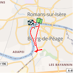
Ruta Senderismo de 4,9 km a descubrir en Auvergne-Rhône-Alpes, Drôme, Bourg-de-Péage. Esta ruta ha sido propuesta por bernadette revoux.
Descripción
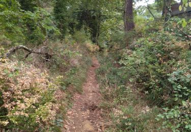
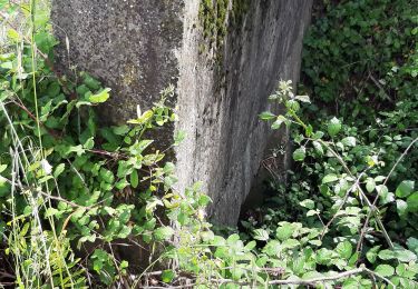
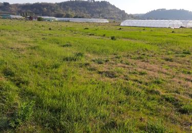
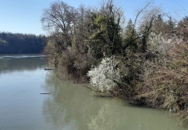
atelier théâtre à la Courte-Echelle, goûter à la boulangerie, bois des Naix, bord de l’Isère.
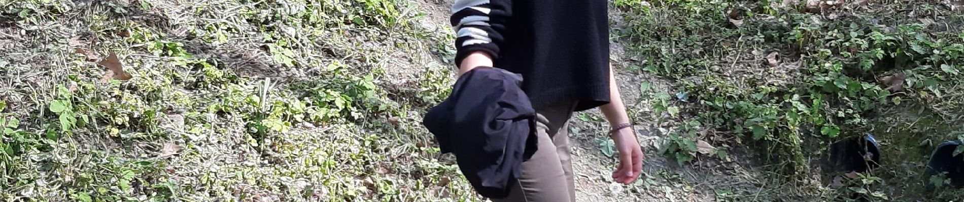
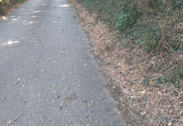
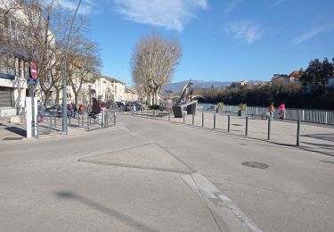
Localización
País:
France
Región :
Auvergne-Rhône-Alpes
Departamento/provincia :
Drôme
Municipio :
Bourg-de-Péage
Localidad:
Unknown
Salida:(Dec)
Salida:(UTM)
661149 ; 4989462 (31T) N.
Comentarios
Excursiones cerca
![Excursión Senderismo Romans-sur-Isère - Les Balmes - Photo](https://media.geolcdn.com/t/375/260/ext.jpg?maxdim=2&url=https%3A%2F%2Fstatic1.geolcdn.com%2Fsiteimages%2Fupload%2Ffiles%2F1553511878bg_sport_marche.png)
![Senderismo Senderismo](https://static1.geolcdn.com/sitytour/trail-icons/101.png)
Les Balmes
Senderismo
Fácil
(1)
Romans-sur-Isère,
Auvergne-Rhône-Alpes,
Drôme,
France
![](/images/other/stat-length.png)
6,7 km | 8,4 km-effort
1h 55min
![](https://static1.geolcdn.com/siteimages/upload/files/16400158638029165_repeat_loop_refresh_sync_direction_icon.png)
Sí
![Excursión Senderismo Romans-sur-Isère - Pourtour dans les Balmes - Photo](https://media.geolcdn.com/t/375/260/ext.jpg?maxdim=2&url=https%3A%2F%2Fstatic1.geolcdn.com%2Fsiteimages%2Fupload%2Ffiles%2F1553511878bg_sport_marche.png)
![Senderismo Senderismo](https://static1.geolcdn.com/sitytour/trail-icons/101.png)
Pourtour dans les Balmes
Senderismo
Fácil
(2)
Romans-sur-Isère,
Auvergne-Rhône-Alpes,
Drôme,
France
![](/images/other/stat-length.png)
7,5 km | 9,4 km-effort
2h 19min
![](https://static1.geolcdn.com/siteimages/upload/files/16400158638029165_repeat_loop_refresh_sync_direction_icon.png)
Sí
![Excursión Bici de carretera Romans-sur-Isère - Romans saint Nazaire - Photo](https://media.geolcdn.com/t/375/260/ext.jpg?maxdim=2&url=https%3A%2F%2Fstatic1.geolcdn.com%2Fsiteimages%2Fupload%2Ffiles%2F1524743154velo.jpg)
![Bici de carretera Bici de carretera](https://static1.geolcdn.com/sitytour/trail-icons/201.png)
Romans saint Nazaire
Bici de carretera
Muy fácil
(1)
Romans-sur-Isère,
Auvergne-Rhône-Alpes,
Drôme,
France
![](/images/other/stat-length.png)
47 km | 53 km-effort
3h 31min
![](https://static1.geolcdn.com/siteimages/upload/files/16400158638029165_repeat_loop_refresh_sync_direction_icon.png)
Sí
![Excursión Bici de carretera Romans-sur-Isère - 26 plle valence tain vv - Photo](https://media.geolcdn.com/t/375/260/67a475ca-b94e-4781-994a-8efe0f44a2e9.jpg&format=jpg&maxdim=2)
![Bici de carretera Bici de carretera](https://static1.geolcdn.com/sitytour/trail-icons/201.png)
26 plle valence tain vv
Bici de carretera
Medio
Romans-sur-Isère,
Auvergne-Rhône-Alpes,
Drôme,
France
![](/images/other/stat-length.png)
77 km | 84 km-effort
6h 38min
![](https://static1.geolcdn.com/siteimages/upload/files/16400158638029165_repeat_loop_refresh_sync_direction_icon.png)
Sí
![Excursión Senderismo Romans-sur-Isère - UP20240307Romans - Photo](https://media.geolcdn.com/t/375/260/8406fb81-2b4f-4caa-83db-7c2e1cd110da.jpg&format=jpg&maxdim=2)
![Senderismo Senderismo](https://static1.geolcdn.com/sitytour/trail-icons/101.png)
UP20240307Romans
Senderismo
Medio
Romans-sur-Isère,
Auvergne-Rhône-Alpes,
Drôme,
France
![](/images/other/stat-length.png)
8,4 km | 9,9 km-effort
2h 7min
![](https://static1.geolcdn.com/siteimages/upload/files/16400158638029165_repeat_loop_refresh_sync_direction_icon.png)
Sí
![Excursión Senderismo Romans-sur-Isère - 26 j do 15.09.22 - Photo](https://media.geolcdn.com/t/375/260/1701e738-083b-4898-af3e-e7c1583e52e2.jpg&format=jpg&maxdim=2)
![Senderismo Senderismo](https://static1.geolcdn.com/sitytour/trail-icons/101.png)
26 j do 15.09.22
Senderismo
Medio
Romans-sur-Isère,
Auvergne-Rhône-Alpes,
Drôme,
France
![](/images/other/stat-length.png)
19,5 km | 25 km-effort
6h 5min
![](https://static1.geolcdn.com/siteimages/upload/files/16400158638029165_repeat_loop_refresh_sync_direction_icon.png)
Sí
![Excursión Bici de carretera Bourg-de-Péage - combovin - Photo](https://media.geolcdn.com/t/375/260/28532606-7135-4c81-86ec-1235ecf667f0.jpg&format=jpg&maxdim=2)
![Bici de carretera Bici de carretera](https://static1.geolcdn.com/sitytour/trail-icons/201.png)
combovin
Bici de carretera
Fácil
Bourg-de-Péage,
Auvergne-Rhône-Alpes,
Drôme,
France
![](/images/other/stat-length.png)
55 km | 61 km-effort
4h 57min
![](https://static1.geolcdn.com/siteimages/upload/files/16400158638029165_repeat_loop_refresh_sync_direction_icon.png)
Sí
![Excursión Senderismo Granges-les-Beaumont - Granges-les-Beaumont - Photo](https://media.geolcdn.com/t/375/260/afb619bd-189b-4bb5-9632-b0d85b916fb7.jpg&format=jpg&maxdim=2)
![Senderismo Senderismo](https://static1.geolcdn.com/sitytour/trail-icons/101.png)
Granges-les-Beaumont
Senderismo
Fácil
Granges-les-Beaumont,
Auvergne-Rhône-Alpes,
Drôme,
France
![](/images/other/stat-length.png)
12,4 km | 15 km-effort
2h 41min
![](https://static1.geolcdn.com/siteimages/upload/files/16400158638029165_repeat_loop_refresh_sync_direction_icon.png)
No
![Excursión Senderismo Bourg-de-Péage - parc Mitterrand bellevue bord de l'Isère - Photo](https://media.geolcdn.com/t/375/260/74189ef5-31de-45d5-8895-a1847329107d.jpg&format=jpg&maxdim=2)
![Senderismo Senderismo](https://static1.geolcdn.com/sitytour/trail-icons/101.png)
parc Mitterrand bellevue bord de l'Isère
Senderismo
Muy fácil
Bourg-de-Péage,
Auvergne-Rhône-Alpes,
Drôme,
France
![](/images/other/stat-length.png)
4,3 km | 4,8 km-effort
59min
![](https://static1.geolcdn.com/siteimages/upload/files/16400158638029165_repeat_loop_refresh_sync_direction_icon.png)
Sí