


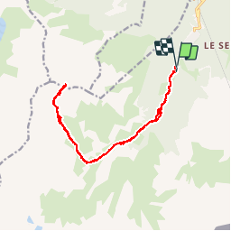

19,4 km | 33 km-effort


Usuario GUIDE

Aplicación GPS de excursión GRATIS
 SityTrail
IGN / Institutos geográficos
SityTrail World
El mundo es suyo
Ruta Esquí de fondo de 17 km a descubrir en Auvergne-Rhône-Alpes, Saboya, Modane. Esta ruta ha sido propuesta por nadd73.
de valfrejus .
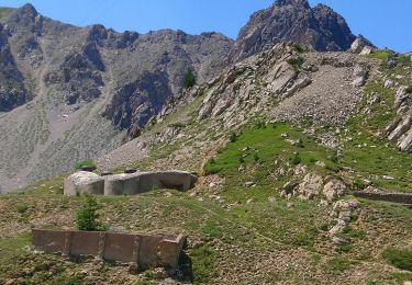
Chemin gelé portage 200m de dénivelé.
Et nous n'avons pas pu descendre le couloir sud car un brouillard à couper au couteau.
l

Senderismo

Esquí de fondo

Esquí de fondo

Esquí de fondo

Esquí de fondo

Raquetas de nieve

Senderismo

Senderismo
Senderismo