![](/images/other/stat-length.png)
![Excursión Senderismo Hauterives - boucle idéale - Photo](https://media.geolcdn.com/t/1900/400/b847dbd1-b22b-4333-8c83-1297ebdeae39.jpg&format=pjpeg&maxdim=2)
boucle idéale
bob2023
Usuario
![Longitud](/images/other/stat-length.png)
![Altitud máxima](https://static1.geolcdn.com/siteimages/upload/files/1508320355ic_sort_altitude_max_24dp.png)
![Desnivel positivo](https://static1.geolcdn.com/siteimages/upload/files/1508320355ic_sort_den_pos_24dp.png)
![Km-Effort](/images/other/stat-length.png)
![Altitud mínima](https://static1.geolcdn.com/siteimages/upload/files/1508320355ic_sort_altitude_min_24dp.png)
![Desnivel negativo](https://static1.geolcdn.com/siteimages/upload/files/1508320355ic_sort_den_neg_24dp.png)
![Boucle](https://static1.geolcdn.com/siteimages/upload/files/16400158638029165_repeat_loop_refresh_sync_direction_icon.png)
![Senderismo](https://static1.geolcdn.com/sitytour/trail-icons/101.png)
2h29
Dificultad : Fácil
![Escanee este código QR para abrir la excursión en la aplicación SityTrail](https://capi.geolives.com/qq0zvz2zws4bq2lad0pu/sitytour/trails/2061242/qr.png?size=200)
Aplicación GPS de excursión GRATIS
A propósito
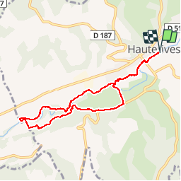
Ruta Senderismo de 7,9 km a descubrir en Auvergne-Rhône-Alpes, Drôme, Hauterives. Esta ruta ha sido propuesta por bob2023.
Descripción
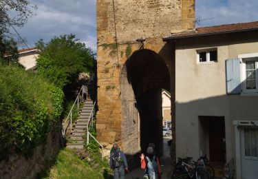
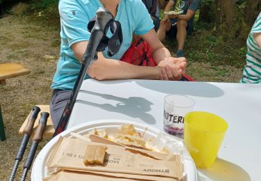
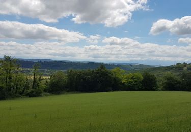
Après la visite du palais idéal du facteur CHEVAL, cette jolie boucle termine merveilleusement la journée.
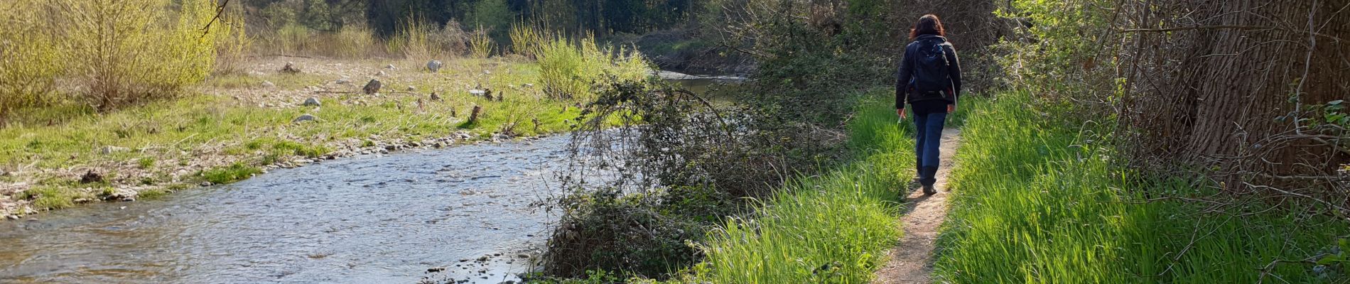
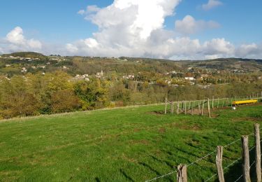
Le sentier longe la Galaure à travers un joli sous-bois. Le retour passe un peu plus haut et permet d'avoir une belle vue sur Hauterives.
Suivre sur la première moitié de la boucle, les marques "Boucle des castors", en profiter pour faire un arrêt au cimetière pour voir le tombeau du facteur CHEVAL . Ensuite finir avec les marques jaunes qui ramènent au point de départ.
Localización
Comentarios
Excursiones cerca
![Excursión sport Moras-en-Valloire - Moras en valloire l’ecolline - Photo](https://media.geolcdn.com/t/375/260/e19f84ca-f352-4c87-8922-7a4e48f9f8b6.jpg&format=jpg&maxdim=2)
sport
![](/images/other/stat-length.png)
![](https://static1.geolcdn.com/siteimages/upload/files/16400158638029165_repeat_loop_refresh_sync_direction_icon.png)
![Excursión Senderismo Hauterives - Hauterives amicale - Photo](https://media.geolcdn.com/t/375/260/c40e550d-f5cd-4e6d-937a-11509e095014.jpg&format=jpg&maxdim=2)
![Senderismo Senderismo](https://static1.geolcdn.com/sitytour/trail-icons/101.png)
Senderismo
![](/images/other/stat-length.png)
![](https://static1.geolcdn.com/siteimages/upload/files/16400158638029165_repeat_loop_refresh_sync_direction_icon.png)
![Excursión Bici de carretera Lens-Lestang - Lens-lestang à Veyrac - Photo](https://media.geolcdn.com/t/375/260/ext.jpg?maxdim=2&url=https%3A%2F%2Fstatic1.geolcdn.com%2Fsiteimages%2Fupload%2Ffiles%2F1524743154velo.jpg)
![Bici de carretera Bici de carretera](https://static1.geolcdn.com/sitytour/trail-icons/201.png)
Bici de carretera
![](/images/other/stat-length.png)
![](https://static1.geolcdn.com/siteimages/upload/files/16400158638029165_repeat_loop_refresh_sync_direction_icon.png)
![Excursión Senderismo Hauterives - 26 hauterives 01.05.23 - Photo](https://media.geolcdn.com/t/375/260/695824ed-e11f-4942-a8d5-167f50e85b62.jpg&format=jpg&maxdim=2)
![Senderismo Senderismo](https://static1.geolcdn.com/sitytour/trail-icons/101.png)
Senderismo
![](/images/other/stat-length.png)
![](https://static1.geolcdn.com/siteimages/upload/files/16400158638029165_repeat_loop_refresh_sync_direction_icon.png)
![Excursión Bicicleta Lens-Lestang - Lens Lestang ballade historique en vélo - Photo](https://media.geolcdn.com/t/375/260/75910d13-8c4a-4cf1-8a55-7a307b59f910.jpg&format=jpg&maxdim=2)
![Bicicleta Bicicleta](https://static1.geolcdn.com/sitytour/trail-icons/200.png)
Bicicleta
![](/images/other/stat-length.png)
![](https://static1.geolcdn.com/siteimages/upload/files/16400158638029165_repeat_loop_refresh_sync_direction_icon.png)
![Excursión Senderismo Lens-Lestang - Lens Lestang- route des Châteaux - Photo](https://media.geolcdn.com/t/375/260/ad478f74-f6f1-4d23-b23c-0533237814a2.jpg&format=jpg&maxdim=2)
![Senderismo Senderismo](https://static1.geolcdn.com/sitytour/trail-icons/101.png)
Senderismo
![](/images/other/stat-length.png)
![](https://static1.geolcdn.com/siteimages/upload/files/16400158638029165_repeat_loop_refresh_sync_direction_icon.png)
![Excursión Senderismo Hauterives - Hauterives - Photo](https://media.geolcdn.com/t/375/260/8f51211a-d544-41d0-9822-209ca83a3066.jpg&format=jpg&maxdim=2)
![Senderismo Senderismo](https://static1.geolcdn.com/sitytour/trail-icons/101.png)
Senderismo
![](/images/other/stat-length.png)
![](https://static1.geolcdn.com/siteimages/upload/files/16400158638029165_repeat_loop_refresh_sync_direction_icon.png)
![Excursión Senderismo Hauterives - marche du facteur Cheval 2024 - Photo](https://media.geolcdn.com/t/375/260/c0bb333c-d9c7-4640-b583-7395dd087ab3.jpg&format=jpg&maxdim=2)
![Senderismo Senderismo](https://static1.geolcdn.com/sitytour/trail-icons/101.png)
Senderismo
![](/images/other/stat-length.png)
![](https://static1.geolcdn.com/siteimages/upload/files/16400158638029165_repeat_loop_refresh_sync_direction_icon.png)
![Excursión Cicloturismo Hauterives - Hauterive - Crest - Photo](https://media.geolcdn.com/t/375/260/04777597-a82a-4bb7-b8c4-83cc6eeb26f8.jpg&format=jpg&maxdim=2)
![Cicloturismo Cicloturismo](https://static1.geolcdn.com/sitytour/trail-icons/204.png)
Cicloturismo
![](/images/other/stat-length.png)
![](https://static1.geolcdn.com/siteimages/upload/files/16400158638029165_repeat_loop_refresh_sync_direction_icon.png)
très bien