![](/images/other/stat-length.png)
![Excursión Marcha nórdica Saint-Germain-en-Laye - SityTrail - MN CDN 14 KM MARE AUX CANES - Photo](https://media.geolcdn.com/t/1900/400/ext.pjpeg?maxdim=2&url=https%3A%2F%2Fstatic1.geolcdn.com%2Fsiteimages%2Fupload%2Ffiles%2F1545311037marcheuse_200dpi.jpg)
SityTrail - MN CDN 14 KM MARE AUX CANES
patb54
Usuario
![Longitud](/images/other/stat-length.png)
Longitud
13,9 km
![Altitud máxima](https://static1.geolcdn.com/siteimages/upload/files/1508320355ic_sort_altitude_max_24dp.png)
Altitud máxima
86 m
![Desnivel positivo](https://static1.geolcdn.com/siteimages/upload/files/1508320355ic_sort_den_pos_24dp.png)
Desnivel positivo
124 m
![Km-Effort](/images/other/stat-length.png)
Km-Effort
15,6 km
![Altitud mínima](https://static1.geolcdn.com/siteimages/upload/files/1508320355ic_sort_altitude_min_24dp.png)
Altitud mínima
41 m
![Desnivel negativo](https://static1.geolcdn.com/siteimages/upload/files/1508320355ic_sort_den_neg_24dp.png)
Desnivel negativo
133 m
![Boucle](https://static1.geolcdn.com/siteimages/upload/files/16400158638029165_repeat_loop_refresh_sync_direction_icon.png)
Boucle
No
Fecha de creación :
2019-04-03 20:47:23.551
Última modificación :
2019-04-03 20:48:50.123
![Marcha nórdica](https://static1.geolcdn.com/sitytour/trail-icons/102.png)
2h00
Dificultad : Muy fácil
![Escanee este código QR para abrir la excursión en la aplicación SityTrail](https://capi.geolives.com/qq0zvz2zws4bq2lad0pu/sitytour/trails/2056585/qr.png?size=200)
Aplicación GPS de excursión GRATIS
A propósito
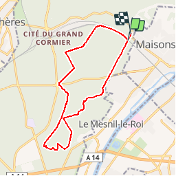
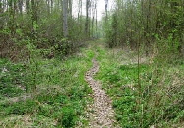
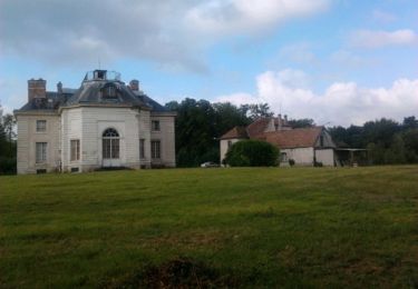
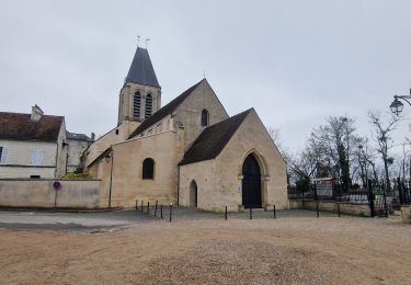
Ruta Marcha nórdica de 13,9 km a descubrir en Isla de Francia, Yvelines, Saint-Germain-en-Laye. Esta ruta ha sido propuesta por patb54.
Descripción
parcours marche nordique 14 km au départ des caves du nord de Maisons laffitte en passant par la mare aux canes
Localización
País:
France
Región :
Isla de Francia
Departamento/provincia :
Yvelines
Municipio :
Saint-Germain-en-Laye
Localidad:
Saint-Germain-en-Laye
Salida:(Dec)
Salida:(UTM)
436415 ; 5422702 (31U) N.
Comentarios
Excursiones cerca
![Excursión A pie Conflans-Sainte-Honorine - Version définitive Conflans 7 janvier - Photo](https://media.geolcdn.com/t/375/260/2f5b666a-1419-402d-9c3e-8de986f24ebf.jpg&format=jpg&maxdim=2)
![A pie A pie](https://static1.geolcdn.com/sitytour/trail-icons/100.png)
Version définitive Conflans 7 janvier
A pie
Medio
(1)
Conflans-Sainte-Honorine,
Isla de Francia,
Yvelines,
France
![](/images/other/stat-length.png)
23 km | 28 km-effort
6h 22min
![](https://static1.geolcdn.com/siteimages/upload/files/16400158638029165_repeat_loop_refresh_sync_direction_icon.png)
No
![Excursión Senderismo Saint-Germain-en-Laye - GRP CV-IDF 2023 - Photo](https://media.geolcdn.com/t/375/260/9864db54-c566-4b60-8ec4-15499d0119f8.jpg&format=jpg&maxdim=2)
![Senderismo Senderismo](https://static1.geolcdn.com/sitytour/trail-icons/101.png)
GRP CV-IDF 2023
Senderismo
Muy difícil
(1)
Saint-Germain-en-Laye,
Isla de Francia,
Yvelines,
France
![](/images/other/stat-length.png)
16,5 km | 19,1 km-effort
4h 21min
![](https://static1.geolcdn.com/siteimages/upload/files/16400158638029165_repeat_loop_refresh_sync_direction_icon.png)
No
![Excursión Senderismo Saint-Germain-en-Laye - circuit MA 271019 - Photo](https://media.geolcdn.com/t/375/260/ec0c3cc2-4262-481e-ac4c-e608d5354784.jpg&format=jpg&maxdim=2)
![Senderismo Senderismo](https://static1.geolcdn.com/sitytour/trail-icons/101.png)
circuit MA 271019
Senderismo
Muy fácil
(1)
Saint-Germain-en-Laye,
Isla de Francia,
Yvelines,
France
![](/images/other/stat-length.png)
4,7 km | 5,2 km-effort
1h 3min
![](https://static1.geolcdn.com/siteimages/upload/files/16400158638029165_repeat_loop_refresh_sync_direction_icon.png)
Sí
![Excursión Senderismo Maisons-Laffitte - Forêt de Saint Germain en Laye - Photo](https://media.geolcdn.com/t/375/260/ext.jpg?maxdim=2&url=https%3A%2F%2Fservices.sitytrail.com%2FGeolivesWS%2FDownloadMedia.ashx%3FTrailID%3D110160%26Media%3D5360_1.jpg)
![Senderismo Senderismo](https://static1.geolcdn.com/sitytour/trail-icons/101.png)
Forêt de Saint Germain en Laye
Senderismo
Difícil
(2)
Maisons-Laffitte,
Isla de Francia,
Yvelines,
France
![](/images/other/stat-length.png)
22 km | 25 km-effort
4h 30min
![](https://static1.geolcdn.com/siteimages/upload/files/16400158638029165_repeat_loop_refresh_sync_direction_icon.png)
Sí
![Excursión Senderismo Saint-Germain-en-Laye - D'Achères Grand Cormier à Maison Laffitte - Photo](https://media.geolcdn.com/t/375/260/ext.jpg?maxdim=2&url=https%3A%2F%2Fservices.sitytrail.com%2FGeolivesWS%2FDownloadMedia.ashx%3FTrailID%3D106827%26Media%3D11535_2.jpg)
![Senderismo Senderismo](https://static1.geolcdn.com/sitytour/trail-icons/101.png)
D'Achères Grand Cormier à Maison Laffitte
Senderismo
Medio
(1)
Saint-Germain-en-Laye,
Isla de Francia,
Yvelines,
France
![](/images/other/stat-length.png)
12,9 km | 14,4 km-effort
3h 0min
![](https://static1.geolcdn.com/siteimages/upload/files/16400158638029165_repeat_loop_refresh_sync_direction_icon.png)
No
![Excursión Senderismo Le Mesnil-le-Roi - RS 5 km porte chene corbeau - Photo](https://media.geolcdn.com/t/375/260/ext.jpg?maxdim=2&url=https%3A%2F%2Fstatic1.geolcdn.com%2Fsiteimages%2Fupload%2Ffiles%2F1553511878bg_sport_marche.png)
![Senderismo Senderismo](https://static1.geolcdn.com/sitytour/trail-icons/101.png)
RS 5 km porte chene corbeau
Senderismo
Fácil
(1)
Le Mesnil-le-Roi,
Isla de Francia,
Yvelines,
France
![](/images/other/stat-length.png)
5,2 km | 5,8 km-effort
1h 18min
![](https://static1.geolcdn.com/siteimages/upload/files/16400158638029165_repeat_loop_refresh_sync_direction_icon.png)
Sí
![Excursión A pie Conflans-Sainte-Honorine - Conflans fin d'oise - Andresy - La Frette - Photo](https://media.geolcdn.com/t/375/260/43572d18-a869-49dd-98f4-125a083ecdd2.jpg&format=jpg&maxdim=2)
![A pie A pie](https://static1.geolcdn.com/sitytour/trail-icons/100.png)
Conflans fin d'oise - Andresy - La Frette
A pie
Medio
Conflans-Sainte-Honorine,
Isla de Francia,
Yvelines,
France
![](/images/other/stat-length.png)
22 km | 27 km-effort
6h 14min
![](https://static1.geolcdn.com/siteimages/upload/files/16400158638029165_repeat_loop_refresh_sync_direction_icon.png)
No
![Excursión Senderismo Saint-Germain-en-Laye - 20230824 5S 5KM - Photo](https://media.geolcdn.com/t/375/260/ext.jpg?maxdim=2&url=https%3A%2F%2Fstatic1.geolcdn.com%2Fsiteimages%2Fupload%2Ffiles%2F1553511878bg_sport_marche.png)
![Senderismo Senderismo](https://static1.geolcdn.com/sitytour/trail-icons/101.png)
20230824 5S 5KM
Senderismo
Medio
(1)
Saint-Germain-en-Laye,
Isla de Francia,
Yvelines,
France
![](/images/other/stat-length.png)
5,5 km | 6,3 km-effort
1h 25min
![](https://static1.geolcdn.com/siteimages/upload/files/16400158638029165_repeat_loop_refresh_sync_direction_icon.png)
Sí
![Excursión Senderismo Saint-Germain-en-Laye - SityTrail - 202230519 RS 5km - Photo](https://media.geolcdn.com/t/375/260/ext.jpg?maxdim=2&url=https%3A%2F%2Fstatic1.geolcdn.com%2Fsiteimages%2Fupload%2Ffiles%2F1553511878bg_sport_marche.png)
![Senderismo Senderismo](https://static1.geolcdn.com/sitytour/trail-icons/101.png)
SityTrail - 202230519 RS 5km
Senderismo
Fácil
(1)
Saint-Germain-en-Laye,
Isla de Francia,
Yvelines,
France
![](/images/other/stat-length.png)
5 km | 5,6 km-effort
1h 16min
![](https://static1.geolcdn.com/siteimages/upload/files/16400158638029165_repeat_loop_refresh_sync_direction_icon.png)
Sí