![](/images/other/stat-length.png)
9168282-Oberlarg : Château de Morimont
E.BURCK
Usuario
![Longitud](/images/other/stat-length.png)
![Altitud máxima](https://static1.geolcdn.com/siteimages/upload/files/1508320355ic_sort_altitude_max_24dp.png)
![Desnivel positivo](https://static1.geolcdn.com/siteimages/upload/files/1508320355ic_sort_den_pos_24dp.png)
![Km-Effort](/images/other/stat-length.png)
![Altitud mínima](https://static1.geolcdn.com/siteimages/upload/files/1508320355ic_sort_altitude_min_24dp.png)
![Desnivel negativo](https://static1.geolcdn.com/siteimages/upload/files/1508320355ic_sort_den_neg_24dp.png)
![Boucle](https://static1.geolcdn.com/siteimages/upload/files/16400158638029165_repeat_loop_refresh_sync_direction_icon.png)
![Senderismo](https://static1.geolcdn.com/sitytour/trail-icons/101.png)
2h46
Dificultad : Difícil
![Escanee este código QR para abrir la excursión en la aplicación SityTrail](https://capi.geolives.com/qq0zvz2zws4bq2lad0pu/sitytour/trails/2055309/qr.png?size=200)
Aplicación GPS de excursión GRATIS
A propósito
Ruta Senderismo de 9 km a descubrir en Gran Este, Alto Rin, Oberlarg. Esta ruta ha sido propuesta por E.BURCK.
Descripción
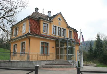
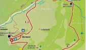
La ballade prendra son départ au pied de la Mairie d’Oberlarg
N 47,457847 - E 7,234409 ou N 47° 27' 28" - E 7° 14' 3,9"
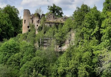
et se terminera au Château de Morimont.
« Les paysages traversés ici comptent parmi les plus beaux du Jura alsacien ».* Nous traverserons un des derniers gués subsistant en Alsace, avant de passer par le site archéologique de la Grotte du Mannlefelsen et par la source de la Largue (549 m).
Une montée douce mais continue nous amènera au bout de moins d’une heure à la Ferme des Ebourbettes (730m), devenue célèbre par l’évasion du Général Giraud en avril 1942. De là on continue en direction du Morimont que l’on atteint au bout d’un peu plus de 2 km.
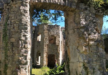
En fin de parcours nous nous retrouverons pour le déjeuner à l’Auberge du Morimont à proximité de la magnifique ruine du château que nous visiterons après le déjeuner.
10h00 : Rendez-vous au parking près de l’école d’Oberlarg
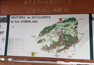
* Citation et plan du parcours de Marc Glotz
Localización
Comentarios
Excursiones cerca
![Excursión Senderismo Levoncourt - Sortie les Copains d'abord.. 24/03/2022 - Photo](https://media.geolcdn.com/t/375/260/e59d3d7b-9ac7-43c7-934b-93ab50cd5556.jpg&format=jpg&maxdim=2)
![Senderismo Senderismo](https://static1.geolcdn.com/sitytour/trail-icons/101.png)
Senderismo
![](/images/other/stat-length.png)
![](https://static1.geolcdn.com/siteimages/upload/files/16400158638029165_repeat_loop_refresh_sync_direction_icon.png)
![Excursión A pie Pleigne - Lucelle Douane - Pleigne - Photo](https://media.geolcdn.com/t/375/260/5e067c34-edcf-4a93-bd6c-7208fa7d1c3b.jpeg&format=jpg&maxdim=2)
![A pie A pie](https://static1.geolcdn.com/sitytour/trail-icons/100.png)
A pie
![](/images/other/stat-length.png)
![](https://static1.geolcdn.com/siteimages/upload/files/16400158638029165_repeat_loop_refresh_sync_direction_icon.png)
![Excursión Senderismo Oberlarg - Oberlarg - sa grotte - la ferme des Ebourbettes - le château de Morimont - Photo](https://media.geolcdn.com/t/375/260/12ac5782-f6dd-4515-a936-425ac3e33bf2.jpg&format=jpg&maxdim=2)
![Senderismo Senderismo](https://static1.geolcdn.com/sitytour/trail-icons/101.png)
Senderismo
![](/images/other/stat-length.png)
![](https://static1.geolcdn.com/siteimages/upload/files/16400158638029165_repeat_loop_refresh_sync_direction_icon.png)
![Excursión Senderismo Oberlarg - oberlag- château de morimont - Photo](https://media.geolcdn.com/t/375/260/7e84c322-06fc-4520-96d4-1ad54658d0ec.jpg&format=jpg&maxdim=2)
![Senderismo Senderismo](https://static1.geolcdn.com/sitytour/trail-icons/101.png)
Senderismo
![](/images/other/stat-length.png)
![](https://static1.geolcdn.com/siteimages/upload/files/16400158638029165_repeat_loop_refresh_sync_direction_icon.png)
![Excursión Senderismo Oberlarg - Château de Morimont avec Patrice - Photo](https://media.geolcdn.com/t/375/260/23bc92de-96db-4f82-bda0-2218ea04717c.jpg&format=jpg&maxdim=2)
![Senderismo Senderismo](https://static1.geolcdn.com/sitytour/trail-icons/101.png)
Senderismo
![](/images/other/stat-length.png)
![](https://static1.geolcdn.com/siteimages/upload/files/16400158638029165_repeat_loop_refresh_sync_direction_icon.png)
![Excursión A pie Bendorf - Rando CLAS du 20/06/2024 par PBo - Photo](https://media.geolcdn.com/t/375/260/ext.jpg?maxdim=2&url=https%3A%2F%2Fstatic1.geolcdn.com%2Fsiteimages%2Fupload%2Ffiles%2F1545311037marcheuse_200dpi.jpg)
![A pie A pie](https://static1.geolcdn.com/sitytour/trail-icons/100.png)
A pie
![](/images/other/stat-length.png)
![](https://static1.geolcdn.com/siteimages/upload/files/16400158638029165_repeat_loop_refresh_sync_direction_icon.png)
![Excursión Senderismo Bendorf - Rando Bendorf 30/05/2024 - Photo](https://media.geolcdn.com/t/375/260/ext.jpg?maxdim=2&url=https%3A%2F%2Fstatic1.geolcdn.com%2Fsiteimages%2Fupload%2Ffiles%2F1553511878bg_sport_marche.png)
![Senderismo Senderismo](https://static1.geolcdn.com/sitytour/trail-icons/101.png)
Senderismo
![](/images/other/stat-length.png)
![](https://static1.geolcdn.com/siteimages/upload/files/16400158638029165_repeat_loop_refresh_sync_direction_icon.png)
![Excursión Senderismo Winkel - Winkel-Petit Kohlberg variante - Photo](https://media.geolcdn.com/t/375/260/ext.jpg?maxdim=2&url=https%3A%2F%2Fstatic1.geolcdn.com%2Fsiteimages%2Fupload%2Ffiles%2F1553511878bg_sport_marche.png)
![Senderismo Senderismo](https://static1.geolcdn.com/sitytour/trail-icons/101.png)
Senderismo
![](/images/other/stat-length.png)
![](https://static1.geolcdn.com/siteimages/upload/files/16400158638029165_repeat_loop_refresh_sync_direction_icon.png)
![Excursión Senderismo Winkel - Winkel-Petit Kohlberg_wpt_trk - Photo](https://media.geolcdn.com/t/375/260/ext.jpg?maxdim=2&url=https%3A%2F%2Fstatic1.geolcdn.com%2Fsiteimages%2Fupload%2Ffiles%2F1553511878bg_sport_marche.png)
![Senderismo Senderismo](https://static1.geolcdn.com/sitytour/trail-icons/101.png)
Senderismo
![](/images/other/stat-length.png)
![](https://static1.geolcdn.com/siteimages/upload/files/16400158638029165_repeat_loop_refresh_sync_direction_icon.png)