![](/images/other/stat-length.png)
![Excursión Senderismo Darney - Darney : Vers le pont Tatal - Photo](https://media.geolcdn.com/t/1900/400/81c8eb71-3f0b-4905-82de-ebd72d8db91a.jpg&format=pjpeg&maxdim=2)
Darney : Vers le pont Tatal
ABICHE
Usuario
![Longitud](/images/other/stat-length.png)
Longitud
16,8 km
![Altitud máxima](https://static1.geolcdn.com/siteimages/upload/files/1508320355ic_sort_altitude_max_24dp.png)
Altitud máxima
338 m
![Desnivel positivo](https://static1.geolcdn.com/siteimages/upload/files/1508320355ic_sort_den_pos_24dp.png)
Desnivel positivo
280 m
![Km-Effort](/images/other/stat-length.png)
Km-Effort
21 km
![Altitud mínima](https://static1.geolcdn.com/siteimages/upload/files/1508320355ic_sort_altitude_min_24dp.png)
Altitud mínima
256 m
![Desnivel negativo](https://static1.geolcdn.com/siteimages/upload/files/1508320355ic_sort_den_neg_24dp.png)
Desnivel negativo
283 m
![Boucle](https://static1.geolcdn.com/siteimages/upload/files/16400158638029165_repeat_loop_refresh_sync_direction_icon.png)
Boucle
Sí
Fecha de creación :
2019-03-29 10:47:23.782
Última modificación :
2019-03-29 20:20:10.429
![Senderismo](https://static1.geolcdn.com/sitytour/trail-icons/101.png)
5h08
Dificultad : Muy fácil
![Escanee este código QR para abrir la excursión en la aplicación SityTrail](https://capi.geolives.com/qq0zvz2zws4bq2lad0pu/sitytour/trails/2054059/qr.png?size=200)
Aplicación GPS de excursión GRATIS
A propósito
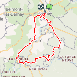
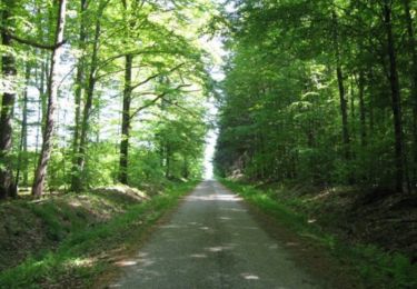
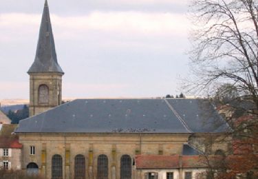
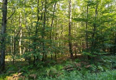
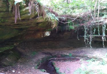
Ruta Senderismo de 16,8 km a descubrir en Gran Este, Vosgos, Darney. Esta ruta ha sido propuesta por ABICHE.
Descripción
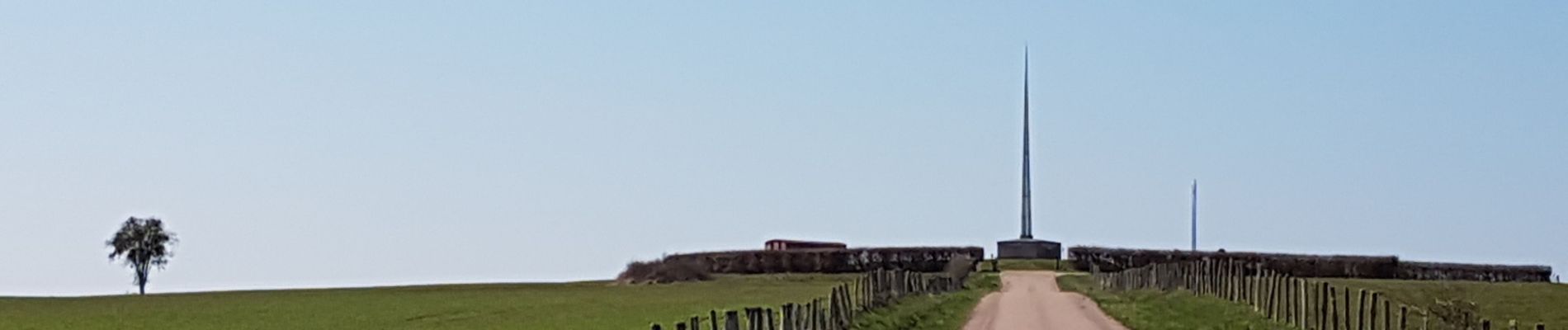
Belle randonnée chargée d'histoire internationale (monument aux troupes tchèques et slovaques - création de l'armée tchécoslovaque) et locale (pont Tatal)
Localización
País:
France
Región :
Gran Este
Departamento/provincia :
Vosgos
Municipio :
Darney
Localidad:
Unknown
Salida:(Dec)
Salida:(UTM)
280124 ; 5329986 (32U) N.
Comentarios
Excursiones cerca
![Excursión Senderismo Belrupt - Sentier Le Val de Saône - Belrupt - Photo](https://media.geolcdn.com/t/375/260/ext.jpg?maxdim=2&url=https%3A%2F%2Fservices.sitytrail.com%2FGeolivesWS%2FDownloadMedia.ashx%3FTrailID%3D317536%26Media%3D16778_6.jpg)
![Senderismo Senderismo](https://static1.geolcdn.com/sitytour/trail-icons/101.png)
Sentier Le Val de Saône - Belrupt
Senderismo
Medio
Belrupt,
Gran Este,
Vosgos,
France
![](/images/other/stat-length.png)
11,1 km | 13 km-effort
2h 45min
![](https://static1.geolcdn.com/siteimages/upload/files/16400158638029165_repeat_loop_refresh_sync_direction_icon.png)
Sí
![Excursión Senderismo Darney - Les terrasses de Darney - Photo](https://media.geolcdn.com/t/375/260/ext.jpg?maxdim=2&url=https%3A%2F%2Fservices.sitytrail.com%2FGeolivesWS%2FDownloadMedia.ashx%3FTrailID%3D317534%26Media%3D16776_6.jpg)
![Senderismo Senderismo](https://static1.geolcdn.com/sitytour/trail-icons/101.png)
Les terrasses de Darney
Senderismo
Medio
Darney,
Gran Este,
Vosgos,
France
![](/images/other/stat-length.png)
10,7 km | 13,1 km-effort
2h 45min
![](https://static1.geolcdn.com/siteimages/upload/files/16400158638029165_repeat_loop_refresh_sync_direction_icon.png)
Sí
![Excursión Senderismo Darney - Les terrasses de Darney - Photo](https://media.geolcdn.com/t/375/260/ext.jpg?maxdim=2&url=https%3A%2F%2Fservices.sitytrail.com%2FGeolivesWS%2FDownloadMedia.ashx%3FTrailID%3D111679%26Media%3D7927_2.jpg)
![Senderismo Senderismo](https://static1.geolcdn.com/sitytour/trail-icons/101.png)
Les terrasses de Darney
Senderismo
Fácil
Darney,
Gran Este,
Vosgos,
France
![](/images/other/stat-length.png)
7,2 km | 9,2 km-effort
1h 49min
![](https://static1.geolcdn.com/siteimages/upload/files/16400158638029165_repeat_loop_refresh_sync_direction_icon.png)
Sí
![Excursión Senderismo Claudon - hennezel march'ettes - Photo](https://media.geolcdn.com/t/375/260/899b9b88-3306-42dc-bad2-769f2f4a0531.jpg&format=jpg&maxdim=2)
![Senderismo Senderismo](https://static1.geolcdn.com/sitytour/trail-icons/101.png)
hennezel march'ettes
Senderismo
Medio
Claudon,
Gran Este,
Vosgos,
France
![](/images/other/stat-length.png)
17,6 km | 22 km-effort
6h 55min
![](https://static1.geolcdn.com/siteimages/upload/files/16400158638029165_repeat_loop_refresh_sync_direction_icon.png)
Sí
![Excursión Senderismo Claudon - l'ourche à la Saône march'ettes - Photo](https://media.geolcdn.com/t/375/260/8fbd56ab-dd54-40ba-94e0-4eef750269dd.jpg&format=jpg&maxdim=2)
![Senderismo Senderismo](https://static1.geolcdn.com/sitytour/trail-icons/101.png)
l'ourche à la Saône march'ettes
Senderismo
Medio
Claudon,
Gran Este,
Vosgos,
France
![](/images/other/stat-length.png)
17,5 km | 22 km-effort
4h 14min
![](https://static1.geolcdn.com/siteimages/upload/files/16400158638029165_repeat_loop_refresh_sync_direction_icon.png)
Sí
![Excursión Senderismo Attigny - couchaumont - Photo](https://media.geolcdn.com/t/375/260/ext.jpg?maxdim=2&url=https%3A%2F%2Fstatic1.geolcdn.com%2Fsiteimages%2Fupload%2Ffiles%2F1553511878bg_sport_marche.png)
![Senderismo Senderismo](https://static1.geolcdn.com/sitytour/trail-icons/101.png)
couchaumont
Senderismo
Muy fácil
Attigny,
Gran Este,
Vosgos,
France
![](/images/other/stat-length.png)
8,8 km | 11 km-effort
2h 25min
![](https://static1.geolcdn.com/siteimages/upload/files/16400158638029165_repeat_loop_refresh_sync_direction_icon.png)
Sí
![Excursión Senderismo Darney - qsdgg - Photo](https://media.geolcdn.com/t/375/260/ext.jpg?maxdim=2&url=https%3A%2F%2Fstatic1.geolcdn.com%2Fsiteimages%2Fupload%2Ffiles%2F1553511878bg_sport_marche.png)
![Senderismo Senderismo](https://static1.geolcdn.com/sitytour/trail-icons/101.png)
![Excursión Senderismo Darney - Darney - Photo](https://media.geolcdn.com/t/375/260/ext.jpg?maxdim=2&url=https%3A%2F%2Fstatic1.geolcdn.com%2Fsiteimages%2Fupload%2Ffiles%2F1553511878bg_sport_marche.png)
![Senderismo Senderismo](https://static1.geolcdn.com/sitytour/trail-icons/101.png)
![Excursión Senderismo Bonvillet - Bonvillet - Photo](https://media.geolcdn.com/t/375/260/ext.jpg?maxdim=2&url=https%3A%2F%2Fstatic1.geolcdn.com%2Fsiteimages%2Fupload%2Ffiles%2F1553511878bg_sport_marche.png)
![Senderismo Senderismo](https://static1.geolcdn.com/sitytour/trail-icons/101.png)
Bonvillet
Senderismo
Medio
Bonvillet,
Gran Este,
Vosgos,
France
![](/images/other/stat-length.png)
11,5 km | 14,2 km-effort
2h 58min
![](https://static1.geolcdn.com/siteimages/upload/files/16400158638029165_repeat_loop_refresh_sync_direction_icon.png)
Sí