![](/images/other/stat-length.png)
![Excursión Senderismo Montaud - DENT DE MOIRANS GROUPE 1 - Photo](https://media.geolcdn.com/t/1900/400/341dd4e4-0b77-4fa9-85ea-985acc362501.jpg&format=pjpeg&maxdim=2)
DENT DE MOIRANS GROUPE 1
floup6138
Usuario
![Longitud](/images/other/stat-length.png)
Longitud
12,7 km
![Altitud máxima](https://static1.geolcdn.com/siteimages/upload/files/1508320355ic_sort_altitude_max_24dp.png)
Altitud máxima
990 m
![Desnivel positivo](https://static1.geolcdn.com/siteimages/upload/files/1508320355ic_sort_den_pos_24dp.png)
Desnivel positivo
615 m
![Km-Effort](/images/other/stat-length.png)
Km-Effort
21 km
![Altitud mínima](https://static1.geolcdn.com/siteimages/upload/files/1508320355ic_sort_altitude_min_24dp.png)
Altitud mínima
459 m
![Desnivel negativo](https://static1.geolcdn.com/siteimages/upload/files/1508320355ic_sort_den_neg_24dp.png)
Desnivel negativo
618 m
![Boucle](https://static1.geolcdn.com/siteimages/upload/files/16400158638029165_repeat_loop_refresh_sync_direction_icon.png)
Boucle
Sí
Fecha de creación :
2019-02-28 09:10:23.924
Última modificación :
2019-02-28 14:54:02.722
![Senderismo](https://static1.geolcdn.com/sitytour/trail-icons/101.png)
4h14
Dificultad : Difícil
![Escanee este código QR para abrir la excursión en la aplicación SityTrail](https://capi.geolives.com/qq0zvz2zws4bq2lad0pu/sitytour/trails/2040789/qr.png?size=200)
Aplicación GPS de excursión GRATIS
A propósito
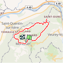
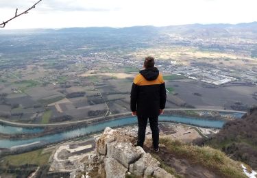
Ruta Senderismo de 12,7 km a descubrir en Auvergne-Rhône-Alpes, Isère, Montaud. Esta ruta ha sido propuesta por floup6138.
Descripción
stationnement à la salle des fêtes, suivre le tracé bien balisé.
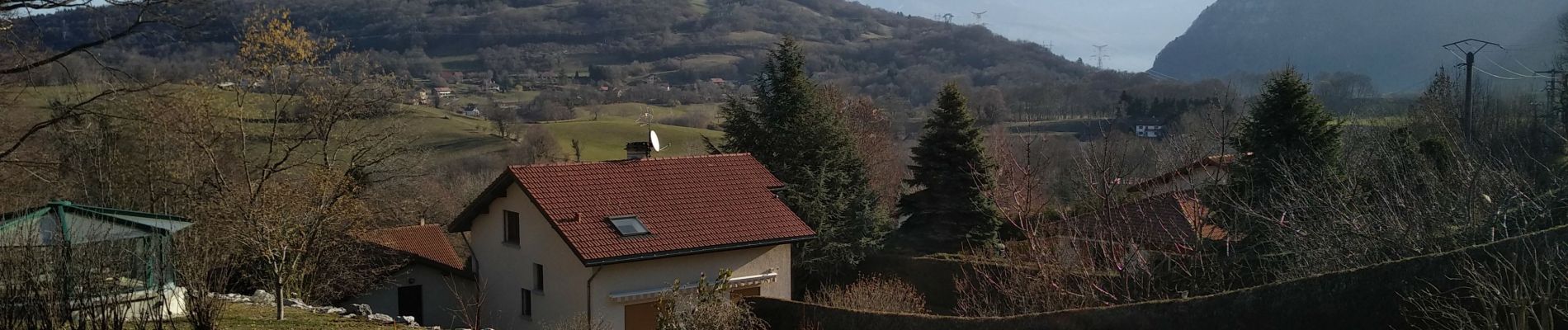
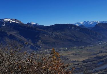
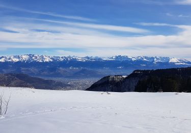
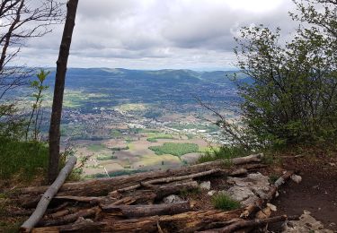
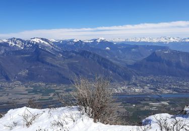
on commence par une grande descente puis montée continue jusqu'à la dent de Moirans.
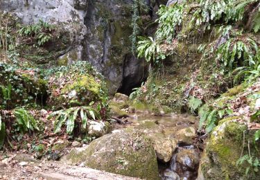
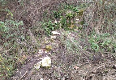
attention si humidité des passages glissants
Localización
País:
France
Región :
Auvergne-Rhône-Alpes
Departamento/provincia :
Isère
Municipio :
Montaud
Localidad:
Unknown
Salida:(Dec)
Salida:(UTM)
701321 ; 5015477 (31T) N.
Comentarios
Excursiones cerca
![Excursión Senderismo Voreppe - 38 voreppe - Photo](https://media.geolcdn.com/t/375/260/ae534631-eaae-45ff-8bde-8ca8e28aadbe.jpg&format=jpg&maxdim=2)
![Senderismo Senderismo](https://static1.geolcdn.com/sitytour/trail-icons/101.png)
38 voreppe
Senderismo
Medio
Voreppe,
Auvergne-Rhône-Alpes,
Isère,
France
![](/images/other/stat-length.png)
8,7 km | 16,8 km-effort
6h 25min
![](https://static1.geolcdn.com/siteimages/upload/files/16400158638029165_repeat_loop_refresh_sync_direction_icon.png)
Sí
![Excursión Senderismo Saint-Quentin-sur-Isère - 38 St Quentin sur isere - Photo](https://media.geolcdn.com/t/375/260/a8213203-4838-4b30-a9a1-6f63f9fa0c7f.jpg&format=jpg&maxdim=2)
![Senderismo Senderismo](https://static1.geolcdn.com/sitytour/trail-icons/101.png)
38 St Quentin sur isere
Senderismo
Medio
Saint-Quentin-sur-Isère,
Auvergne-Rhône-Alpes,
Isère,
France
![](/images/other/stat-length.png)
17 km | 28 km-effort
7h 22min
![](https://static1.geolcdn.com/siteimages/upload/files/16400158638029165_repeat_loop_refresh_sync_direction_icon.png)
Sí
![Excursión Senderismo Voreppe - le trou au loup - Photo](https://media.geolcdn.com/t/375/260/4be90cdf-26f4-4d2a-b22f-02f0baa87490.jpg&format=jpg&maxdim=2)
![Senderismo Senderismo](https://static1.geolcdn.com/sitytour/trail-icons/101.png)
le trou au loup
Senderismo
Difícil
Voreppe,
Auvergne-Rhône-Alpes,
Isère,
France
![](/images/other/stat-length.png)
8,5 km | 16,5 km-effort
6h 29min
![](https://static1.geolcdn.com/siteimages/upload/files/16400158638029165_repeat_loop_refresh_sync_direction_icon.png)
Sí
![Excursión Senderismo Saint-Quentin-sur-Isère - Dent de Moirans - Photo](https://media.geolcdn.com/t/375/260/cc5b3296-26ad-4d08-b80e-e1eedf7283f6.jpg&format=jpg&maxdim=2)
![Senderismo Senderismo](https://static1.geolcdn.com/sitytour/trail-icons/101.png)
Dent de Moirans
Senderismo
Muy difícil
Saint-Quentin-sur-Isère,
Auvergne-Rhône-Alpes,
Isère,
France
![](/images/other/stat-length.png)
14,7 km | 26 km-effort
6h 17min
![](https://static1.geolcdn.com/siteimages/upload/files/16400158638029165_repeat_loop_refresh_sync_direction_icon.png)
Sí
![Excursión Senderismo Saint-Quentin-sur-Isère - 38 carrières echaillon - Photo](https://media.geolcdn.com/t/375/260/728d4589-2ee2-49ea-a83d-3257b1bf0904.jpg&format=jpg&maxdim=2)
![Senderismo Senderismo](https://static1.geolcdn.com/sitytour/trail-icons/101.png)
38 carrières echaillon
Senderismo
Difícil
Saint-Quentin-sur-Isère,
Auvergne-Rhône-Alpes,
Isère,
France
![](/images/other/stat-length.png)
2,4 km | 4,5 km-effort
2h 55min
![](https://static1.geolcdn.com/siteimages/upload/files/16400158638029165_repeat_loop_refresh_sync_direction_icon.png)
Sí
![Excursión Raquetas de nieve Autrans-Méaudre en Vercors - La Grande Brèche - La Buffe - La Sure (2022) - Photo](https://media.geolcdn.com/t/375/260/0ed3592b-52f6-40cf-babc-f54ce22268ca.jpg&format=jpg&maxdim=2)
![Raquetas de nieve Raquetas de nieve](https://static1.geolcdn.com/sitytour/trail-icons/504.png)
La Grande Brèche - La Buffe - La Sure (2022)
Raquetas de nieve
Medio
Autrans-Méaudre en Vercors,
Auvergne-Rhône-Alpes,
Isère,
France
![](/images/other/stat-length.png)
12,9 km | 22 km-effort
4h 28min
![](https://static1.geolcdn.com/siteimages/upload/files/16400158638029165_repeat_loop_refresh_sync_direction_icon.png)
Sí
![Excursión Senderismo Montaud - La Dent de Moirans - Photo](https://media.geolcdn.com/t/375/260/42159542-0525-485e-906a-e99c0c2c152d.jpg&format=jpg&maxdim=2)
![Senderismo Senderismo](https://static1.geolcdn.com/sitytour/trail-icons/101.png)
La Dent de Moirans
Senderismo
Fácil
Montaud,
Auvergne-Rhône-Alpes,
Isère,
France
![](/images/other/stat-length.png)
11 km | 16,4 km-effort
4h 38min
![](https://static1.geolcdn.com/siteimages/upload/files/16400158638029165_repeat_loop_refresh_sync_direction_icon.png)
Sí
![Excursión Senderismo Autrans-Méaudre en Vercors - boucle la Buffe - la Sure - Photo](https://media.geolcdn.com/t/375/260/9d650f75-523f-40ee-a83c-0bfaf17ae3cc.jpg&format=jpg&maxdim=2)
![Senderismo Senderismo](https://static1.geolcdn.com/sitytour/trail-icons/101.png)
boucle la Buffe - la Sure
Senderismo
Difícil
Autrans-Méaudre en Vercors,
Auvergne-Rhône-Alpes,
Isère,
France
![](/images/other/stat-length.png)
8,6 km | 16,1 km-effort
4h 52min
![](https://static1.geolcdn.com/siteimages/upload/files/16400158638029165_repeat_loop_refresh_sync_direction_icon.png)
Sí
![Excursión Senderismo Montaud - La dent de Moirans - Photo](https://media.geolcdn.com/t/375/260/c31d5ba7-98c1-4d2c-8f51-1281362b0eb5.jpg&format=jpg&maxdim=2)
![Senderismo Senderismo](https://static1.geolcdn.com/sitytour/trail-icons/101.png)
La dent de Moirans
Senderismo
Muy fácil
(1)
Montaud,
Auvergne-Rhône-Alpes,
Isère,
France
![](/images/other/stat-length.png)
8,9 km | 13,5 km-effort
2h 57min
![](https://static1.geolcdn.com/siteimages/upload/files/16400158638029165_repeat_loop_refresh_sync_direction_icon.png)
Sí