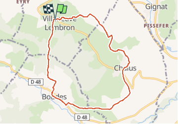
![](/images/other/stat-length.png)
![Excursión Senderismo Villeneuve - Villeneuve_Boudes_Chalus - Photo](https://media.geolcdn.com/t/1900/400/fa4d9ad2-0c04-4754-942b-a8352fff5676.jpg&format=pjpeg&maxdim=2)
Villeneuve_Boudes_Chalus
jagarnier
Usuario GUIDE
![Longitud](/images/other/stat-length.png)
![Altitud máxima](https://static1.geolcdn.com/siteimages/upload/files/1508320355ic_sort_altitude_max_24dp.png)
![Desnivel positivo](https://static1.geolcdn.com/siteimages/upload/files/1508320355ic_sort_den_pos_24dp.png)
![Km-Effort](/images/other/stat-length.png)
![Altitud mínima](https://static1.geolcdn.com/siteimages/upload/files/1508320355ic_sort_altitude_min_24dp.png)
![Desnivel negativo](https://static1.geolcdn.com/siteimages/upload/files/1508320355ic_sort_den_neg_24dp.png)
![Boucle](https://static1.geolcdn.com/siteimages/upload/files/16400158638029165_repeat_loop_refresh_sync_direction_icon.png)
![Senderismo](https://static1.geolcdn.com/sitytour/trail-icons/101.png)
2h45
Dificultad : Medio
![Escanee este código QR para abrir la excursión en la aplicación SityTrail](https://capi.geolives.com/qq0zvz2zws4bq2lad0pu/sitytour/trails/2012670/qr.png?size=200)
Aplicación GPS de excursión GRATIS
A propósito
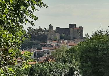
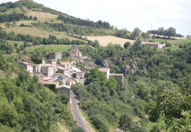
Ruta Senderismo de 8,9 km a descubrir en Auvergne-Rhône-Alpes, Puy-de-Dôme, Villeneuve. Esta ruta ha sido propuesta por jagarnier.
Descripción
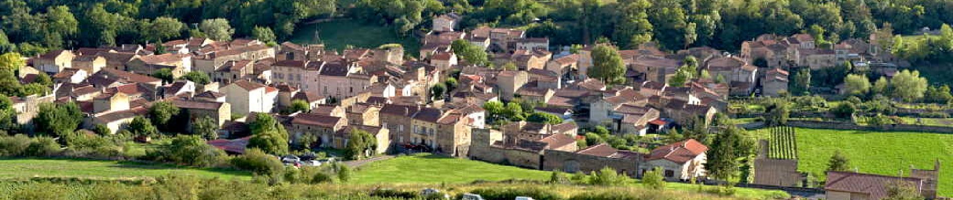
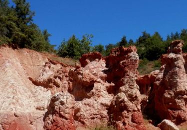
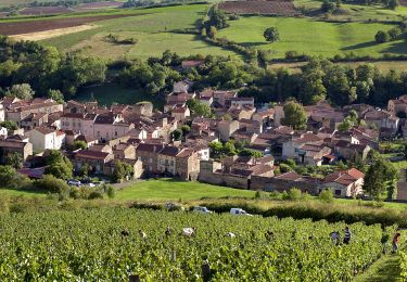
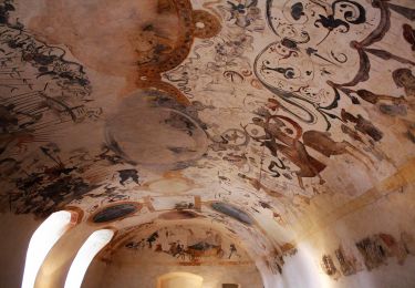
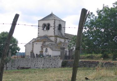
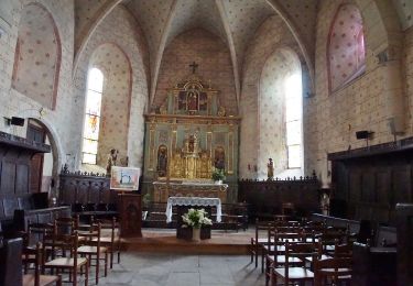
Trois villages, Villeneuve, Boudes et Chalus, marqués dans leurs pierres par l’ancienne puissance des seigneurs locaux : Les Chalus et les d'Aureille. Vous découvrirez aussi les vignobles en terrasses de Boudes et reviendrez comblés de ce voyage au cœur du Lembron.
Localización
Comentarios
Excursiones cerca
![Excursión Senderismo Boudes - Boudes_Cheminees_Fees - Photo](https://media.geolcdn.com/t/375/260/2d6f9b52-9afa-4443-acb4-142ca3c3881a.jpg&format=jpg&maxdim=2)
![Senderismo Senderismo](https://static1.geolcdn.com/sitytour/trail-icons/101.png)
Senderismo
![](/images/other/stat-length.png)
![](https://static1.geolcdn.com/siteimages/upload/files/16400158638029165_repeat_loop_refresh_sync_direction_icon.png)
![Excursión Senderismo Boudes - Boudes_Vallee_Saints - Photo](https://media.geolcdn.com/t/375/260/75dcab49-0943-405f-9b02-ddf9cf506eea.jpg&format=jpg&maxdim=2)
![Senderismo Senderismo](https://static1.geolcdn.com/sitytour/trail-icons/101.png)
Senderismo
![](/images/other/stat-length.png)
![](https://static1.geolcdn.com/siteimages/upload/files/16400158638029165_repeat_loop_refresh_sync_direction_icon.png)
![Excursión Senderismo Boudes - Boudes_Coteaux - Photo](https://media.geolcdn.com/t/375/260/84417786-618e-40d7-80a8-c68612090218.jpg&format=jpg&maxdim=2)
![Senderismo Senderismo](https://static1.geolcdn.com/sitytour/trail-icons/101.png)
Senderismo
![](/images/other/stat-length.png)
![](https://static1.geolcdn.com/siteimages/upload/files/16400158638029165_repeat_loop_refresh_sync_direction_icon.png)
![Excursión A pie Boudes - Villeneuve, Boudes, Chalus - Photo](https://media.geolcdn.com/t/375/260/9a83dcb2-377f-43a0-8436-358d4c634f72.jpeg&format=jpg&maxdim=2)
![A pie A pie](https://static1.geolcdn.com/sitytour/trail-icons/100.png)
A pie
![](/images/other/stat-length.png)
![](https://static1.geolcdn.com/siteimages/upload/files/16400158638029165_repeat_loop_refresh_sync_direction_icon.png)
![Excursión A pie Madriat - Bard et Letz - Photo](https://media.geolcdn.com/t/375/260/e7b4e9aa-8c72-4cfb-b241-a0f535763702.jpeg&format=jpg&maxdim=2)
![A pie A pie](https://static1.geolcdn.com/sitytour/trail-icons/100.png)
A pie
![](/images/other/stat-length.png)
![](https://static1.geolcdn.com/siteimages/upload/files/16400158638029165_repeat_loop_refresh_sync_direction_icon.png)
![Excursión A pie Boudes - La Vallee des Saints - Photo](https://media.geolcdn.com/t/375/260/8b5212f5-c0d3-403b-b77d-cbcbaaa74e95.jpeg&format=jpg&maxdim=2)
![A pie A pie](https://static1.geolcdn.com/sitytour/trail-icons/100.png)
A pie
![](/images/other/stat-length.png)
![](https://static1.geolcdn.com/siteimages/upload/files/16400158638029165_repeat_loop_refresh_sync_direction_icon.png)
![Excursión A pie Mareugheol - La Chaux et le Bois de Jaby - Photo](https://media.geolcdn.com/t/375/260/d7ed3937-d9f3-475d-9b76-187d38d4bf46.jpeg&format=jpg&maxdim=2)
![A pie A pie](https://static1.geolcdn.com/sitytour/trail-icons/100.png)
A pie
![](/images/other/stat-length.png)
![](https://static1.geolcdn.com/siteimages/upload/files/16400158638029165_repeat_loop_refresh_sync_direction_icon.png)
![Excursión A pie Villeneuve - Vodable et Colamine - Photo](https://media.geolcdn.com/t/375/260/fd9aa514-9038-4f51-9473-e7a8f5ea4688.jpeg&format=jpg&maxdim=2)
![A pie A pie](https://static1.geolcdn.com/sitytour/trail-icons/100.png)
A pie
![](/images/other/stat-length.png)
![](https://static1.geolcdn.com/siteimages/upload/files/16400158638029165_repeat_loop_refresh_sync_direction_icon.png)
![Excursión A pie Solignat - Le Puy d'Ysson - Photo](https://media.geolcdn.com/t/375/260/f1717d1b-4654-496b-985d-41ee86c18055.jpeg&format=jpg&maxdim=2)
![A pie A pie](https://static1.geolcdn.com/sitytour/trail-icons/100.png)
A pie
![](/images/other/stat-length.png)
![](https://static1.geolcdn.com/siteimages/upload/files/16400158638029165_repeat_loop_refresh_sync_direction_icon.png)