![](/images/other/stat-length.png)
![Excursión Senderismo Camoël - Ferel La Vilaine - Photo](https://media.geolcdn.com/t/1900/400/ext.pjpeg?maxdim=2&url=https%3A%2F%2Fservices.sitytrail.com%2FGeolivesWS%2FDownloadMedia.ashx%3FTrailID%3D195979%26Media%3D56fb7bfa-285a-47ba-ac7f-c67a108bf67d.jpg)
Ferel La Vilaine
neoroll44
Usuario
![Longitud](/images/other/stat-length.png)
Longitud
14 km
![Altitud máxima](https://static1.geolcdn.com/siteimages/upload/files/1508320355ic_sort_altitude_max_24dp.png)
Altitud máxima
43 m
![Desnivel positivo](https://static1.geolcdn.com/siteimages/upload/files/1508320355ic_sort_den_pos_24dp.png)
Desnivel positivo
211 m
![Km-Effort](/images/other/stat-length.png)
Km-Effort
16,8 km
![Altitud mínima](https://static1.geolcdn.com/siteimages/upload/files/1508320355ic_sort_altitude_min_24dp.png)
Altitud mínima
1 m
![Desnivel negativo](https://static1.geolcdn.com/siteimages/upload/files/1508320355ic_sort_den_neg_24dp.png)
Desnivel negativo
211 m
![Boucle](https://static1.geolcdn.com/siteimages/upload/files/16400158638029165_repeat_loop_refresh_sync_direction_icon.png)
Boucle
Sí
Fecha de creación :
2015-09-28 00:00:00.0
Última modificación :
2015-09-28 00:00:00.0
![Senderismo](https://static1.geolcdn.com/sitytour/trail-icons/101.png)
3h40
Dificultad : Medio
![Escanee este código QR para abrir la excursión en la aplicación SityTrail](https://capi.geolives.com/qq0zvz2zws4bq2lad0pu/sitytour/trails/195979/qr.png?size=200)
Aplicación GPS de excursión GRATIS
A propósito
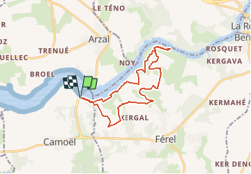
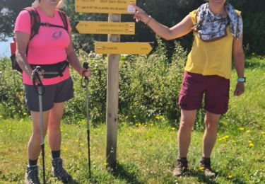
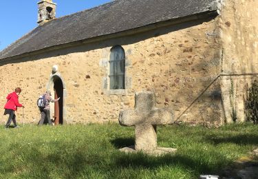
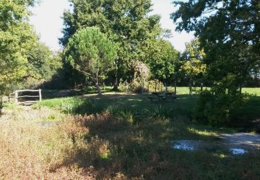
Ruta Senderismo de 14 km a descubrir en Bretaña, Morbihan, Camoël. Esta ruta ha sido propuesta por neoroll44.
Descripción
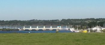
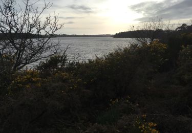
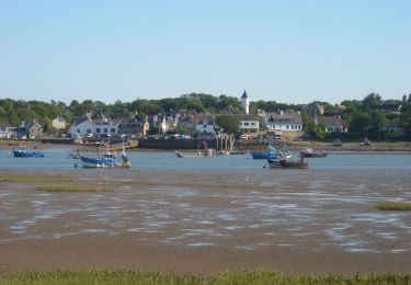
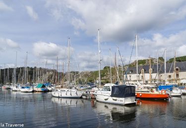
Depuis le port du barrage d'Arzal, longez la Vilaine jusqu'à l'aire de pique-nique de l'Isle et revenez par les terres et les coulées.
Localización
País:
France
Región :
Bretaña
Departamento/provincia :
Morbihan
Municipio :
Camoël
Localidad:
Unknown
Salida:(Dec)
Salida:(UTM)
546263 ; 5260467 (30T) N.
Comentarios
Excursiones cerca
![Excursión Senderismo Muzillac - vignes MusiMax - Photo](https://media.geolcdn.com/t/375/260/ext.jpg?maxdim=2&url=https%3A%2F%2Fservices.sitytrail.com%2FGeolivesWS%2FDownloadMedia.ashx%3FTrailID%3D364765%26Media%3D20141123120843.jpg)
![Senderismo Senderismo](https://static1.geolcdn.com/sitytour/trail-icons/101.png)
vignes MusiMax
Senderismo
Muy fácil
(1)
Muzillac,
Bretaña,
Morbihan,
France
![](/images/other/stat-length.png)
12,4 km | 13,9 km-effort
3h 11min
![](https://static1.geolcdn.com/siteimages/upload/files/16400158638029165_repeat_loop_refresh_sync_direction_icon.png)
Sí
![Excursión Senderismo Arzal - Arzal boucle de la Vilaine - Photo](https://media.geolcdn.com/t/375/260/ext.jpg?maxdim=2&url=https%3A%2F%2Fservices.sitytrail.com%2FGeolivesWS%2FDownloadMedia.ashx%3FTrailID%3D1119056%26Media%3D20190305171416.jpg)
![Senderismo Senderismo](https://static1.geolcdn.com/sitytour/trail-icons/101.png)
Arzal boucle de la Vilaine
Senderismo
Fácil
Arzal,
Bretaña,
Morbihan,
France
![](/images/other/stat-length.png)
12,3 km | 13,9 km-effort
3h 22min
![](https://static1.geolcdn.com/siteimages/upload/files/16400158638029165_repeat_loop_refresh_sync_direction_icon.png)
No
![Excursión Senderismo Arzal - Arzal_Estuaire - Photo](https://media.geolcdn.com/t/375/260/ext.jpg?maxdim=2&url=https%3A%2F%2Fservices.sitytrail.com%2FGeolivesWS%2FDownloadMedia.ashx%3FTrailID%3D558516%26Media%3Ddde3d70b-3910-4427-afb5-ab4f33137455.jpg)
![Senderismo Senderismo](https://static1.geolcdn.com/sitytour/trail-icons/101.png)
Arzal_Estuaire
Senderismo
Medio
Arzal,
Bretaña,
Morbihan,
France
![](/images/other/stat-length.png)
11,6 km | 13,4 km-effort
3h 0min
![](https://static1.geolcdn.com/siteimages/upload/files/16400158638029165_repeat_loop_refresh_sync_direction_icon.png)
Sí
![Excursión Senderismo Camoël - rando 3 du 11 juin 2021 - Photo](https://media.geolcdn.com/t/375/260/984a0f2c-cc06-4764-8a8f-2e2500a242eb.jpg&format=jpg&maxdim=2)
![Senderismo Senderismo](https://static1.geolcdn.com/sitytour/trail-icons/101.png)
rando 3 du 11 juin 2021
Senderismo
Fácil
Camoël,
Bretaña,
Morbihan,
France
![](/images/other/stat-length.png)
18,8 km | 21 km-effort
4h 42min
![](https://static1.geolcdn.com/siteimages/upload/files/16400158638029165_repeat_loop_refresh_sync_direction_icon.png)
No
![Excursión Senderismo Muzillac - Biliée vignes - Photo](https://media.geolcdn.com/t/375/260/f48e8c81-dfc2-4f1e-b36e-5423cfb354f3.jpg&format=jpg&maxdim=2)
![Senderismo Senderismo](https://static1.geolcdn.com/sitytour/trail-icons/101.png)
![Excursión Senderismo Camoël - Boucle ente le barrage d'Arzal et La Roche Bernard - Photo](https://media.geolcdn.com/t/375/260/200bfa68-5e88-4b6c-8f2e-c2f437b785db.jpg&format=jpg&maxdim=2)
![Senderismo Senderismo](https://static1.geolcdn.com/sitytour/trail-icons/101.png)
Boucle ente le barrage d'Arzal et La Roche Bernard
Senderismo
Medio
Camoël,
Bretaña,
Morbihan,
France
![](/images/other/stat-length.png)
21 km | 25 km-effort
3h 23min
![](https://static1.geolcdn.com/siteimages/upload/files/16400158638029165_repeat_loop_refresh_sync_direction_icon.png)
Sí
![Excursión Senderismo Pénestin - 24.04.2019 - Tréhiguier à Penestin - Photo](https://media.geolcdn.com/t/375/260/ext.jpg?maxdim=2&url=https%3A%2F%2Fservices.sitytrail.com%2FGeolivesWS%2FDownloadMedia.ashx%3FTrailID%3D1140072%26Media%3D20190424143649.jpg)
![Senderismo Senderismo](https://static1.geolcdn.com/sitytour/trail-icons/101.png)
24.04.2019 - Tréhiguier à Penestin
Senderismo
Muy fácil
(1)
Pénestin,
Bretaña,
Morbihan,
France
![](/images/other/stat-length.png)
9,6 km | 10,6 km-effort
2h 19min
![](https://static1.geolcdn.com/siteimages/upload/files/16400158638029165_repeat_loop_refresh_sync_direction_icon.png)
Sí
![Excursión Senderismo Férel - Ferel_Coulées - Photo](https://media.geolcdn.com/t/375/260/ext.jpg?maxdim=2&url=https%3A%2F%2Fservices.sitytrail.com%2FGeolivesWS%2FDownloadMedia.ashx%3FTrailID%3D476925%26Media%3D985b50a2-2f8f-47b9-b123-864c344eef81.jpg)
![Senderismo Senderismo](https://static1.geolcdn.com/sitytour/trail-icons/101.png)
![Excursión Senderismo Muzillac - vignes MusiMax - Photo](https://media.geolcdn.com/t/375/260/ext.jpg?maxdim=2&url=https%3A%2F%2Fservices.sitytrail.com%2FGeolivesWS%2FDownloadMedia.ashx%3FTrailID%3D364771%26Media%3D20141123120843.jpg)
![Senderismo Senderismo](https://static1.geolcdn.com/sitytour/trail-icons/101.png)
vignes MusiMax
Senderismo
Muy fácil
Muzillac,
Bretaña,
Morbihan,
France
![](/images/other/stat-length.png)
12,4 km | 13,9 km-effort
3h 11min
![](https://static1.geolcdn.com/siteimages/upload/files/16400158638029165_repeat_loop_refresh_sync_direction_icon.png)
Sí