


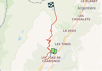

6,1 km | 9,4 km-effort


Usuario


Aplicación GPS de excursión GRATIS
 SityTrail
IGN / Institutos geográficos
SityTrail World
El mundo es suyo
Ruta Senderismo de 8,4 km a descubrir en Auvergne-Rhône-Alpes, Alta Saboya, Chamonix-Mont-Blanc. Esta ruta ha sido propuesta por hugha.
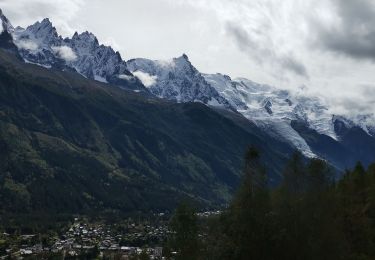
Montée de Chamonix jusqu'au chalet de la Flégère (possibilité de le faire en téléphérique) puis marche vers le Chalet du Lac Blanc

Senderismo

Carrera

Senderismo

Senderismo

Carrera

Senderismo

Senderismo

Bici de montaña
Senderismo