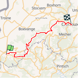
![](/images/other/stat-length.png)
![Excursión Senderismo Wincrange - Boucle Les paysages cachés - Tronçon 3 - Derenbach - Clervaux - Photo](https://media.geolcdn.com/t/1900/400/ext.pjpeg?maxdim=2&url=https%3A%2F%2Fservices.sitytrail.com%2FGeolivesWS%2FDownloadMedia.ashx%3FTrailID%3D186889%26Media%3Ded9e0348-8a1b-4768-a23b-377c5505bd87.jpg)
Boucle Les paysages cachés - Tronçon 3 - Derenbach - Clervaux
Escapardenne
Escapardenne, évadez-vous du quotidien GUIDE+
![Longitud](/images/other/stat-length.png)
![Altitud máxima](https://static1.geolcdn.com/siteimages/upload/files/1508320355ic_sort_altitude_max_24dp.png)
![Desnivel positivo](https://static1.geolcdn.com/siteimages/upload/files/1508320355ic_sort_den_pos_24dp.png)
![Km-Effort](/images/other/stat-length.png)
![Altitud mínima](https://static1.geolcdn.com/siteimages/upload/files/1508320355ic_sort_altitude_min_24dp.png)
![Desnivel negativo](https://static1.geolcdn.com/siteimages/upload/files/1508320355ic_sort_den_neg_24dp.png)
![Boucle](https://static1.geolcdn.com/siteimages/upload/files/16400158638029165_repeat_loop_refresh_sync_direction_icon.png)
![Senderismo](https://static1.geolcdn.com/sitytour/trail-icons/101.png)
--
Dificultad : Desconocido
![Escanee este código QR para abrir la excursión en la aplicación SityTrail](https://capi.geolives.com/qq0zvz2zws4bq2lad0pu/sitytour/trails/186889/qr.png?size=200)
Aplicación GPS de excursión GRATIS
A propósito
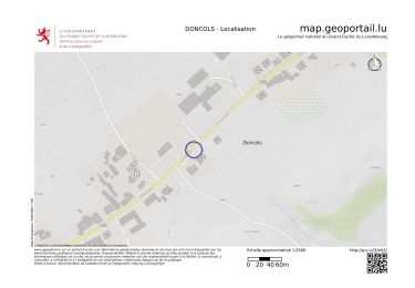
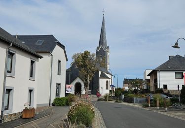
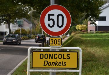
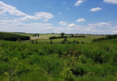
Ruta Senderismo de 19,7 km a descubrir en Desconocido, Canton Clervaux, Wincrange. Esta ruta ha sido propuesta por Escapardenne.
Descripción
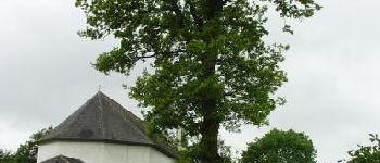
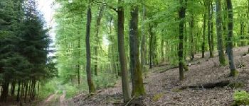
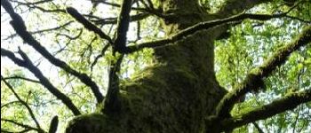
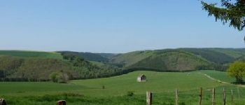
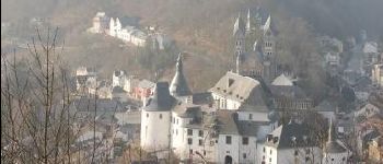
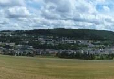
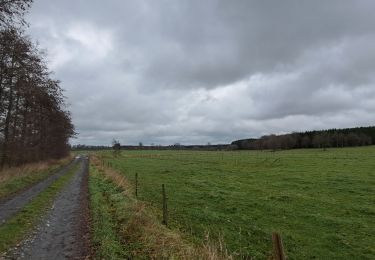
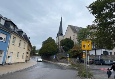
Tronçon 3 de la boucle "Les paysages cachés" (80 km)Cette boucle de randonnée couvre un territoire très prisé par les randonneurs, à savoir l''Ardenne luxembourgeoise entre Clervaux, Kautenbach et Wiltz. En reliant Wiltz à Clervaux par la partie Ouest de l''Éislek, le public pourra découvrir une région peu connue, à l''abri des regards, où se dévoilent à chaque instant de magnifiques paysages cachés.
Puntos de interés
Localización
Comentarios
Excursiones cerca
![Excursión Senderismo Wiltz - Boucle Les paysages cachés - Tronçon 2 - Wiltz - Derenbach - Photo](https://media.geolcdn.com/t/375/260/ext.jpg?maxdim=2&url=https%3A%2F%2Fservices.sitytrail.com%2FGeolivesWS%2FDownloadMedia.ashx%3FTrailID%3D186888%26Media%3Db472288c-6c46-45b5-a2bb-917883af490a.jpg)
![Senderismo Senderismo](https://static1.geolcdn.com/sitytour/trail-icons/101.png)
Senderismo
![](/images/other/stat-length.png)
![](https://static1.geolcdn.com/siteimages/upload/files/16400158638029165_repeat_loop_refresh_sync_direction_icon.png)
![Excursión Senderismo Winseler - 20240915 - Moniteurs - Doncols 5.3 Km - Photo](https://media.geolcdn.com/t/375/260/a40ad321-f97d-49b4-ba10-f9c8de7bc454.jpeg&format=jpg&maxdim=2)
![Senderismo Senderismo](https://static1.geolcdn.com/sitytour/trail-icons/101.png)
Senderismo
![](/images/other/stat-length.png)
![](https://static1.geolcdn.com/siteimages/upload/files/16400158638029165_repeat_loop_refresh_sync_direction_icon.png)
![Excursión Senderismo Wiltz - Eschweiler - Auto-pédestre New - Photo](https://media.geolcdn.com/t/375/260/6a13ab18-d427-45a8-ad0b-c98fc3704bd9.jpg&format=jpg&maxdim=2)
![Senderismo Senderismo](https://static1.geolcdn.com/sitytour/trail-icons/101.png)
Senderismo
![](/images/other/stat-length.png)
![](https://static1.geolcdn.com/siteimages/upload/files/16400158638029165_repeat_loop_refresh_sync_direction_icon.png)
![Senderismo Senderismo](https://static1.geolcdn.com/sitytour/trail-icons/101.png)
Senderismo
![](/images/other/stat-length.png)
![](https://static1.geolcdn.com/siteimages/upload/files/16400158638029165_repeat_loop_refresh_sync_direction_icon.png)
![Excursión Senderismo Bastoña - Du Chemin de Croix à La Mine - Photo](https://media.geolcdn.com/t/375/260/5d8e0ff1-4513-482c-9c6a-d231aaa0ca37.jpg&format=jpg&maxdim=2)
![Senderismo Senderismo](https://static1.geolcdn.com/sitytour/trail-icons/101.png)
Senderismo
![](/images/other/stat-length.png)
![](https://static1.geolcdn.com/siteimages/upload/files/16400158638029165_repeat_loop_refresh_sync_direction_icon.png)
![Excursión Senderismo Wiltz - 2023-10-02_13h19m59_sentier-local-wi-4 - Photo](https://media.geolcdn.com/t/375/260/ext.jpg?maxdim=2&url=https%3A%2F%2Fstatic1.geolcdn.com%2Fsiteimages%2Fupload%2Ffiles%2F1553511878bg_sport_marche.png)
![Senderismo Senderismo](https://static1.geolcdn.com/sitytour/trail-icons/101.png)
Senderismo
![](/images/other/stat-length.png)
![](https://static1.geolcdn.com/siteimages/upload/files/16400158638029165_repeat_loop_refresh_sync_direction_icon.png)
![Excursión Senderismo Wiltz - 2023-07-03_11h18m42_autopedestre-wiltz - Photo](https://media.geolcdn.com/t/375/260/ext.jpg?maxdim=2&url=https%3A%2F%2Fstatic1.geolcdn.com%2Fsiteimages%2Fupload%2Ffiles%2F1553511878bg_sport_marche.png)
![Senderismo Senderismo](https://static1.geolcdn.com/sitytour/trail-icons/101.png)
Senderismo
![](/images/other/stat-length.png)
![](https://static1.geolcdn.com/siteimages/upload/files/16400158638029165_repeat_loop_refresh_sync_direction_icon.png)
![Excursión Senderismo Bastoña - Boursy (Bastogne) - Photo](https://media.geolcdn.com/t/375/260/da1d78b8-1e04-45ed-96e5-d6d774a2c3fc.jpg&format=jpg&maxdim=2)
![Senderismo Senderismo](https://static1.geolcdn.com/sitytour/trail-icons/101.png)
Senderismo
![](/images/other/stat-length.png)
![](https://static1.geolcdn.com/siteimages/upload/files/16400158638029165_repeat_loop_refresh_sync_direction_icon.png)
![Excursión Senderismo Wiltz - 89.401 Wiltz - Circuit Ville Haute - Photo](https://media.geolcdn.com/t/375/260/f8decdf4-8a97-41f6-b18b-f93ac1f34bb3.jpg&format=jpg&maxdim=2)
![Senderismo Senderismo](https://static1.geolcdn.com/sitytour/trail-icons/101.png)
Senderismo
![](/images/other/stat-length.png)
![](https://static1.geolcdn.com/siteimages/upload/files/16400158638029165_repeat_loop_refresh_sync_direction_icon.png)