![](/images/other/stat-length.png)
![Excursión Senderismo Daubeuf-près-Vatteville - Daubeuf-près Vatteville - ND de Bellegarde - Photo](https://media.geolcdn.com/t/1900/400/ext.pjpeg?maxdim=2&url=https%3A%2F%2Fstatic1.geolcdn.com%2Fsiteimages%2Fupload%2Ffiles%2F1553511878bg_sport_marche.png)
Daubeuf-près Vatteville - ND de Bellegarde
marcel.F
Usuario
![Longitud](/images/other/stat-length.png)
Longitud
11,8 km
![Altitud máxima](https://static1.geolcdn.com/siteimages/upload/files/1508320355ic_sort_altitude_max_24dp.png)
Altitud máxima
143 m
![Desnivel positivo](https://static1.geolcdn.com/siteimages/upload/files/1508320355ic_sort_den_pos_24dp.png)
Desnivel positivo
243 m
![Km-Effort](/images/other/stat-length.png)
Km-Effort
15,1 km
![Altitud mínima](https://static1.geolcdn.com/siteimages/upload/files/1508320355ic_sort_altitude_min_24dp.png)
Altitud mínima
12 m
![Desnivel negativo](https://static1.geolcdn.com/siteimages/upload/files/1508320355ic_sort_den_neg_24dp.png)
Desnivel negativo
248 m
![Boucle](https://static1.geolcdn.com/siteimages/upload/files/16400158638029165_repeat_loop_refresh_sync_direction_icon.png)
Boucle
Sí
Fecha de creación :
2018-04-22 00:00:00.0
Última modificación :
2019-04-21 14:54:40.564
![Senderismo](https://static1.geolcdn.com/sitytour/trail-icons/101.png)
1h49
Dificultad : Fácil
![Escanee este código QR para abrir la excursión en la aplicación SityTrail](https://capi.geolives.com/qq0zvz2zws4bq2lad0pu/sitytour/trails/184396/qr.png?size=200)
Aplicación GPS de excursión GRATIS
A propósito
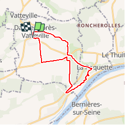
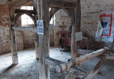
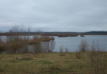
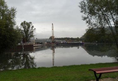
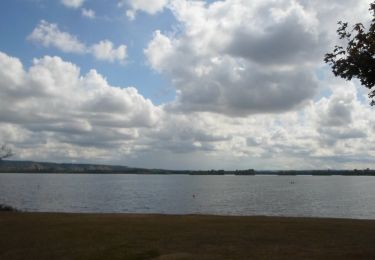
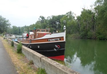
Ruta Senderismo de 11,8 km a descubrir en Normandía, Eure, Daubeuf-près-Vatteville. Esta ruta ha sido propuesta por marcel.F.
Descripción
Boucle au départ de Daubeuf-près-Vatteville (parking réserve incendie)
vers Notre Dame de Bellegarde
Localización
País:
France
Región :
Normandía
Departamento/provincia :
Eure
Municipio :
Daubeuf-près-Vatteville
Localidad:
Unknown
Salida:(Dec)
Salida:(UTM)
376455 ; 5458351 (31U) N.
Comentarios
Excursiones cerca
![Excursión Senderismo Herqueville - Daniel - Photo](https://media.geolcdn.com/t/375/260/ext.jpg?maxdim=2&url=https%3A%2F%2Fstatic1.geolcdn.com%2Fsiteimages%2Fupload%2Ffiles%2F1553511878bg_sport_marche.png)
![Senderismo Senderismo](https://static1.geolcdn.com/sitytour/trail-icons/101.png)
Daniel
Senderismo
Muy fácil
(2)
Herqueville,
Normandía,
Eure,
France
![](/images/other/stat-length.png)
9,8 km | 11,2 km-effort
2h 40min
![](https://static1.geolcdn.com/siteimages/upload/files/16400158638029165_repeat_loop_refresh_sync_direction_icon.png)
Sí
![Excursión Senderismo Poses - 20231121-poses cool - Photo](https://media.geolcdn.com/t/375/260/ext.jpg?maxdim=2&url=https%3A%2F%2Fmedia.geolcdn.com%2Ff%2F9d80a214-3218-4561-a307-0304e1006cd7.JPG)
![Senderismo Senderismo](https://static1.geolcdn.com/sitytour/trail-icons/101.png)
20231121-poses cool
Senderismo
Fácil
Poses,
Normandía,
Eure,
France
![](/images/other/stat-length.png)
9,6 km | 10,3 km-effort
2h 37min
![](https://static1.geolcdn.com/siteimages/upload/files/16400158638029165_repeat_loop_refresh_sync_direction_icon.png)
Sí
![Excursión Senderismo Poses - Poses le Val Pitan - Photo](https://media.geolcdn.com/t/375/260/ext.jpg?maxdim=2&url=https%3A%2F%2Fmedia.geolcdn.com%2Ff%2F4c42f14a-6884-4e67-8d15-a7596b1ce635.jpg)
![Senderismo Senderismo](https://static1.geolcdn.com/sitytour/trail-icons/101.png)
Poses le Val Pitan
Senderismo
Fácil
Poses,
Normandía,
Eure,
France
![](/images/other/stat-length.png)
4,3 km | 5,6 km-effort
1h 34min
![](https://static1.geolcdn.com/siteimages/upload/files/16400158638029165_repeat_loop_refresh_sync_direction_icon.png)
Sí
![Excursión Senderismo Heuqueville - 20230810-Heuqueville Jourrnée - Photo](https://media.geolcdn.com/t/375/260/ext.jpg?maxdim=2&url=https%3A%2F%2Fmedia.geolcdn.com%2Ff%2Fabf9f114-cedb-4b67-a0c7-6866c6477a1a.JPG)
![Senderismo Senderismo](https://static1.geolcdn.com/sitytour/trail-icons/101.png)
20230810-Heuqueville Jourrnée
Senderismo
Difícil
Heuqueville,
Normandía,
Eure,
France
![](/images/other/stat-length.png)
20 km | 27 km-effort
5h 57min
![](https://static1.geolcdn.com/siteimages/upload/files/16400158638029165_repeat_loop_refresh_sync_direction_icon.png)
Sí
![Excursión Senderismo Poses - rando côte des deux amants - Photo](https://media.geolcdn.com/t/375/260/ext.jpg?maxdim=2&url=https%3A%2F%2Fmedia.geolcdn.com%2Ff%2Fe52efcca-f1f2-4b9a-baa2-419c63b5e778.jpg)
![Senderismo Senderismo](https://static1.geolcdn.com/sitytour/trail-icons/101.png)
rando côte des deux amants
Senderismo
Difícil
Poses,
Normandía,
Eure,
France
![](/images/other/stat-length.png)
11,7 km | 14,2 km-effort
3h 43min
![](https://static1.geolcdn.com/siteimages/upload/files/16400158638029165_repeat_loop_refresh_sync_direction_icon.png)
Sí
![Excursión Senderismo Poses - 20230105-Poses - Photo](https://media.geolcdn.com/t/375/260/ext.jpg?maxdim=2&url=https%3A%2F%2Fmedia.geolcdn.com%2Ff%2F7418f046-184b-4401-ab3e-f9721e0e1a6b.JPG)
![Senderismo Senderismo](https://static1.geolcdn.com/sitytour/trail-icons/101.png)
![Excursión Senderismo Poses - 20220920-Poses Cool - Photo](https://media.geolcdn.com/t/375/260/ext.jpg?maxdim=2&url=https%3A%2F%2Fmedia.geolcdn.com%2Ff%2Fd143465a-b95c-4e87-9930-14d66c1a3023.JPG)
![Senderismo Senderismo](https://static1.geolcdn.com/sitytour/trail-icons/101.png)
20220920-Poses Cool
Senderismo
Fácil
Poses,
Normandía,
Eure,
France
![](/images/other/stat-length.png)
7 km | 7,5 km-effort
1h 50min
![](https://static1.geolcdn.com/siteimages/upload/files/16400158638029165_repeat_loop_refresh_sync_direction_icon.png)
Sí
![Excursión Senderismo Poses - 20220903-Poses - Photo](https://media.geolcdn.com/t/375/260/ext.jpg?maxdim=2&url=https%3A%2F%2Fmedia.geolcdn.com%2Ff%2Fdee06762-10eb-485f-89ff-9366a883ddd7.JPG)
![Senderismo Senderismo](https://static1.geolcdn.com/sitytour/trail-icons/101.png)
![Excursión Senderismo Poses - 20220621-Poses](https://media.geolcdn.com/t/375/260/ext.jpg?maxdim=2&url=https%3A%2F%2Fmedia.geolcdn.com%2Ff%2F30af2423-5ea6-490e-99c6-3e98b2bfcbf3.JPG)
![Senderismo Senderismo](https://static1.geolcdn.com/sitytour/trail-icons/101.png)
20220621-Poses "Cool"
Senderismo
Fácil
Poses,
Normandía,
Eure,
France
![](/images/other/stat-length.png)
7,7 km | 8,2 km-effort
1h 59min
![](https://static1.geolcdn.com/siteimages/upload/files/16400158638029165_repeat_loop_refresh_sync_direction_icon.png)
Sí