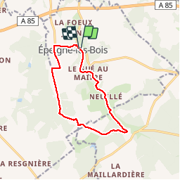
![](/images/other/stat-length.png)
![Excursión Senderismo Épeigné-les-Bois - Épeigné-les-Bois - Photo](https://media.geolcdn.com/t/1900/400/ext.pjpeg?maxdim=2&url=https%3A%2F%2Fservices.sitytrail.com%2FGeolivesWS%2FDownloadMedia.ashx%3FTrailID%3D183159%26Media%3D4398415d-0a4d-43ae-bc90-425b2abb4cd3.jpg)
Épeigné-les-Bois
LEMENIO
Usuario
![Longitud](/images/other/stat-length.png)
![Altitud máxima](https://static1.geolcdn.com/siteimages/upload/files/1508320355ic_sort_altitude_max_24dp.png)
![Desnivel positivo](https://static1.geolcdn.com/siteimages/upload/files/1508320355ic_sort_den_pos_24dp.png)
![Km-Effort](/images/other/stat-length.png)
![Altitud mínima](https://static1.geolcdn.com/siteimages/upload/files/1508320355ic_sort_altitude_min_24dp.png)
![Desnivel negativo](https://static1.geolcdn.com/siteimages/upload/files/1508320355ic_sort_den_neg_24dp.png)
![Boucle](https://static1.geolcdn.com/siteimages/upload/files/16400158638029165_repeat_loop_refresh_sync_direction_icon.png)
![Senderismo](https://static1.geolcdn.com/sitytour/trail-icons/101.png)
2h59
Dificultad : Fácil
![Escanee este código QR para abrir la excursión en la aplicación SityTrail](https://capi.geolives.com/qq0zvz2zws4bq2lad0pu/sitytour/trails/183159/qr.png?size=200)
Aplicación GPS de excursión GRATIS
A propósito
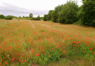
Ruta Senderismo de 11,5 km a descubrir en Centro, Indre y Loira, Épeigné-les-Bois. Esta ruta ha sido propuesta por LEMENIO.
Descripción
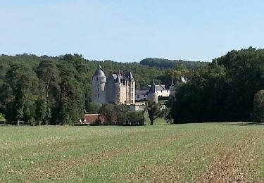
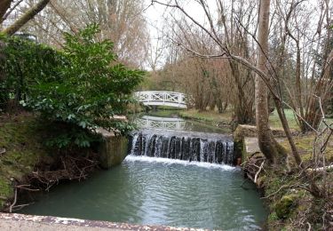
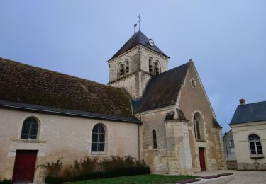
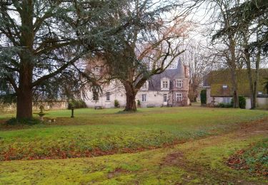
Départ parking du plan d'eau. Télécharger le dépliant touristique du circuit en cliquant sur l'icône signalant sur la carte ci-contre la source ST AIGNAN. Curiosité : En face de l'église remarquez la pancarte qui indique la source et le petit portail bleu. Descendre les escaliers qui mènent à la source. Allumer l'éclairage en appuyant sur l'interrupteur qui se trouve à l'entrée de la grotte (à gauche).Ensuite à mi-parcours vous apercevrez la château de Montpoupon dans la verdure (cliquer sur l'icône pour voir les photos).Retour en longeant l'étang.
Localización
Comentarios
Excursiones cerca
![Excursión Senderismo Épeigné-les-Bois - Epeigné-les-Bois - Montpoupon - 11,5km 160m 2h15mn - 2016 12 29 - Photo](https://media.geolcdn.com/t/375/260/22b359e3-6d6b-40c2-85c5-21ba9f35e3e3.jpg&format=jpg&maxdim=2)
![Senderismo Senderismo](https://static1.geolcdn.com/sitytour/trail-icons/101.png)
Senderismo
![](/images/other/stat-length.png)
![](https://static1.geolcdn.com/siteimages/upload/files/16400158638029165_repeat_loop_refresh_sync_direction_icon.png)
![Excursión Senderismo Luzillé - les petits gars - Photo](https://media.geolcdn.com/t/375/260/ext.jpg?maxdim=2&url=https%3A%2F%2Fservices.sitytrail.com%2FGeolivesWS%2FDownloadMedia.ashx%3FTrailID%3D740867%26Media%3Dfix__20170427113816.jpg)
![Senderismo Senderismo](https://static1.geolcdn.com/sitytour/trail-icons/101.png)
Senderismo
![](/images/other/stat-length.png)
![](https://static1.geolcdn.com/siteimages/upload/files/16400158638029165_repeat_loop_refresh_sync_direction_icon.png)
![Excursión Senderismo Francueil - Chenonceaux - GR41 Francueil - 12.7km 160m 2h45 - 2022 01 01 - Photo](https://media.geolcdn.com/t/375/260/d77c3233-33cb-4dd7-bc1d-c59e94e3839d.jpg&format=jpg&maxdim=2)
![Senderismo Senderismo](https://static1.geolcdn.com/sitytour/trail-icons/101.png)
Senderismo
![](/images/other/stat-length.png)
![](https://static1.geolcdn.com/siteimages/upload/files/16400158638029165_repeat_loop_refresh_sync_direction_icon.png)
![Excursión Senderismo Saint-Georges-sur-Cher - Saint-Georges-sur-Cher - les Magasins Montfourgon le Moulin du Porteau - 10km 110m 2h25 - 2021 01 02 - Photo](https://media.geolcdn.com/t/375/260/f115f6ef-46e3-4de7-a2db-116f89709983.jpg&format=jpg&maxdim=2)
![Senderismo Senderismo](https://static1.geolcdn.com/sitytour/trail-icons/101.png)
Senderismo
![](/images/other/stat-length.png)
![](https://static1.geolcdn.com/siteimages/upload/files/16400158638029165_repeat_loop_refresh_sync_direction_icon.png)
![Excursión Senderismo Saint-Georges-sur-Cher - Saint-Georges-sur-Cher - Photo](https://media.geolcdn.com/t/375/260/ext.jpg?maxdim=2&url=https%3A%2F%2Fservices.sitytrail.com%2FGeolivesWS%2FDownloadMedia.ashx%3FTrailID%3D258187%26Media%3Dfix__20140316093314.jpg)
![Senderismo Senderismo](https://static1.geolcdn.com/sitytour/trail-icons/101.png)
Senderismo
![](/images/other/stat-length.png)
![](https://static1.geolcdn.com/siteimages/upload/files/16400158638029165_repeat_loop_refresh_sync_direction_icon.png)
![Excursión Senderismo Saint-Georges-sur-Cher - Saint-Georges-sur-Cher - les Magasins la Vallée Pitrou la Poterie - 6.8km 80m 1h40 - 2020 06 21 - Photo](https://media.geolcdn.com/t/375/260/589544d1-ae35-4674-85ff-5bd9b379f2d0.jpg&format=jpg&maxdim=2)
![Senderismo Senderismo](https://static1.geolcdn.com/sitytour/trail-icons/101.png)
Senderismo
![](/images/other/stat-length.png)
![](https://static1.geolcdn.com/siteimages/upload/files/16400158638029165_repeat_loop_refresh_sync_direction_icon.png)
![Excursión Senderismo Saint-Georges-sur-Cher - Saint-Georges-sur-Cher - 2015 12 31 - Photo](https://media.geolcdn.com/t/375/260/85c959b3-d173-4846-80b2-3990bd4a362c.jpg&format=jpg&maxdim=2)
![Senderismo Senderismo](https://static1.geolcdn.com/sitytour/trail-icons/101.png)
Senderismo
![](/images/other/stat-length.png)
![](https://static1.geolcdn.com/siteimages/upload/files/16400158638029165_repeat_loop_refresh_sync_direction_icon.png)
![Excursión Senderismo Saint-Georges-sur-Cher - Francueil - La Chaise - 2016 01 02 - Photo](https://media.geolcdn.com/t/375/260/83881801-51ed-4d24-80ba-37787d095f02.jpg&format=jpg&maxdim=2)
![Senderismo Senderismo](https://static1.geolcdn.com/sitytour/trail-icons/101.png)
Senderismo
![](/images/other/stat-length.png)
![](https://static1.geolcdn.com/siteimages/upload/files/16400158638029165_repeat_loop_refresh_sync_direction_icon.png)
![Excursión Senderismo Francueil - Francueil - Luzillé - 14.6km 155m 3h05 - 2018 12 30 - Photo](https://media.geolcdn.com/t/375/260/9bdb2dd3-6dd0-4684-96a9-c5947b6f8b9f.jpg&format=jpg&maxdim=2)
![Senderismo Senderismo](https://static1.geolcdn.com/sitytour/trail-icons/101.png)
Senderismo
![](/images/other/stat-length.png)
![](https://static1.geolcdn.com/siteimages/upload/files/16400158638029165_repeat_loop_refresh_sync_direction_icon.png)