![](/images/other/stat-length.png)
![Excursión Senderismo Sablons sur Huisne - Condé sur Huisne Est 10.1 Km - Photo](https://media.geolcdn.com/t/1900/400/ext.pjpeg?maxdim=2&url=https%3A%2F%2Fstatic1.geolcdn.com%2Fsiteimages%2Fupload%2Ffiles%2F1553511878bg_sport_marche.png)
Condé sur Huisne Est 10.1 Km
ODDAD78
Usuario
![Longitud](/images/other/stat-length.png)
Longitud
10,1 km
![Altitud máxima](https://static1.geolcdn.com/siteimages/upload/files/1508320355ic_sort_altitude_max_24dp.png)
Altitud máxima
181 m
![Desnivel positivo](https://static1.geolcdn.com/siteimages/upload/files/1508320355ic_sort_den_pos_24dp.png)
Desnivel positivo
153 m
![Km-Effort](/images/other/stat-length.png)
Km-Effort
12,1 km
![Altitud mínima](https://static1.geolcdn.com/siteimages/upload/files/1508320355ic_sort_altitude_min_24dp.png)
Altitud mínima
116 m
![Desnivel negativo](https://static1.geolcdn.com/siteimages/upload/files/1508320355ic_sort_den_neg_24dp.png)
Desnivel negativo
153 m
![Boucle](https://static1.geolcdn.com/siteimages/upload/files/16400158638029165_repeat_loop_refresh_sync_direction_icon.png)
Boucle
Sí
Fecha de creación :
2019-04-13 16:36:32.652
Última modificación :
2019-04-13 16:36:32.686
![Senderismo](https://static1.geolcdn.com/sitytour/trail-icons/101.png)
2h42
Dificultad : Fácil
![Escanee este código QR para abrir la excursión en la aplicación SityTrail](https://capi.geolives.com/qq0zvz2zws4bq2lad0pu/sitytour/trails/182590/qr.png?size=200)
Aplicación GPS de excursión GRATIS
A propósito
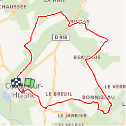
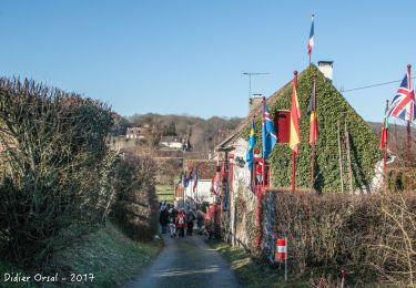
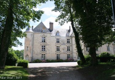
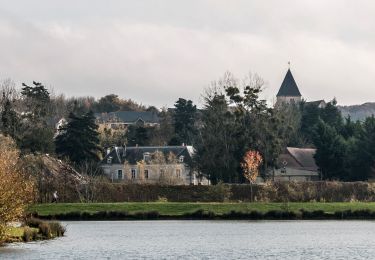
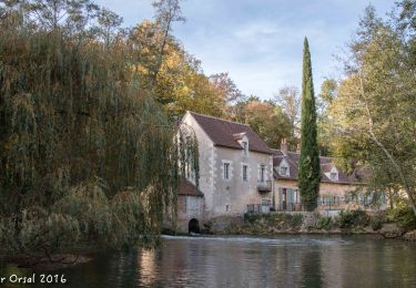
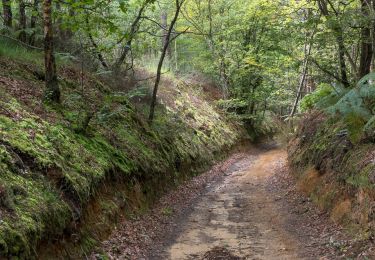
Ruta Senderismo de 10,1 km a descubrir en Normandía, Orne, Sablons sur Huisne. Esta ruta ha sido propuesta por ODDAD78.
Descripción
Version modifiée de "Condé sur Huisne" (neitga61) intégrant un départ par la voie verte et un racourci.
Localización
País:
France
Región :
Normandía
Departamento/provincia :
Orne
Municipio :
Sablons sur Huisne
Localidad:
Unknown
Salida:(Dec)
Salida:(UTM)
340823 ; 5360779 (31U) N.
Comentarios
Excursiones cerca
![Excursión Senderismo Rémalard en Perche - La Nymphe du Perche 5,0 Km - Photo](https://media.geolcdn.com/t/375/260/17cc6b0d-b494-41c7-85a0-ede1466ba884.jpg&format=jpg&maxdim=2)
![Senderismo Senderismo](https://static1.geolcdn.com/sitytour/trail-icons/101.png)
La Nymphe du Perche 5,0 Km
Senderismo
Medio
(1)
Rémalard en Perche,
Normandía,
Orne,
France
![](/images/other/stat-length.png)
5 km | 6,3 km-effort
1h 25min
![](https://static1.geolcdn.com/siteimages/upload/files/16400158638029165_repeat_loop_refresh_sync_direction_icon.png)
Sí
![Excursión Senderismo Sablons sur Huisne - Villeray, au Fil de l'Huisne 11.8 Km - Photo](https://media.geolcdn.com/t/375/260/389a8b4c-26cd-4921-9eb3-f44fb8104715.jpg&format=jpg&maxdim=2)
![Senderismo Senderismo](https://static1.geolcdn.com/sitytour/trail-icons/101.png)
Villeray, au Fil de l'Huisne 11.8 Km
Senderismo
Difícil
(1)
Sablons sur Huisne,
Normandía,
Orne,
France
![](/images/other/stat-length.png)
12,6 km | 14,7 km-effort
3h 20min
![](https://static1.geolcdn.com/siteimages/upload/files/16400158638029165_repeat_loop_refresh_sync_direction_icon.png)
Sí
![Excursión Senderismo Sablons sur Huisne - Condé Les Sablons, vallée de l'Huisne - Photo](https://media.geolcdn.com/t/375/260/eb8eb92b-43d4-4641-a3d8-e02a1195662f.jpg&format=jpg&maxdim=2)
![Senderismo Senderismo](https://static1.geolcdn.com/sitytour/trail-icons/101.png)
Condé Les Sablons, vallée de l'Huisne
Senderismo
Difícil
Sablons sur Huisne,
Normandía,
Orne,
France
![](/images/other/stat-length.png)
13,1 km | 15,1 km-effort
3h 25min
![](https://static1.geolcdn.com/siteimages/upload/files/16400158638029165_repeat_loop_refresh_sync_direction_icon.png)
Sí
![Excursión Senderismo Arcisses - 2023-04-24_20h15m45_Ozée 9,1 km - Photo](https://media.geolcdn.com/t/375/260/ext.jpg?maxdim=2&url=https%3A%2F%2Fstatic1.geolcdn.com%2Fsiteimages%2Fupload%2Ffiles%2F1553511878bg_sport_marche.png)
![Senderismo Senderismo](https://static1.geolcdn.com/sitytour/trail-icons/101.png)
2023-04-24_20h15m45_Ozée 9,1 km
Senderismo
Medio
(1)
Arcisses,
Centro,
Eure-y-Loir,
France
![](/images/other/stat-length.png)
9,1 km | 11,2 km-effort
2h 32min
![](https://static1.geolcdn.com/siteimages/upload/files/16400158638029165_repeat_loop_refresh_sync_direction_icon.png)
Sí
![Excursión Senderismo Sablons sur Huisne - Condé-sur-Huisne - Coudreceau 12 km - Photo](https://media.geolcdn.com/t/375/260/87972a85-bf69-4274-be1a-37d8d7d8a4ac.jpg&format=jpg&maxdim=2)
![Senderismo Senderismo](https://static1.geolcdn.com/sitytour/trail-icons/101.png)
Condé-sur-Huisne - Coudreceau 12 km
Senderismo
Fácil
Sablons sur Huisne,
Normandía,
Orne,
France
![](/images/other/stat-length.png)
12,3 km | 15,3 km-effort
3h 10min
![](https://static1.geolcdn.com/siteimages/upload/files/16400158638029165_repeat_loop_refresh_sync_direction_icon.png)
No
![Excursión Senderismo Saint-Pierre-la-Bruyère - Condé-sur-Huisne - Saint-Pierre-la-Bruyère via Villeray 8,5 km - Photo](https://media.geolcdn.com/t/375/260/3374e628-d3bf-422a-bb99-175704d9ab1f.jpg&format=jpg&maxdim=2)
![Senderismo Senderismo](https://static1.geolcdn.com/sitytour/trail-icons/101.png)
Condé-sur-Huisne - Saint-Pierre-la-Bruyère via Villeray 8,5 km
Senderismo
Fácil
Saint-Pierre-la-Bruyère,
Normandía,
Orne,
France
![](/images/other/stat-length.png)
8,5 km | 10 km-effort
3h 23min
![](https://static1.geolcdn.com/siteimages/upload/files/16400158638029165_repeat_loop_refresh_sync_direction_icon.png)
No
![Excursión Senderismo Sablons sur Huisne - Condé-sur-Huisne - Nogent-le-Rotrou via Saint-Pierre-la-Bruyère 11 km - Photo](https://media.geolcdn.com/t/375/260/e847ed75-06a8-4a98-b0e3-0da9e66dfbf2.jpg&format=jpg&maxdim=2)
![Senderismo Senderismo](https://static1.geolcdn.com/sitytour/trail-icons/101.png)
Condé-sur-Huisne - Nogent-le-Rotrou via Saint-Pierre-la-Bruyère 11 km
Senderismo
Fácil
Sablons sur Huisne,
Normandía,
Orne,
France
![](/images/other/stat-length.png)
10,8 km | 13 km-effort
2h 34min
![](https://static1.geolcdn.com/siteimages/upload/files/16400158638029165_repeat_loop_refresh_sync_direction_icon.png)
No
![Excursión Senderismo Sablons sur Huisne - Condé-sur-Huisne - Rémalard via Villeray 11 km - Photo](https://media.geolcdn.com/t/375/260/8f2a07be-6c5a-402b-acba-3e9821d1fe63.jpg&format=jpg&maxdim=2)
![Senderismo Senderismo](https://static1.geolcdn.com/sitytour/trail-icons/101.png)
Condé-sur-Huisne - Rémalard via Villeray 11 km
Senderismo
Fácil
Sablons sur Huisne,
Normandía,
Orne,
France
![](/images/other/stat-length.png)
10,9 km | 12,4 km-effort
3h 19min
![](https://static1.geolcdn.com/siteimages/upload/files/16400158638029165_repeat_loop_refresh_sync_direction_icon.png)
No
![Excursión Senderismo Sablons sur Huisne - Condé-sur-Huisne - Rémalard via La Courroue 12 km - Photo](https://media.geolcdn.com/t/375/260/4db3e208-edae-4cc2-a089-9ddb16b1768d.jpg&format=jpg&maxdim=2)
![Senderismo Senderismo](https://static1.geolcdn.com/sitytour/trail-icons/101.png)
Condé-sur-Huisne - Rémalard via La Courroue 12 km
Senderismo
Fácil
Sablons sur Huisne,
Normandía,
Orne,
France
![](/images/other/stat-length.png)
12,5 km | 14,7 km-effort
3h 16min
![](https://static1.geolcdn.com/siteimages/upload/files/16400158638029165_repeat_loop_refresh_sync_direction_icon.png)
No