![](/images/other/stat-length.png)
![Excursión Senderismo Saint-Marcel-lès-Valence - Balade VSM N°1 Fouillouse - Photo](https://media.geolcdn.com/t/1900/400/ext.pjpeg?maxdim=2&url=https%3A%2F%2Fstatic1.geolcdn.com%2Fsiteimages%2Fupload%2Ffiles%2F1553511878bg_sport_marche.png)
Balade VSM N°1 Fouillouse
michelguilhou
Usuario
![Longitud](/images/other/stat-length.png)
![Altitud máxima](https://static1.geolcdn.com/siteimages/upload/files/1508320355ic_sort_altitude_max_24dp.png)
![Desnivel positivo](https://static1.geolcdn.com/siteimages/upload/files/1508320355ic_sort_den_pos_24dp.png)
![Km-Effort](/images/other/stat-length.png)
![Altitud mínima](https://static1.geolcdn.com/siteimages/upload/files/1508320355ic_sort_altitude_min_24dp.png)
![Desnivel negativo](https://static1.geolcdn.com/siteimages/upload/files/1508320355ic_sort_den_neg_24dp.png)
![Boucle](https://static1.geolcdn.com/siteimages/upload/files/16400158638029165_repeat_loop_refresh_sync_direction_icon.png)
![Senderismo](https://static1.geolcdn.com/sitytour/trail-icons/101.png)
2h00
Dificultad : Fácil
![Escanee este código QR para abrir la excursión en la aplicación SityTrail](https://capi.geolives.com/qq0zvz2zws4bq2lad0pu/sitytour/trails/174099/qr.png?size=200)
Aplicación GPS de excursión GRATIS
A propósito
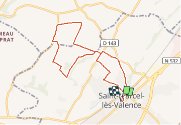
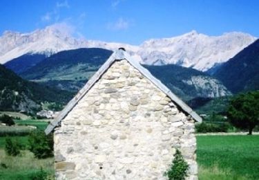
Ruta Senderismo de 9,3 km a descubrir en Auvergne-Rhône-Alpes, Drôme, Saint-Marcel-lès-Valence. Esta ruta ha sido propuesta por michelguilhou.
Descripción
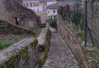
DEPART de la mairie,
direction de l’église, prendre le « Pass’âge » et monter par la côte de Surel.
1) Au 1ier virage à droite, prendre sur la Gauche : la rue du plateau.
2) Au bout de la rue du plateau, balise « céder le passage », prendre la rue sur la Droite.
Puis la 1ière petite route à Gauche en direction des « Carrières »
3) Laisser la belle ferme « Patry » à Gauche et continuer jusqu’au carrefour
Laisser à Gauche la direction des « Carrières » et prendre à Droite
4) Tourner sur le chemin à Gauche, le long de la haie de peupliers, à 200m de la route de Chateauneuf
5) Attention, dans le creux, prendre le premier chemin de terre à Gauche, jusqu’aux 2 propriétés clôturées
6) 100m après les 2 propriétés, prendre un chemin à Droite, le long d’une haie d’arbres
7) Juste après la station météo, on arrive sur une route. Prendre à Droite
Par temps clair, admirer le Vercors et les monts d’Ardèche
8) Continuer la route. En face d’un grand hangar agricole, prendre la route à Droite jusqu’à Fouillouse.
Continuer 100 m après le stop
9) Tourner à Droite aux 6 boîtes aux lettres
10) Au niveau du virage à Gauche, prendre le chemin de terre à Droite
11) Tourner sur le 1ier chemin à Gauche, (borne d’arrosage). A l’élevage du mas des Vernets on retrouve le goudron jusqu’à la route.
12) Prendre la route à Gauche, sur 50 m puis à Droite le chemin de terre jusqu’à l’ancienne route de Chateauneuf, continuer jusqu’à l’indication à Gauche « cimetière ». Passer devant le cimetière et rejoindre le Pass’âge
Puntos de interés
Localización
Comentarios
Excursiones cerca
![Excursión Senderismo Saint-Marcel-lès-Valence - Balade VSM N° 5 - pour rejoindre le Guimand - Photo](https://media.geolcdn.com/t/375/260/ext.jpg?maxdim=2&url=https%3A%2F%2Fstatic1.geolcdn.com%2Fsiteimages%2Fupload%2Ffiles%2F1553511878bg_sport_marche.png)
![Senderismo Senderismo](https://static1.geolcdn.com/sitytour/trail-icons/101.png)
Senderismo
![](/images/other/stat-length.png)
![](https://static1.geolcdn.com/siteimages/upload/files/16400158638029165_repeat_loop_refresh_sync_direction_icon.png)
![Excursión Senderismo Châteauneuf-sur-Isère - 26 Châteauneuf didier - Photo](https://media.geolcdn.com/t/375/260/a4c5edcc-8f3c-45e2-8c8a-8f7fc0f64334.jpg&format=jpg&maxdim=2)
![Senderismo Senderismo](https://static1.geolcdn.com/sitytour/trail-icons/101.png)
Senderismo
![](/images/other/stat-length.png)
![](https://static1.geolcdn.com/siteimages/upload/files/16400158638029165_repeat_loop_refresh_sync_direction_icon.png)
![Excursión Senderismo Châteauneuf-sur-Isère - Châteauneuf/isere - Photo](https://media.geolcdn.com/t/375/260/231a22ca-832d-4248-a718-db7a90127622.jpg&format=jpg&maxdim=2)
![Senderismo Senderismo](https://static1.geolcdn.com/sitytour/trail-icons/101.png)
Senderismo
![](/images/other/stat-length.png)
![](https://static1.geolcdn.com/siteimages/upload/files/16400158638029165_repeat_loop_refresh_sync_direction_icon.png)
![Excursión Senderismo Saint-Marcel-lès-Valence - Vers le Guimand - Photo](https://media.geolcdn.com/t/375/260/57b98d48-2046-42f0-8662-00caa40854e6.jpg&format=jpg&maxdim=2)
![Senderismo Senderismo](https://static1.geolcdn.com/sitytour/trail-icons/101.png)
Senderismo
![](/images/other/stat-length.png)
![](https://static1.geolcdn.com/siteimages/upload/files/16400158638029165_repeat_loop_refresh_sync_direction_icon.png)
![Excursión Senderismo Châteauneuf-sur-Isère - 26 château Neuf sur Isère 08 05 21 - Photo](https://media.geolcdn.com/t/375/260/ext.jpg?maxdim=2&url=https%3A%2F%2Fstatic1.geolcdn.com%2Fsiteimages%2Fupload%2Ffiles%2F1553511878bg_sport_marche.png)
![Senderismo Senderismo](https://static1.geolcdn.com/sitytour/trail-icons/101.png)
Senderismo
![](/images/other/stat-length.png)
![](https://static1.geolcdn.com/siteimages/upload/files/16400158638029165_repeat_loop_refresh_sync_direction_icon.png)
![Excursión Bici de montaña Valencia de Francia - Grande Traversée des PréAlpes à VTT : Valence - Gap - Sisteron - Photo](https://media.geolcdn.com/t/375/260/ext.jpg?maxdim=2&url=https%3A%2F%2Fservices.sitytrail.com%2FGeolivesWS%2FDownloadMedia.ashx%3FTrailID%3D102172%26Media%3D2562_2.jpg)
![Bici de montaña Bici de montaña](https://static1.geolcdn.com/sitytour/trail-icons/202.png)
Bici de montaña
![](/images/other/stat-length.png)
![](https://static1.geolcdn.com/siteimages/upload/files/16400158638029165_repeat_loop_refresh_sync_direction_icon.png)
![Excursión Bici de montaña Valencia de Francia - Grande Traversée des PréAlpes à VTT : Valence - Livron sur Drôme - Photo](https://media.geolcdn.com/t/375/260/ext.jpg?maxdim=2&url=https%3A%2F%2Fservices.sitytrail.com%2FGeolivesWS%2FDownloadMedia.ashx%3FTrailID%3D102153%26Media%3D2543_2.jpg)
![Bici de montaña Bici de montaña](https://static1.geolcdn.com/sitytour/trail-icons/202.png)
Bici de montaña
![](/images/other/stat-length.png)
![](https://static1.geolcdn.com/siteimages/upload/files/16400158638029165_repeat_loop_refresh_sync_direction_icon.png)
![Excursión Senderismo Châteauneuf-sur-Isère - Château neuf sur Isère - Photo](https://media.geolcdn.com/t/375/260/ext.jpg?maxdim=2&url=https%3A%2F%2Fstatic1.geolcdn.com%2Fsiteimages%2Fupload%2Ffiles%2F1553511878bg_sport_marche.png)
![Senderismo Senderismo](https://static1.geolcdn.com/sitytour/trail-icons/101.png)
Senderismo
![](/images/other/stat-length.png)
![](https://static1.geolcdn.com/siteimages/upload/files/16400158638029165_repeat_loop_refresh_sync_direction_icon.png)
![Excursión Paseo ecuestre Bourg-lès-Valence - Télégraphe - Photo](https://media.geolcdn.com/t/375/260/6c4e2012-89e1-424c-b59b-88fe72cd426c.jpg&format=jpg&maxdim=2)
![Paseo ecuestre Paseo ecuestre](https://static1.geolcdn.com/sitytour/trail-icons/301.png)
Paseo ecuestre
![](/images/other/stat-length.png)
![](https://static1.geolcdn.com/siteimages/upload/files/16400158638029165_repeat_loop_refresh_sync_direction_icon.png)