![](/images/other/stat-length.png)
![Excursión Bici de montaña Gernelle - De Gernelle à Vivier au Court - Photo](https://media.geolcdn.com/t/1900/400/ext.pjpeg?maxdim=2&url=https%3A%2F%2Fservices.sitytrail.com%2FGeolivesWS%2FDownloadMedia.ashx%3FTrailID%3D173171%26Media%3D14750_4.jpg)
De Gernelle à Vivier au Court
tracegps
Usuario
![Longitud](/images/other/stat-length.png)
Longitud
22 km
![Altitud máxima](https://static1.geolcdn.com/siteimages/upload/files/1508320355ic_sort_altitude_max_24dp.png)
Altitud máxima
302 m
![Desnivel positivo](https://static1.geolcdn.com/siteimages/upload/files/1508320355ic_sort_den_pos_24dp.png)
Desnivel positivo
422 m
![Km-Effort](/images/other/stat-length.png)
Km-Effort
27 km
![Altitud mínima](https://static1.geolcdn.com/siteimages/upload/files/1508320355ic_sort_altitude_min_24dp.png)
Altitud mínima
180 m
![Desnivel negativo](https://static1.geolcdn.com/siteimages/upload/files/1508320355ic_sort_den_neg_24dp.png)
Desnivel negativo
422 m
![Boucle](https://static1.geolcdn.com/siteimages/upload/files/16400158638029165_repeat_loop_refresh_sync_direction_icon.png)
Boucle
Sí
Fecha de creación :
2014-12-10 00:00:00.0
Última modificación :
2014-12-10 00:00:00.0
![Bici de montaña](https://static1.geolcdn.com/sitytour/trail-icons/202.png)
2h15
Dificultad : Medio
![Escanee este código QR para abrir la excursión en la aplicación SityTrail](https://capi.geolives.com/qq0zvz2zws4bq2lad0pu/sitytour/trails/173171/qr.png?size=200)
Aplicación GPS de excursión GRATIS
A propósito
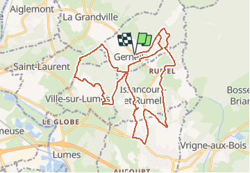
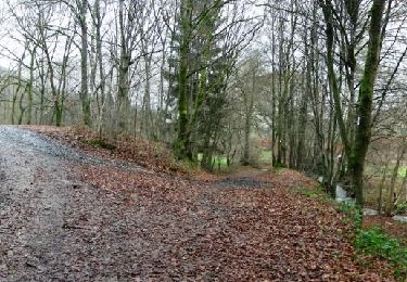
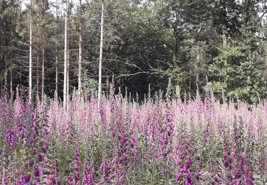
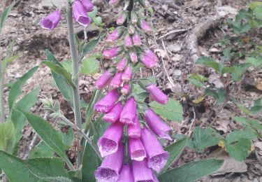
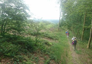
Ruta Bici de montaña de 22 km a descubrir en Gran Este, Ardenas, Gernelle. Esta ruta ha sido propuesta por tracegps.
Descripción
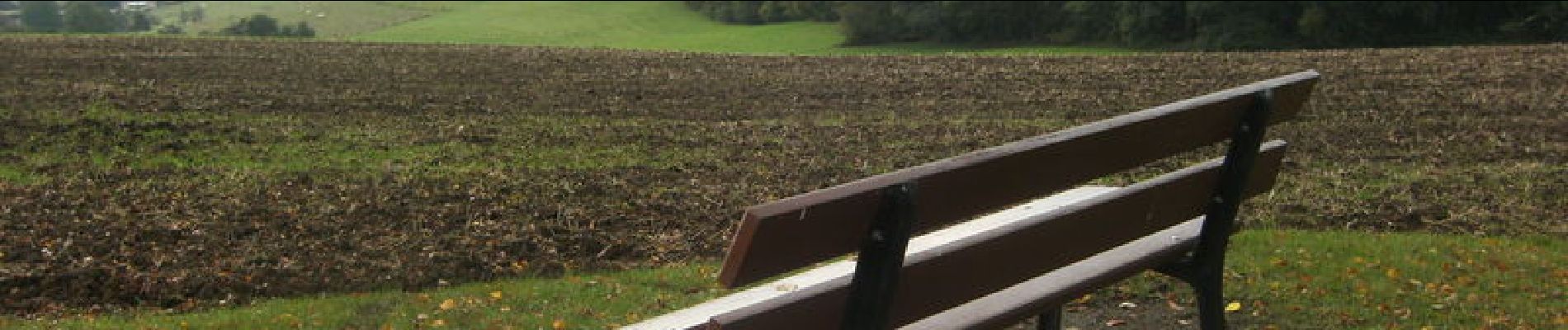
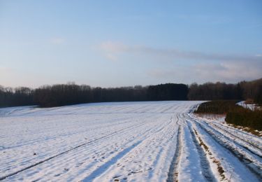
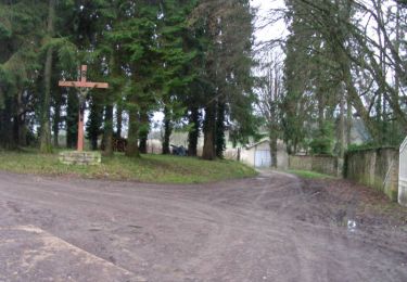
Départ de l'église de Gernelle. Circuit varié dans les bois et en lisière, dans les champs...peu difficile car peu de dénivelé. Très peu de routes et peu fréquentées.
Localización
País:
France
Región :
Gran Este
Departamento/provincia :
Ardenas
Municipio :
Gernelle
Localidad:
Unknown
Salida:(Dec)
Salida:(UTM)
630895 ; 5514346 (31U) N.
Comentarios
Excursiones cerca
![Excursión Senderismo Neufmanil - 2022-01-10_15h31m44_SityTrail - 2331539 - neufmanil-2020x02x11 - Photo](https://media.geolcdn.com/t/375/260/ext.jpg?maxdim=2&url=https%3A%2F%2Fstatic1.geolcdn.com%2Fsiteimages%2Fupload%2Ffiles%2F1553511878bg_sport_marche.png)
![Senderismo Senderismo](https://static1.geolcdn.com/sitytour/trail-icons/101.png)
2022-01-10_15h31m44_SityTrail - 2331539 - neufmanil-2020x02x11
Senderismo
Muy difícil
(1)
Neufmanil,
Gran Este,
Ardenas,
France
![](/images/other/stat-length.png)
14,1 km | 19,1 km-effort
4h 20min
![](https://static1.geolcdn.com/siteimages/upload/files/16400158638029165_repeat_loop_refresh_sync_direction_icon.png)
Sí
![Excursión Senderismo La Grandville - La Granville 2024 - Photo](https://media.geolcdn.com/t/375/260/ext.jpg?maxdim=2&url=https%3A%2F%2Fstatic1.geolcdn.com%2Fsiteimages%2Fupload%2Ffiles%2F1553511878bg_sport_marche.png)
![Senderismo Senderismo](https://static1.geolcdn.com/sitytour/trail-icons/101.png)
La Granville 2024
Senderismo
Difícil
(1)
La Grandville,
Gran Este,
Ardenas,
France
![](/images/other/stat-length.png)
11,5 km | 16,6 km-effort
3h 45min
![](https://static1.geolcdn.com/siteimages/upload/files/16400158638029165_repeat_loop_refresh_sync_direction_icon.png)
Sí
![Excursión Senderismo Nouzonville - De Nouzonville à Aiglemont - Photo](https://media.geolcdn.com/t/375/260/ext.jpg?maxdim=2&url=https%3A%2F%2Fservices.sitytrail.com%2FGeolivesWS%2FDownloadMedia.ashx%3FTrailID%3D191374%26Media%3D14943_3.jpg)
![Senderismo Senderismo](https://static1.geolcdn.com/sitytour/trail-icons/101.png)
De Nouzonville à Aiglemont
Senderismo
Difícil
(1)
Nouzonville,
Gran Este,
Ardenas,
France
![](/images/other/stat-length.png)
13,8 km | 19,4 km-effort
3h 0min
![](https://static1.geolcdn.com/siteimages/upload/files/16400158638029165_repeat_loop_refresh_sync_direction_icon.png)
Sí
![Excursión Bici de montaña Lumes - Lumes - Gespon - Photo](https://media.geolcdn.com/t/375/260/ext.jpg?maxdim=2&url=https%3A%2F%2Fservices.sitytrail.com%2FGeolivesWS%2FDownloadMedia.ashx%3FTrailID%3D104229%26Media%3D7397_5.jpg)
![Bici de montaña Bici de montaña](https://static1.geolcdn.com/sitytour/trail-icons/202.png)
Lumes - Gespon
Bici de montaña
Difícil
Lumes,
Gran Este,
Ardenas,
France
![](/images/other/stat-length.png)
36 km | 46 km-effort
3h 45min
![](https://static1.geolcdn.com/siteimages/upload/files/16400158638029165_repeat_loop_refresh_sync_direction_icon.png)
Sí
![Excursión Bici de montaña Lumes - Lumes - Le loup - Photo](https://media.geolcdn.com/t/375/260/ext.jpg?maxdim=2&url=https%3A%2F%2Fservices.sitytrail.com%2FGeolivesWS%2FDownloadMedia.ashx%3FTrailID%3D104193%26Media%3D7323_6.jpg)
![Bici de montaña Bici de montaña](https://static1.geolcdn.com/sitytour/trail-icons/202.png)
Lumes - Le loup
Bici de montaña
Difícil
Lumes,
Gran Este,
Ardenas,
France
![](/images/other/stat-length.png)
51 km | 63 km-effort
3h 30min
![](https://static1.geolcdn.com/siteimages/upload/files/16400158638029165_repeat_loop_refresh_sync_direction_icon.png)
Sí
![Excursión Senderismo Aiglemont - aiglemont neufmanil - Photo](https://media.geolcdn.com/t/375/260/c41dda85-7d91-43e7-9172-d16cb3f7dd97.jpg&format=jpg&maxdim=2)
![Senderismo Senderismo](https://static1.geolcdn.com/sitytour/trail-icons/101.png)
aiglemont neufmanil
Senderismo
Medio
Aiglemont,
Gran Este,
Ardenas,
France
![](/images/other/stat-length.png)
9,6 km | 13 km-effort
2h 52min
![](https://static1.geolcdn.com/siteimages/upload/files/16400158638029165_repeat_loop_refresh_sync_direction_icon.png)
No
![Excursión Senderismo Neufmanil - neufmanil la goutelle - Photo](https://media.geolcdn.com/t/375/260/2649965d-5e70-4f52-907a-c5ee95d97075.jpg&format=jpg&maxdim=2)
![Senderismo Senderismo](https://static1.geolcdn.com/sitytour/trail-icons/101.png)
neufmanil la goutelle
Senderismo
Medio
Neufmanil,
Gran Este,
Ardenas,
France
![](/images/other/stat-length.png)
9,4 km | 11,9 km-effort
2h 36min
![](https://static1.geolcdn.com/siteimages/upload/files/16400158638029165_repeat_loop_refresh_sync_direction_icon.png)
Sí
![Excursión Senderismo La Grandville - La Granville 30_06_20 - Photo](https://media.geolcdn.com/t/375/260/739ee074-0492-4124-a930-350ae2385034.jpg&format=jpg&maxdim=2)
![Senderismo Senderismo](https://static1.geolcdn.com/sitytour/trail-icons/101.png)
La Granville 30_06_20
Senderismo
Muy fácil
La Grandville,
Gran Este,
Ardenas,
France
![](/images/other/stat-length.png)
11,7 km | 15,8 km-effort
4h 1min
![](https://static1.geolcdn.com/siteimages/upload/files/16400158638029165_repeat_loop_refresh_sync_direction_icon.png)
Sí
![Excursión Senderismo Aiglemont - Anes de Neufmanil - Photo](https://media.geolcdn.com/t/375/260/ext.jpg?maxdim=2&url=https%3A%2F%2Fservices.sitytrail.com%2FGeolivesWS%2FDownloadMedia.ashx%3FTrailID%3D1036910%26Media%3D20180909170658.jpg)
![Senderismo Senderismo](https://static1.geolcdn.com/sitytour/trail-icons/101.png)
Anes de Neufmanil
Senderismo
Difícil
Aiglemont,
Gran Este,
Ardenas,
France
![](/images/other/stat-length.png)
4,2 km | 6,5 km-effort
2h 9min
![](https://static1.geolcdn.com/siteimages/upload/files/16400158638029165_repeat_loop_refresh_sync_direction_icon.png)
Sí