![](/images/other/stat-length.png)
![Excursión Senderismo Arcisses - Autour de Margon - Photo](https://media.geolcdn.com/t/1900/400/ext.pjpeg?maxdim=2&url=https%3A%2F%2Fservices.sitytrail.com%2FGeolivesWS%2FDownloadMedia.ashx%3FTrailID%3D172829%26Media%3D14263_6.jpg)
Autour de Margon
tracegps
Usuario
![Longitud](/images/other/stat-length.png)
![Altitud máxima](https://static1.geolcdn.com/siteimages/upload/files/1508320355ic_sort_altitude_max_24dp.png)
![Desnivel positivo](https://static1.geolcdn.com/siteimages/upload/files/1508320355ic_sort_den_pos_24dp.png)
![Km-Effort](/images/other/stat-length.png)
![Altitud mínima](https://static1.geolcdn.com/siteimages/upload/files/1508320355ic_sort_altitude_min_24dp.png)
![Desnivel negativo](https://static1.geolcdn.com/siteimages/upload/files/1508320355ic_sort_den_neg_24dp.png)
![Boucle](https://static1.geolcdn.com/siteimages/upload/files/16400158638029165_repeat_loop_refresh_sync_direction_icon.png)
![Senderismo](https://static1.geolcdn.com/sitytour/trail-icons/101.png)
3h25
Dificultad : Medio
![Escanee este código QR para abrir la excursión en la aplicación SityTrail](https://capi.geolives.com/qq0zvz2zws4bq2lad0pu/sitytour/trails/172829/qr.png?size=200)
Aplicación GPS de excursión GRATIS
A propósito
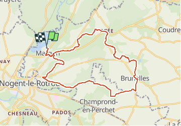
Ruta Senderismo de 18,2 km a descubrir en Centro, Eure-y-Loir, Arcisses. Esta ruta ha sido propuesta por tracegps.
Descripción
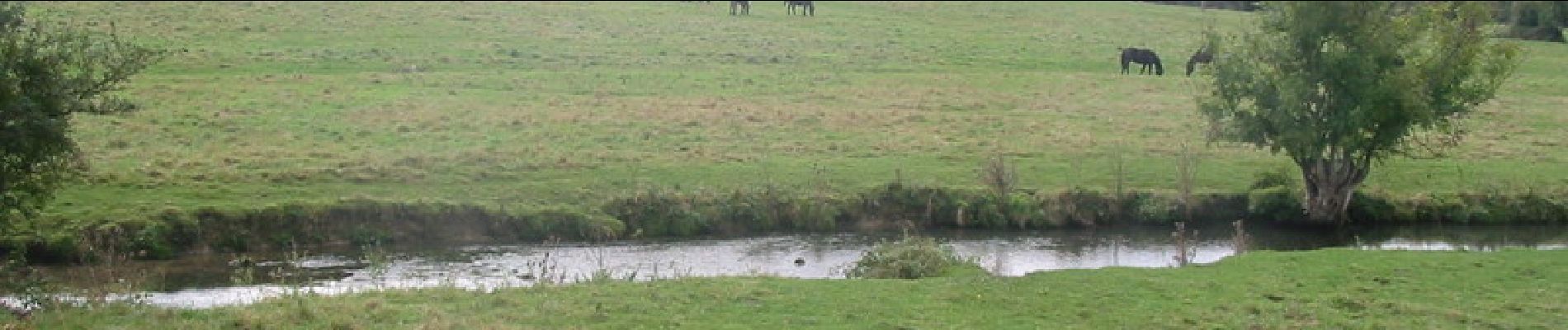
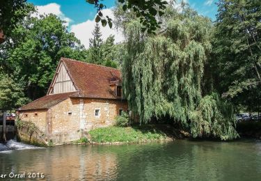
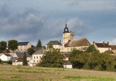
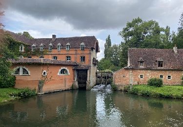
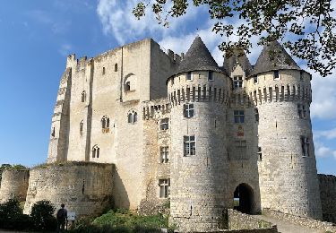
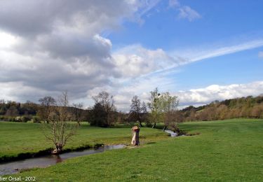
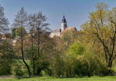
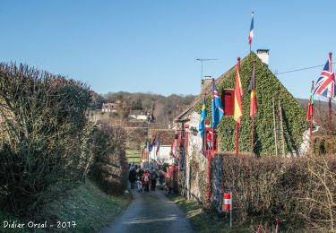
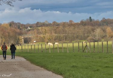
Départ de l'église de Margon. On longe la petite rivière " La Cloche". Rapidement nous pénétrons dans le bois de Champrond en Perchet .Plus tard nous passons devant la vieille église. Avant de terminer la rando nous passons dans la vallée d'Ozée prés des différents moulins et prés dans lesquels paissent les chevaux percherons.
Localización
Comentarios
Excursiones cerca
![Excursión Senderismo Sablons sur Huisne - Villeray, au Fil de l'Huisne 11.8 Km - Photo](https://media.geolcdn.com/t/375/260/389a8b4c-26cd-4921-9eb3-f44fb8104715.jpg&format=jpg&maxdim=2)
![Senderismo Senderismo](https://static1.geolcdn.com/sitytour/trail-icons/101.png)
Senderismo
![](/images/other/stat-length.png)
![](https://static1.geolcdn.com/siteimages/upload/files/16400158638029165_repeat_loop_refresh_sync_direction_icon.png)
![Excursión Senderismo Arcisses - Brunelles - Autour du Promontoire 10 km - Photo](https://media.geolcdn.com/t/375/260/d22874c5-839f-4011-a0f9-00e8c44e1208.jpeg&format=jpg&maxdim=2)
![Senderismo Senderismo](https://static1.geolcdn.com/sitytour/trail-icons/101.png)
Senderismo
![](/images/other/stat-length.png)
![](https://static1.geolcdn.com/siteimages/upload/files/16400158638029165_repeat_loop_refresh_sync_direction_icon.png)
![Excursión Senderismo Sablons sur Huisne - Condé Les Sablons, vallée de l'Huisne - Photo](https://media.geolcdn.com/t/375/260/eb8eb92b-43d4-4641-a3d8-e02a1195662f.jpg&format=jpg&maxdim=2)
![Senderismo Senderismo](https://static1.geolcdn.com/sitytour/trail-icons/101.png)
Senderismo
![](/images/other/stat-length.png)
![](https://static1.geolcdn.com/siteimages/upload/files/16400158638029165_repeat_loop_refresh_sync_direction_icon.png)
![Excursión Senderismo Nogent-le-Rotrou - NOGENT LE ROTROU - Photo](https://media.geolcdn.com/t/375/260/c00ba3d7-9b96-49a3-b019-bc489240b465.jpg&format=jpg&maxdim=2)
![Senderismo Senderismo](https://static1.geolcdn.com/sitytour/trail-icons/101.png)
Senderismo
![](/images/other/stat-length.png)
![](https://static1.geolcdn.com/siteimages/upload/files/16400158638029165_repeat_loop_refresh_sync_direction_icon.png)
![Excursión Senderismo Arcisses - 2023-04-24_20h15m45_Ozée 9,1 km - Photo](https://media.geolcdn.com/t/375/260/ext.jpg?maxdim=2&url=https%3A%2F%2Fstatic1.geolcdn.com%2Fsiteimages%2Fupload%2Ffiles%2F1553511878bg_sport_marche.png)
![Senderismo Senderismo](https://static1.geolcdn.com/sitytour/trail-icons/101.png)
Senderismo
![](/images/other/stat-length.png)
![](https://static1.geolcdn.com/siteimages/upload/files/16400158638029165_repeat_loop_refresh_sync_direction_icon.png)
![Excursión Senderismo Nogent-le-Rotrou - SityTrail - Nogent-le-Rotrou - Saint-Victor-de-Buthon 19 km - Photo](https://media.geolcdn.com/t/375/260/c6e34c0a-1640-462d-a835-4ae8958f9be6.jpg&format=jpg&maxdim=2)
![Senderismo Senderismo](https://static1.geolcdn.com/sitytour/trail-icons/101.png)
Senderismo
![](/images/other/stat-length.png)
![](https://static1.geolcdn.com/siteimages/upload/files/16400158638029165_repeat_loop_refresh_sync_direction_icon.png)
![Excursión Senderismo Nogent-le-Rotrou - 10981160-ZProjet Nogent - Thiron 2 - Photo](https://media.geolcdn.com/t/375/260/8889b3ec-9799-4b99-8939-6db73505b4bd.jpg&format=jpg&maxdim=2)
![Senderismo Senderismo](https://static1.geolcdn.com/sitytour/trail-icons/101.png)
Senderismo
![](/images/other/stat-length.png)
![](https://static1.geolcdn.com/siteimages/upload/files/16400158638029165_repeat_loop_refresh_sync_direction_icon.png)
![Excursión Senderismo Sablons sur Huisne - Condé-sur-Huisne - Coudreceau 12 km - Photo](https://media.geolcdn.com/t/375/260/87972a85-bf69-4274-be1a-37d8d7d8a4ac.jpg&format=jpg&maxdim=2)
![Senderismo Senderismo](https://static1.geolcdn.com/sitytour/trail-icons/101.png)
Senderismo
![](/images/other/stat-length.png)
![](https://static1.geolcdn.com/siteimages/upload/files/16400158638029165_repeat_loop_refresh_sync_direction_icon.png)
![Excursión Senderismo Nogent-le-Rotrou - Nogent-le-Rotrou - Saint-Pierre-la-Bruyère 5,5 km - Photo](https://media.geolcdn.com/t/375/260/eef3d37d-dc69-482d-942f-97ed22dd3c19.jpg&format=jpg&maxdim=2)
![Senderismo Senderismo](https://static1.geolcdn.com/sitytour/trail-icons/101.png)
Senderismo
![](/images/other/stat-length.png)
![](https://static1.geolcdn.com/siteimages/upload/files/16400158638029165_repeat_loop_refresh_sync_direction_icon.png)