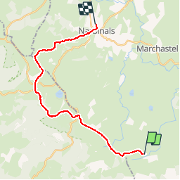
![](/images/other/stat-length.png)
![Excursión Senderismo Les Salces - Tour des Monts d'Aubrac - Du refuge des Rajas à Nasbinals - Photo](https://media.geolcdn.com/t/1900/400/ext.pjpeg?maxdim=2&url=https%3A%2F%2Fservices.sitytrail.com%2FGeolivesWS%2FDownloadMedia.ashx%3FTrailID%3D172692%26Media%3D14070_6.jpg)
Tour des Monts d'Aubrac - Du refuge des Rajas à Nasbinals
tracegps
Usuario
![Longitud](/images/other/stat-length.png)
![Altitud máxima](https://static1.geolcdn.com/siteimages/upload/files/1508320355ic_sort_altitude_max_24dp.png)
![Desnivel positivo](https://static1.geolcdn.com/siteimages/upload/files/1508320355ic_sort_den_pos_24dp.png)
![Km-Effort](/images/other/stat-length.png)
![Altitud mínima](https://static1.geolcdn.com/siteimages/upload/files/1508320355ic_sort_altitude_min_24dp.png)
![Desnivel negativo](https://static1.geolcdn.com/siteimages/upload/files/1508320355ic_sort_den_neg_24dp.png)
![Boucle](https://static1.geolcdn.com/siteimages/upload/files/16400158638029165_repeat_loop_refresh_sync_direction_icon.png)
![Senderismo](https://static1.geolcdn.com/sitytour/trail-icons/101.png)
5h30
Dificultad : Medio
![Escanee este código QR para abrir la excursión en la aplicación SityTrail](https://capi.geolives.com/qq0zvz2zws4bq2lad0pu/sitytour/trails/172692/qr.png?size=200)
Aplicación GPS de excursión GRATIS
A propósito
Ruta Senderismo de 22 km a descubrir en Occitania, Lozère, Les Salces. Esta ruta ha sido propuesta por tracegps.
Descripción
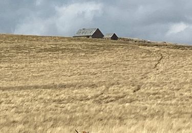
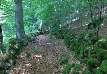
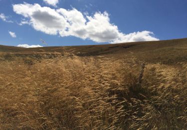
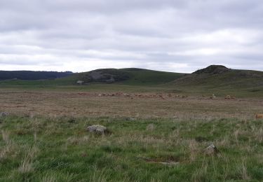
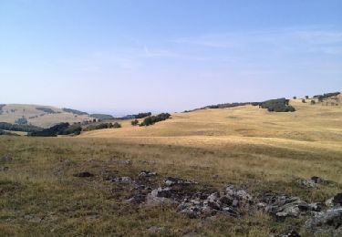
4ème étape de ce circuit qui en comporte 6. Refuge des Rajas - Aubrac - Nasbinals : 22 km. Très belle étape entrecoupée de la visite du buron de Caméjane à 8km du refuge des Rajas ( 2h ) situé hors GRP ( suivre balisage GR6A pas toujours très bien marqué ) qui permet de déguster ( à réserver ) l'aligot artisanal fait au feu de bois. Poursuite vers Aubrac, nous quittons le refuge par un ancien balisage du GR 6A très mal marqué donc bien suivre la trace GPS. Pause à Aubrac puis poursuite vers Nasbinals où nous croiserons beaucoup de pèlerins en sens inverse....!
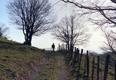
Localización
Comentarios
Excursiones cerca
![Excursión Senderismo Saint Geniez d'Olt et d'Aubrac - Les Vergnes Mailhebiau Tourbière - Photo](https://media.geolcdn.com/t/375/260/e78d9056-9093-4928-88b6-4bbf4637125b.jpg&format=jpg&maxdim=2)
![Senderismo Senderismo](https://static1.geolcdn.com/sitytour/trail-icons/101.png)
Senderismo
![](/images/other/stat-length.png)
![](https://static1.geolcdn.com/siteimages/upload/files/16400158638029165_repeat_loop_refresh_sync_direction_icon.png)
![Excursión Senderismo Saint Geniez d'Olt et d'Aubrac - Croix de Rodes Lac de Bonnecombe Signal de Mailhebiau - Photo](https://media.geolcdn.com/t/375/260/656d423b-e3b9-47a3-b781-744261c38bdb.jpg&format=jpg&maxdim=2)
![Senderismo Senderismo](https://static1.geolcdn.com/sitytour/trail-icons/101.png)
Senderismo
![](/images/other/stat-length.png)
![](https://static1.geolcdn.com/siteimages/upload/files/16400158638029165_repeat_loop_refresh_sync_direction_icon.png)
![Excursión Senderismo Les Hermaux - Rando Lozère.. Rajas..Malailhebiai. - Photo](https://media.geolcdn.com/t/375/260/d7d4238f-1d05-4619-84e8-be25d5ba8938.jpg&format=jpg&maxdim=2)
![Senderismo Senderismo](https://static1.geolcdn.com/sitytour/trail-icons/101.png)
Senderismo
![](/images/other/stat-length.png)
![](https://static1.geolcdn.com/siteimages/upload/files/16400158638029165_repeat_loop_refresh_sync_direction_icon.png)
![Excursión Senderismo Nasbinals - Montorzier Croix de Vaysse Croix de Rodes - Photo](https://media.geolcdn.com/t/375/260/a81222cc-0444-4bf5-96c1-4ce2500b22df.jpg&format=jpg&maxdim=2)
![Senderismo Senderismo](https://static1.geolcdn.com/sitytour/trail-icons/101.png)
Senderismo
![](/images/other/stat-length.png)
![](https://static1.geolcdn.com/siteimages/upload/files/16400158638029165_repeat_loop_refresh_sync_direction_icon.png)
![Excursión Senderismo Les Salces - rajas st chely - Photo](https://media.geolcdn.com/t/375/260/9aaad3f4-6f6b-4807-af95-223f8ba68638.jpg&format=jpg&maxdim=2)
![Senderismo Senderismo](https://static1.geolcdn.com/sitytour/trail-icons/101.png)
Senderismo
![](/images/other/stat-length.png)
![](https://static1.geolcdn.com/siteimages/upload/files/16400158638029165_repeat_loop_refresh_sync_direction_icon.png)
![Excursión Senderismo Les Salces - Autour de maillebiau bonnecombes rajas - Photo](https://media.geolcdn.com/t/375/260/a70b3c7e-488a-42fa-a6af-35098b00d7a3.jpg&format=jpg&maxdim=2)
![Senderismo Senderismo](https://static1.geolcdn.com/sitytour/trail-icons/101.png)
Senderismo
![](/images/other/stat-length.png)
![](https://static1.geolcdn.com/siteimages/upload/files/16400158638029165_repeat_loop_refresh_sync_direction_icon.png)
![Excursión Senderismo Marchastel - cap combattut - Photo](https://media.geolcdn.com/t/375/260/eb793311-0e49-4670-bd6d-8912eba6bc33.jpg&format=jpg&maxdim=2)
![Senderismo Senderismo](https://static1.geolcdn.com/sitytour/trail-icons/101.png)
Senderismo
![](/images/other/stat-length.png)
![](https://static1.geolcdn.com/siteimages/upload/files/16400158638029165_repeat_loop_refresh_sync_direction_icon.png)
![Excursión Senderismo Les Hermaux - Signal de Mailhebiau - Photo](https://media.geolcdn.com/t/375/260/ext.jpg?maxdim=2&url=https%3A%2F%2Fservices.sitytrail.com%2FGeolivesWS%2FDownloadMedia.ashx%3FTrailID%3D152984%26Media%3D20120909121339.jpg)
![Senderismo Senderismo](https://static1.geolcdn.com/sitytour/trail-icons/101.png)
Senderismo
![](/images/other/stat-length.png)
![](https://static1.geolcdn.com/siteimages/upload/files/16400158638029165_repeat_loop_refresh_sync_direction_icon.png)
![Excursión Senderismo Trélans - Les plagnes à Saint Chely l'aubrac - Photo](https://media.geolcdn.com/t/375/260/20046715-4144-406f-96f7-d9ec6ecee00d.jpg&format=jpg&maxdim=2)
![Senderismo Senderismo](https://static1.geolcdn.com/sitytour/trail-icons/101.png)
Senderismo
![](/images/other/stat-length.png)
![](https://static1.geolcdn.com/siteimages/upload/files/16400158638029165_repeat_loop_refresh_sync_direction_icon.png)