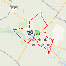
![](/images/other/stat-length.png)
![Excursión Senderismo Clairefontaine-en-Yvelines - _Aux sources de la Rabette - Photo](https://media.geolcdn.com/t/1900/400/ext.pjpeg?maxdim=2&url=https%3A%2F%2Fservices.sitytrail.com%2FGeolivesWS%2FDownloadMedia.ashx%3FTrailID%3D172067%26Media%3D8303e7f0-43e7-437e-9972-9962d4dcef0e.jpg)
_Aux sources de la Rabette
Parc naturel régional de la Haute Vallée de Chevreuse
Randonnées du Parc naturel régional de la Haute Vallée de Chevreuse GUIDE+
![Longitud](/images/other/stat-length.png)
![Altitud máxima](https://static1.geolcdn.com/siteimages/upload/files/1508320355ic_sort_altitude_max_24dp.png)
![Desnivel positivo](https://static1.geolcdn.com/siteimages/upload/files/1508320355ic_sort_den_pos_24dp.png)
![Km-Effort](/images/other/stat-length.png)
![Altitud mínima](https://static1.geolcdn.com/siteimages/upload/files/1508320355ic_sort_altitude_min_24dp.png)
![Desnivel negativo](https://static1.geolcdn.com/siteimages/upload/files/1508320355ic_sort_den_neg_24dp.png)
![Boucle](https://static1.geolcdn.com/siteimages/upload/files/16400158638029165_repeat_loop_refresh_sync_direction_icon.png)
![Senderismo](https://static1.geolcdn.com/sitytour/trail-icons/101.png)
1h51
Dificultad : Fácil
![Escanee este código QR para abrir la excursión en la aplicación SityTrail](https://capi.geolives.com/qq0zvz2zws4bq2lad0pu/sitytour/trails/172067/qr.png?size=200)
Aplicación GPS de excursión GRATIS
A propósito
Ruta Senderismo de 7,2 km a descubrir en Isla de Francia, Yvelines, Clairefontaine-en-Yvelines. Esta ruta ha sido propuesta por Parc naturel régional de la Haute Vallée de Chevreuse.
Descripción
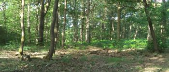
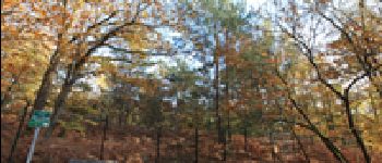
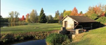
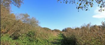
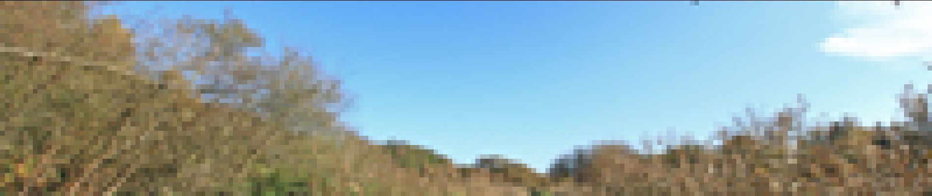
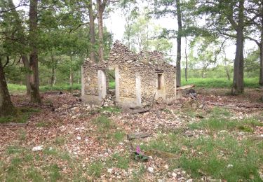
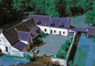
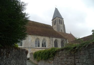
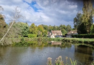
Pinèdes odorantes, étangs oniriques, prairies ondulantes, habitats anciens remarquables, châteaux étonnants et... Centre technique national de football ! Clairefontaine vous propose une ballade
Puntos de interés
Localización
Comentarios
Excursiones cerca
![Excursión Senderismo La Celle-les-Bordes - _Sensations originelles - Photo](https://media.geolcdn.com/t/375/260/ext.jpg?maxdim=2&url=https%3A%2F%2Fservices.sitytrail.com%2FGeolivesWS%2FDownloadMedia.ashx%3FTrailID%3D172073%26Media%3D62ffcccf-49cf-426b-af31-a3cdff83876e.JPG)
![Senderismo Senderismo](https://static1.geolcdn.com/sitytour/trail-icons/101.png)
Senderismo
![](/images/other/stat-length.png)
![](https://static1.geolcdn.com/siteimages/upload/files/16400158638029165_repeat_loop_refresh_sync_direction_icon.png)
![Excursión Senderismo La Celle-les-Bordes - _Animaux de la ferme et faune sauvage - Photo](https://media.geolcdn.com/t/375/260/ext.jpg?maxdim=2&url=https%3A%2F%2Fservices.sitytrail.com%2FGeolivesWS%2FDownloadMedia.ashx%3FTrailID%3D749987%26Media%3D2b4960e8-40f4-40d7-ba40-d1279ecfb88b.jpg)
![Senderismo Senderismo](https://static1.geolcdn.com/sitytour/trail-icons/101.png)
Senderismo
![](/images/other/stat-length.png)
![](https://static1.geolcdn.com/siteimages/upload/files/16400158638029165_repeat_loop_refresh_sync_direction_icon.png)
![Excursión Senderismo La Celle-les-Bordes - _Entre allées royales et pâtures - Photo](https://media.geolcdn.com/t/375/260/ext.jpg?maxdim=2&url=https%3A%2F%2Fservices.sitytrail.com%2FGeolivesWS%2FDownloadMedia.ashx%3FTrailID%3D751392%26Media%3D7991b926-f5be-4041-a4fe-180d615e51da.jpg)
![Senderismo Senderismo](https://static1.geolcdn.com/sitytour/trail-icons/101.png)
Senderismo
![](/images/other/stat-length.png)
![](https://static1.geolcdn.com/siteimages/upload/files/16400158638029165_repeat_loop_refresh_sync_direction_icon.png)
![Excursión Senderismo Sonchamp - _Sonchamp, entre ruelles, étang et forêt - Photo](https://media.geolcdn.com/t/375/260/ext.jpg?maxdim=2&url=https%3A%2F%2Fservices.sitytrail.com%2FGeolivesWS%2FDownloadMedia.ashx%3FTrailID%3D793359%26Media%3Da7fdaaed-ef91-44f6-b9b8-e931274307db.JPG)
![Senderismo Senderismo](https://static1.geolcdn.com/sitytour/trail-icons/101.png)
Senderismo
![](/images/other/stat-length.png)
![](https://static1.geolcdn.com/siteimages/upload/files/16400158638029165_repeat_loop_refresh_sync_direction_icon.png)
![Excursión Senderismo Sonchamp - _La marlotterie - Photo](https://media.geolcdn.com/t/375/260/ext.jpg?maxdim=2&url=https%3A%2F%2Fservices.sitytrail.com%2FGeolivesWS%2FDownloadMedia.ashx%3FTrailID%3D780610%26Media%3D9a2ac7f9-d16a-44b5-b35a-b5d44d659c80.jpg)
![Senderismo Senderismo](https://static1.geolcdn.com/sitytour/trail-icons/101.png)
Senderismo
![](/images/other/stat-length.png)
![](https://static1.geolcdn.com/siteimages/upload/files/16400158638029165_repeat_loop_refresh_sync_direction_icon.png)
![Excursión Senderismo Sonchamp - Sonchamps-Lorieux - Photo](https://media.geolcdn.com/t/375/260/ext.jpg?maxdim=2&url=https%3A%2F%2Fstatic1.geolcdn.com%2Fsiteimages%2Fupload%2Ffiles%2F1553511878bg_sport_marche.png)
![Senderismo Senderismo](https://static1.geolcdn.com/sitytour/trail-icons/101.png)
Senderismo
![](/images/other/stat-length.png)
![](https://static1.geolcdn.com/siteimages/upload/files/16400158638029165_repeat_loop_refresh_sync_direction_icon.png)
![Excursión Senderismo Clairefontaine-en-Yvelines - Clairefontaine - Photo](https://media.geolcdn.com/t/375/260/f9ebf4ea-ca14-458b-9191-1e3f45b135cd.jpg&format=jpg&maxdim=2)
![Senderismo Senderismo](https://static1.geolcdn.com/sitytour/trail-icons/101.png)
Senderismo
![](/images/other/stat-length.png)
![](https://static1.geolcdn.com/siteimages/upload/files/16400158638029165_repeat_loop_refresh_sync_direction_icon.png)
![Excursión Senderismo Saint-Arnoult-en-Yvelines - Yvelines_Saint-Arnoult=>BoisDeRochefort=>Rochefort - Photo](https://media.geolcdn.com/t/375/260/4db7159e-1f12-446b-909c-36750ce5637d.jpg&format=jpg&maxdim=2)
![Senderismo Senderismo](https://static1.geolcdn.com/sitytour/trail-icons/101.png)
Senderismo
![](/images/other/stat-length.png)
![](https://static1.geolcdn.com/siteimages/upload/files/16400158638029165_repeat_loop_refresh_sync_direction_icon.png)
![Excursión Senderismo La Celle-les-Bordes - Yvelines_La-Celle-Les-Bordes=>Moutiers - Photo](https://media.geolcdn.com/t/375/260/00e30d76-b5ab-43c4-9465-175a5fa29736.jpg&format=jpg&maxdim=2)
![Senderismo Senderismo](https://static1.geolcdn.com/sitytour/trail-icons/101.png)
Senderismo
![](/images/other/stat-length.png)
![](https://static1.geolcdn.com/siteimages/upload/files/16400158638029165_repeat_loop_refresh_sync_direction_icon.png)
Bien
Très bonne balade accessible à tous.
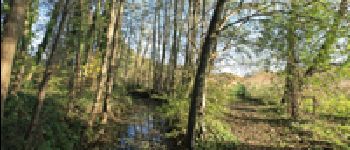
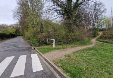
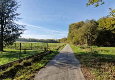
Première partie dans les zones humides très agréable, forêt également mais beaucoup trop de chemins bordés de grillage des deux côtés .
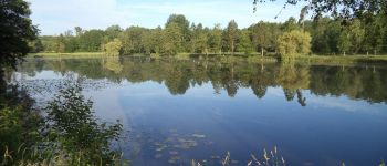
Richesse des paysages traversés, sentiers ruraux, forêt, étangs
Itinéraire peu fréquenté, bien entretenu et peu dangereux (quant aux routes). Deux belles parties du chemin longent de beaux marécages. Le passage dans les bois au milieu/2 tiers du parcours est la partie la moins intéressante.Attention la 2e fontaine d'eau potable ne fonctionne pas. Gros point fort, le circuit commence et termine sur un bel étang.
well, it is a great idea, and I must admit we discovered a lot of nice places around our house. The must to have. subscription at 25€/year is very reasonable. IGN maps for a given region of France cost 17€ per map.But the application itself is ugly. can't switch it off after the track is finished. has to force quit it. ergonomics us not good either. hope it will be improved!
Jolie promenade autour du village avec des points d'intérêt notables.
Rando avec terrains diversifiés, abscence d oiseaux, d où une grande quantité de moustiques... A éviter lors de période de pluie(segment marécageux)