![](/images/other/stat-length.png)
![Excursión Senderismo Benet - Sainte- Christine 2 - Photo](https://media.geolcdn.com/t/1900/400/ext.pjpeg?maxdim=2&url=https%3A%2F%2Fservices.sitytrail.com%2FGeolivesWS%2FDownloadMedia.ashx%3FTrailID%3D157540%26Media%3D20121009154221.jpeg)
Sainte- Christine 2
olaze
Usuario
![Longitud](/images/other/stat-length.png)
Longitud
10,6 km
![Altitud máxima](https://static1.geolcdn.com/siteimages/upload/files/1508320355ic_sort_altitude_max_24dp.png)
Altitud máxima
12 m
![Desnivel positivo](https://static1.geolcdn.com/siteimages/upload/files/1508320355ic_sort_den_pos_24dp.png)
Desnivel positivo
62 m
![Km-Effort](/images/other/stat-length.png)
Km-Effort
11,5 km
![Altitud mínima](https://static1.geolcdn.com/siteimages/upload/files/1508320355ic_sort_altitude_min_24dp.png)
Altitud mínima
0 m
![Desnivel negativo](https://static1.geolcdn.com/siteimages/upload/files/1508320355ic_sort_den_neg_24dp.png)
Desnivel negativo
64 m
![Boucle](https://static1.geolcdn.com/siteimages/upload/files/16400158638029165_repeat_loop_refresh_sync_direction_icon.png)
Boucle
Sí
Fecha de creación :
2014-12-10 00:00:00.0
Última modificación :
2014-12-10 00:00:00.0
![Senderismo](https://static1.geolcdn.com/sitytour/trail-icons/101.png)
2h47
Dificultad : Fácil
![Escanee este código QR para abrir la excursión en la aplicación SityTrail](https://capi.geolives.com/qq0zvz2zws4bq2lad0pu/sitytour/trails/157540/qr.png?size=200)
Aplicación GPS de excursión GRATIS
A propósito
Ruta Senderismo de 10,6 km a descubrir en Países del Loira, Vandea, Benet. Esta ruta ha sido propuesta por olaze.
Descripción
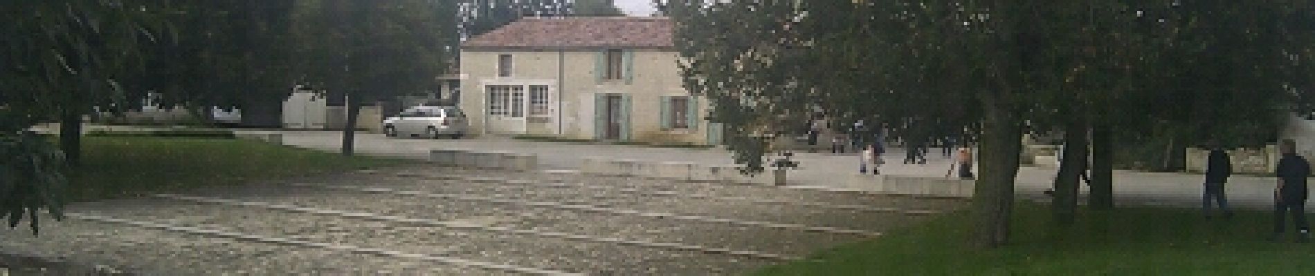
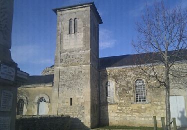
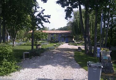
Départ:retour de Ste-Christine.
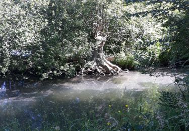
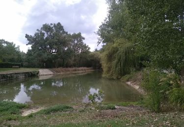
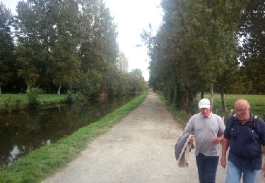
Le long de La rigole d'Aziré.
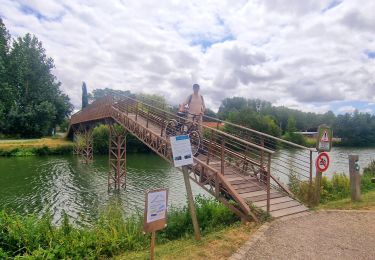
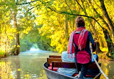
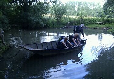
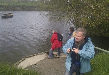
Canal de Courdault.Port de Courdault.La Garenne.Les Nattes.
Club rando Bessines, oct 2012
Localización
País:
France
Región :
Países del Loira
Departamento/provincia :
Vandea
Municipio :
Benet
Localidad:
Unknown
Salida:(Dec)
Salida:(UTM)
679560 ; 5136706 (30T) N.
Comentarios
Excursiones cerca
![Excursión Senderismo Bouillé-Courdault - bouille - Photo](https://media.geolcdn.com/t/375/260/5ab1bec1-8161-429a-b08b-93e7df517407.jpg&format=jpg&maxdim=2)
![Senderismo Senderismo](https://static1.geolcdn.com/sitytour/trail-icons/101.png)
bouille
Senderismo
Muy fácil
(1)
Bouillé-Courdault,
Países del Loira,
Vandea,
France
![](/images/other/stat-length.png)
11,3 km | 12,1 km-effort
3h 52min
![](https://static1.geolcdn.com/siteimages/upload/files/16400158638029165_repeat_loop_refresh_sync_direction_icon.png)
No
![Excursión Bicicleta híbrida Le Mazeau - Cyclo dans le marais Poitevin - Photo](https://media.geolcdn.com/t/375/260/86905f3c-566b-4bf0-9e35-0be64feae71f.jpg&format=jpg&maxdim=2)
![Bicicleta híbrida Bicicleta híbrida](https://static1.geolcdn.com/sitytour/trail-icons/203.png)
Cyclo dans le marais Poitevin
Bicicleta híbrida
Fácil
Le Mazeau,
Países del Loira,
Vandea,
France
![](/images/other/stat-length.png)
48 km | 51 km-effort
4h 10min
![](https://static1.geolcdn.com/siteimages/upload/files/16400158638029165_repeat_loop_refresh_sync_direction_icon.png)
Sí
![Excursión Senderismo Le Mazeau - Mazeau_Marais_Sauvage - Photo](https://media.geolcdn.com/t/375/260/c928f69a-d8cb-467b-bfde-89b85eb625c6.jpg&format=jpg&maxdim=2)
![Senderismo Senderismo](https://static1.geolcdn.com/sitytour/trail-icons/101.png)
Mazeau_Marais_Sauvage
Senderismo
Fácil
Le Mazeau,
Países del Loira,
Vandea,
France
![](/images/other/stat-length.png)
8,6 km | 9,2 km-effort
2h 45min
![](https://static1.geolcdn.com/siteimages/upload/files/16400158638029165_repeat_loop_refresh_sync_direction_icon.png)
Sí
![Excursión Senderismo Benet - Les Nattes - Photo](https://media.geolcdn.com/t/375/260/a97c3037-e825-40d3-8987-e43b5676dc7d.jpg&format=jpg&maxdim=2)
![Senderismo Senderismo](https://static1.geolcdn.com/sitytour/trail-icons/101.png)
Les Nattes
Senderismo
Fácil
Benet,
Países del Loira,
Vandea,
France
![](/images/other/stat-length.png)
9,8 km | 10,5 km-effort
3h 17min
![](https://static1.geolcdn.com/siteimages/upload/files/16400158638029165_repeat_loop_refresh_sync_direction_icon.png)
Sí
![Excursión Senderismo Le Mazeau - Le Mazeau 1 - Photo](https://media.geolcdn.com/t/375/260/ext.jpg?maxdim=2&url=https%3A%2F%2Fservices.sitytrail.com%2FGeolivesWS%2FDownloadMedia.ashx%3FTrailID%3D843604%26Media%3Dfix__20171010154548.jpg)
![Senderismo Senderismo](https://static1.geolcdn.com/sitytour/trail-icons/101.png)
Le Mazeau 1
Senderismo
Fácil
Le Mazeau,
Países del Loira,
Vandea,
France
![](/images/other/stat-length.png)
8,6 km | 9,3 km-effort
2h 1min
![](https://static1.geolcdn.com/siteimages/upload/files/16400158638029165_repeat_loop_refresh_sync_direction_icon.png)
Sí
![Excursión Senderismo Saint-Sigismond - saint-Sigismond - Photo](https://media.geolcdn.com/t/375/260/ext.jpg?maxdim=2&url=https%3A%2F%2Fservices.sitytrail.com%2FGeolivesWS%2FDownloadMedia.ashx%3FTrailID%3D165225%26Media%3D20121204154143.jpeg)
![Senderismo Senderismo](https://static1.geolcdn.com/sitytour/trail-icons/101.png)
saint-Sigismond
Senderismo
Fácil
Saint-Sigismond,
Países del Loira,
Vandea,
France
![](/images/other/stat-length.png)
10 km | 10,7 km-effort
2h 22min
![](https://static1.geolcdn.com/siteimages/upload/files/16400158638029165_repeat_loop_refresh_sync_direction_icon.png)
Sí
![Excursión Senderismo Benet - Aziré ATSCAF - Photo](https://media.geolcdn.com/t/375/260/ext.jpg?maxdim=2&url=https%3A%2F%2Fservices.sitytrail.com%2FGeolivesWS%2FDownloadMedia.ashx%3FTrailID%3D134923%26Media%3D20120622102911.jpeg)
![Senderismo Senderismo](https://static1.geolcdn.com/sitytour/trail-icons/101.png)
Aziré ATSCAF
Senderismo
Fácil
Benet,
Países del Loira,
Vandea,
France
![](/images/other/stat-length.png)
9,6 km | 10,3 km-effort
2h 41min
![](https://static1.geolcdn.com/siteimages/upload/files/16400158638029165_repeat_loop_refresh_sync_direction_icon.png)
Sí
![Excursión Senderismo Le Mazeau - Village de La Sèvre - Photo](https://media.geolcdn.com/t/375/260/ext.jpg?maxdim=2&url=https%3A%2F%2Fservices.sitytrail.com%2FGeolivesWS%2FDownloadMedia.ashx%3FTrailID%3D126835%26Media%3D20120511111934.jpeg)
![Senderismo Senderismo](https://static1.geolcdn.com/sitytour/trail-icons/101.png)
Village de La Sèvre
Senderismo
Fácil
Le Mazeau,
Países del Loira,
Vandea,
France
![](/images/other/stat-length.png)
8,7 km | 9,3 km-effort
2h 2min
![](https://static1.geolcdn.com/siteimages/upload/files/16400158638029165_repeat_loop_refresh_sync_direction_icon.png)
Sí
![Excursión Senderismo Le Mazeau - Le Mazeau à Arçais circuit 3 - Photo](https://media.geolcdn.com/t/375/260/ext.jpg?maxdim=2&url=https%3A%2F%2Fservices.sitytrail.com%2FGeolivesWS%2FDownloadMedia.ashx%3FTrailID%3D122608%26Media%3D20120420162308.jpeg)
![Senderismo Senderismo](https://static1.geolcdn.com/sitytour/trail-icons/101.png)
Le Mazeau à Arçais circuit 3
Senderismo
Fácil
Le Mazeau,
Países del Loira,
Vandea,
France
![](/images/other/stat-length.png)
11,8 km | 12,7 km-effort
2h 40min
![](https://static1.geolcdn.com/siteimages/upload/files/16400158638029165_repeat_loop_refresh_sync_direction_icon.png)
Sí