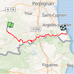
![](/images/other/stat-length.png)
![Excursión Senderismo Corsavy - GR10 De Batère à Banyuls-sur-Mer (Pyrénées-Orientales) - Photo](https://media.geolcdn.com/t/1900/400/ext.pjpeg?maxdim=2&url=https%3A%2F%2Fstatic1.geolcdn.com%2Fsiteimages%2Fupload%2Ffiles%2F1553511878bg_sport_marche.png)
GR10 De Batère à Banyuls-sur-Mer (Pyrénées-Orientales)
poussin18
Usuario
![Longitud](/images/other/stat-length.png)
![Altitud máxima](https://static1.geolcdn.com/siteimages/upload/files/1508320355ic_sort_altitude_max_24dp.png)
![Desnivel positivo](https://static1.geolcdn.com/siteimages/upload/files/1508320355ic_sort_den_pos_24dp.png)
![Km-Effort](/images/other/stat-length.png)
![Altitud mínima](https://static1.geolcdn.com/siteimages/upload/files/1508320355ic_sort_altitude_min_24dp.png)
![Desnivel negativo](https://static1.geolcdn.com/siteimages/upload/files/1508320355ic_sort_den_neg_24dp.png)
![Boucle](https://static1.geolcdn.com/siteimages/upload/files/16400158638029165_repeat_loop_refresh_sync_direction_icon.png)
![Senderismo](https://static1.geolcdn.com/sitytour/trail-icons/101.png)
--
Dificultad : Difícil
![Escanee este código QR para abrir la excursión en la aplicación SityTrail](https://capi.geolives.com/qq0zvz2zws4bq2lad0pu/sitytour/trails/148856/qr.png?size=200)
Aplicación GPS de excursión GRATIS
A propósito
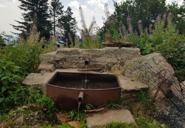
Ruta Senderismo de 85 km a descubrir en Occitania, Pirineos Orientales, Corsavy. Esta ruta ha sido propuesta por poussin18.
Descripción
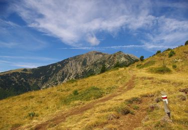
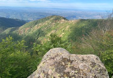
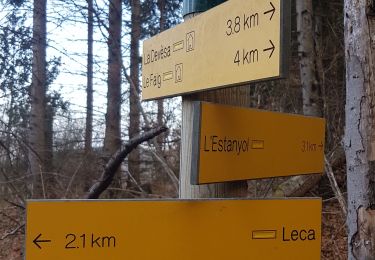
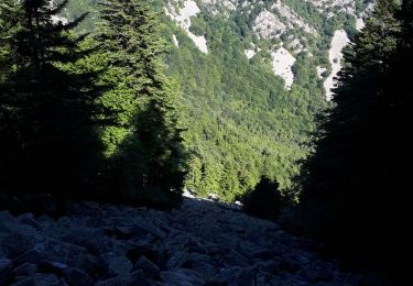
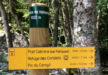
Randonnée avec le GR10 à travers les Pyrénées-Orientales de Batère à Banyuls-sur-Mer. Batère (Corsavy): Gîte d'étape l'Aventurine, 04 68 39 12 01
La Tagnarède: Refuge du Club Alpin Français, 04 68 54 56 38
Banyuls-sur-Mer: Hôtel Le Catalan, 04 68 88 02 80
Localización
Comentarios
Excursiones cerca
![Excursión A pie Valmanya - Tour del Canigó - Photo](https://media.geolcdn.com/t/375/260/d70f77f9-d4e3-4a97-8f21-2b252e3f9842.jpeg&format=jpg&maxdim=2)
![A pie A pie](https://static1.geolcdn.com/sitytour/trail-icons/100.png)
A pie
![](/images/other/stat-length.png)
![](https://static1.geolcdn.com/siteimages/upload/files/16400158638029165_repeat_loop_refresh_sync_direction_icon.png)
![Excursión Senderismo Corsavy - Tour du Canigou - Photo](https://media.geolcdn.com/t/375/260/ext.jpg?maxdim=2&url=https%3A%2F%2Fstatic1.geolcdn.com%2Fsiteimages%2Fupload%2Ffiles%2F1553511878bg_sport_marche.png)
![Senderismo Senderismo](https://static1.geolcdn.com/sitytour/trail-icons/101.png)
Senderismo
![](/images/other/stat-length.png)
![](https://static1.geolcdn.com/siteimages/upload/files/16400158638029165_repeat_loop_refresh_sync_direction_icon.png)
![Excursión sport Valmanya - 20241013 Los Masos-Prat Cabrera… - Photo](https://media.geolcdn.com/t/375/260/31e31d29-0e6a-46e9-9786-fccc3cfba894.jpg&format=jpg&maxdim=2)
sport
![](/images/other/stat-length.png)
![](https://static1.geolcdn.com/siteimages/upload/files/16400158638029165_repeat_loop_refresh_sync_direction_icon.png)
![Excursión Senderismo Corsavy - 2022 TRANSPYRÉNÉENNE : refuge de Batere -Montalba - HOSTAL dels Traucayres - Photo](https://media.geolcdn.com/t/375/260/2dc3b86f-78ad-496e-bb51-5b658d77182b.jpg&format=jpg&maxdim=2)
![Senderismo Senderismo](https://static1.geolcdn.com/sitytour/trail-icons/101.png)
Senderismo
![](/images/other/stat-length.png)
![](https://static1.geolcdn.com/siteimages/upload/files/16400158638029165_repeat_loop_refresh_sync_direction_icon.png)
![Excursión Senderismo Corsavy - leca cabanes del faig14km 871m 4h45 - Photo](https://media.geolcdn.com/t/375/260/fa6fd1c5-d850-4de5-aa2f-243b4a5f6506.jpg&format=jpg&maxdim=2)
![Senderismo Senderismo](https://static1.geolcdn.com/sitytour/trail-icons/101.png)
Senderismo
![](/images/other/stat-length.png)
![](https://static1.geolcdn.com/siteimages/upload/files/16400158638029165_repeat_loop_refresh_sync_direction_icon.png)
![Excursión Senderismo Valmanya - Los Masos Prat Cabrera - Photo](https://media.geolcdn.com/t/375/260/5a982ed8-e8a5-434c-a713-d69b9e6ce2c7.jpg&format=jpg&maxdim=2)
![Senderismo Senderismo](https://static1.geolcdn.com/sitytour/trail-icons/101.png)
Senderismo
![](/images/other/stat-length.png)
![](https://static1.geolcdn.com/siteimages/upload/files/16400158638029165_repeat_loop_refresh_sync_direction_icon.png)
![Excursión Senderismo Valmanya - 20210705 Pic du Canigou par L’os Masos de Valmanya - Photo](https://media.geolcdn.com/t/375/260/ae1ed3c1-7b9e-4093-a4d0-3a15b5e38122.jpg&format=jpg&maxdim=2)
![Senderismo Senderismo](https://static1.geolcdn.com/sitytour/trail-icons/101.png)
Senderismo
![](/images/other/stat-length.png)
![](https://static1.geolcdn.com/siteimages/upload/files/16400158638029165_repeat_loop_refresh_sync_direction_icon.png)
![Excursión Senderismo Valmanya - 20200815 Los Masos - Pinatell - Photo](https://media.geolcdn.com/t/375/260/d25d2398-5015-4e44-b91d-e33032cf6975.jpg&format=jpg&maxdim=2)
![Senderismo Senderismo](https://static1.geolcdn.com/sitytour/trail-icons/101.png)
Senderismo
![](/images/other/stat-length.png)
![](https://static1.geolcdn.com/siteimages/upload/files/16400158638029165_repeat_loop_refresh_sync_direction_icon.png)
![Excursión Senderismo Valmanya - Balcon du Canigou - Photo](https://media.geolcdn.com/t/375/260/e86977a0-9fbf-4029-ab8e-02d73e191ae0.jpg&format=jpg&maxdim=2)
![Senderismo Senderismo](https://static1.geolcdn.com/sitytour/trail-icons/101.png)
Senderismo
![](/images/other/stat-length.png)
![](https://static1.geolcdn.com/siteimages/upload/files/16400158638029165_repeat_loop_refresh_sync_direction_icon.png)