![](/images/other/stat-length.png)
![Excursión Senderismo Sprimont - Dolembreux - Hayen - Hautegné (promenade n°7 Sprimont, 8 km) - Photo](https://media.geolcdn.com/t/1900/400/ext.pjpeg?maxdim=2&url=https%3A%2F%2Fstatic1.geolcdn.com%2Fsiteimages%2Fupload%2Ffiles%2F1553511878bg_sport_marche.png)
Dolembreux - Hayen - Hautegné (promenade n°7 Sprimont, 8 km)
tilto
Usuario
![Longitud](/images/other/stat-length.png)
![Altitud máxima](https://static1.geolcdn.com/siteimages/upload/files/1508320355ic_sort_altitude_max_24dp.png)
![Desnivel positivo](https://static1.geolcdn.com/siteimages/upload/files/1508320355ic_sort_den_pos_24dp.png)
![Km-Effort](/images/other/stat-length.png)
![Altitud mínima](https://static1.geolcdn.com/siteimages/upload/files/1508320355ic_sort_altitude_min_24dp.png)
![Desnivel negativo](https://static1.geolcdn.com/siteimages/upload/files/1508320355ic_sort_den_neg_24dp.png)
![Boucle](https://static1.geolcdn.com/siteimages/upload/files/16400158638029165_repeat_loop_refresh_sync_direction_icon.png)
![Senderismo](https://static1.geolcdn.com/sitytour/trail-icons/101.png)
1h45
Dificultad : Medio
![Escanee este código QR para abrir la excursión en la aplicación SityTrail](https://capi.geolives.com/qq0zvz2zws4bq2lad0pu/sitytour/trails/139086/qr.png?size=200)
Aplicación GPS de excursión GRATIS
A propósito
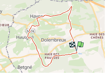
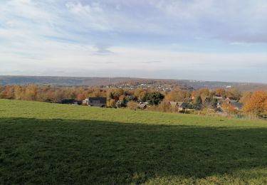
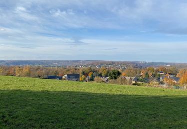
Ruta Senderismo de 8 km a descubrir en Valonia, Lieja, Sprimont. Esta ruta ha sido propuesta por tilto.
Descripción
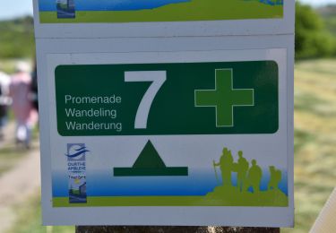
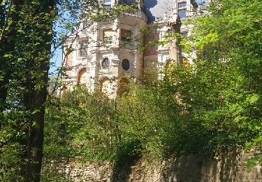
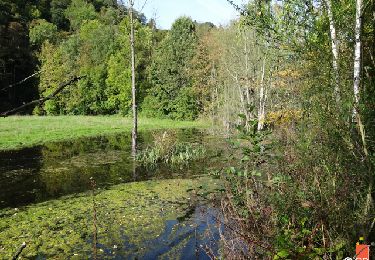
Circuit n° 7 de la commune de Sprimont, balisé croix verte sur font blanc. Départ rue de la Pêcherie, 2. B-4140 Dolembreux, en direction de la Haie des Pauvres, pour mener vers Hautgné. Le parcours se dirige alors vers Hayen et le chantoir du Trou Renard (cavité naturelle collectrice d'eau, typique de la région). La boucle emprunte alors la rue Trixhe Nollet pour atteindre, vers le Sud, le lieu-dit Piretfontaine. Retour aux étangs par le Gr.
Gros chemins caillouteux en pleine nature.
Extrait du site internet : http://www.ourthe-ambleve.be/insitu/fiche.php?lang=fr&cle=8582
Localización
Comentarios
Excursiones cerca
![Excursión Senderismo Esneux - RB-Lg-20_Tilff - Photo](https://media.geolcdn.com/t/375/260/ext.jpg?maxdim=2&url=https%3A%2F%2Fservices.sitytrail.com%2FGeolivesWS%2FDownloadMedia.ashx%3FTrailID%3D400739%26Media%3D2cb4df8e-af53-4650-9797-54389fe3086f.jpg)
![Senderismo Senderismo](https://static1.geolcdn.com/sitytour/trail-icons/101.png)
Senderismo
![](/images/other/stat-length.png)
![](https://static1.geolcdn.com/siteimages/upload/files/16400158638029165_repeat_loop_refresh_sync_direction_icon.png)
![Excursión Senderismo Esneux - 2023-11-10_18h47m33_1728.gpx.xml - Photo](https://media.geolcdn.com/t/375/260/c48a71c5-4004-4c2c-808e-9fa33492e14f.jpg&format=jpg&maxdim=2)
![Senderismo Senderismo](https://static1.geolcdn.com/sitytour/trail-icons/101.png)
Senderismo
![](/images/other/stat-length.png)
![](https://static1.geolcdn.com/siteimages/upload/files/16400158638029165_repeat_loop_refresh_sync_direction_icon.png)
![Senderismo Senderismo](https://static1.geolcdn.com/sitytour/trail-icons/101.png)
Senderismo
![](/images/other/stat-length.png)
![](https://static1.geolcdn.com/siteimages/upload/files/16400158638029165_repeat_loop_refresh_sync_direction_icon.png)
![Excursión Senderismo Esneux - 2021-03-15_18h38m57_1414 - Photo](https://media.geolcdn.com/t/375/260/e55fc444-f647-4a9e-8e3d-6379c3eaaeb3.jpg&format=jpg&maxdim=2)
![Senderismo Senderismo](https://static1.geolcdn.com/sitytour/trail-icons/101.png)
Senderismo
![](/images/other/stat-length.png)
![](https://static1.geolcdn.com/siteimages/upload/files/16400158638029165_repeat_loop_refresh_sync_direction_icon.png)
![Excursión Senderismo Esneux - Hony - La Roche aux Faucons - Esneux - Photo](https://media.geolcdn.com/t/375/260/f6e3ccd1-92e1-4c56-a0ee-51e1f3a9d450.jpg&format=jpg&maxdim=2)
![Senderismo Senderismo](https://static1.geolcdn.com/sitytour/trail-icons/101.png)
Senderismo
![](/images/other/stat-length.png)
![](https://static1.geolcdn.com/siteimages/upload/files/16400158638029165_repeat_loop_refresh_sync_direction_icon.png)
![Excursión Senderismo Esneux - esneux - Photo](https://media.geolcdn.com/t/375/260/d159b70f-178d-42e1-9d71-816392d5ce53.jpg&format=jpg&maxdim=2)
![Senderismo Senderismo](https://static1.geolcdn.com/sitytour/trail-icons/101.png)
![Excursión Senderismo Esneux - Esneux - Photo](https://media.geolcdn.com/t/375/260/57a65b1f-f206-4b38-acf9-1e79f556fa5d.jpg&format=jpg&maxdim=2)
![Senderismo Senderismo](https://static1.geolcdn.com/sitytour/trail-icons/101.png)
![Excursión Senderismo Esneux - dans la campagne d Esneux - Photo](https://media.geolcdn.com/t/375/260/ext.jpg?maxdim=2&url=https%3A%2F%2Fservices.sitytrail.com%2FGeolivesWS%2FDownloadMedia.ashx%3FTrailID%3D1136641%26Media%3Dfix__20190419145221.jpg)
![Senderismo Senderismo](https://static1.geolcdn.com/sitytour/trail-icons/101.png)
Senderismo
![](/images/other/stat-length.png)
![](https://static1.geolcdn.com/siteimages/upload/files/16400158638029165_repeat_loop_refresh_sync_direction_icon.png)
![Excursión Senderismo Esneux - RB-Lg-20_Tilff_via-racc-3 - Photo](https://media.geolcdn.com/t/375/260/ext.jpg?maxdim=2&url=https%3A%2F%2Fservices.sitytrail.com%2FGeolivesWS%2FDownloadMedia.ashx%3FTrailID%3D400745%26Media%3D2cb4df8e-af53-4650-9797-54389fe3086f.jpg)
![Senderismo Senderismo](https://static1.geolcdn.com/sitytour/trail-icons/101.png)
Senderismo
![](/images/other/stat-length.png)
![](https://static1.geolcdn.com/siteimages/upload/files/16400158638029165_repeat_loop_refresh_sync_direction_icon.png)
top
splendide !!!