![](/images/other/stat-length.png)
![Excursión Senderismo La Gorgue - Chemin de randonnée des Magots (Version longue) - La Gorgue - Photo](https://media.geolcdn.com/t/1900/400/ext.pjpeg?maxdim=2&url=https%3A%2F%2Fservices.sitytrail.com%2FGeolivesWS%2FDownloadMedia.ashx%3FTrailID%3D129826%26Media%3D13377_5.jpg)
Chemin de randonnée des Magots (Version longue) - La Gorgue
tracegps
Usuario
![Longitud](/images/other/stat-length.png)
![Altitud máxima](https://static1.geolcdn.com/siteimages/upload/files/1508320355ic_sort_altitude_max_24dp.png)
![Desnivel positivo](https://static1.geolcdn.com/siteimages/upload/files/1508320355ic_sort_den_pos_24dp.png)
![Km-Effort](/images/other/stat-length.png)
![Altitud mínima](https://static1.geolcdn.com/siteimages/upload/files/1508320355ic_sort_altitude_min_24dp.png)
![Desnivel negativo](https://static1.geolcdn.com/siteimages/upload/files/1508320355ic_sort_den_neg_24dp.png)
![Boucle](https://static1.geolcdn.com/siteimages/upload/files/16400158638029165_repeat_loop_refresh_sync_direction_icon.png)
![Senderismo](https://static1.geolcdn.com/sitytour/trail-icons/101.png)
3h25
Dificultad : Difícil
![Escanee este código QR para abrir la excursión en la aplicación SityTrail](https://capi.geolives.com/qq0zvz2zws4bq2lad0pu/sitytour/trails/129826/qr.png?size=200)
Aplicación GPS de excursión GRATIS
A propósito
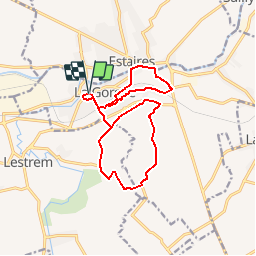
Ruta Senderismo de 13,7 km a descubrir en Alta Francia, Norte, La Gorgue. Esta ruta ha sido propuesta por tracegps.
Descripción
Circuit proposé par la commune de La Gorgue. Des temps immémoriaux, essayons de retracer et de replacer la naissance du surnom donné aux habitants de La Gorgue : Les Magots. La Flandre, érigée en comté est la propriété de Philippe le Hardi Duc de Bourgogne en 1384. Prés d'un siècle après, le pays de Flandre devient un domaine des Halsbourg d'Autriche, puis d'Espagne. Si la domination Espagnole était sécurisante par une présence armée, enrichissante par l'architecture, les arts etc., l'esprit Calviniste guettait dans l'ombre avec leurs adeptes : les Gueux. Ces derniers haïssaient les Espagnols et la religion catholique. Ils saccageaient les églises, chapelles et couvents. Le 16 août 1566, venus du pays de l'Alloeu, ils pillèrent l'église cassèrent les statues et firent d'autres actes de vandalisme pour ridiculiser la religion ; tout comme à l'Abbaye de Beaupré. C'est alors qu'ils prirent un bouc, un « magot » et le placèrent sur l'autel puis sous le dais utilisé la veille pour la procession de l'Assomption, et promenèrent cet animal dans la ville. La répression fut terrible par les Espagnols mais elle ne put faire oublier cette mésaventure qui laissa ce sobriquet de « Magots » aux habitants de La Gorgue. Départ de l'église. Retrouvez ce circuit sur le site de la mairie de La Gorgue.
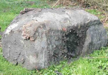
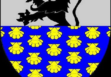
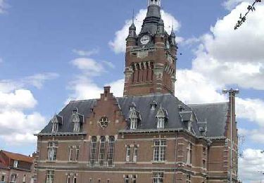
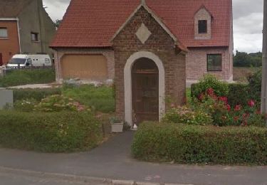
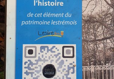
Localización
Comentarios
Excursiones cerca
![Excursión A pie Sailly-sur-la-Lys - Chemin Champêtre - Photo](https://media.geolcdn.com/t/375/260/08a11db1-c43e-4c4d-8e74-bd4badb13341.jpeg&format=jpg&maxdim=2)
![A pie A pie](https://static1.geolcdn.com/sitytour/trail-icons/100.png)
A pie
![](/images/other/stat-length.png)
![](https://static1.geolcdn.com/siteimages/upload/files/16400158638029165_repeat_loop_refresh_sync_direction_icon.png)
![Excursión A pie Sailly-sur-la-Lys - Chemin des Sûres - Photo](https://media.geolcdn.com/t/375/260/2d90e37f-3ffe-435a-b486-cb4efad56f04.jpeg&format=jpg&maxdim=2)
![A pie A pie](https://static1.geolcdn.com/sitytour/trail-icons/100.png)
A pie
![](/images/other/stat-length.png)
![](https://static1.geolcdn.com/siteimages/upload/files/16400158638029165_repeat_loop_refresh_sync_direction_icon.png)
![Excursión Senderismo Sailly-sur-la-Lys - Chemin Champêtre - Sailly-sur-la-Lys - Photo](https://media.geolcdn.com/t/375/260/ext.jpg?maxdim=2&url=https%3A%2F%2Fstatic1.geolcdn.com%2Fsiteimages%2Fupload%2Ffiles%2F1553511878bg_sport_marche.png)
![Senderismo Senderismo](https://static1.geolcdn.com/sitytour/trail-icons/101.png)
Senderismo
![](/images/other/stat-length.png)
![](https://static1.geolcdn.com/siteimages/upload/files/16400158638029165_repeat_loop_refresh_sync_direction_icon.png)
![Excursión Senderismo Sailly-sur-la-Lys - Chemin Champêtre - Sailly sur la Lys - Photo](https://media.geolcdn.com/t/375/260/ext.jpg?maxdim=2&url=https%3A%2F%2Fservices.sitytrail.com%2FGeolivesWS%2FDownloadMedia.ashx%3FTrailID%3D318007%26Media%3D17461_6.jpg)
![Senderismo Senderismo](https://static1.geolcdn.com/sitytour/trail-icons/101.png)
Senderismo
![](/images/other/stat-length.png)
![](https://static1.geolcdn.com/siteimages/upload/files/16400158638029165_repeat_loop_refresh_sync_direction_icon.png)
![Excursión Senderismo La Gorgue - Chemin de randonnée des Magots (Version Courte) - La Gorgue - Photo](https://media.geolcdn.com/t/375/260/ext.jpg?maxdim=2&url=https%3A%2F%2Fservices.sitytrail.com%2FGeolivesWS%2FDownloadMedia.ashx%3FTrailID%3D129825%26Media%3D13376_5.jpg)
![Senderismo Senderismo](https://static1.geolcdn.com/sitytour/trail-icons/101.png)
Senderismo
![](/images/other/stat-length.png)
![](https://static1.geolcdn.com/siteimages/upload/files/16400158638029165_repeat_loop_refresh_sync_direction_icon.png)
![Excursión Senderismo La Gorgue - Chemin «Au fil de la Lys» - La Gorgue - Photo](https://media.geolcdn.com/t/375/260/ext.jpg?maxdim=2&url=https%3A%2F%2Fservices.sitytrail.com%2FGeolivesWS%2FDownloadMedia.ashx%3FTrailID%3D129794%26Media%3D13341_6.jpg)
![Senderismo Senderismo](https://static1.geolcdn.com/sitytour/trail-icons/101.png)
Senderismo
![](/images/other/stat-length.png)
![](https://static1.geolcdn.com/siteimages/upload/files/16400158638029165_repeat_loop_refresh_sync_direction_icon.png)
![Excursión Senderismo Merville - Circuit des rivières - Merville - Photo](https://media.geolcdn.com/t/375/260/ext.jpg?maxdim=2&url=https%3A%2F%2Fservices.sitytrail.com%2FGeolivesWS%2FDownloadMedia.ashx%3FTrailID%3D109344%26Media%3D3611_6.jpg)
![Senderismo Senderismo](https://static1.geolcdn.com/sitytour/trail-icons/101.png)
Senderismo
![](/images/other/stat-length.png)
![](https://static1.geolcdn.com/siteimages/upload/files/16400158638029165_repeat_loop_refresh_sync_direction_icon.png)
![Senderismo Senderismo](https://static1.geolcdn.com/sitytour/trail-icons/101.png)
Senderismo
![](/images/other/stat-length.png)
![](https://static1.geolcdn.com/siteimages/upload/files/16400158638029165_repeat_loop_refresh_sync_direction_icon.png)
![Excursión Senderismo Lestrem - lestrem benb 13.11.2022 - Photo](https://media.geolcdn.com/t/375/260/8963e277-9835-43ac-88be-a7b70e17a1e2.jpg&format=jpg&maxdim=2)
![Senderismo Senderismo](https://static1.geolcdn.com/sitytour/trail-icons/101.png)
Senderismo
![](/images/other/stat-length.png)
![](https://static1.geolcdn.com/siteimages/upload/files/16400158638029165_repeat_loop_refresh_sync_direction_icon.png)