![](/images/other/stat-length.png)
![Excursión Senderismo Saint-Jeure-d'Andaure - En pays d'Andaure - Photo](https://media.geolcdn.com/t/1900/400/ext.pjpeg?maxdim=2&url=https%3A%2F%2Fservices.sitytrail.com%2FGeolivesWS%2FDownloadMedia.ashx%3FTrailID%3D129815%26Media%3D13364_6.jpg)
En pays d'Andaure
tracegps
Usuario
![Longitud](/images/other/stat-length.png)
Longitud
6,8 km
![Altitud máxima](https://static1.geolcdn.com/siteimages/upload/files/1508320355ic_sort_altitude_max_24dp.png)
Altitud máxima
1123 m
![Desnivel positivo](https://static1.geolcdn.com/siteimages/upload/files/1508320355ic_sort_den_pos_24dp.png)
Desnivel positivo
247 m
![Km-Effort](/images/other/stat-length.png)
Km-Effort
10,1 km
![Altitud mínima](https://static1.geolcdn.com/siteimages/upload/files/1508320355ic_sort_altitude_min_24dp.png)
Altitud mínima
887 m
![Desnivel negativo](https://static1.geolcdn.com/siteimages/upload/files/1508320355ic_sort_den_neg_24dp.png)
Desnivel negativo
243 m
![Boucle](https://static1.geolcdn.com/siteimages/upload/files/16400158638029165_repeat_loop_refresh_sync_direction_icon.png)
Boucle
Sí
Fecha de creación :
2014-12-10 00:00:00.0
Última modificación :
2014-12-10 00:00:00.0
![Senderismo](https://static1.geolcdn.com/sitytour/trail-icons/101.png)
2h30
Dificultad : Medio
![Escanee este código QR para abrir la excursión en la aplicación SityTrail](https://capi.geolives.com/qq0zvz2zws4bq2lad0pu/sitytour/trails/129815/qr.png?size=200)
Aplicación GPS de excursión GRATIS
A propósito
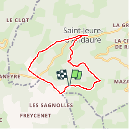
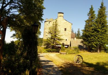
Ruta Senderismo de 6,8 km a descubrir en Auvergne-Rhône-Alpes, Ardecha, Saint-Jeure-d'Andaure. Esta ruta ha sido propuesta por tracegps.
Descripción
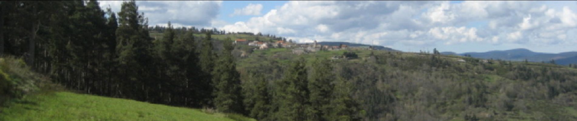
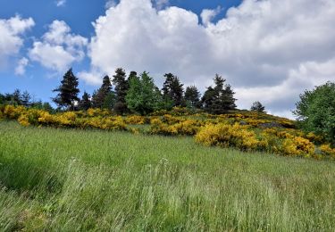
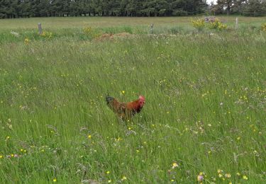
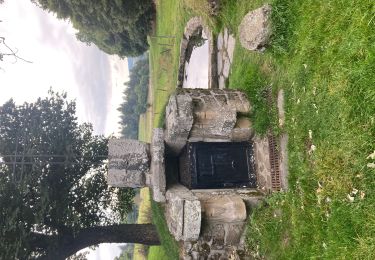
Beau circuit ardéchois, passage au col de Brun. Montée au dessus de St Jeure d'Andaure. Descente au dessous du village. Beaux paysages et belles vues sur la Haute Ardèche si belle au printemps. Calme assuré !
Localización
País:
France
Región :
Auvergne-Rhône-Alpes
Departamento/provincia :
Ardecha
Municipio :
Saint-Jeure-d'Andaure
Localidad:
Unknown
Salida:(Dec)
Salida:(UTM)
614521 ; 4987792 (31T) N.
Comentarios
Excursiones cerca
![Excursión Senderismo Saint-Agrève - La chaux par les Sagnoles - Photo](https://media.geolcdn.com/t/375/260/2ec8b69d-9d2d-4eb0-8ab2-4718ed369489.jpg&format=jpg&maxdim=2)
![Senderismo Senderismo](https://static1.geolcdn.com/sitytour/trail-icons/101.png)
La chaux par les Sagnoles
Senderismo
Medio
(1)
Saint-Agrève,
Auvergne-Rhône-Alpes,
Ardecha,
France
![](/images/other/stat-length.png)
6,4 km | 8,9 km-effort
2h 17min
![](https://static1.geolcdn.com/siteimages/upload/files/16400158638029165_repeat_loop_refresh_sync_direction_icon.png)
Sí
![Excursión Senderismo Saint-Agrève - Le serre par le col de brun - Photo](https://media.geolcdn.com/t/375/260/0ab7f4ef-e569-4c05-ab5d-1eb0828a7e96.jpg&format=jpg&maxdim=2)
![Senderismo Senderismo](https://static1.geolcdn.com/sitytour/trail-icons/101.png)
Le serre par le col de brun
Senderismo
Fácil
Saint-Agrève,
Auvergne-Rhône-Alpes,
Ardecha,
France
![](/images/other/stat-length.png)
4,1 km | 5,1 km-effort
1h 20min
![](https://static1.geolcdn.com/siteimages/upload/files/16400158638029165_repeat_loop_refresh_sync_direction_icon.png)
Sí
![Excursión Bici de montaña Désaignes - Autour de Combeneyre - Désaignes - Photo](https://media.geolcdn.com/t/375/260/ext.jpg?maxdim=2&url=https%3A%2F%2Fservices.sitytrail.com%2FGeolivesWS%2FDownloadMedia.ashx%3FTrailID%3D317488%26Media%3D16721_5.jpg)
![Bici de montaña Bici de montaña](https://static1.geolcdn.com/sitytour/trail-icons/202.png)
Autour de Combeneyre - Désaignes
Bici de montaña
Medio
Désaignes,
Auvergne-Rhône-Alpes,
Ardecha,
France
![](/images/other/stat-length.png)
13,1 km | 18,3 km-effort
1h 30min
![](https://static1.geolcdn.com/siteimages/upload/files/16400158638029165_repeat_loop_refresh_sync_direction_icon.png)
Sí
![Excursión Senderismo Désaignes - Autour de Combeneyre - Désaignes - Photo](https://media.geolcdn.com/t/375/260/ext.jpg?maxdim=2&url=https%3A%2F%2Fservices.sitytrail.com%2FGeolivesWS%2FDownloadMedia.ashx%3FTrailID%3D317487%26Media%3D16721_5.jpg)
![Senderismo Senderismo](https://static1.geolcdn.com/sitytour/trail-icons/101.png)
Autour de Combeneyre - Désaignes
Senderismo
Medio
Désaignes,
Auvergne-Rhône-Alpes,
Ardecha,
France
![](/images/other/stat-length.png)
13,1 km | 18,3 km-effort
3h 0min
![](https://static1.geolcdn.com/siteimages/upload/files/16400158638029165_repeat_loop_refresh_sync_direction_icon.png)
Sí
![Excursión Senderismo Désaignes - La Terrasse - Désaignes - Photo](https://media.geolcdn.com/t/375/260/ext.jpg?maxdim=2&url=https%3A%2F%2Fservices.sitytrail.com%2FGeolivesWS%2FDownloadMedia.ashx%3FTrailID%3D214851%26Media%3D15389_6.jpg)
![Senderismo Senderismo](https://static1.geolcdn.com/sitytour/trail-icons/101.png)
La Terrasse - Désaignes
Senderismo
Medio
Désaignes,
Auvergne-Rhône-Alpes,
Ardecha,
France
![](/images/other/stat-length.png)
13,3 km | 21 km-effort
4h 0min
![](https://static1.geolcdn.com/siteimages/upload/files/16400158638029165_repeat_loop_refresh_sync_direction_icon.png)
Sí
![Excursión Senderismo Désaignes - Les Sauvages - Desaignes - Photo](https://media.geolcdn.com/t/375/260/ext.jpg?maxdim=2&url=https%3A%2F%2Fservices.sitytrail.com%2FGeolivesWS%2FDownloadMedia.ashx%3FTrailID%3D173220%26Media%3D14823_5.jpg)
![Senderismo Senderismo](https://static1.geolcdn.com/sitytour/trail-icons/101.png)
Les Sauvages - Desaignes
Senderismo
Medio
Désaignes,
Auvergne-Rhône-Alpes,
Ardecha,
France
![](/images/other/stat-length.png)
12,3 km | 17,1 km-effort
3h 0min
![](https://static1.geolcdn.com/siteimages/upload/files/16400158638029165_repeat_loop_refresh_sync_direction_icon.png)
Sí
![Excursión Senderismo Saint-Agrève - Saint-Agrève - Photo](https://media.geolcdn.com/t/375/260/f29c2b82-43c8-4052-a60d-cd95cfb4626d.jpg&format=jpg&maxdim=2)
![Senderismo Senderismo](https://static1.geolcdn.com/sitytour/trail-icons/101.png)
Saint-Agrève
Senderismo
Medio
Saint-Agrève,
Auvergne-Rhône-Alpes,
Ardecha,
France
![](/images/other/stat-length.png)
15,3 km | 19,2 km-effort
4h 4min
![](https://static1.geolcdn.com/siteimages/upload/files/16400158638029165_repeat_loop_refresh_sync_direction_icon.png)
Sí
![Excursión Senderismo Labatie-d'Andaure - Le rocher de Peyrolle Labatie d Andaure - Photo](https://media.geolcdn.com/t/375/260/f50eaea1-4e3f-4b35-96c0-8ab429eb0a50.jpg&format=jpg&maxdim=2)
![Senderismo Senderismo](https://static1.geolcdn.com/sitytour/trail-icons/101.png)
Le rocher de Peyrolle Labatie d Andaure
Senderismo
Difícil
(1)
Labatie-d'Andaure,
Auvergne-Rhône-Alpes,
Ardecha,
France
![](/images/other/stat-length.png)
7,4 km | 12,1 km-effort
2h 1min
![](https://static1.geolcdn.com/siteimages/upload/files/16400158638029165_repeat_loop_refresh_sync_direction_icon.png)
Sí
![Excursión Senderismo Devesset - le grail - Photo](https://media.geolcdn.com/t/375/260/2b05e325-e4fc-4530-95a7-2b1114c525d0.jpg&format=jpg&maxdim=2)
![Senderismo Senderismo](https://static1.geolcdn.com/sitytour/trail-icons/101.png)
le grail
Senderismo
Muy fácil
Devesset,
Auvergne-Rhône-Alpes,
Ardecha,
France
![](/images/other/stat-length.png)
12 km | 0 m-effort
4h 2min
![](https://static1.geolcdn.com/siteimages/upload/files/16400158638029165_repeat_loop_refresh_sync_direction_icon.png)
Sí
Très beau circuit conforme à la présentation. Beaux paysages, durée prévue facilement respectée par un marcheur moyen. Merci pour le partage.