![](/images/other/stat-length.png)
![Excursión Bici de montaña Saint-Pierre-la-Bruyère - Randonnée à Saint Pierre la Bruyère - Photo](https://media.geolcdn.com/t/1900/400/ext.pjpeg?maxdim=2&url=https%3A%2F%2Fservices.sitytrail.com%2FGeolivesWS%2FDownloadMedia.ashx%3FTrailID%3D129638%26Media%3D13157_2.jpg)
Randonnée à Saint Pierre la Bruyère
tracegps
Usuario
![Longitud](/images/other/stat-length.png)
Longitud
15,4 km
![Altitud máxima](https://static1.geolcdn.com/siteimages/upload/files/1508320355ic_sort_altitude_max_24dp.png)
Altitud máxima
224 m
![Desnivel positivo](https://static1.geolcdn.com/siteimages/upload/files/1508320355ic_sort_den_pos_24dp.png)
Desnivel positivo
293 m
![Km-Effort](/images/other/stat-length.png)
Km-Effort
19,3 km
![Altitud mínima](https://static1.geolcdn.com/siteimages/upload/files/1508320355ic_sort_altitude_min_24dp.png)
Altitud mínima
107 m
![Desnivel negativo](https://static1.geolcdn.com/siteimages/upload/files/1508320355ic_sort_den_neg_24dp.png)
Desnivel negativo
296 m
![Boucle](https://static1.geolcdn.com/siteimages/upload/files/16400158638029165_repeat_loop_refresh_sync_direction_icon.png)
Boucle
Sí
Fecha de creación :
2014-12-10 00:00:00.0
Última modificación :
2014-12-10 00:00:00.0
![Bici de montaña](https://static1.geolcdn.com/sitytour/trail-icons/202.png)
1h15
Dificultad : Medio
![Escanee este código QR para abrir la excursión en la aplicación SityTrail](https://capi.geolives.com/qq0zvz2zws4bq2lad0pu/sitytour/trails/129638/qr.png?size=200)
Aplicación GPS de excursión GRATIS
A propósito
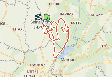
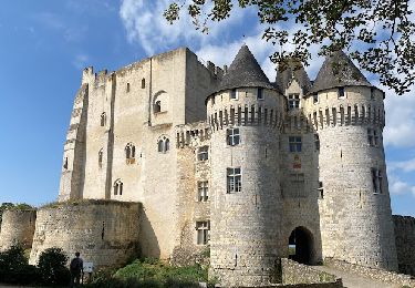
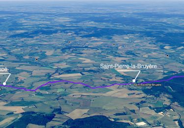
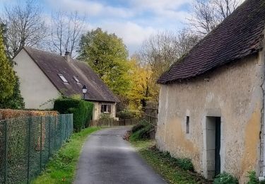
Ruta Bici de montaña de 15,4 km a descubrir en Normandía, Orne, Saint-Pierre-la-Bruyère. Esta ruta ha sido propuesta por tracegps.
Descripción
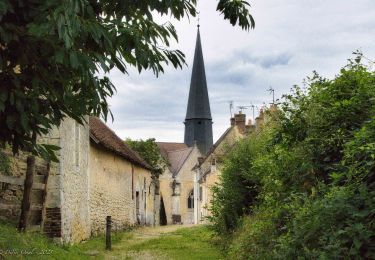
Départ du petit village. On pénètre rapidement dans le bois on en ressort 15 km plus loin. Retour au village par la route sur 1 km. Pas de difficultés particulières. Une bonne oxygénation.
Localización
País:
France
Región :
Normandía
Departamento/provincia :
Orne
Municipio :
Saint-Pierre-la-Bruyère
Localidad:
Unknown
Salida:(Dec)
Salida:(UTM)
337458 ; 5358852 (31U) N.
Comentarios
Excursiones cerca
![Excursión Senderismo Sablons sur Huisne - Villeray, au Fil de l'Huisne 11.8 Km - Photo](https://media.geolcdn.com/t/375/260/389a8b4c-26cd-4921-9eb3-f44fb8104715.jpg&format=jpg&maxdim=2)
![Senderismo Senderismo](https://static1.geolcdn.com/sitytour/trail-icons/101.png)
Villeray, au Fil de l'Huisne 11.8 Km
Senderismo
Difícil
(1)
Sablons sur Huisne,
Normandía,
Orne,
France
![](/images/other/stat-length.png)
12,6 km | 14,7 km-effort
3h 20min
![](https://static1.geolcdn.com/siteimages/upload/files/16400158638029165_repeat_loop_refresh_sync_direction_icon.png)
Sí
![Excursión Senderismo Sablons sur Huisne - Condé Les Sablons, vallée de l'Huisne - Photo](https://media.geolcdn.com/t/375/260/eb8eb92b-43d4-4641-a3d8-e02a1195662f.jpg&format=jpg&maxdim=2)
![Senderismo Senderismo](https://static1.geolcdn.com/sitytour/trail-icons/101.png)
Condé Les Sablons, vallée de l'Huisne
Senderismo
Difícil
Sablons sur Huisne,
Normandía,
Orne,
France
![](/images/other/stat-length.png)
13,1 km | 15,1 km-effort
3h 25min
![](https://static1.geolcdn.com/siteimages/upload/files/16400158638029165_repeat_loop_refresh_sync_direction_icon.png)
Sí
![Excursión Senderismo Nogent-le-Rotrou - NOGENT LE ROTROU - Photo](https://media.geolcdn.com/t/375/260/c00ba3d7-9b96-49a3-b019-bc489240b465.jpg&format=jpg&maxdim=2)
![Senderismo Senderismo](https://static1.geolcdn.com/sitytour/trail-icons/101.png)
NOGENT LE ROTROU
Senderismo
Medio
Nogent-le-Rotrou,
Centro,
Eure-y-Loir,
France
![](/images/other/stat-length.png)
5,8 km | 6,9 km-effort
1h 33min
![](https://static1.geolcdn.com/siteimages/upload/files/16400158638029165_repeat_loop_refresh_sync_direction_icon.png)
Sí
![Excursión Senderismo Verrières - SityTrail - SityTrail - Les Vieilles Trognes 9 Km - Photo](https://media.geolcdn.com/t/375/260/2f52e433-da7f-4851-a063-0b8449b76186.jpg&format=jpg&maxdim=2)
![Senderismo Senderismo](https://static1.geolcdn.com/sitytour/trail-icons/101.png)
SityTrail - SityTrail - Les Vieilles Trognes 9 Km
Senderismo
Difícil
Verrières,
Normandía,
Orne,
France
![](/images/other/stat-length.png)
11,4 km | 13,7 km-effort
3h 6min
![](https://static1.geolcdn.com/siteimages/upload/files/16400158638029165_repeat_loop_refresh_sync_direction_icon.png)
Sí
![Excursión Senderismo Nogent-le-Rotrou - SityTrail - Nogent-le-Rotrou - Saint-Victor-de-Buthon 19 km - Photo](https://media.geolcdn.com/t/375/260/c6e34c0a-1640-462d-a835-4ae8958f9be6.jpg&format=jpg&maxdim=2)
![Senderismo Senderismo](https://static1.geolcdn.com/sitytour/trail-icons/101.png)
SityTrail - Nogent-le-Rotrou - Saint-Victor-de-Buthon 19 km
Senderismo
Muy difícil
Nogent-le-Rotrou,
Centro,
Eure-y-Loir,
France
![](/images/other/stat-length.png)
19 km | 23 km-effort
5h 5min
![](https://static1.geolcdn.com/siteimages/upload/files/16400158638029165_repeat_loop_refresh_sync_direction_icon.png)
No
![Excursión Senderismo Berd'huis - SityTrail - Berd'huis - Condé-sur-Huisne 14 km - Photo](https://media.geolcdn.com/t/375/260/e562d127-d462-4485-b928-bb7147049073.png&format=jpg&maxdim=2)
![Senderismo Senderismo](https://static1.geolcdn.com/sitytour/trail-icons/101.png)
SityTrail - Berd'huis - Condé-sur-Huisne 14 km
Senderismo
Difícil
Berd'huis,
Normandía,
Orne,
France
![](/images/other/stat-length.png)
13,9 km | 16,7 km-effort
3h 37min
![](https://static1.geolcdn.com/siteimages/upload/files/16400158638029165_repeat_loop_refresh_sync_direction_icon.png)
No
![Excursión Senderismo Berd'huis - SityTrail - Berd'huis - Saint-Cyr-la-Rosière via Préaux-du-Perche 12 km - Photo](https://media.geolcdn.com/t/375/260/9f597d4c-6499-477b-a914-13f046dbb439.jpg&format=jpg&maxdim=2)
![Senderismo Senderismo](https://static1.geolcdn.com/sitytour/trail-icons/101.png)
SityTrail - Berd'huis - Saint-Cyr-la-Rosière via Préaux-du-Perche 12 km
Senderismo
Muy fácil
Berd'huis,
Normandía,
Orne,
France
![](/images/other/stat-length.png)
4,1 km | 4,9 km-effort
1h 0min
![](https://static1.geolcdn.com/siteimages/upload/files/16400158638029165_repeat_loop_refresh_sync_direction_icon.png)
No
![Excursión Senderismo Nogent-le-Rotrou - 10981160-ZProjet Nogent - Thiron 2 - Photo](https://media.geolcdn.com/t/375/260/8889b3ec-9799-4b99-8939-6db73505b4bd.jpg&format=jpg&maxdim=2)
![Senderismo Senderismo](https://static1.geolcdn.com/sitytour/trail-icons/101.png)
10981160-ZProjet Nogent - Thiron 2
Senderismo
Muy difícil
Nogent-le-Rotrou,
Centro,
Eure-y-Loir,
France
![](/images/other/stat-length.png)
22 km | 26 km-effort
6h 0min
![](https://static1.geolcdn.com/siteimages/upload/files/16400158638029165_repeat_loop_refresh_sync_direction_icon.png)
No
![Excursión Senderismo Sablons sur Huisne - Condé-sur-Huisne - Coudreceau 12 km - Photo](https://media.geolcdn.com/t/375/260/87972a85-bf69-4274-be1a-37d8d7d8a4ac.jpg&format=jpg&maxdim=2)
![Senderismo Senderismo](https://static1.geolcdn.com/sitytour/trail-icons/101.png)
Condé-sur-Huisne - Coudreceau 12 km
Senderismo
Fácil
Sablons sur Huisne,
Normandía,
Orne,
France
![](/images/other/stat-length.png)
12,3 km | 15,3 km-effort
3h 10min
![](https://static1.geolcdn.com/siteimages/upload/files/16400158638029165_repeat_loop_refresh_sync_direction_icon.png)
No
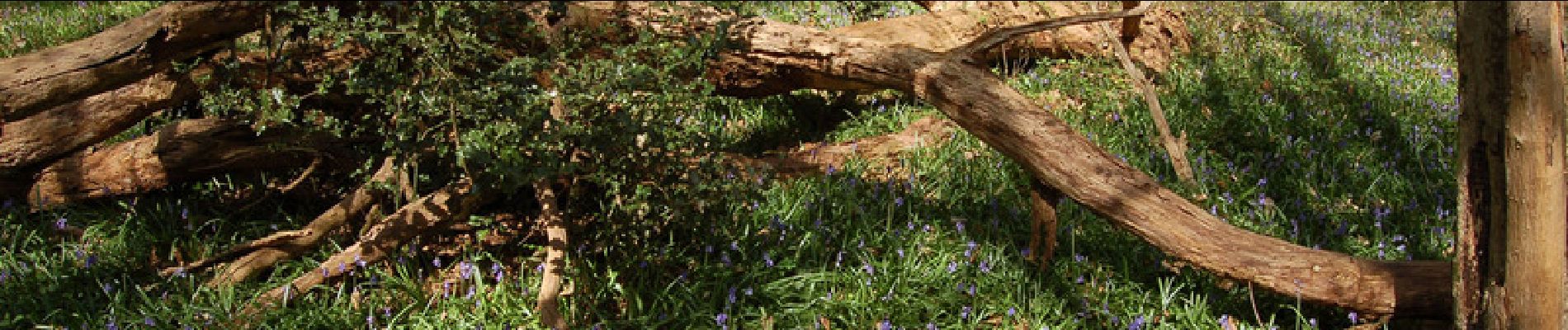
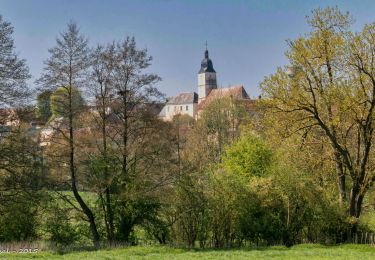
2/3 impraticable à éviter , ronces orties herbes a 1m80 non entretenu à éviter !!!