![](/images/other/stat-length.png)
![Excursión Bici de montaña Dieppe - Les trois forêts - Dieppe - Photo](https://media.geolcdn.com/t/1900/400/ext.pjpeg?maxdim=2&url=https%3A%2F%2Fservices.sitytrail.com%2FGeolivesWS%2FDownloadMedia.ashx%3FTrailID%3D118724%26Media%3D12917_2.jpg)
Les trois forêts - Dieppe
tracegps
Usuario
![Longitud](/images/other/stat-length.png)
![Altitud máxima](https://static1.geolcdn.com/siteimages/upload/files/1508320355ic_sort_altitude_max_24dp.png)
![Desnivel positivo](https://static1.geolcdn.com/siteimages/upload/files/1508320355ic_sort_den_pos_24dp.png)
![Km-Effort](/images/other/stat-length.png)
![Altitud mínima](https://static1.geolcdn.com/siteimages/upload/files/1508320355ic_sort_altitude_min_24dp.png)
![Desnivel negativo](https://static1.geolcdn.com/siteimages/upload/files/1508320355ic_sort_den_neg_24dp.png)
![Boucle](https://static1.geolcdn.com/siteimages/upload/files/16400158638029165_repeat_loop_refresh_sync_direction_icon.png)
![Bici de montaña](https://static1.geolcdn.com/sitytour/trail-icons/202.png)
4h00
Dificultad : Difícil
![Escanee este código QR para abrir la excursión en la aplicación SityTrail](https://capi.geolives.com/qq0zvz2zws4bq2lad0pu/sitytour/trails/118724/qr.png?size=200)
Aplicación GPS de excursión GRATIS
A propósito
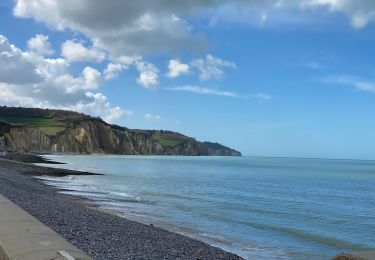
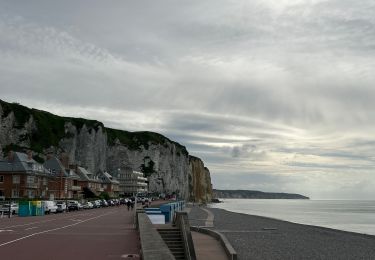
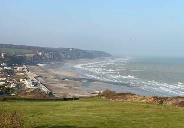
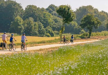
Ruta Bici de montaña de 47 km a descubrir en Normandía, Sena-Marítimo, Dieppe. Esta ruta ha sido propuesta por tracegps.
Descripción
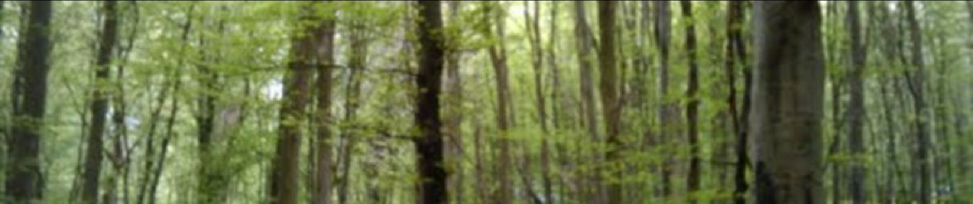
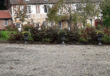
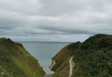
Un très beau circuit dans l’arrière pays dieppois. Il suit les routes de grande randonnée du pays, au long du littoral, et ensuite par trois forets: d'Arques, Pimont, Le Croc (Foret d'Eawy). Le segment par les deux dernières forêts est assez difficile, surtout après la pluie. Le circuit ne pose pas des problèmes particuliers, mais je ne le trouve pas quand même recommandable aux débutants.
Localización
Comentarios
Excursiones cerca
![Excursión Senderismo Varengeville-sur-Mer - Pourville jusqu'aux Terrasses de Vasterival - Photo](https://media.geolcdn.com/t/375/260/ext.jpg?maxdim=2&url=https%3A%2F%2Fstatic1.geolcdn.com%2Fsiteimages%2Fupload%2Ffiles%2F1553511878bg_sport_marche.png)
![Senderismo Senderismo](https://static1.geolcdn.com/sitytour/trail-icons/101.png)
Senderismo
![](/images/other/stat-length.png)
![](https://static1.geolcdn.com/siteimages/upload/files/16400158638029165_repeat_loop_refresh_sync_direction_icon.png)
![Excursión Senderismo Dieppe - GR21 : De Dieppe à Pourville-Sur-Mer - Photo](https://media.geolcdn.com/t/375/260/9af66fc9-7eaf-4a54-b63d-df14d7092c30.jpeg&format=jpg&maxdim=2)
![Senderismo Senderismo](https://static1.geolcdn.com/sitytour/trail-icons/101.png)
Senderismo
![](/images/other/stat-length.png)
![](https://static1.geolcdn.com/siteimages/upload/files/16400158638029165_repeat_loop_refresh_sync_direction_icon.png)
![Excursión A pie Dieppe - Dieppe coté mer 1 - Photo](https://media.geolcdn.com/t/375/260/17716324-48c0-4442-af65-fedeb6808833.jpeg&format=jpg&maxdim=2)
![A pie A pie](https://static1.geolcdn.com/sitytour/trail-icons/100.png)
A pie
![](/images/other/stat-length.png)
![](https://static1.geolcdn.com/siteimages/upload/files/16400158638029165_repeat_loop_refresh_sync_direction_icon.png)
![Excursión Senderismo Hautot-sur-Mer - Autour de Varengeville-sur-Mer - Photo](https://media.geolcdn.com/t/375/260/60d902af-7cf1-469a-9cec-da74be4158a3.jpeg&format=jpg&maxdim=2)
![Senderismo Senderismo](https://static1.geolcdn.com/sitytour/trail-icons/101.png)
Senderismo
![](/images/other/stat-length.png)
![](https://static1.geolcdn.com/siteimages/upload/files/16400158638029165_repeat_loop_refresh_sync_direction_icon.png)
![Excursión Senderismo Hautot-sur-Mer - Petit Appeville vers Pourville sur mer - Photo](https://media.geolcdn.com/t/375/260/f27eecc9-b419-4f96-979b-ca5c51e90ae0.jpg&format=jpg&maxdim=2)
![Senderismo Senderismo](https://static1.geolcdn.com/sitytour/trail-icons/101.png)
Senderismo
![](/images/other/stat-length.png)
![](https://static1.geolcdn.com/siteimages/upload/files/16400158638029165_repeat_loop_refresh_sync_direction_icon.png)
![Excursión Senderismo Petit-Caux - bracquemont belleville - Photo](https://media.geolcdn.com/t/375/260/da3850e3-aaac-4075-9ca6-53fbc3d5c050.jpg&format=jpg&maxdim=2)
![Senderismo Senderismo](https://static1.geolcdn.com/sitytour/trail-icons/101.png)
Senderismo
![](/images/other/stat-length.png)
![](https://static1.geolcdn.com/siteimages/upload/files/16400158638029165_repeat_loop_refresh_sync_direction_icon.png)
![Bici eléctrica Bici eléctrica](https://static1.geolcdn.com/sitytour/trail-icons/205.png)
Bici eléctrica
![](/images/other/stat-length.png)
![](https://static1.geolcdn.com/siteimages/upload/files/16400158638029165_repeat_loop_refresh_sync_direction_icon.png)
![Excursión Senderismo Dieppe - Dieppe - Photo](https://media.geolcdn.com/t/375/260/25ca68d2-67d2-41cc-84f5-ed5d3a2e8f7b.jpg&format=jpg&maxdim=2)
![Senderismo Senderismo](https://static1.geolcdn.com/sitytour/trail-icons/101.png)
![Excursión Senderismo Hautot-sur-Mer - Activity - Photo](https://media.geolcdn.com/t/375/260/58a18e9e-d5e0-45f3-a421-9d8e594845b6.jpg&format=jpg&maxdim=2)
![Senderismo Senderismo](https://static1.geolcdn.com/sitytour/trail-icons/101.png)
Senderismo
![](/images/other/stat-length.png)
![](https://static1.geolcdn.com/siteimages/upload/files/16400158638029165_repeat_loop_refresh_sync_direction_icon.png)